Cyclone Season - Invest 96S (low, not a cyclone)
- Nov 9, 2025
- 1 min read
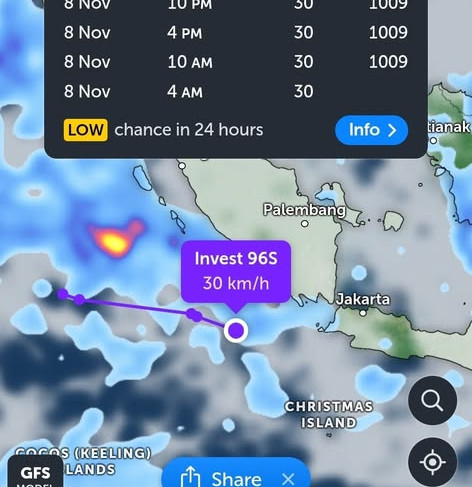
As of 6:00 UTC Sat 9 Nov it’s near 6.8°S, 102.3°E (well WNW of Cocos/Christmas Island), about 15 kt winds (~30 km/h) and 1009 mb pressure. In other words: a weak, messy low over warm water.
Model guidance (ensemble tracks):
Most tracks slide east along/under Java over the next few days, then some runs drift it toward the Timor Sea/NW of Australia late next week. A few keep it weak and wandering. Spread is large → confidence is low.
Development odds:
Next 2–3 days: Low – wind shear and organisation look poor.
Mid to late next week: Low to maybe moderate if it survives and finds lighter shear over the Timor Sea. Still a long shot at this stage.
Who should pay attention?
Boaties/freight routes around Cocos–Christmas–south of Java: squally showers and lumpy seas at times.
WA Kimberley/NW coast & Top End: just early notice only. If it persists, moisture could lift build-up showers/storms late week into next weekend. Way too early for tracks or strength calls.
What this is not:
Not a cyclone.
Not a threat to Australia in the coming few days.
Not something to stock up for—just one to keep an eye on as the season slowly wakes up.
I’ll update if models start to agree and the environment improves. For now: watcher, not a worrier.


Comments