Morning Weather - February 17 - Wally's Weather Australia
- Feb 16, 2024
- 5 min read
This weather update is brought to you by Genesis Electrical NQ

Genesis Electrical NQ
We can Solve all of your Electrical, Air Conditioning and Solar needs!
Phone: 1300 443 637
Email: info@genesislec.com
Monsoon Update
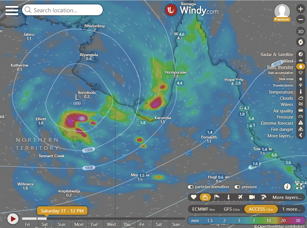
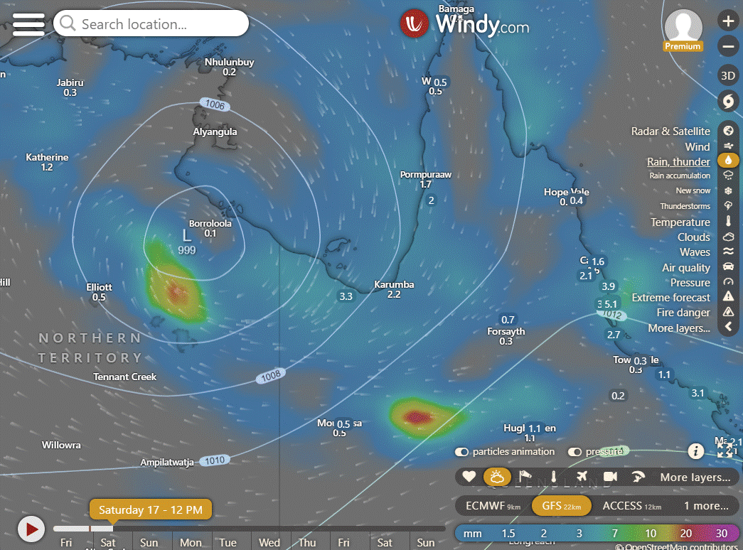
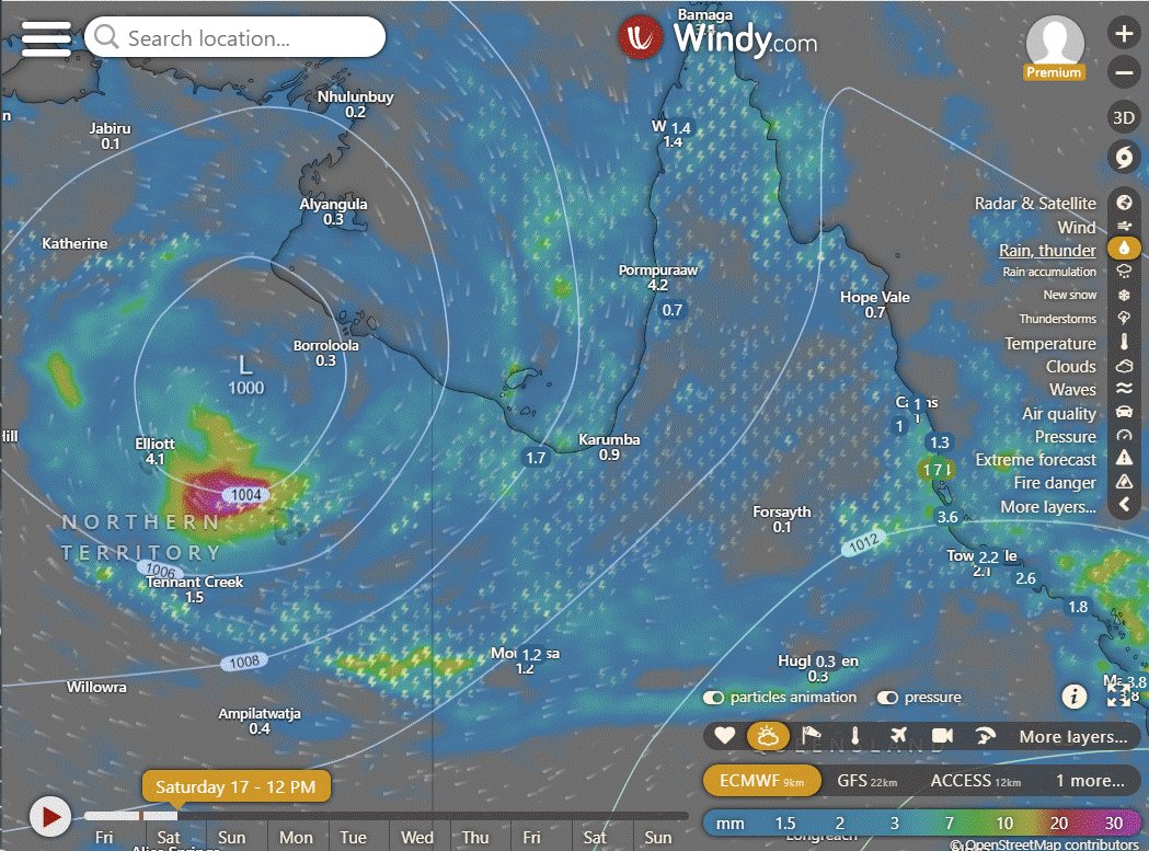
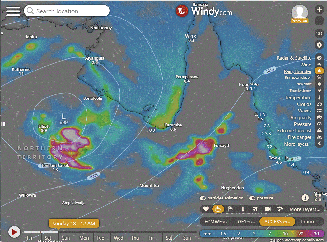
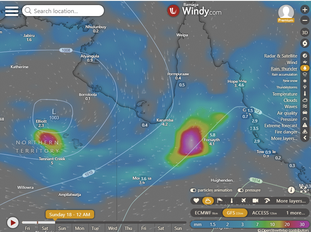
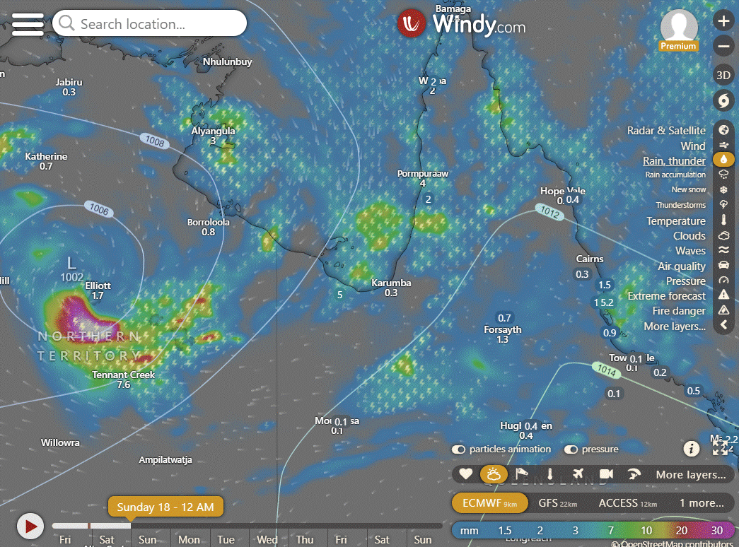
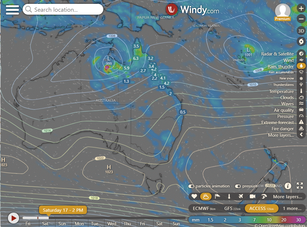
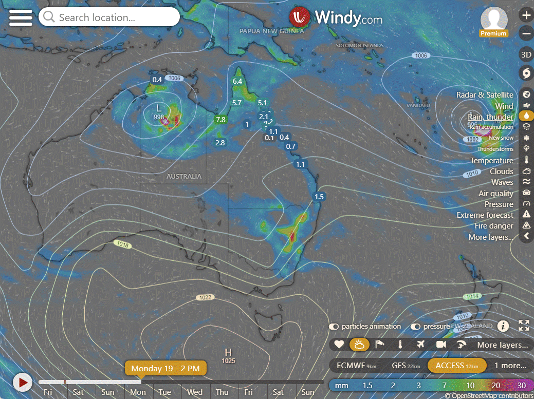
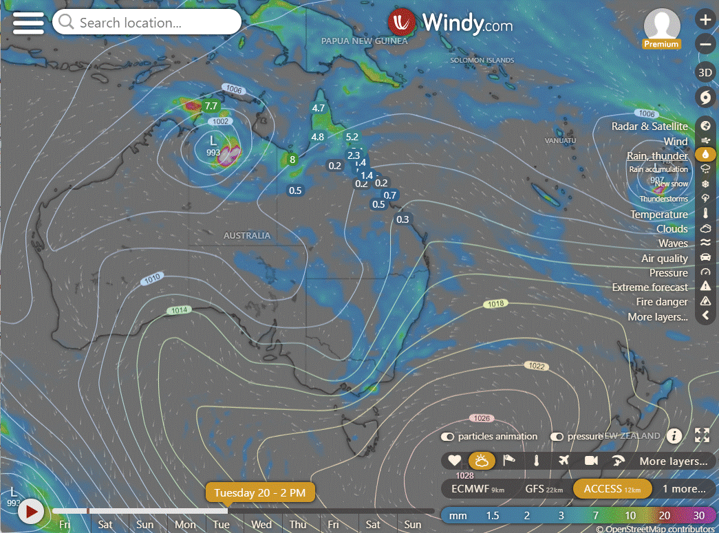
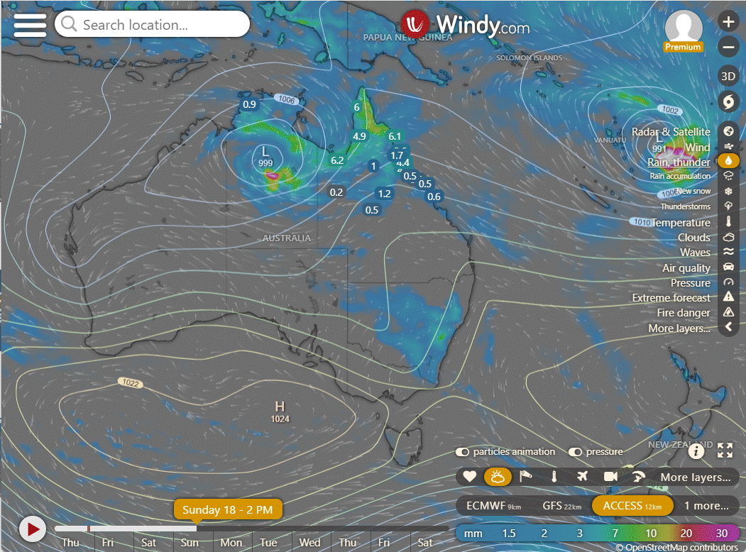
TC Lincoln formed but will be short lived as it heads South over land shortly. Tropical Cyclone 14P (Lincoln) is currently around 423 nautical miles east-southeast of Darwin, Australia. In the last six hours, it moved south-southwest at a speed of 08 knots and has accelerated, making landfall. The system's position is confidently determined from radar observations, and its intensity is estimated from nearby surface wind reports, including one from Centre Island, 33 nautical miles northwest. The cyclone is expected to continue southwestward, moving further inland, and interactions with land are likely to lead to its dissipation within the next 12 hours.
National
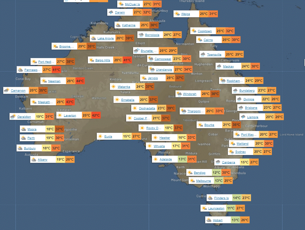
A monsoon low is bringing heavy rain, storms, and gusty winds from NW QLD across the NT interior. Showers and storms are expected in the northern tropics, as well as parts of QLD, NSW, and eastern VIC due to humid winds. High-pressure systems will keep much of the remaining areas dry. Easterly winds in WA are dry and hot.
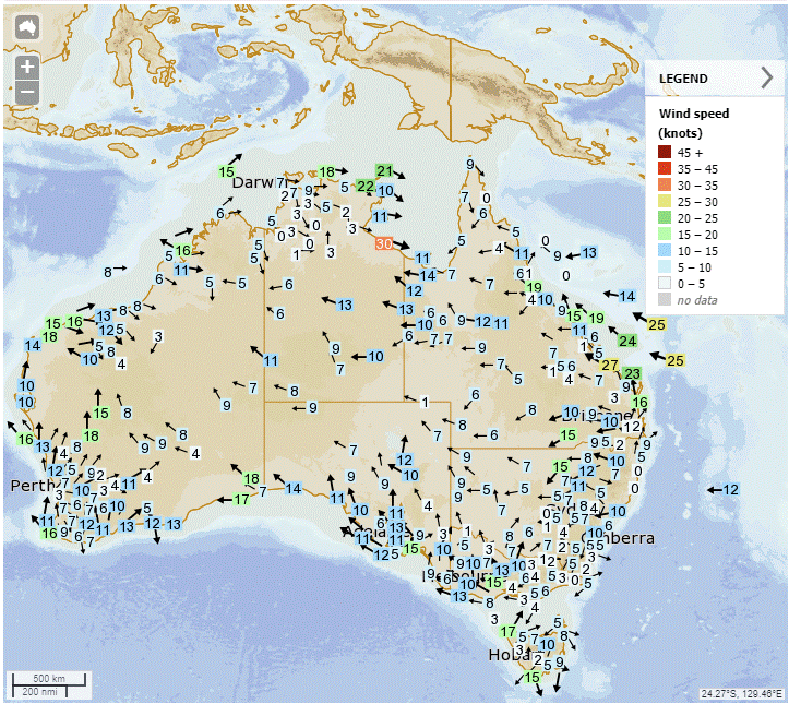
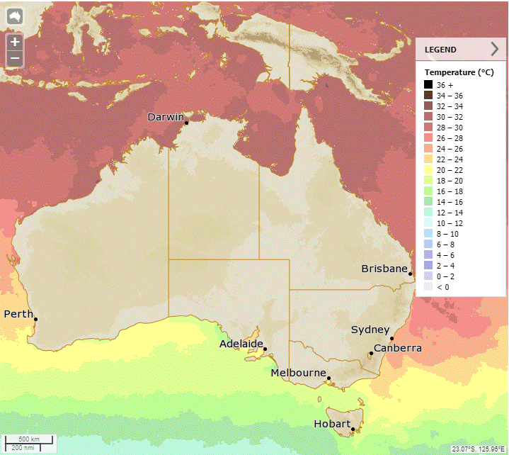
Synoptic | Temp/Rain | Wind | Sea Surface Temp
State
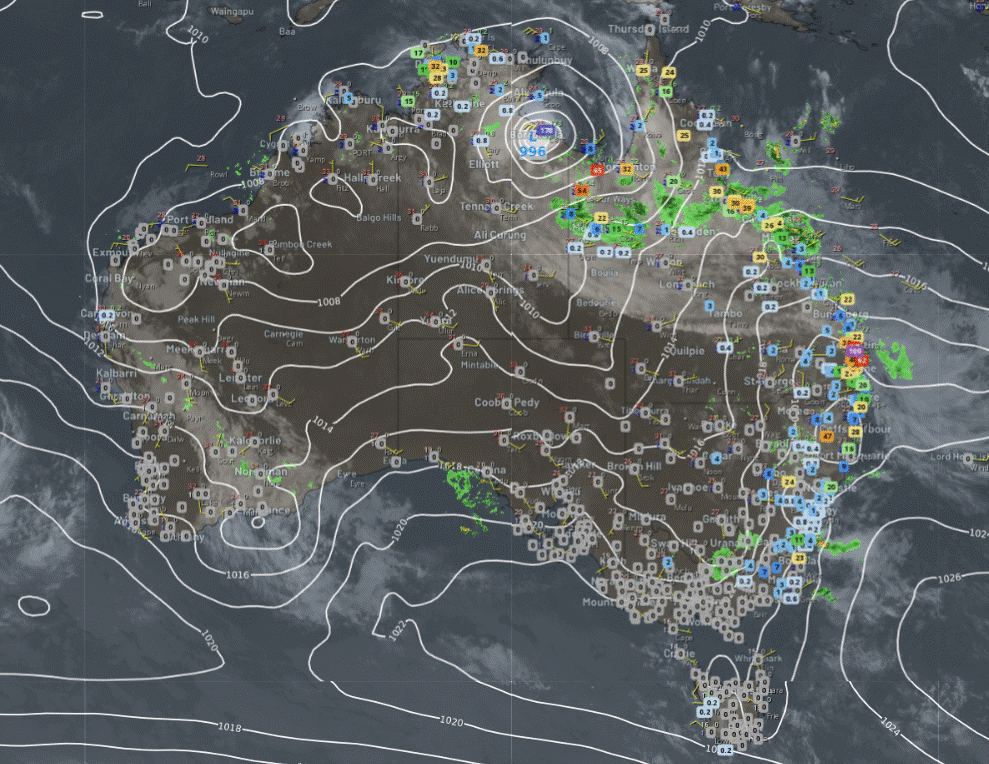
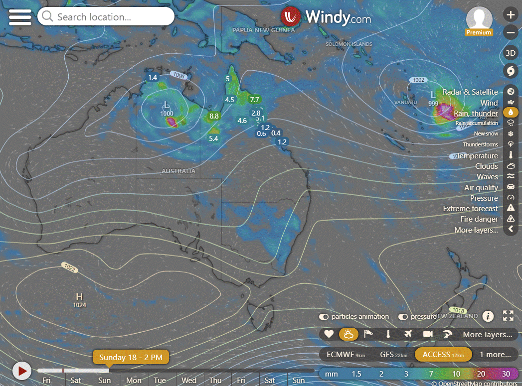
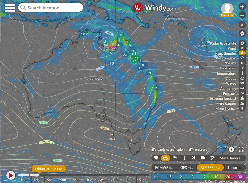
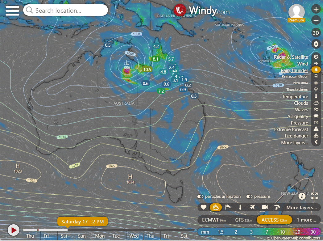
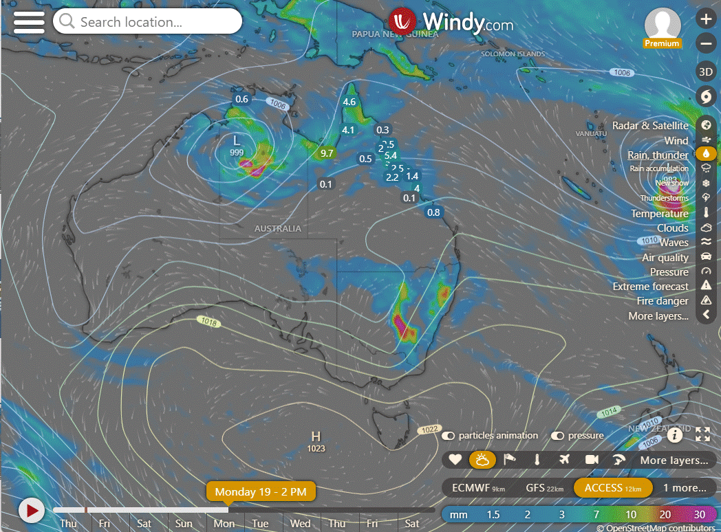
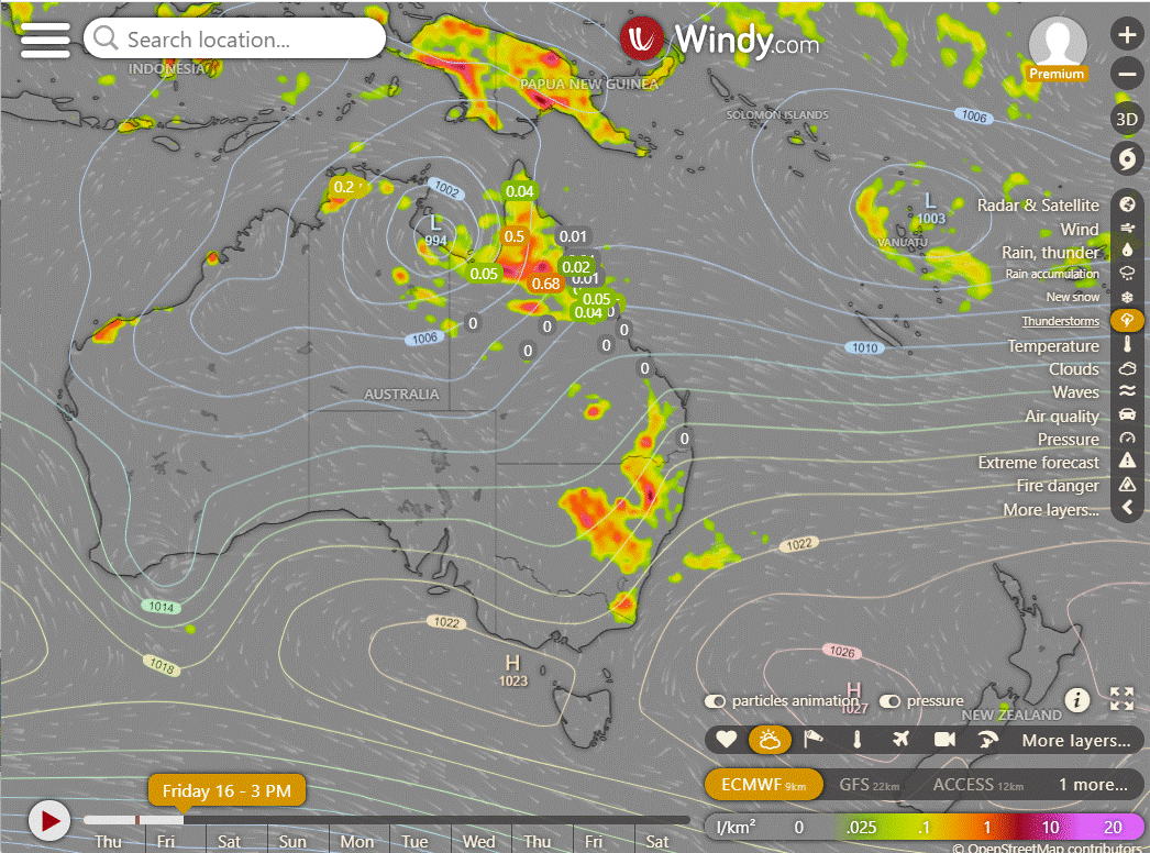
Monsoon trough over Gulf of Carpentaria & western Peninsula with Cyclone Lincoln. Cyclone will move to Northern Territory, then westward over the weekend, weakening the trough over QLD. Weak trough in western QLD will bring unsettled conditions, but will move out later. Ridge over eastern & southern QLD will strengthen as new high pressure system approaches Tasman Sea. Weak upper trough in south will increase rainfall along east coast, but settled conditions returning to southern QLD over the weekend as trough moves offshore.
ACCESS (Values are rainfall over 3 hours)
4-day
Saturday: Isolated thunderstorms and showers, heavy rainfall possible over Peninsula, Gulf Country, and North Tropical Coast. Heavy rainfall possible near northeast coast between Innisfail and Townsville. Scattered showers and thunderstorms for remaining eastern districts, widespread rain at times along the coast. Light to moderate winds, fresh at times in western Queensland and strong along the coastal Gulf Country and west Peninsula coast. Possible damaging wind gusts in Gulf Country.
Sunday: Sunday: Thunderstorms and showers across northern and far northern Queensland, with locally heavy rainfall possible. Isolated showers in the remaining eastern districts. A chance of thunderstorms in far southern Queensland. Partly cloudy in the central and southern interior. Below-average temperatures in the northwest, near average elsewhere.
Monday: Scattered showers with possible thunderstorms in the Gulf Country, North West, Peninsula, North Tropical Coast. Showers in remaining eastern districts. Isolated showers and thunderstorms in southern inland and southeastern Queensland. Max temps below average in the northwest, above average in the south.
Tuesday: Scattered showers, some turning to rain, with isolated thunderstorms in the northern areas. More scattered showers in the eastern districts. Isolated showers and a chance of thunderstorms in the south. Temperatures mostly below average in the northwest, and near or slightly above average in other areas.
North Tropical Coast and Tablelands:
Max temperature: 31, Min temperature: low to mid 20s, Wind speed: easterly 15 to 20 km/h becoming light in the evening, Wind direction: easterly, Rainfall: showers most likely in the late morning and afternoon with a chance of a thunderstorm, Other: cloudy with heavy falls possible along the coastal fringe.
Herbert and Lower Burdekin:
Max temperature: 30; Min temperature: low to mid 20s; Wind speed: light winds becoming easterly 15 to 20 km/h in the early afternoon then becoming light in the evening; Wind direction: easterly; Rainfall: very high chance of showers, most likely in the late morning and afternoon; Other: cloudy, chance of thunderstorm.
Central Coast and Whitsundays:
Max temperature: around 30, min temperature: low to mid 20s, wind speed: 15 to 25 km/h, wind direction: east to southeasterly, rainfall: high chance of showers, thunderstorm in the north, heavy falls possible, other: cloudy.
Peninsula:
Max temperature: Low 30s, Min temperature: Mid 20s, Wind speed: Light, Wind direction: North to northeasterly, Rainfall: High chance of showers and chance of a thunderstorm, Other: Cloudy with light winds becoming north to northeasterly 15 to 20 km/h in the morning then becoming light in the evening.
Gulf Country:
Max temperature around 30 with overnight temperatures in the low to mid 20s, windy with winds east to northeasterly 20-30 km/h, cloudy with a very high chance of showers, chance of a thunderstorm, possible heavy falls and damaging winds near the Northern Territory border.
Northern Goldfields and Upper Flinders:
Max temperature: 30, Min temperature: low to mid 20s, Wind speed: 20 to 30 km/h, Wind direction: easterly, Rainfall: Very high chance of showers, Other: Cloudy with chance of thunderstorm.
Capricornia:
Max temperature: 30, Min temperature: 19-23, Wind speed: 15-25 km/h, Wind direction: east to southeasterly, Rainfall: medium chance of showers, Other: Partly cloudy.
Central Highlands and Coalfields:
The summary for the weather is: Max temperature of 30, min temperature between 19 and 22, light winds becoming easterly, partly cloudy, medium chance of showers in the north, slight chance elsewhere, and a chance of thunderstorms in the northwest.
Central West:
Maximum temperature: 34, Minimum temperature: low 20s, Wind speed: 20 to 30 km/h easterly, Wind direction: easterly, Rainfall: partly cloudy with medium chance of showers north of Longreach and slight chance elsewhere, other: chance of thunderstorm north of Longreach.
North West:
Maximum temperature: 34, Minimum temperature: low to mid 20s, Wind speed: 25 to 35 km/h, Wind direction: easterly, Rainfall: Very high chance of showers with possible heavy falls, Other: Cloudy, chance of thunderstorm, damaging winds possible.
Channel Country:
Today's weather will have a max temperature of 39, a min temperature of mid to high 20s, wind speed of 20 to 30 km/h, wind direction easterly, and a chance of thunderstorm in the northwest with partly cloudy skies and slight chance of a shower near Northern Territory border.
Maranoa and Warrego:
Max temperature: 36°C, Min temperature: 19°C, Wind speed: 15-20 km/h, Wind direction: east to northeasterly, Rainfall: slight chance of shower in northwest, mainly dry elsewhere.
Darling Downs and Granite Belt:
Max temperature: 29 to 34, Min temperature: around 19, Wind: E to NE 15 to 20 km/h becoming light before dawn then becoming easterly 15 to 20 km/h in the morning, Rainfall: near zero chance, Clouds: Partly cloudy with medium chance of showers in the far east.
Wide Bay and Burnett:
Max temperature: 30, Min temperature: 18-21, Wind speed: Light winds becoming east to southeasterly 15-25 km/h, Wind direction: East to southeasterly, Rainfall: Medium chance of showers, Overnight: 18-21, Daytime: 30
Southeast Coast:
Max temperature: 30°C, Min temperature: 19-22°C, Wind speed: 15-20 km/h, Wind direction: east-southeasterly, Rainfall: high chance of showers and thunderstorm in morning and afternoon, Partly cloudy.
WEATHER WARNINGS
Various weather warnings are in effect, including a Gale Warning for South East Gulf of Carpentaria, Tropical Cyclone Advice for the Northern Territory, Flood Warning for the Maroochy River, Severe Weather Warning for parts of Carpentaria and Barkly districts, and others.
Major and minor flood warnings are issued for several rivers, including the Nicholson River, Balonne River, Stanley River, Bulloo River, Paroo River (Qld), Moonie River, and more.
A Flood Watch is issued for Gulf Of Carpentaria And Western Cape York Peninsula Catchments.
A Fire Weather Warning is in place for Roe, Lakes, and Fitzgerald Inland.
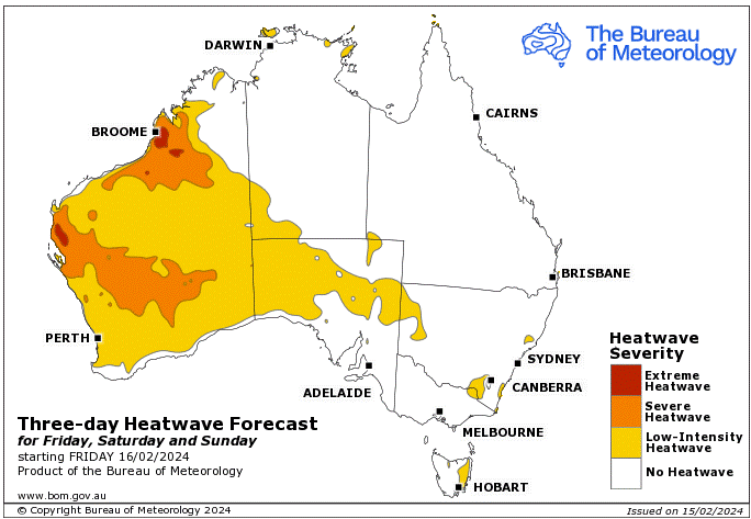
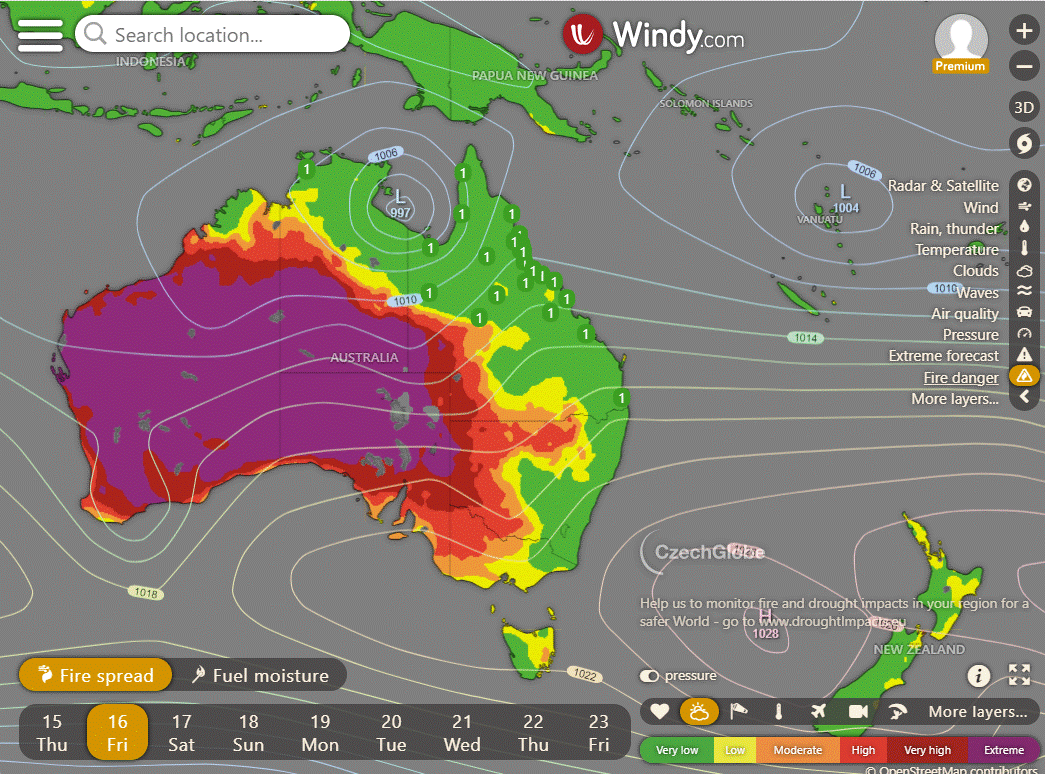
Storms - Heatwave - Fire danger
Click here to support to Wally's Weather
National maps by Weatherzone (weatherzone.com.au)
State maps by Windy (Windy.com)
Weather forecast supplemented by Bureau of Meteorology (bom.gov.au)
Rainfall daily totals (https://meteologix.com/ )
AccuWeather (https://www.accuweather.com/)
Nine Weather (https://www.9news.com.au/weather)
Wally's Weather provides professionally researched data and information. Andrew aka 'Wally' has over 20 years of experience in meteorology research and data analysis. In 2023 finished top 4 for the AMOS national weather forecasting competition. The content here is provided as educational information aimed at providing the community and businesses with the tools required to determine local-based forecasts. IMPORTANT: The forecasts and information posted should never be used on their own to make business decisions as local influences.


Comments