Morning Weather - February 18 - Wally's Weather Australia
- Feb 17, 2024
- 5 min read
This weather update is brought to you by Genesis Electrical NQ

Genesis Electrical NQ
We can Solve all of your Electrical, Air Conditioning and Solar needs!
Phone: 1300 443 637
Email: info@genesislec.com
Monsoon Update
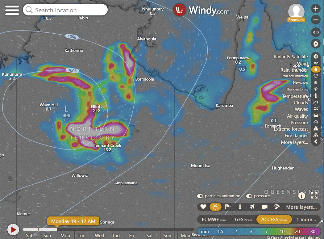
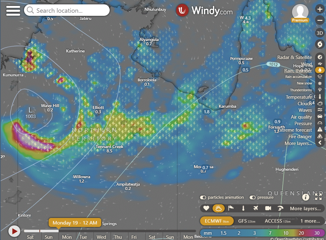
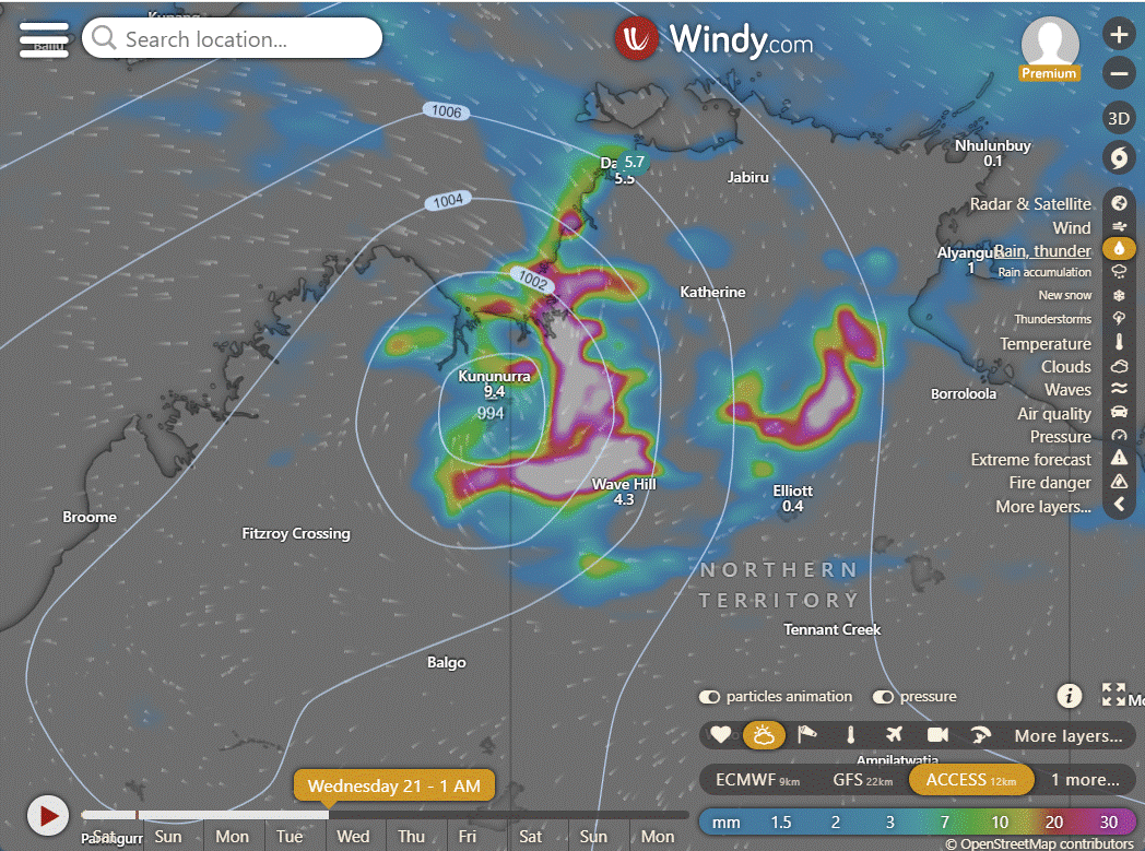
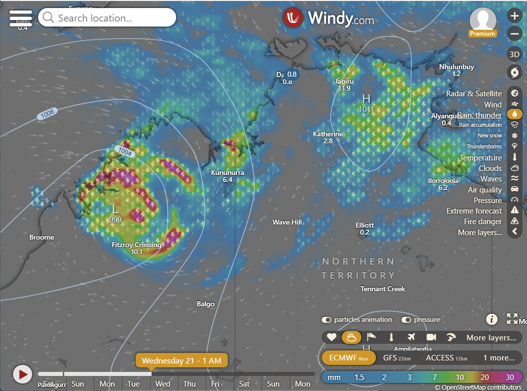
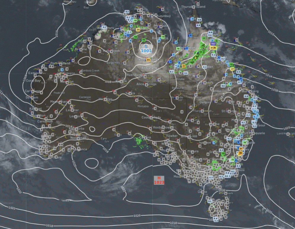
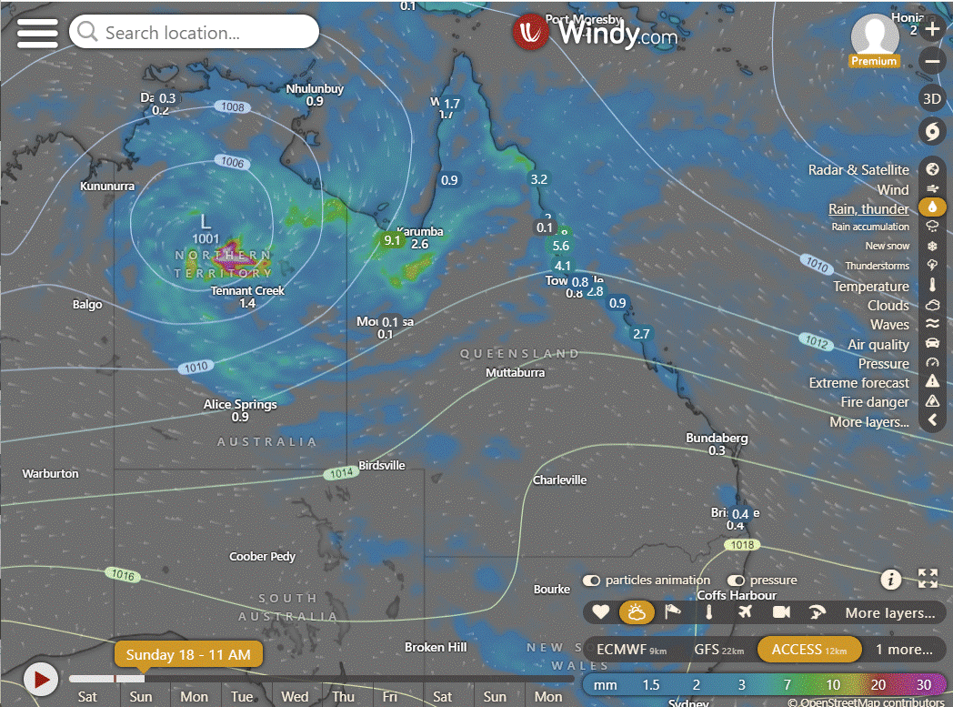
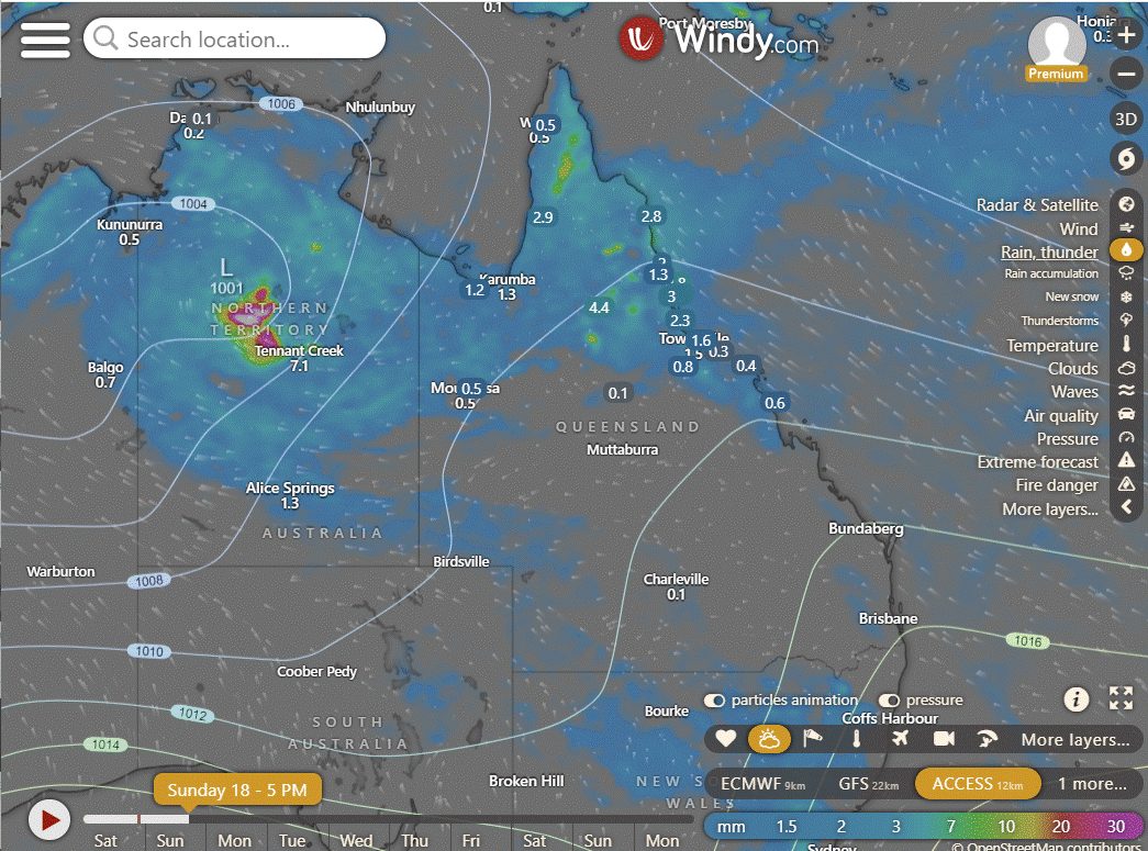
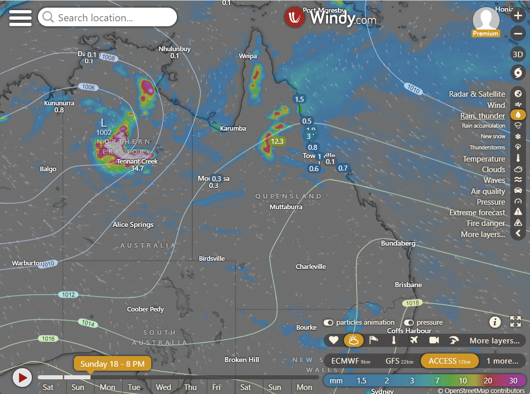
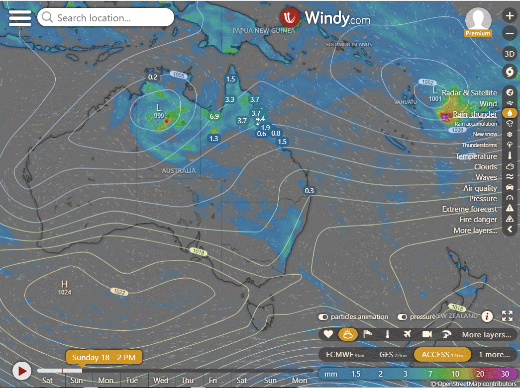
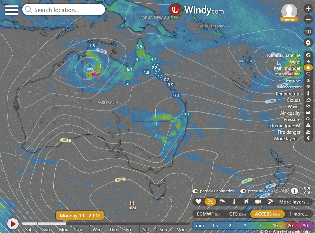
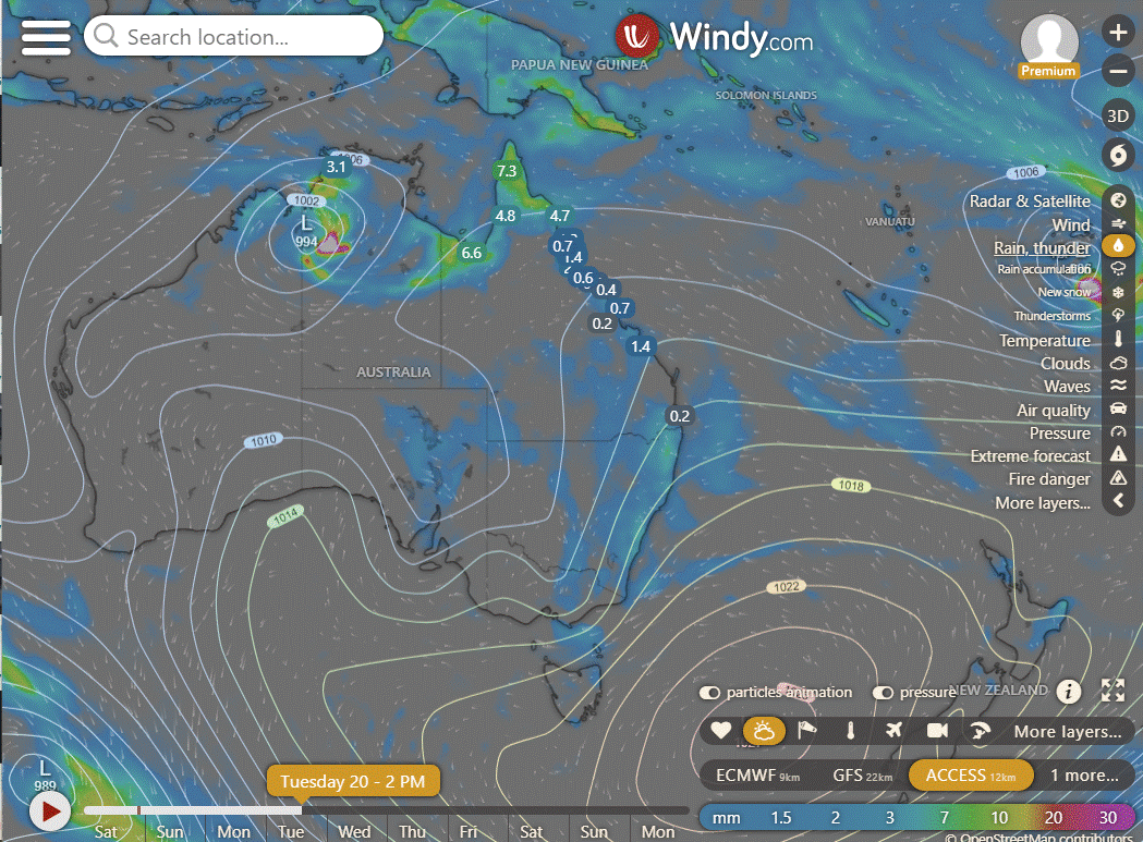
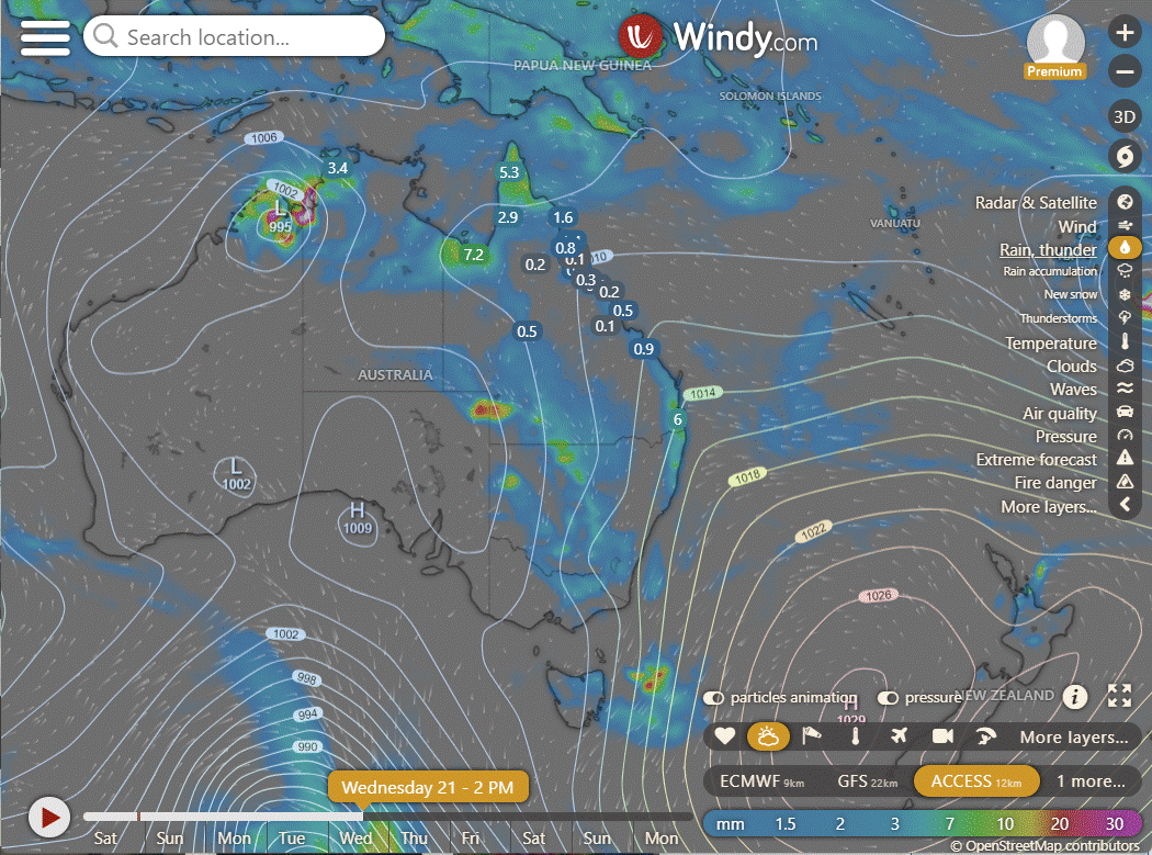
Ex TC Lincoln has moved WSW deeper into the NT and looks to be making a bolt for the WA coast. After that it is a bit unclear, it could head further out or stay along the coast. Three days is best we can do with alignment between the models. The rain is going with it sadly.


National
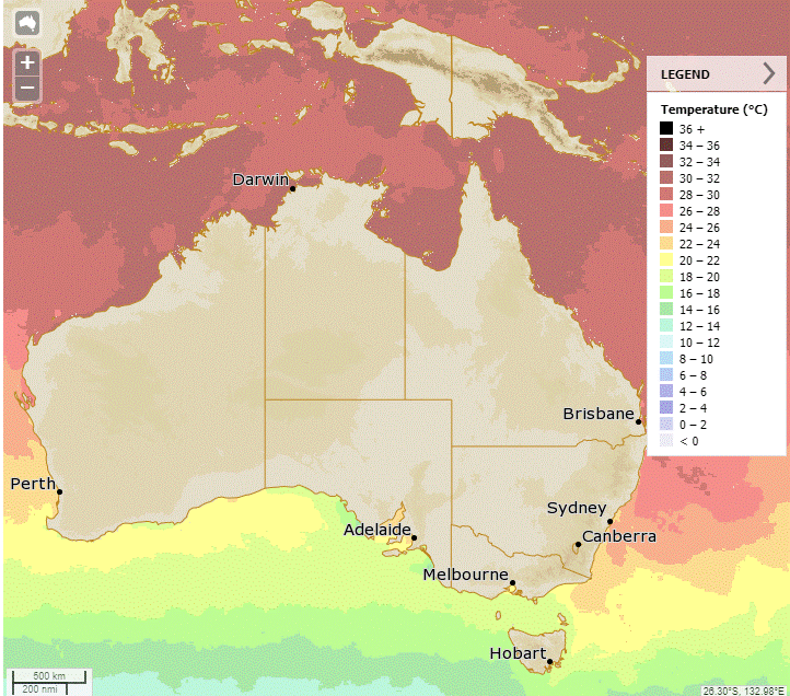
A weakening monsoon low will continue to bring heavy rain, storms, and gusty winds to the NT's interior and WA's north. Showers are expected in parts of QLD's north, NSW, and Tas due to moist onshore winds. High pressure will keep the rest of the areas dry while directing hot winds towards WA's south.

Synoptic | Temp/Rain | Wind | Sea Surface Temp
State
Monsoon trough weakening with Cyclone Lincoln moving westward. Ridge strengthening over eastern Queensland. Showers in far southeast on Monday and Tuesday. Another trough moving east across southern Queensland next week.

ACCESS (Values are rainfall over 3 hours)
4-day
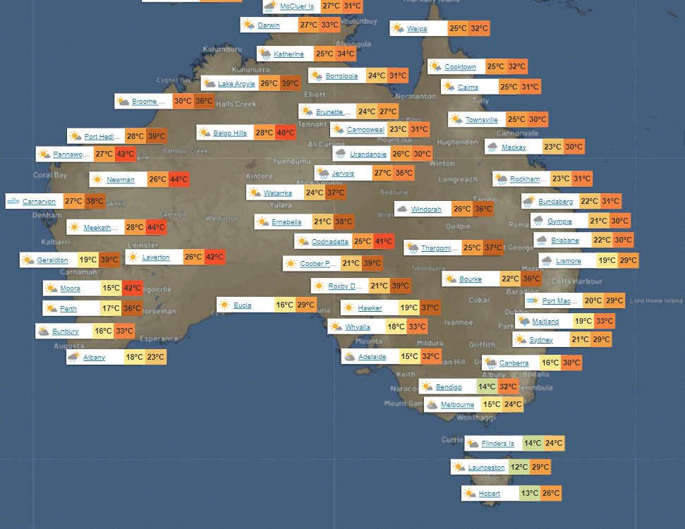
Sunday: Showers in northern Queensland with possible heavy rain. Isolated showers in southern and central areas. Moderate winds shifting to southeasterly.
Monday: Monday: Isolated thunderstorms, scattered showers with rain at times, and possible severe thunderstorms in southeastern Queensland. Varied precipitation across different regions. Temperature extremes with below-average in the northwest and above-average in the south.
Tuesday: Rain at times with isolated thunderstorms in some areas, scattered showers in other regions, some above average temperatures.
Wednesday: Varying showers and thunderstorms across regions. Cooler temperatures in the northwest, near to above average elsewhere.
North Tropical Coast and Tablelands:
Max temperature: 31°C, Min temperature: low to mid 20s, Wind speed: Light, Wind direction: east to southeasterly, Rainfall: Showers likely, Other: Cloudy with chance of thunderstorm.
Herbert and Lower Burdekin:
Max temperature: 30°C, Min temperature: 20°C, Wind speed: 15-20 km/h, Wind direction: Southeasterly becoming easterly, Rainfall: Showers likely, Other: Cloudy with chance of thunderstorm.
Central Coast and Whitsundays:
Max temperature around 30, min temperature in the low to mid 20s, wind 20 to 30 km/h from the east to southeast, with partly cloudy skies and a chance of showers and thunderstorms.
Peninsula:
The forecast for tomorrow includes a high of around 30°C, low of mid-20s, light winds, very high chance of showers in the late morning, possible thunderstorms in the south, and cloudy skies.
Gulf Country:
Max temperature: low 30s, Min temperature: mid 20s, Wind speed: Becoming east to northeasterly 15 to 20 km/h, Wind direction: Light winds becoming east to northeasterly, Rainfall: Showers and chance of thunderstorm, Other: Cloudy with very high chance of showers and possibly severe thunderstorm.
Northern Goldfields and Upper Flinders:
Max temperature: around 30, Min temperature: low 20s, Wind speed: easterly 15 to 25 km/h, Wind direction: east, Rainfall: showers likely, Cloud cover: Cloudy.
Capricornia:
Max temperature: low 30s, Min temperature: 18-23, Wind speed: southeasterly 20-30 km/h becoming light, Wind direction: southeasterly to easterly, Rainfall: slight chance near coast, Other: Partly cloudy, overnight temperatures dropping overnight.
Central Highlands and Coalfields:
Mostly sunny morning with light winds becoming easterly-southeasterly, chance of thunderstorm in north afternoon/evening, temperatures 19-22°C overnight, low 30s°C during the day, and minimal rainfall.
Central West:
Max temperature: low to mid 30s, Min temperature: low to mid 20s, Wind speed: easterly 20 to 30 km/h becoming light, Wind direction: easterly, Rainfall: slight chance of a shower in the northwest, Other: Partly cloudy with near zero chance of rain, chance of thunderstorm in the northwest.
North West:
Max temperature: around 30, Min temperature: low to mid 20s, Wind speed: easterly 20 to 30 km/h becoming light, Wind direction: east, Rainfall: chance of showers, Other: partly cloudy, very high chance of showers north of Mt Isa, medium chance elsewhere, chance of thunderstorm possibly severe.
Channel Country:
Mostly sunny with a slight chance of showers near the Northern Territory border, near zero elsewhere, with a chance of thunderstorms in the northwest in the afternoon and evening; maximum temperature in the mid to high 30s, minimum temperature in the mid to high 20s, winds east to northeasterly 15 to 25 km/h becoming light in the late evening, and no mention of rainfall.
Maranoa and Warrego:
Max temperature in the low to high 30s, min temperature overnight between 19 and 24, wind speed light becoming easterly 15 to 20 km/h, wind direction east, slight chance of a shower near New South Wales border with near zero chance elsewhere, and mostly sunny with a chance of thunderstorm in the afternoon and evening.
Darling Downs and Granite Belt:
The weather forecast for the day includes mostly sunny skies with a maximum temperature of 30 to 35 degrees, light winds becoming easterly at 15 to 20 km/h, with a slight chance of showers in the southwest and near-zero chance elsewhere, potential thunderstorms near the New South Wales border by late morning, and overnight temperatures between 17 and 21 degrees.
Wide Bay and Burnett:
Max temperature of around 30, min temperature between 18-21, south to southeasterly winds 15-25 km/h becoming light, mostly sunny with medium chance of showers on coastal fringe, near zero elsewhere.
Southeast Coast:
The weather will be partly cloudy with a slight chance of a shower, winds south to southeasterly 15-20 km/h becoming east to southeasterly 15-25 km/h in the morning then light in the evening, with overnight temperatures between 18-22°C and daytime temperatures around 30°C.
WEATHER WARNINGS
Severe Thunderstorm Warning (Heavy Rainfall) for parts of North Tropical Coast and Tablelands.
Fire Weather Warning for MidW Cst, Midwest Inland, Lesueur, Swan Inland North, Swan Inland South, Capes, Brockman, Blackwood & Southern Forests.
Strong Wind Warning for Sunday for Leeuwin Coast.
Severe Weather Warning (Heavy, Locally Intense Rainfall & Damaging Winds) for Gregory, Barkly, Tanami, Carpentaria & Simpson districts.
Fire Weather Warning for Eastern Eyre Peninsula.
Minor Flood Warning For The Stanley River.
Strong Wind Warning for Sunday for Central North, Lower East, South East, and South West coasts.
Moderate Flood Warning For The Barcoo River And Minor Flood Warning For Cooper Creek.
Major Flood Warning For The Flinders River.
Initial Flood Watch For East, West And North Kimberley And Fitzroy Rivers And Sturt Creek District.
Major Flood Warning For The Nicholson River.
Minor Flood Warning For The Mary River.
Flood Watch For Parts Of Bonaparte Coastal Rivers, Carpentaria Coastal Rivers, Central Inland Rivers And Kimberley.
Major Flood Warning For The Diamantina River.
Flood Watch For Gulf Of Carpentaria Catchments.
Moderate Flood Warning For The Daly River.
Major Flood Warning For Eyre Creek And Minor Flood Warning For The Georgina River.
Minor Flood Warning For The Dawson And Isaac Rivers And Flood Warning For The Comet River.
Final Flood Warning For The Maroochy River.
Minor Flood Warning For The Balonne River Minor And Bokhara River.
Minor Flood Warning For The Bulloo River.
Minor Flood Warning For The Paroo River (Qld).
Minor Flood Warning For The Moonie River.
Flood Warning For The Inland Rivers Sa.
Minor Flood Warning For The Paroo River (Nsw).
Minor Flood Warning For The Lower Warrego River (Qld).

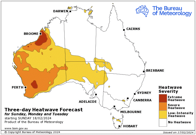
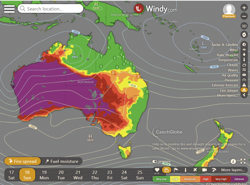
Storms - Heatwave - Fire danger
Click here to support to Wally's Weather
National maps by Weatherzone (weatherzone.com.au)
State maps by Windy (Windy.com)
Weather forecast supplemented by Bureau of Meteorology (bom.gov.au)
Rainfall daily totals (https://meteologix.com/ )
AccuWeather (https://www.accuweather.com/)
Nine Weather (https://www.9news.com.au/weather)
Wally's Weather provides professionally researched data and information. Andrew aka 'Wally' has over 20 years of experience in meteorology research and data analysis. In 2023 finished top 4 for the AMOS national weather forecasting competition. The content here is provided as educational information aimed at providing the community and businesses with the tools required to determine local-based forecasts. IMPORTANT: The forecasts and information posted should never be used on their own to make business decisions as local influences.


Comments