Morning Weather - February 2 - Wally's Weather Australia
- Feb 1, 2024
- 6 min read
This weather update is brought to you by Genesis Electrical NQ

Genesis Electrical NQ
We can Solve all of your Electrical, Air Conditioning and Solar needs!
Phone: 1300 443 637
Email: info@genesislec.com
Monsoon update
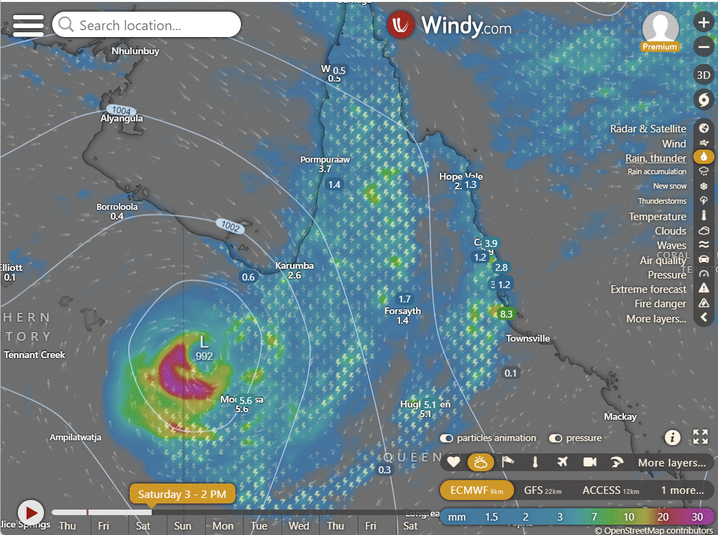
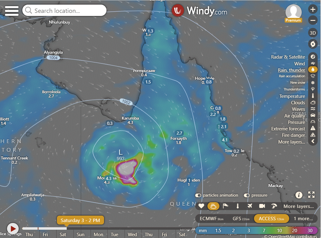
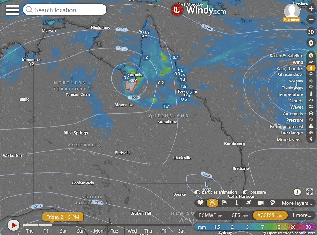
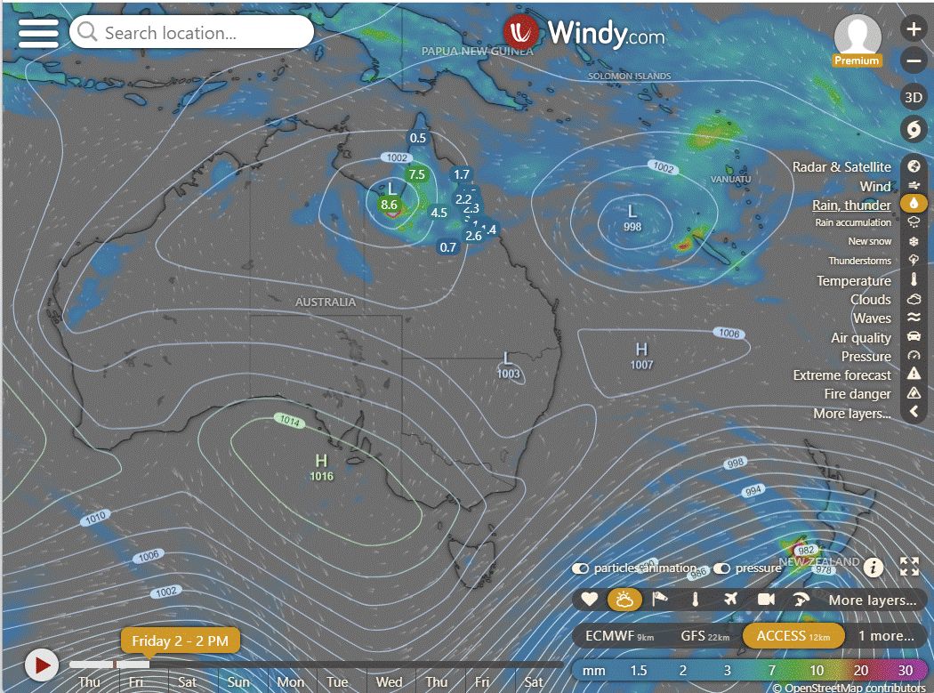
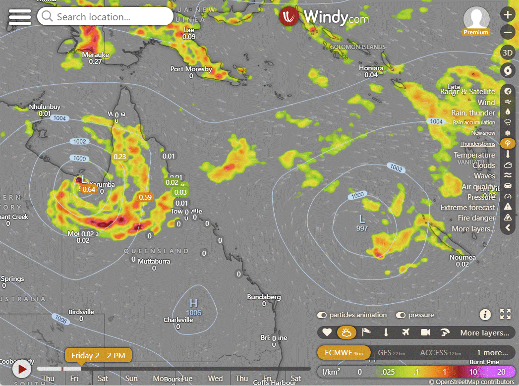
Ex TC Kirrily may develop into a cyclone within 24 hours according to JTWC criteria. ACCESS do not believe this will happen. However the have been over 90km/h gusts at Mornington Island today. It is not expected to hang around and if it does reach cyclone category, it could quickly lose it as it heads back Suuth.
Recent reports from Mornington Island indicate westward winds at 26 knots (about 48 kilometers per hour). The system is currently hugging the southern coast of the Gulf of Carpentaria. Predictions from global weather models suggest it will move slowly and somewhat unpredictably over the next 36-48 hours. There's a chance it might briefly become a weak tropical cyclone before heading back south. There's a high likelihood that this system could develop into a significant tropical cyclone in the next 24 hours.

EC | ACCESS | GFS
National
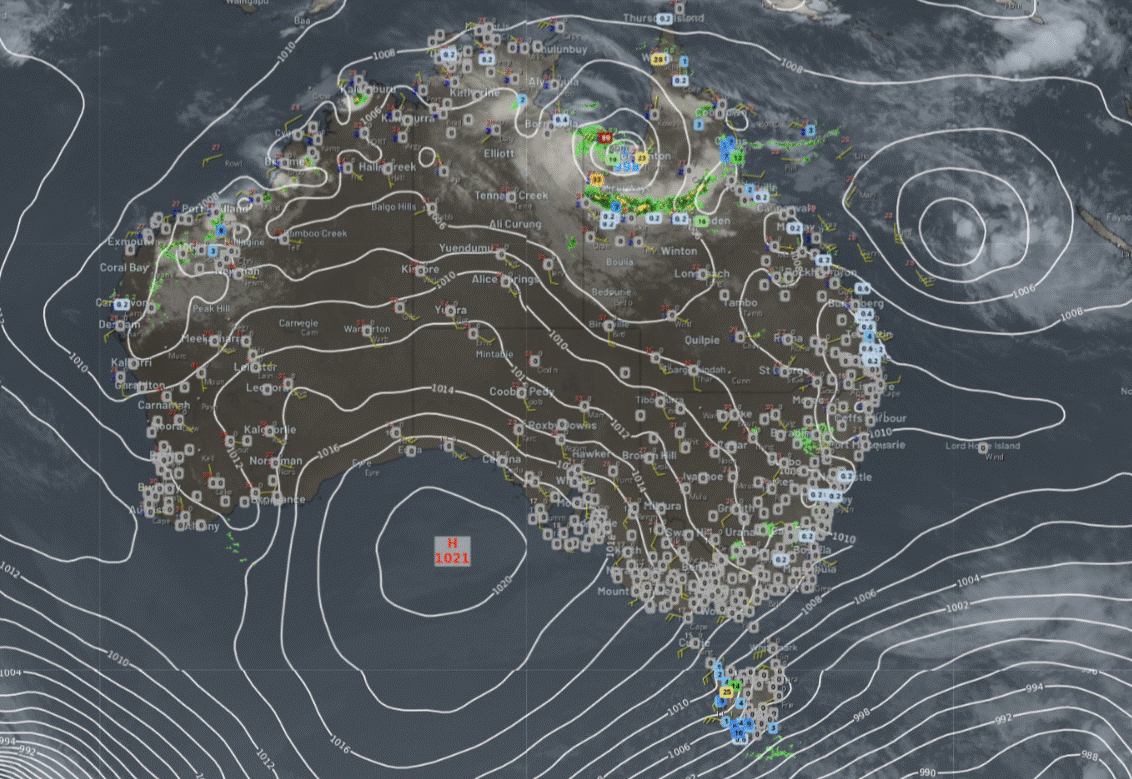
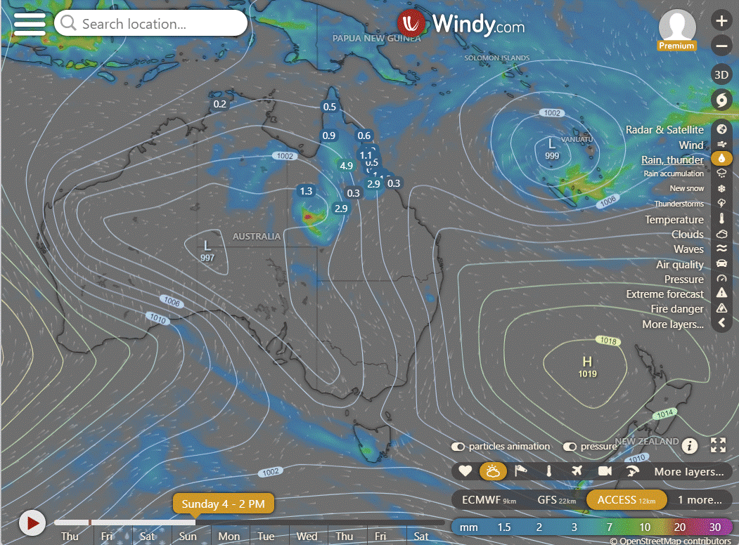
A low and troughs will bring rain, showers, and storms over northern parts of Queensland, the Northern Territory, and Western Australia, with the heaviest precipitation in Queensland.
A trough over Western Australia will draw hot and dry winds to the west coast. Onshore winds will bring showers to eastern New South Wales. High pressure will keep the southern regions dry.
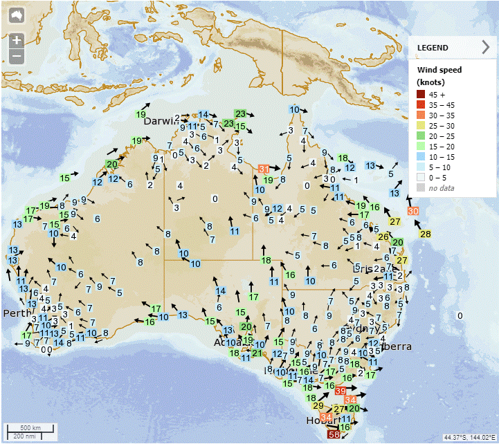

Synoptic | Temp/Rain | Wind | Sea Surface Temp
State
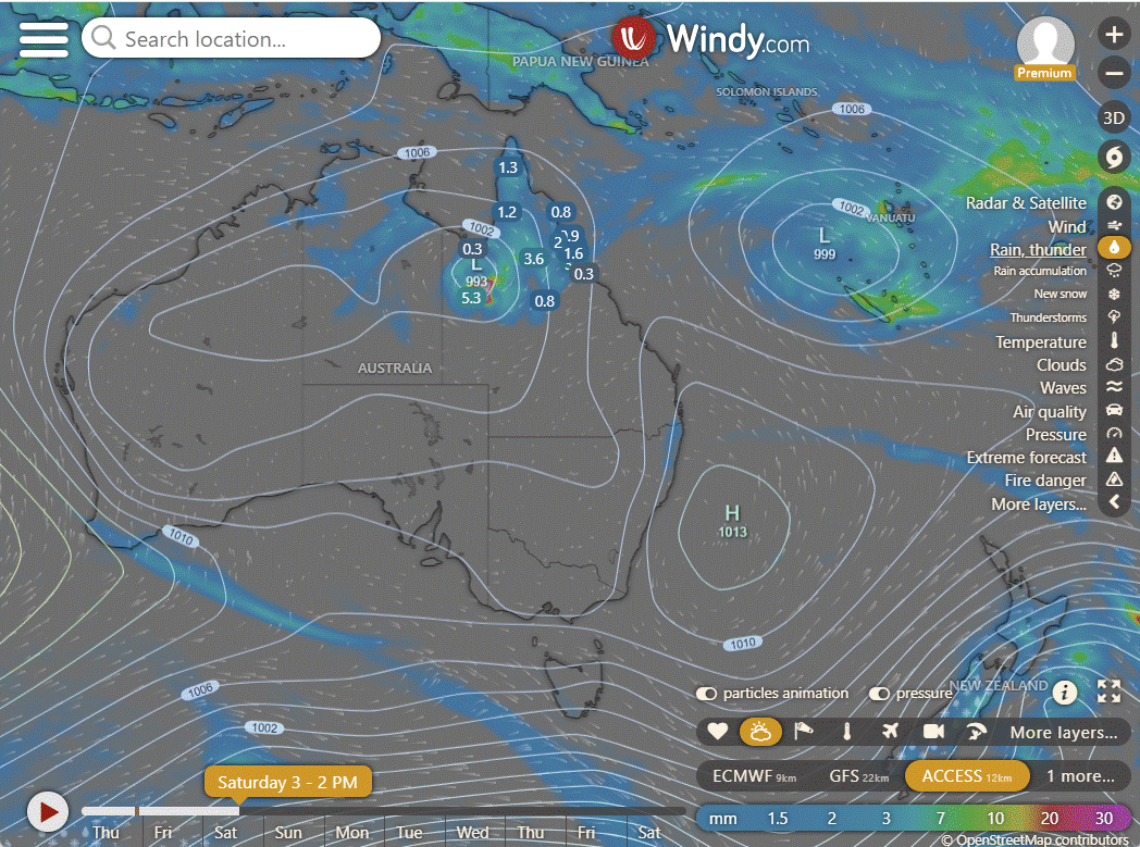
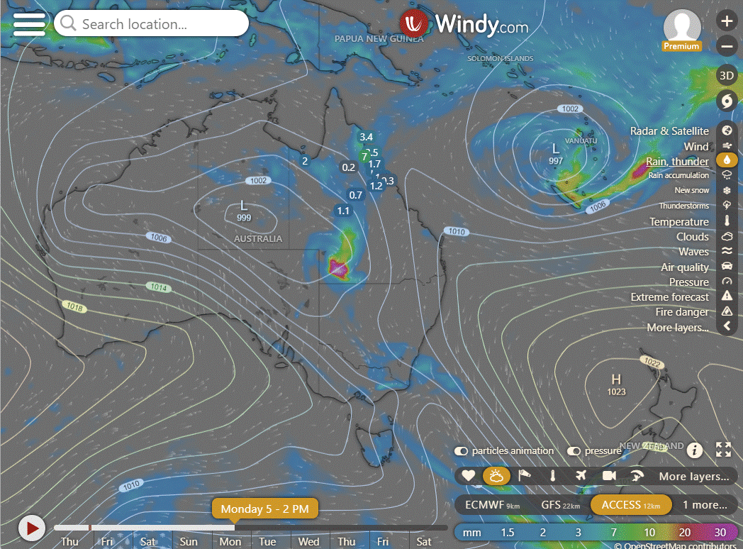
Ex-tropical Cyclone Kirrily is near southern Gulf of Carpentaria, causing heavy rain, flooding, and damaging winds. It will move south into inland western Queensland over the weekend, bringing more rain and flooding. A trough extends across northern Queensland between Kirrily and a low in the Coral Sea, causing unsettled conditions. South of the trough, it is cooler and less humid. A ridge in the southeast brings settled conditions and helps push the trough northwards into Far Northern Queensland.


ACCESS (Values are rainfall over 3 hours)
4-day
Friday: Scattered showers and thunderstorms north of Winton to Mackay. Heavy rain and severe thunderstorms in northern and far northern Queensland. Isolated showers on the east coast south of Mackay. Partly cloudy elsewhere with varying winds. Gale force winds possible on the Gulf Coast and islands.
Saturday: Scattered showers and storms in Far North and North West Queensland. Widespread showers and occasional rain in the North West, with heavy falls and damaging winds from ex-tropical Cyclone Kirrily. Isolated showers in southeast Queensland, partly cloudy elsewhere. Temps below average in parts of Gulf Country and North West, and above avg elsewhere.
Sunday: Northern and western districts will see scattered showers and isolated thunderstorms. Showers will become more widespread with possible heavy falls in the far west interior, depending on the movement of ex-Tropical Cyclone Kirrily. Isolated showers are expected in eastern districts south of Townsville, while other areas will be partly cloudy. Maximum temperatures will be below average in western Queensland and above average elsewhere.
Monday: Monday: Showers and thunderstorms likely in some areas, with possible severe thunderstorms and heavy rain in the southwest. Isolated showers in the east and partly cloudy elsewhere. Temperatures below average in the west and above average elsewhere.
North Tropical Coast and Tablelands:
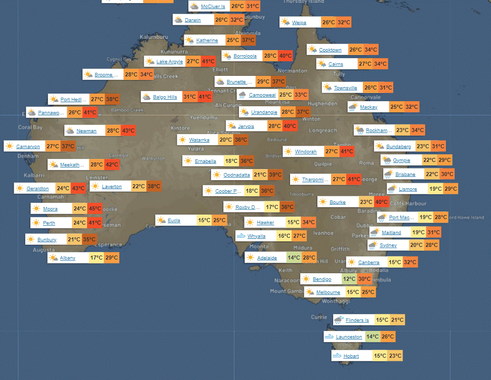
Max temperature: 30, Min temperature: low to mid 20s, Wind speed: light, Wind direction: N/A, Rainfall: Cloudy, Very high chance of showers, Chance of a thunderstorm, possibly severe, Risk of heavy rain near the coast leading to flash flooding.
Herbert and Lower Burdekin:
Max temperature: 30, Min temperature: low to mid 20s, Wind speed: Light, Wind direction: - , Rainfall: High chance of showers, Thunderstorm possible, Risk of heavy rain and flash flooding, Partly cloudy.
Central Coast and Whitsundays:
Max temperature: low 30s, Min temperature: low to mid 20s, Wind speed: southeast 15 to 20 km/h, Wind direction: northeast to southeast, Rainfall: slight chance of a shower in the north, near zero chance elsewhere, Other: partly cloudy, chance of a thunderstorm in the north, winds becoming light in the evening.
Peninsula:
Max temperature: low to mid 30s, Min temperature: mid 20s, Wind speed: NW 20-30 km/h becoming light in the late evening, Rainfall: High chance of showers, Wind direction: NW, Other: Partly cloudy, chance of thunderstorm.
Gulf Country:
Max temperature: 32, Min temperature: mid 20s, Wind speed: 25-35 km/h, Wind direction: northeast to southeasterly tending northwest to northeasterly, Rainfall: very high chance of rain, Chance of thunderstorm: possible, Damaging winds and heavy rain possible, Flash flooding possible in the west, Cloudy.
Northern Goldfields and Upper Flinders:
Max temperature is 30 to 36, min temperature is low to mid 20s, wind speed is 15 to 20 km/h becoming 15 to 25 km/h, wind direction is east to northeasterly, rainfall is very high chance of showers in the north and medium chance elsewhere, and there is a chance of severe thunderstorms.
Capricornia:
Max temperature: low to mid 30s, Min temperature: 19-24, Wind speed: light, Wind direction: northeast to southeasterly, Rainfall: Sunny
Central Highlands and Coalfields:
Max temperature: low to mid 30s, min temperature: low 20s, wind speed: light, wind direction: not stated, rainfall: none, other: sunny with overnight temperature falling to low 20s.
Central West:
Max temperature: 35-40, Min temperature: low to mid 20s, Wind speed: 15-25 km/h, Wind direction: east to northeasterly, Rainfall: sunny morning with chance of thunderstorm in the northwest afternoon and evening.
North West:
The weather forecast for tomorrow covers a range of conditions including maximum temperature, minimum temperature, wind speed, wind direction, rainfall, and cloud cover. There is a very high chance of rain north of Mt Isa and a slight chance elsewhere, as well as a chance of a thunderstorm. Damaging winds and heavy rain may occur in the northeast, potentially leading to flash flooding. Winds are expected to start as east to southeasterly at 15 to 20 km/h, becoming light early in the morning and then shifting to east to southeasterly at 20 to 30 km/h later in the morning. Overnight temperatures will fall to the low to mid 20s, while daytime temperatures will range from 28 to 38 degrees Celsius.
Channel Country:
Max temperature: 40, Min temperature: mid to high 20s, Wind speed: 15-35 km/h, Wind direction: S to SE, Rainfall: Sunny, Other: Chance of raised dust near the South Australian border in the late morning and afternoon.
Maranoa and Warrego:
Max temperature: 36 to 42, Min temperature: low to mid 20s, Wind speed: northwest to northeasterly 15 to 20 km/h becoming light in the morning then becoming southeast to southwesterly 15 to 20 km/h in the early afternoon, Rainfall: none, Other: Sunny.
Darling Downs and Granite Belt:
Max temperature: 39, Min temperature: 17-23, Wind speed: Light winds, Wind direction: Sunny, Rainfall: None
Wide Bay and Burnett:
Max temperature: low to mid 30s, min temperature: 17-21, wind speed: light, wind direction: sunny, rainfall: none, forecast: Overnight temps falling, with daytime temps reaching low 30s.
Southeast Coast:
Max temperature: low to mid 30s, Min temperature: 17-21, Wind speed: Light, Wind direction: Sunny, Rainfall: None.
WEATHER WARNINGS
Minor Flood Warning for the Haughton River Catchment.
Gale Warning for Banks Strait and Franklin Sound, East of Flinders Island, Fred Hen Bay and Norfolks, Central Plateau Lakes, and Lower East, Southeast, and Southwest coasts.
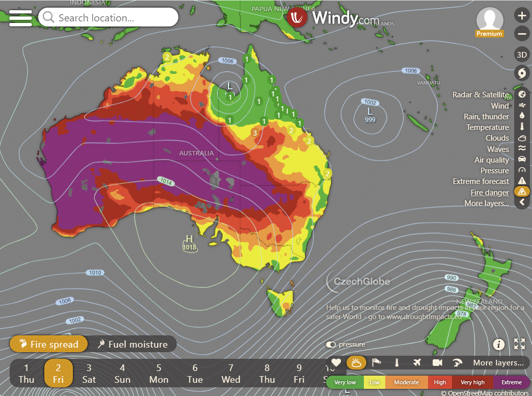
Fire Weather Warning for Swan Inland North, Swan Inland South, Brockman, and Blackwood.
Severe Weather Warning (Heavy, Locally Intense Rainfall And Damaging Winds) for parts of Gulf Country.
Severe Weather Warning (Heavy Rainfall) for parts of North Tropical Coast and Tablelands and Herbert and Lower Burdekin.
Major Flood Warning For The Condamine And Balonne Rivers.
Strong Wind Warning for Friday for Arafura, Gove Peninsula, and Roper Groote coasts.
Hazardous Surf Warning for Saturday for Byron, Coffs, Macquarie, Hunter, Sydney, Illawarra, Batemans, and Eden coasts.
Gale Warning for Western, Southeastern, and Southern Areas.
Severe Weather Warning (Damaging Winds) South East, Central Plateau & Western, Upper Derwent, Northwest Coast, East Coast, Central North & Midlands.
Gale Warning South East Gulf of Carpentaria. Strong Wind Warning for Hervey Bay, Capricornia, and Fraser Island coasts. (Cancelled Sunday Coast Waters)
Major Flood Warning For The Moonie River.
Strong Wind Warning for Central, Central Gippsland, and East Gippsland coasts.
Major Flood Warning For The Flinders River And Minor Flood Warning For The Cloncurry River.
Strong Wind Warning for Spencer Gulf.
Strong Wind Warning for Eden Coast.
Minor Flood Warning For The Bulloo River.
Moderate Flood Warning For The Paroo River (Queensland).
Minor Flood Warning For The Thomson And Barcoo Rivers And Cooper Creek.
Flood Watch For Parts Of The Carpentaria Coast And Eastern Inland.
Flood Watch For Parts Of The Gulf Of Carpentaria.
Moderate Flood Warning For The Diamantina River.
Minor Flood Warning For The Daly River.
Final Flood Warning For The Fitzroy River.
Initial Minor Flood Warning For The Georgina River And Eyre Creek.
Final Flood Warning For The Bremer River And Warrill Creek.
Flood Warning For The Warrego River (Queensland).
Moderate Flood Warning For The Dawson River.
Fire Weather Warning for Swan Inland North, Swan Inland South, Capes, Brockman, Blackwood, and Southern Forests.
Minor Flood Warning For The Paroo River (New South Wales).

Storms - Heatwave - Fire danger
Click here to support to Wally's Weather
National maps by Weatherzone (weatherzone.com.au)
State maps by Windy (Windy.com)
Weather forecast supplemented by Bureau of Meteorology (bom.gov.au)
Rainfall daily totals (https://meteologix.com/ )
AccuWeather (https://www.accuweather.com/)
Nine Weather (https://www.9news.com.au/weather)
Wally's Weather provides professionally researched data and information. Andrew aka 'Wally' has over 20 years of experience in meteorology research and data analysis. In 2023 finished top 4 for the AMOS national weather forecasting competition. The content here is provided as educational information aimed at providing the community and businesses with the tools required to determine local-based forecasts. IMPORTANT: The forecasts and information posted should never be used on their own to make business decisions as local influences.


Hvala za izčrpne strokovne komentarje, pozdrav iz Slovenije vsem kateri se ukvarjate s to problematiko!