Morning Weather - February 7 - Wally's Weather Australia
- Feb 6, 2024
- 6 min read
This weather update is brought to you by Genesis Electrical NQ

Genesis Electrical NQ
We can Solve all of your Electrical, Air Conditioning and Solar needs!
Phone: 1300 443 637
Email: info@genesislec.com
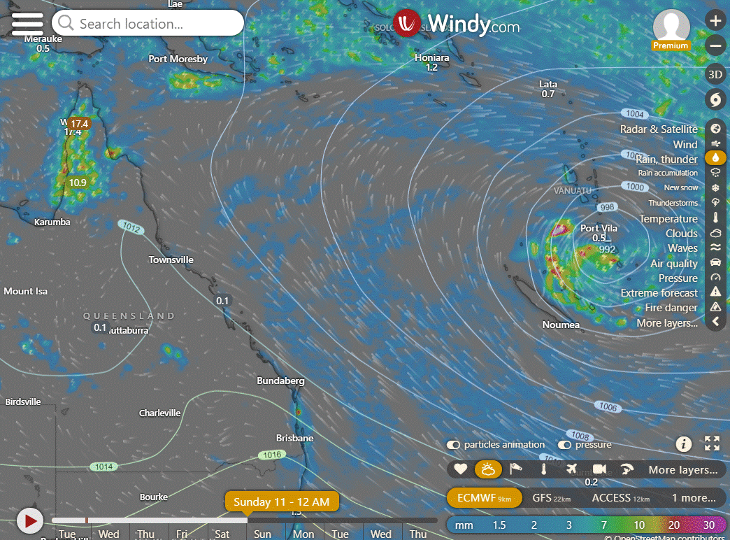
Monsoon update
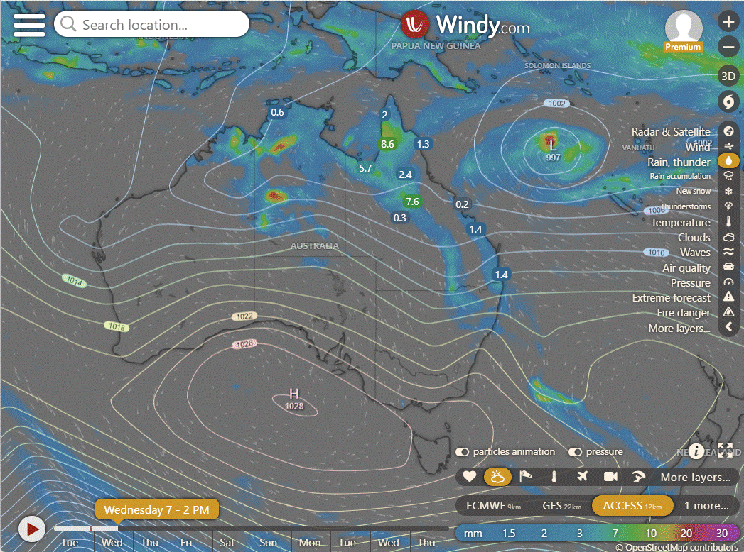
06U in 4 days still shows some variation but looking very much like it is headed for the graveyard. The systems that start up after this should impact this region to Fiji more as the monsoon pulse has shifted East.


EC | ACCESS | GFS
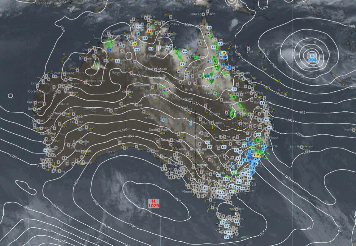
National
Troughs will generate showers and storms over the northern tropics, the NT interior, and Queensland. Onshore winds will bring showers into southeast Queensland and northeast New South Wales. High pressure is expected to keep much of Tasmania, Victoria, South Australia, and Western Australia dry and mostly settled.
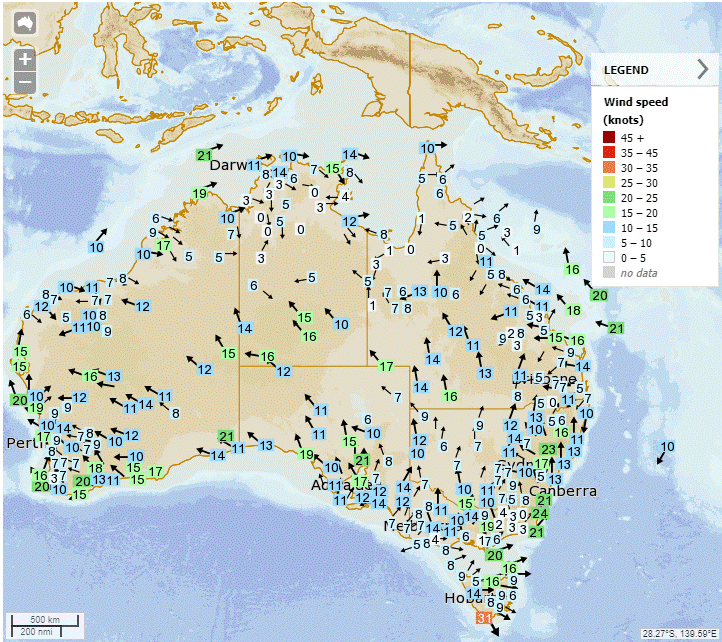

Synoptic | Temp/Rain | Wind | Sea Surface Temp
State
Ex-Tropical Cyclone Kirrily absorbed into trough moving through NSW and extending north into interior QLD. Unsettled conditions expected as trough moves west over next few days. Ridge over QLD strengthens on Wednesday, persisting for several days with highs moving across Great Australian Bight and southern Tasman Sea. Low in eastern Coral Sea moving northwest, then east by weekend. Combined with ridge, this will enhance coastal winds from late Wednesday.
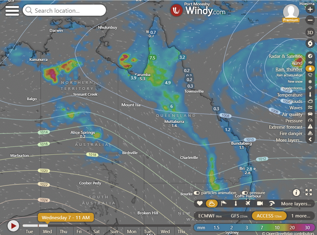
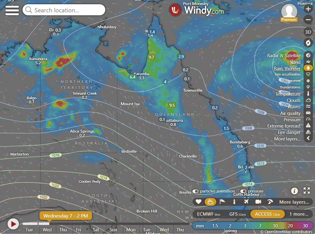
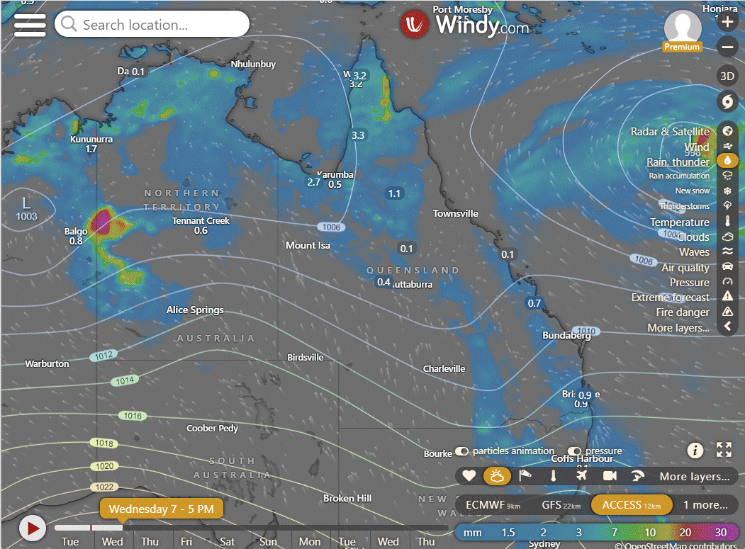

ACCESS (Values are rainfall over 3 hours)
4-day
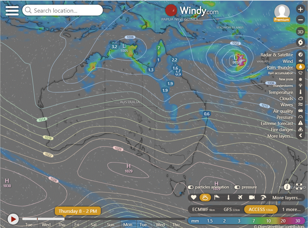
Wednesday: Scattered showers and thunderstorms in interior and northern Queensland north of Townsville, isolated in southwest Queensland. Severe thunderstorms with heavy falls on the Atherton Tablelands and Northern Gold Fields and Upper Flinders. Partly cloudy in eastern districts south of Bowen, isolated showers returning to South East Coast in late evening. Light northeast winds in east, tending northwest in Far North. Moderate southeast to southwest winds in western Queensland.
Thursday: Scattered showers and thunderstorms in the Peninsula, Gulf Country, and northern interior, extending into the southern interior. Showers for eastern districts south of Cooktown. Showers becoming widespread at times over northern Cape York Peninsula. Mostly sunny in the far west. Below average temperatures in the far southwest.
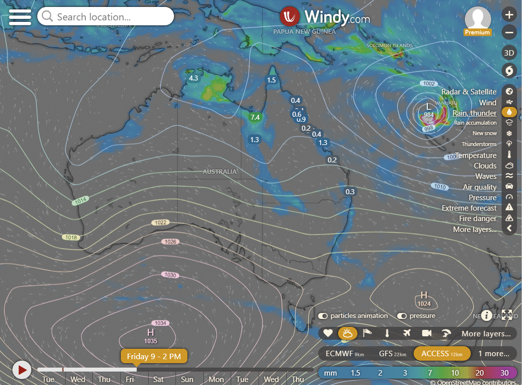
Friday: Isolated showers & storms in western QLD, Gulf Country & Peninsula, scattered on Peninsula. Scattered showers in the east. Partly cloudy elsewhere. Max temps below average in western QLD, above average elsewhere.
Saturday: Some rain and storms in western Queensland, the Gulf Country, and Peninsula, turning to scattered showers on the Peninsula. Showers in eastern areas. Partly cloudy elsewhere. Western Queensland has below average maximum temperatures, while other areas have above average temperatures.

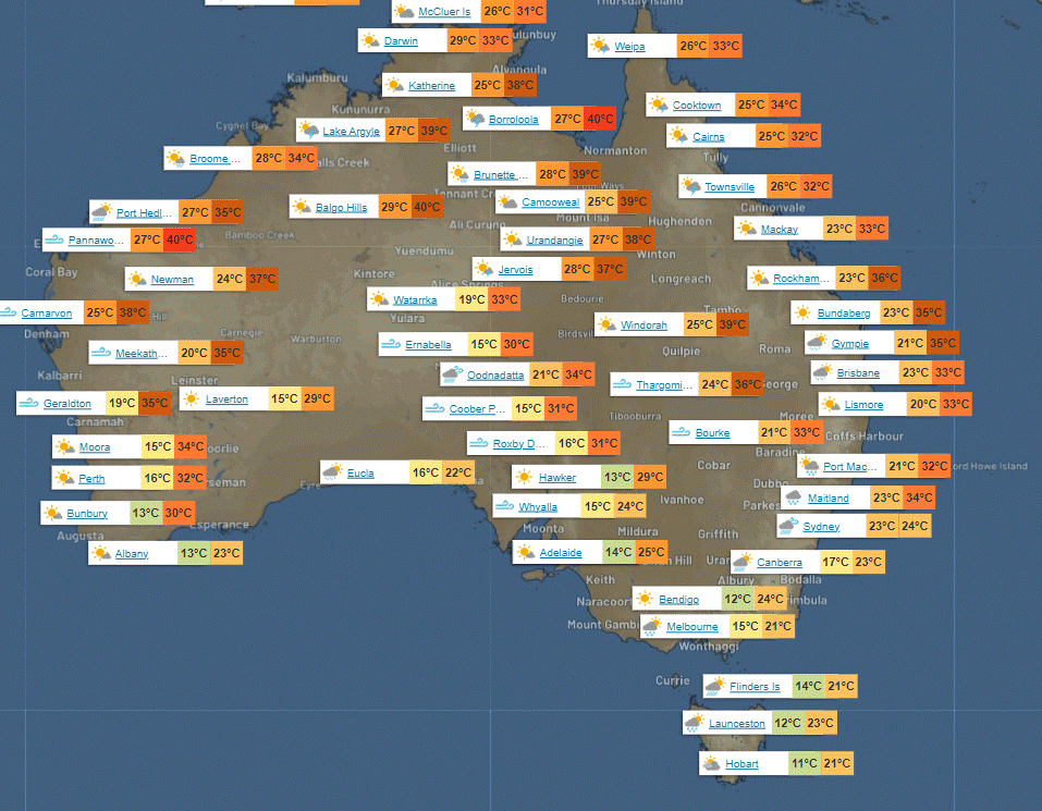
North Tropical Coast and Tablelands:
Max temperature: low to mid 30s; minimum temperature: low to mid 20s; wind speed: light to easterly 15 to 20 km/h; wind direction: easterly; rainfall: medium chance of showers in the north, slight chance elsewhere; other: partly cloudy, chance of a thunderstorm.
Herbert and Lower Burdekin:
Max temperature: low to mid 30s, Min temperature: low to mid 20s, Wind speed: easterly 15 to 20 km/h becoming light, Rainfall: slight chance of a shower, Other: mostly sunny, chance of a thunderstorm inland.
Central Coast and Whitsundays:
Max temperature: 32 to 37, Min temperature: low to mid 20s, Wind speed: 20 to 30 km/h, Wind direction: east to southeasterly, Rainfall: slight chance of a shower, other: Mostly sunny, Light winds becoming breezy in the morning.
Peninsula:
Max temperature: low 30s, minimum temperature: mid 20s, wind speed: light, wind direction: unknown, rainfall: high chance of showers in late morning and afternoon, chance of thunderstorm, other: cloudy.
Gulf Country:
Max temperature: 31 to 36, Min temperature: mid 20s, Wind speed: light becoming southeasterly 15 to 25 km/h in the middle of the day then tending easterly 15 to 20 km/h in the evening, Wind direction: southeasterly becoming easterly, Rainfall: High chance of showers, most likely in the morning and afternoon, Other: Partly cloudy with chance of thunderstorm.
Northern Goldfields and Upper Flinders:
Max temperature: 37, min temperature: low 20s, wind speed: light, wind direction: east to southeasterly, rainfall: chance of showers, other: partly cloudy, chance of thunderstorm.
Capricornia:
Max temperature: low to high 30s; Min temperature: low to mid 20s; Wind speed: light becoming easterly 20 to 30 km/h; Wind direction: southeasterly in the morning, becoming easterly; Rainfall: medium chance of showers in late morning and afternoon; Other: Partly cloudy.
Central Highlands and Coalfields:
Max temperature: low to high 30s, Min temperature: low to mid 20s, Wind speed: light winds becoming east to southeasterly 15 to 25 km/h, Wind direction: east to southeasterly, Rainfall: medium chance of showers, Other: partly cloudy with a chance of a thunderstorm and overnight temperatures falling.
Central West:
Max temperature: 34 to 40, Min temperature: low to high 20s, Wind speed: southeasterly 15 to 25 km/h becoming south to southeasterly 25 to 35 km/h, Rainfall: Partly cloudy with medium chance of showers north of Longreach, most likely in late morning and afternoon, near zero chance of rain elsewhere, Other: chance of a thunderstorm.
North West:
Max temperature: high 30s, Min temperature: mid 20s, Wind speed: 25 to 35 km/h southeasterly, Wind direction: southeasterly, Rainfall: near zero chance, Other: Mostly sunny with medium chance of showers north of Mt Isa, thunderstorm possible in the morning and afternoon.
Channel Country:
The weather forecast includes a max temperature of 32 to 39°C, a min temperature of 20 to 25°C, a wind speed of 20 to 30 km/h in the morning and 30 to 45 km/h later, with a southeasterly wind direction, and no mention of rainfall. The overall weather is described as sunny.
Maranoa and Warrego:
Mostly sunny with showers likely in the east, thunderstorms possible. Southerly winds increasing to southeasterly. Highs in the low to high 30s, lows in the low to mid 20s.
Darling Downs and Granite Belt:
Max temperature: 32 to 38, Min temperature: low to mid 20s, Wind speed: 15 to 20 km/h early, Wind direction: east to northeasterly, Rainfall: High chance of showers, Other: Partly cloudy with a chance of thunderstorm, possibly severe.
Wide Bay and Burnett:
Max temperature: 30 to 35, Min temperature: low to mid 20s, Wind speed: light winds becoming east to southeasterly 20 to 30 km/h in the morning, Wind direction: east to southeasterly, Rainfall: Medium chance of showers, most likely in the morning and afternoon, Other: Partly cloudy.
Southeast Coast:
Max temperature: around 30, Min temperature: low to mid 20s, Wind speed: 15 to 25 km/h, Wind direction: east to southeasterly, Rainfall: high chance of showers, Fog in the north in the early morning.
WEATHER WARNINGS
Strong Wind Warning for Gascoyne and Geraldton coasts.
Fire Weather Warning for Barkly North.
Strong Wind Warning for East Gippsland Coast.
Strong Wind Warning for Spencer Gulf.
Strong Wind Warning for South East and South West coasts.
Gale Warning for Sydney and Illawarra coasts. Strong Wind Warning for Sydney Enclosed Waters & Hunter, Batemans, and Eden coasts.
Minor Flood Warning For The Bulloo River.
Major Flood Warning For The Flinders River.
Flood Warning For The Inland Rivers SA.
Minor Flood Warning For Cooper Creek And Flood Warning For The Thomson And Barcoo Rivers.
Minor Flood Warning For The Paroo River (Queensland).
Major Flood Warning For The Balonne River And Final Flood Warning For The Condamine River.
Minor Flood Warning For The Paroo River (New South Wales).
Moderate Flood Warning For The Diamantina River.
Moderate Flood Warning For The Georgina River And Eyre Creek.
Major Flood Warning For The Nicholson River And Flood Warning For The Leichhardt River.
Major Flood Warning For The Moonie River.
Minor Flood Warning For The Lower Warrego River (Queensland).
Initial Minor Flood Warning For The Upper Herbert River.
Minor Flood Warning For The Dawson And Final Flood Warning For The Connors And Isaac Rivers.

Storms - Heatwave - Fire danger
Click here to support to Wally's Weather
National maps by Weatherzone (weatherzone.com.au)
State maps by Windy (Windy.com)
Weather forecast supplemented by Bureau of Meteorology (bom.gov.au)
Rainfall daily totals (https://meteologix.com/ )
AccuWeather (https://www.accuweather.com/)
Nine Weather (https://www.9news.com.au/weather)
Wally's Weather provides professionally researched data and information. Andrew aka 'Wally' has over 20 years of experience in meteorology research and data analysis. In 2023 finished top 4 for the AMOS national weather forecasting competition. The content here is provided as educational information aimed at providing the community and businesses with the tools required to determine local-based forecasts. IMPORTANT: The forecasts and information posted should never be used on their own to make business decisions as local influences.


Comments