Morning Weather - January 27 - Wally's Weather Australia
- Jan 25, 2024
- 6 min read
Updated: Jan 26, 2024
This weather update is brought to you by Genesis Electrical NQ

Genesis Electrical NQ
We can Solve all of your Electrical, Air Conditioning and Solar needs!
Phone: 1300 443 637
Email: info@genesislec.com
Monsoon update
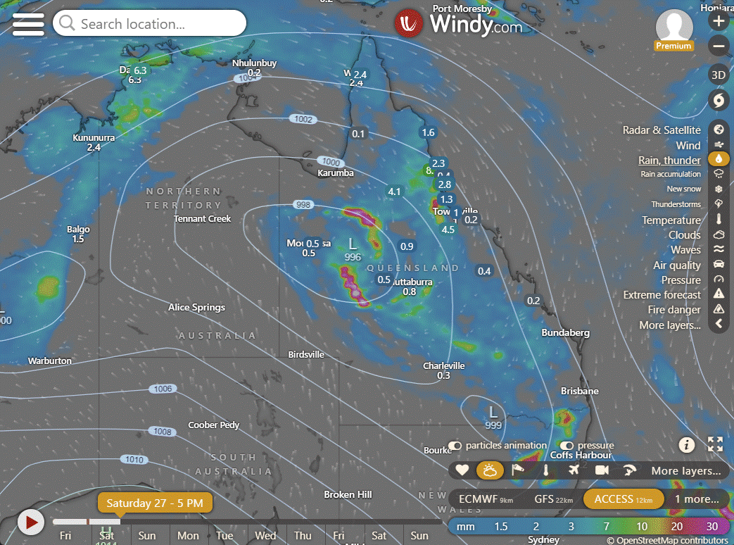
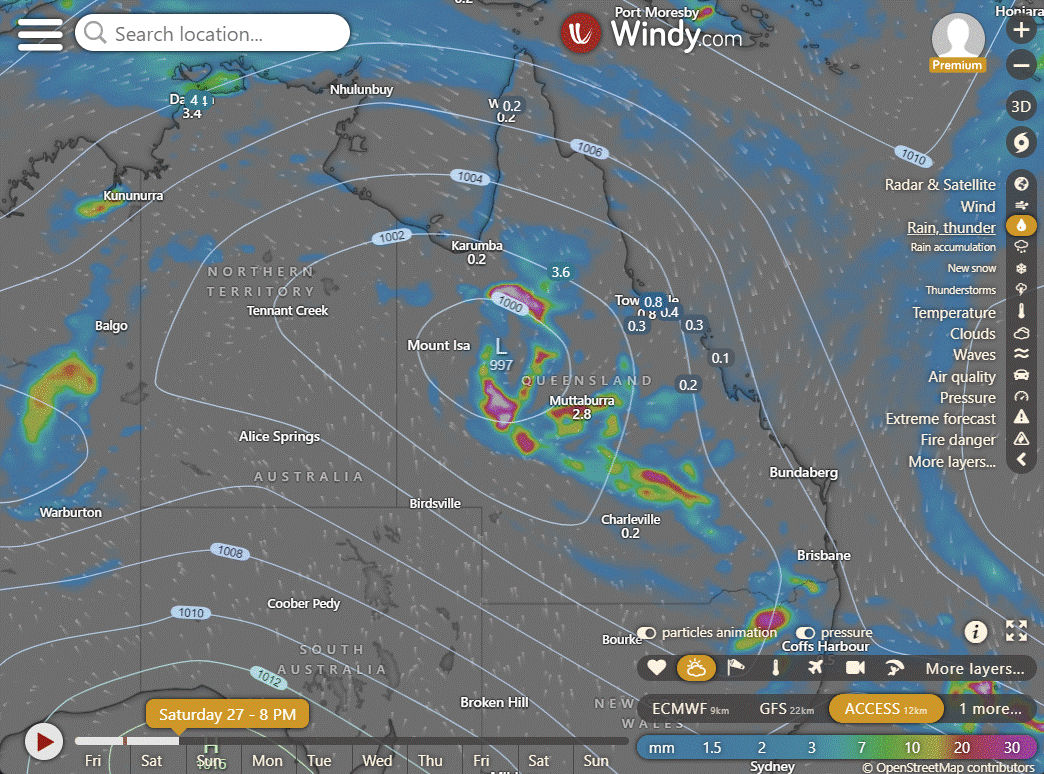
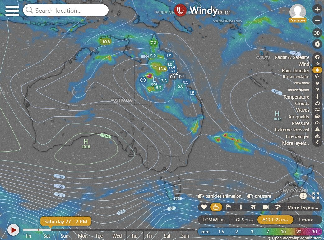
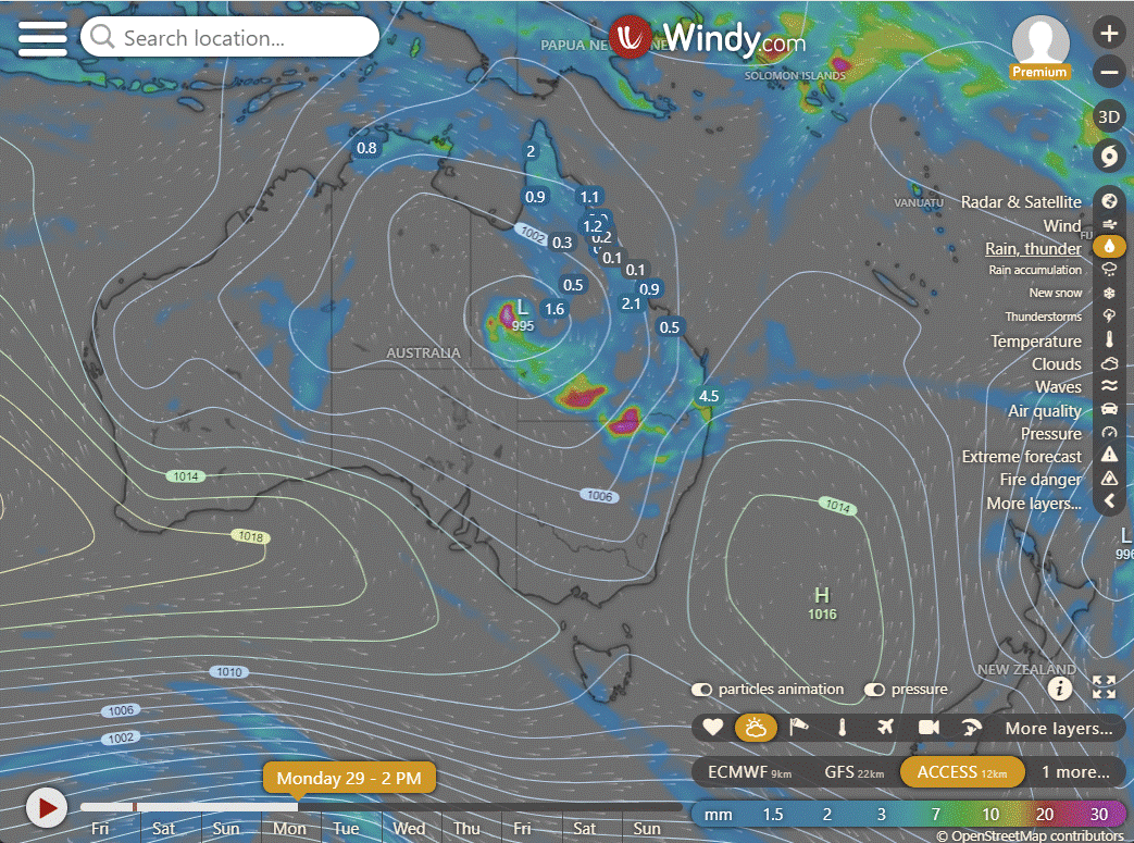
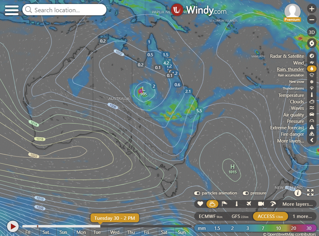
Ex TC Kirrily has headed West inland and is centred South West of Hughenden. Storms over near Isa, they were pretty intense over there last night while we were all focused on the cyclone. More storms in the Gulf. We have a very active monsoon now over Phase 6 which is essentially the Coral Sea. You're going to see lots of "look at this" posts around the place. And having just sat for ages watching a low, if you watch those kinds of posts it's going to drive you nuts. So once I see something that looks like it will eventuate, and the JTWC have got it on their radar, then I will let you know. I will be tracking the others in the long-range posts on the website as a thankyou to the Big Shout members.
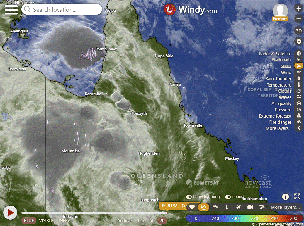


Ex TC Kirrily over Western QLD | Phase 6 Monsoon Activated in Coral Sea | Example of heavy rain over the Coral Sea over the next 7 days.
National
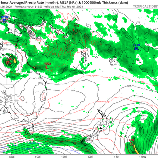
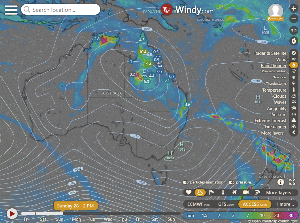
A tropical cyclone in the Coral Sea is expected to approach the QLD coast. The monsoon trough and low will bring continued rain and storms across the northern tropics. Troughs extending across the country will result in showers and storms for WA and SA. Intense heat is expected to persist through the interior.
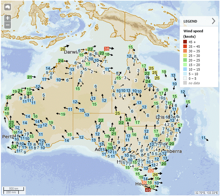
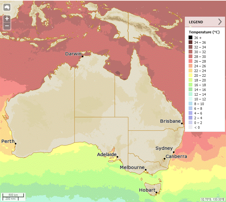
Synoptic | Temp/Rain | Wind | Sea Surface Temp
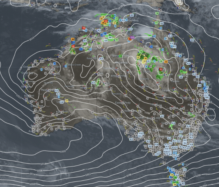
State
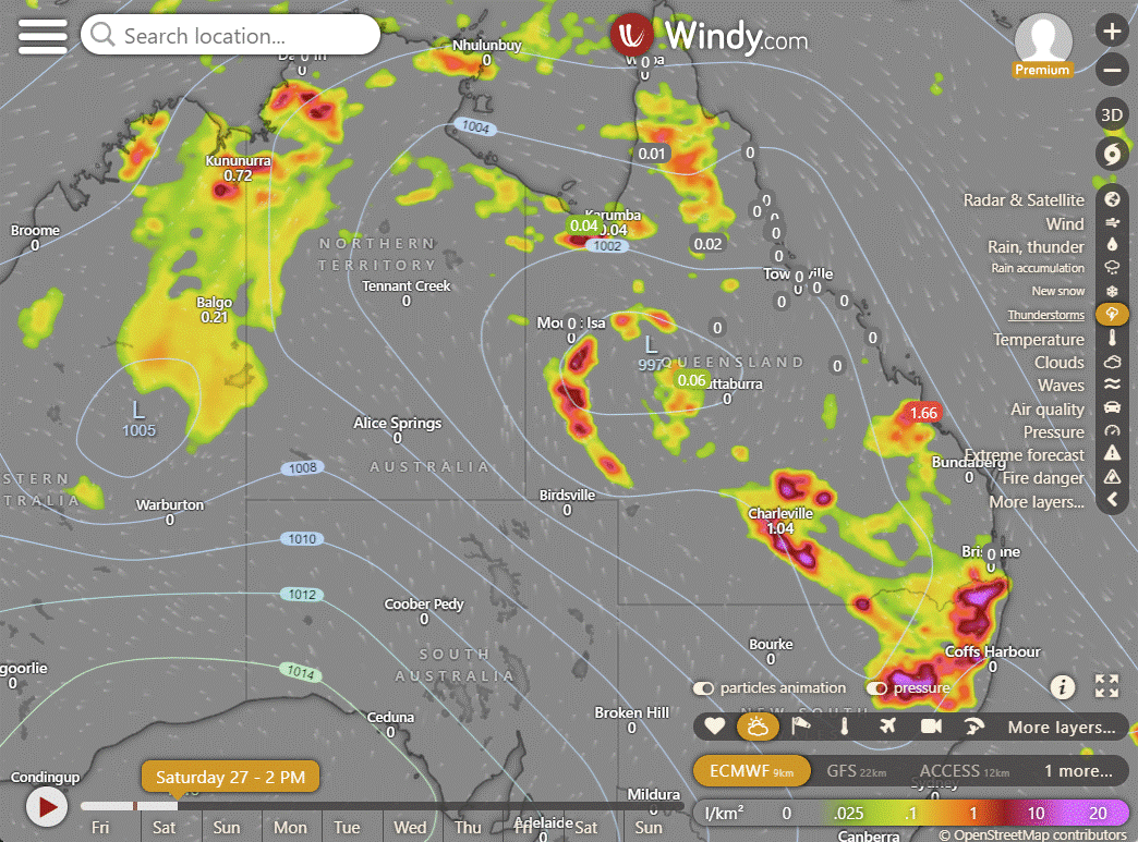
Ex-Tropical Cyclone Kirrily moving westwards across northern Queensland bringing heavy rain and flooding. Trough in southern Queensland causing showers and thunderstorms. Ridge pushing trough towards central and eventually northern Queensland.
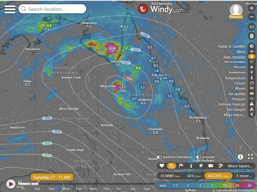
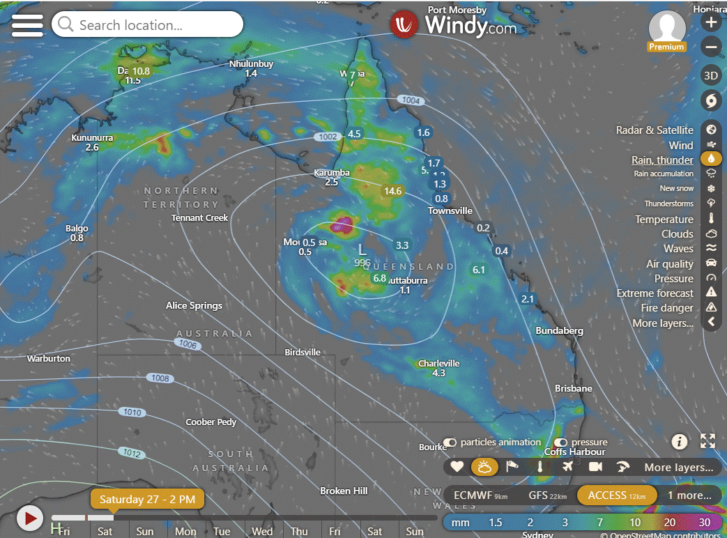
ACCESS 3Hour Rainfall
4-day
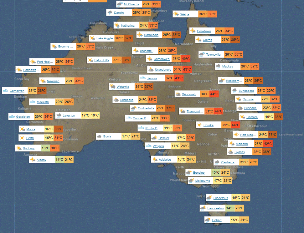
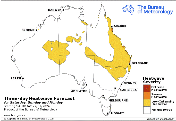
Saturday: Isolated showers and thunderstorms in most of the state, turning scattered in the northern, central, and eastern regions. Widespread showers with some rain in the northern and central interior. Damaging winds and heavy rainfall possible in the northern interior due to ex-Tropical Cyclone Kirrily. Light to moderate winds from northwest to northeast, fresh to strong and gusty on the coast. South to southeast wind change in the far southwest. Heatwave conditions in central, southern, and eastern Queensland, extreme in the southwest and severe elsewhere.
Sunday: Scattered showers, thunderstorms across most of the state, especially in the northwest. Heavy rain and possible flooding near ex-Tropical Cyclone Kirrily. Severe thunderstorms with heavy rainfall in the interior and eastern districts. Partly cloudy in far southwest. High temperatures in the southeast, low in the northwest. Heatwave in tropical northeast coast.
Monday: Scattered showers and thunderstorms across most of the state, becoming more widespread in certain areas. Severe thunderstorms possible in the western, central and southern interior and eastern districts. Higher temperatures in the southeast. Above average temperatures on the east coast and the southwest, below average in the northwest and interior. Heatwave conditions improving.
Tuesday: Mostly showers and thunderstorms in most areas, with more widespread activity in the north, central, and southern interior regions. Some showers and possible thunderstorms in the southeast. Temperatures are above average along the tropical coast, below average in central and southeastern areas, and near or slightly below average elsewhere.
North Tropical Coast and Tablelands:
Max temperature: 34, Min temperature: low to mid 20s, Wind speed: light to 25 km/h, Wind direction: northwesterly, Rainfall: high chance of showers, Other: partly cloudy with chance of thunderstorm, overnight temperatures falling to low to mid 20s
Herbert and Lower Burdekin:
Max temperature: low to mid 30s, min temperature: low to mid 20s, wind speed: light, wind direction: northwest to northeasterly, rainfall: high chance of showers, other: partly cloudy with a chance of severe thunderstorms.
Central Coast and Whitsundays:
Max temperature: low to mid 30s, Min temperature: low to mid 20s, Wind speed: N-NE 15-25 km/h, Wind direction: N-NE, Rainfall: High chance of showers, Thunderstorm possible, Partly cloudy.
Peninsula:
Max temperature: low to mid 30s, min temperature: mid 20s, wind speed: 20 to 30 km/h northwest, wind direction: northwest, rainfall: high chance of showers throughout the day, possible thunderstorm, other: cloudy with temperatures decreasing overnight.
Gulf Country:
Max temperature: low to mid 30s, Min temperature: mid 20s, Wind speed: 20 to 30 km/h NW, Wind direction: NW, Rainfall: Cloudy with high chance of showers in the east, medium chance elsewhere, Chance of thunderstorm, Heavy falls possible in the south.
Northern Goldfields and Upper Flinders:
Max temperature: 35, Min temperature: low to mid 20s, Wind speed: 20 to 30 km/h, Wind direction: north to northwesterly, Rainfall: Very high chance of showers, Thunderstorm possible, Heavy falls possible in the south, Cloudy.
Capricornia:
Max temperature: low to mid 30s; Min temperature: low to high 20s; Wind speed: light winds becoming north to northeasterly 15 to 25 km/h in the morning; Wind direction: varying from light to northeasterly; Rainfall: Partly cloudy with medium chance of showers, most likely in the late morning and afternoon, chance of a thunderstorm.
Central Highlands and Coalfields:
Max temperature: mid to high 30s; min temperature: low to mid 20s; wind speed: light becoming 15-20 km/h; wind direction: northeasterly becoming north to northeasterly; rainfall: high chance of showers; other: partly cloudy, chance of thunderstorm, possibly severe.
Central West:
Max temperature: 32 to 38, Min temperature: low to high 20s, Wind speed: 15 to 30 km/h, Wind direction: north to northeasterly, Rainfall: very high chance, possibly heavy, Partly cloudy with chance of thunderstorm.
North West:
Max temperature: 40, Min temperature: 23, Wind speed: 25-35 km/h, Wind direction: NE to SE, Rainfall: Very high chance east of Mt Isa, medium chance elsewhere, Thunderstorm possible, Heavy falls possible east of Mt Isa, Cloudy.
Channel Country:
Max temperature: 43, Min temperature: 30, Wind speed: 25-40 km/h, Wind direction: south to southeasterly, Rainfall: medium chance in the north, thunderstorm possible.
Maranoa and Warrego:
The weather will be partly cloudy with a high chance of showers, a chance of thunderstorms, and temperatures ranging from the mid to high 20s overnight and around 40 during the day. Winds will start from the northwest to northeasterly at 15 to 25 km/h and then shift to southeast to southwesterly in the early afternoon.
Darling Downs and Granite Belt:
Max temperature: 41, Min temperature: 23, Wind speed: NW 15-25 km/h, Rainfall: Partly cloudy with high chance of showers over Granite Belt and medium chance elsewhere, Chance of thunderstorm, Overnight temperatures: 23-29.
Wide Bay and Burnett:
Max temperature: mid to high 30s, Min temperature: low to mid 20s, Wind speed: light becoming northerly 15-25 km/h, Wind direction: north, Rainfall: medium chance of showers, Other: Partly cloudy, chance of thunderstorm.
Southeast Coast:
Max temperature: 33 to 38, Min temperature: low to mid 20s, Wind: light becoming north to northeasterly 15-25 km/h, Rainfall: High chance of showers, Thunderstorm possible, Partly cloudy.
WEATHER WARNINGS
Severe Thunderstorm Warning:
Parts of Lasseter and Tanami districts.
Parts of Kimberley district.
Gulf Country and North West (previously issued, now canceled).
Strong Wind Warning:
Sydney Enclosed Waters & Byron, Coffs, Macquarie, Hunter, Sydney, Illawarra, Batemans, and Eden coasts.
Gascoyne, Geraldton, Lancelin, and Bunbury Geographe coasts. Cancellation for Perth Local Waters.
Arafura and Gove Peninsula coasts. Cancellation for Roper Groote Coast.
North East Gulf of Carpentaria, Torres Strait & Peninsula, Cooktown, and Cairns coasts.
Port Phillip, Western Port & Central, Central Gippsland, and East Gippsland coasts.
Banks Strait & Franklin Sound, East of Flinders Island & South East & South West coasts.
Spencer Gulf.
Severe Weather Warning (Heavy, Locally Intense Rainfall):
Gulf Country, Northern Goldfields & Upper Flinders, North West & Central West.
Flood Warnings:
Moderate Flood Warning for The Herbert River.
Minor Flood Warning for The Paroo River (Qld).
Minor Flood Warning for Cooper Creek.
Minor Flood Warning for The Paroo River (Nsw).
Minor Flood Warning for The Warrego River (Nsw).
Minor Flood Warning for The Fitzroy River.
Initial Minor Flood Warning For The Burdekin River.
Initial Moderate Flood Warning For The Flinders River.
Moderate Flood Warning For The Daly River.
Flood Warning For The Victoria River.
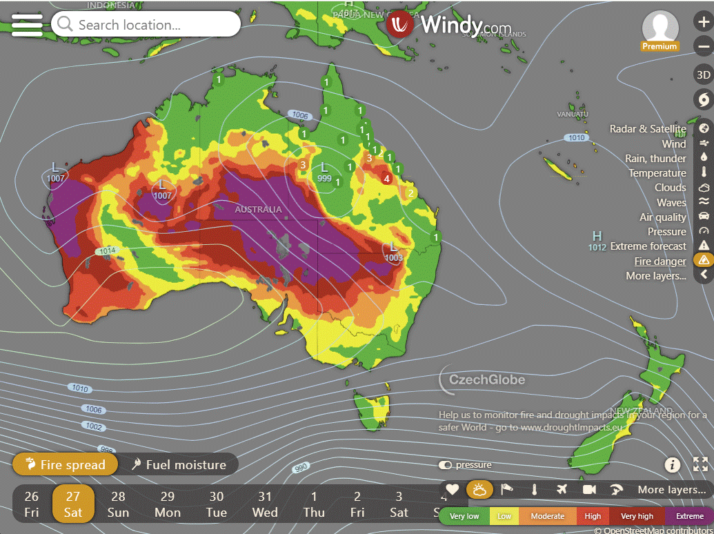
Storms - Heatwave - Fire danger
Click here to support to Wally's Weather
National maps by Weatherzone (weatherzone.com.au)
State maps by Windy (Windy.com)
Weather forecast supplemented by Bureau of Meteorology (bom.gov.au)
Rainfall daily totals (https://meteologix.com/ )
AccuWeather (https://www.accuweather.com/)
Nine Weather (https://www.9news.com.au/weather)
Wally's Weather provides professionally researched data and information. Andrew aka 'Wally' has over 20 years of experience in meteorology research and data analysis. In 2023 finished top 4 for the AMOS national weather forecasting competition. The content here is provided as educational information aimed at providing the community and businesses with the tools required to determine local-based forecasts. IMPORTANT: The forecasts and information posted should never be used on their own to make business decisions as local influences.


Comments