Morning Weather - January 31 - Wally's Weather Australia
- Jan 30, 2024
- 7 min read
This weather update is brought to you by Genesis Electrical NQ

Genesis Electrical NQ
We can Solve all of your Electrical, Air Conditioning and Solar needs!
Phone: 1300 443 637
Email: info@genesislec.com
Monsoon update
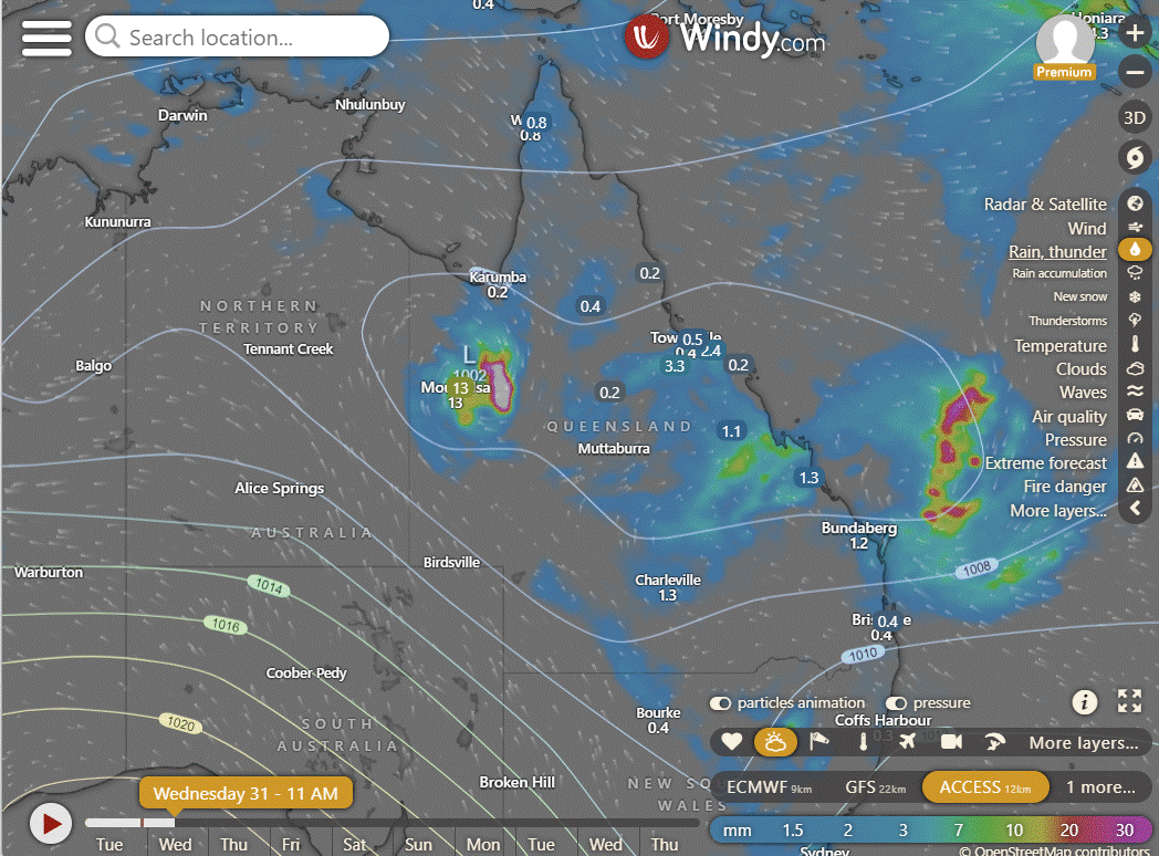
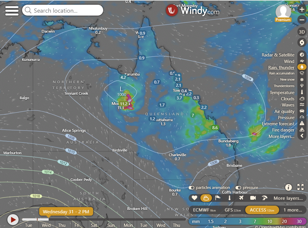
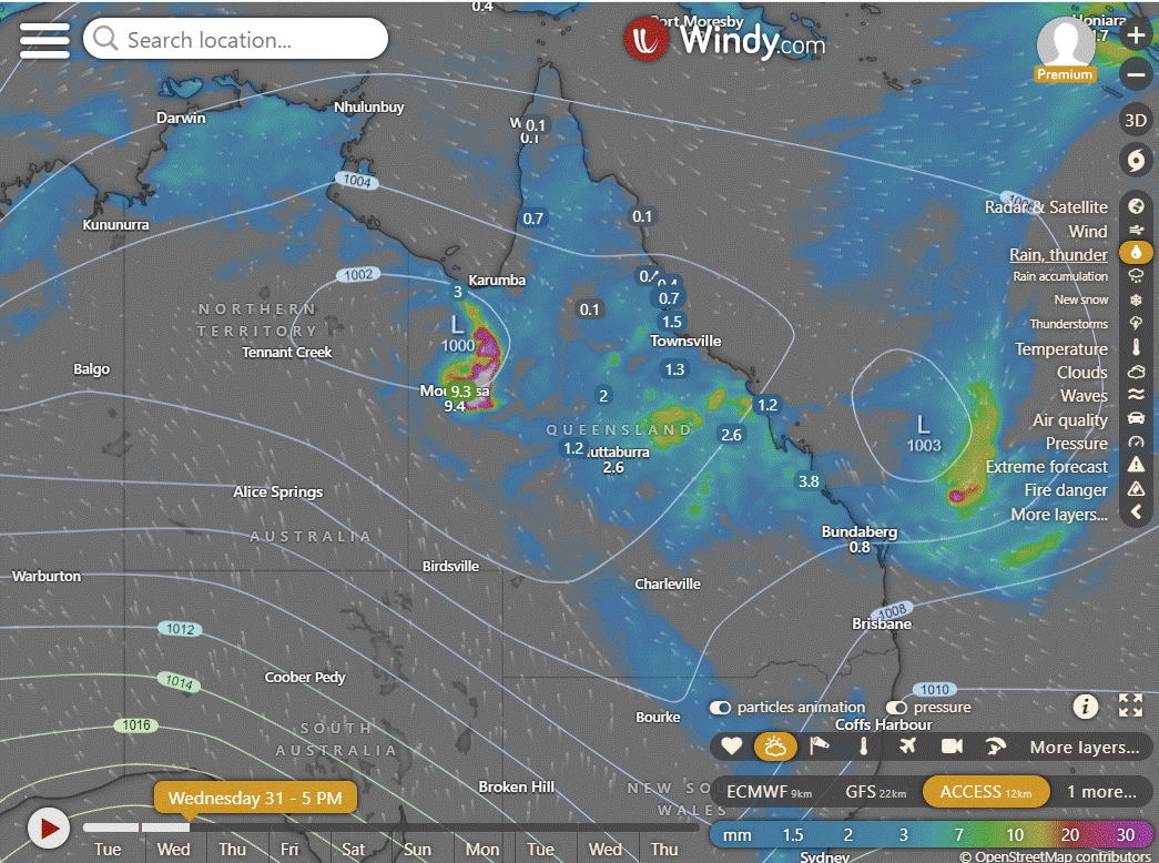
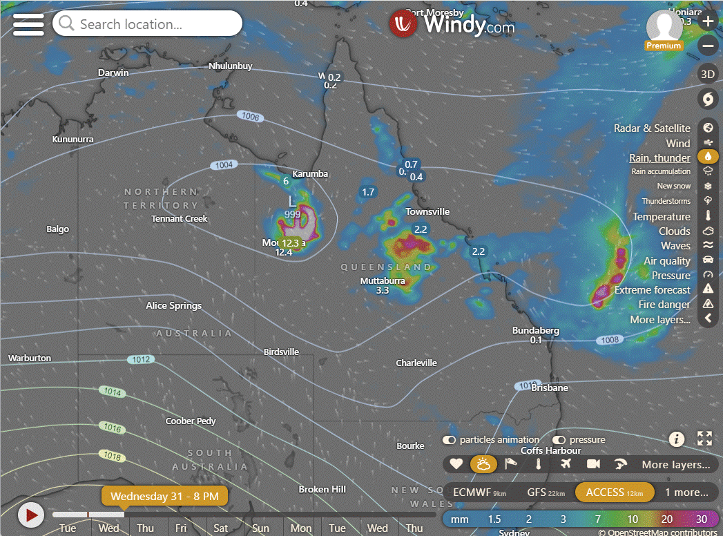
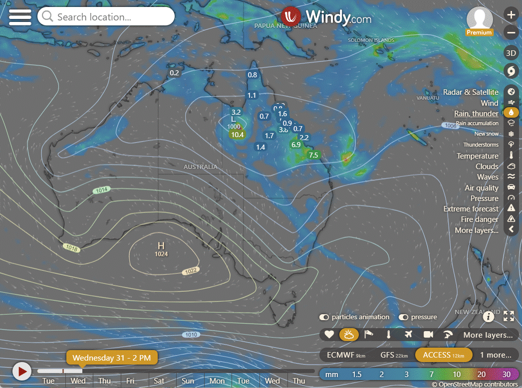
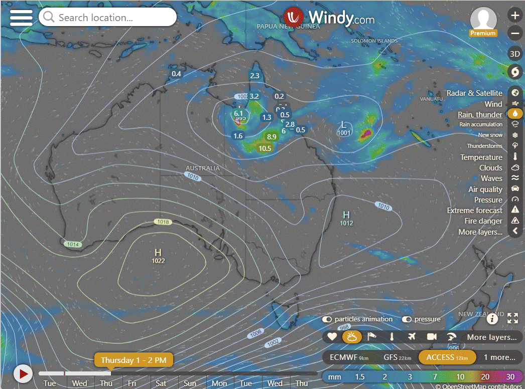
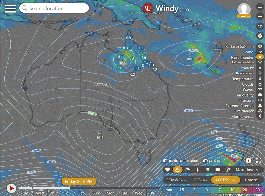
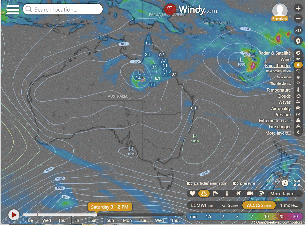
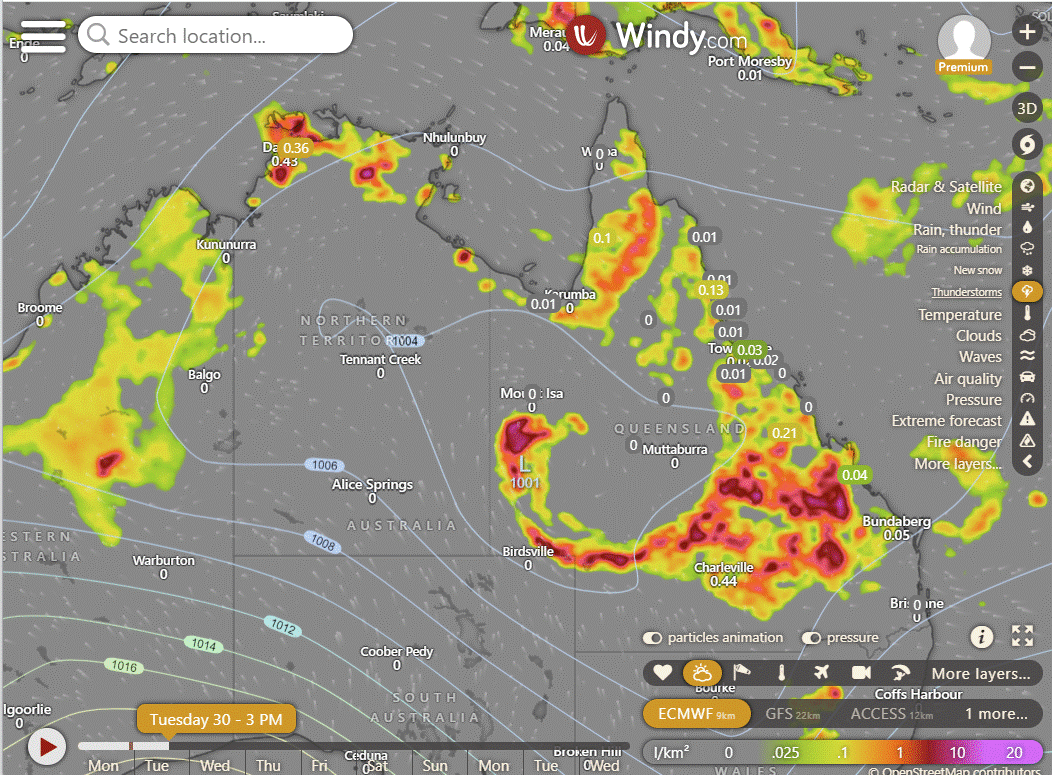
Ex TC Kirrily is now starting to show at least some short-term consistency heading to the Gulf and sitting just over the coast. There is a chance of further development here, but no consistency in the intensity across forecasts. Where it will sit is close to the SE corner of the gulf and that is where systems pull air across the FNQ and as South as the Burdekin and that generates rain which could get heavy at times. The EC has the intensity high, GFS very low and ACCESS in between. The models below are 2 days from now showing roughly what to expect. The 14 day forecast in the Long Range does show the ECL forming off the coast of QLD heading NE and boomerang back towards the Capricorn Coast. But there is still a lot of inconsistency with other models there. The long range has also identified possible systems near the Pilbara and North East coast of the QLD Peninsula in the second week of Feb. The monsoon pulse is very active, it has been a long time since we have seen it this active. And we have a second round pulse in March to come.
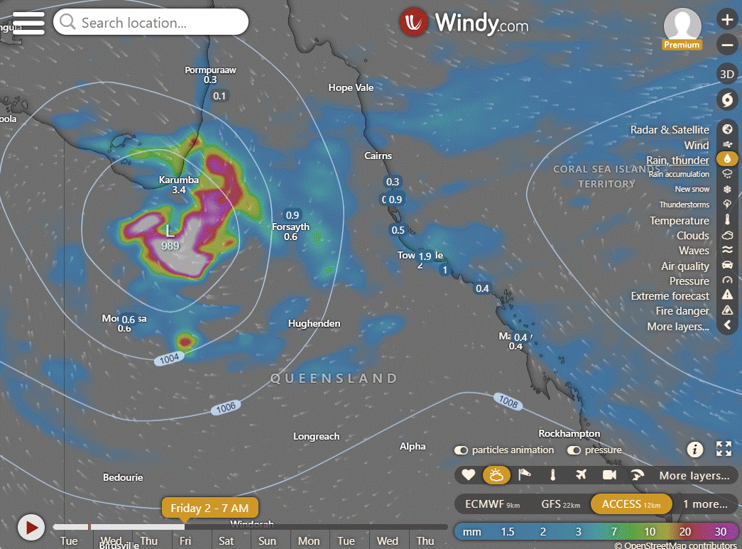
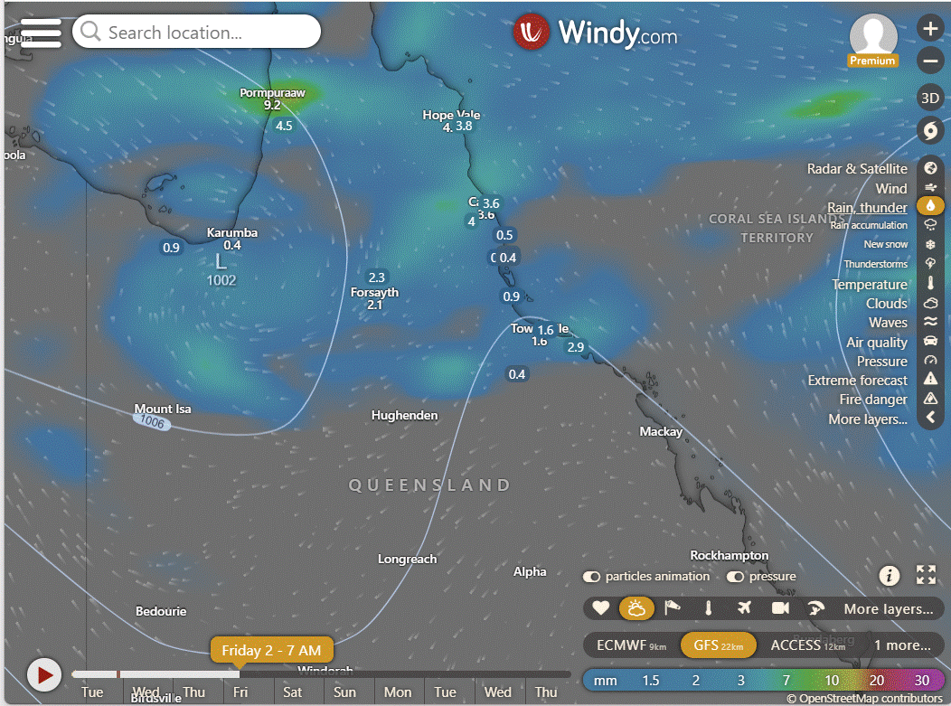
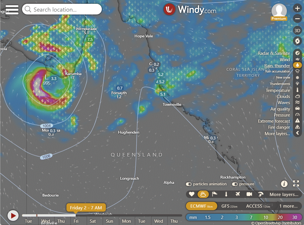
ACCESS | GFS | EC
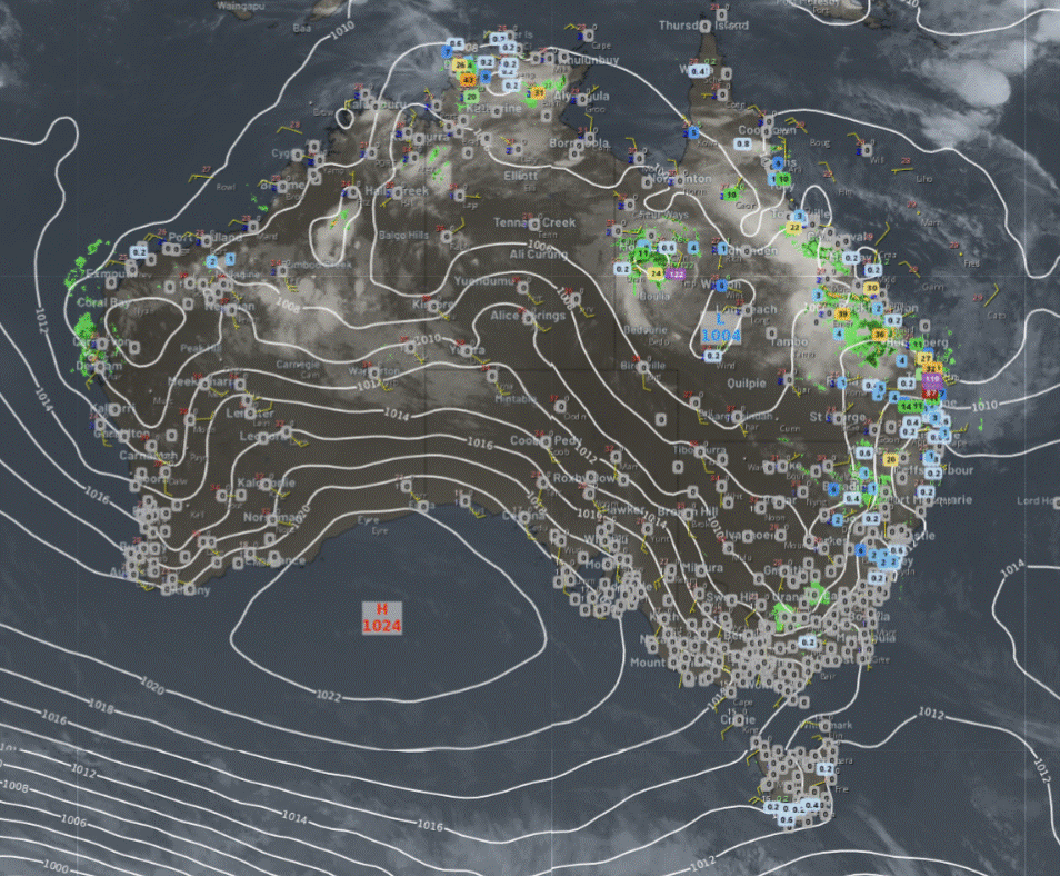
National
A trough over New South Wales and southern Queensland will move northeast, bringing a southerly change along the NSW coast. Hot easterly winds will intensify over Western Australia. A trough in the north will continue triggering some showers and storms. Cooler winds for southern South Australia and Victoria around a high.
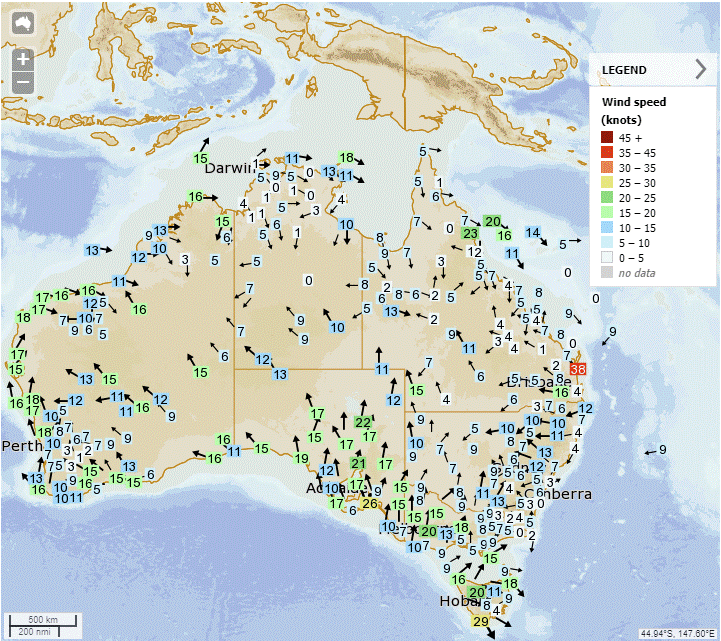
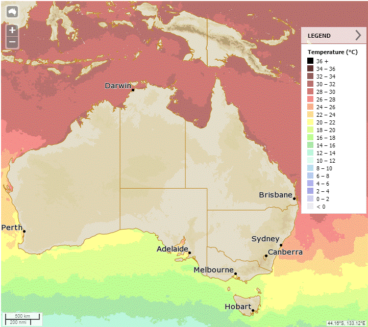
Synoptic | Temp/Rain | Wind | Sea Surface Temp
State
Ex-Tropical Cyclone Kirrily moving slowly in western Queensland, causing heavy rain and flooding. Uncertain beyond Thursday. Unsettled conditions in southern and southeastern Queensland due to trough. Low pressure system may form off southern coast. Deep tropical moisture across state. Ridge extending along east coast from Wednesday, pushing trough northwards into central and northern Queensland.
ACCESS (Values are rainfall over 3 hours)
4-day
Wednesday: Scattered showers and isolated thunderstorms across state, heavy rainfall in northwestern areas near ex-Tropical Cyclone Kirrily. Possible severe thunderstorms and heavy rainfall in other parts of state. Light to moderate winds, heatwave conditions on east coast.
Thursday: Scattered showers and thunderstorms across most of the state, with more isolated activity in certain areas. Possible heavy falls in the northwest. Severe thunderstorms with heavy rainfall in parts of northern and far northern Queensland. Southeasterly winds along the east coast. Temperature varies across regions. Heatwave conditions easing in the northeast tropical coast.
Friday: Scattered showers and isolated thunderstorms in central and northern districts north of Mackay to Mount Isa, becoming widespread at times in parts of far northern Queensland, the Gulf Country, and the northeast tropical coast. Isolated showers in central districts and around the east coast south of Mackay, with cloudy conditions in the South East and inland southern Queensland. Severe thunderstorms with heavy rainfall possible in parts of northern and far northern Queensland. More widespread heavy falls possible in northwestern Queensland depending on ex-Tropical Cyclone Kirrily's movement. Maximum temperatures below average in the northwest, northern, and central interior, above average in the southern and southeast Queensland, and near average elsewhere.
Saturday: Scattered showers and thunderstorms in central and northern districts, spreading to far north Queensland. Isolated showers in central and southeast Queensland. Possible severe thunderstorms and heavy rainfall in northern Queensland. Below average temperatures in the northwest and northern interior, above average elsewhere.
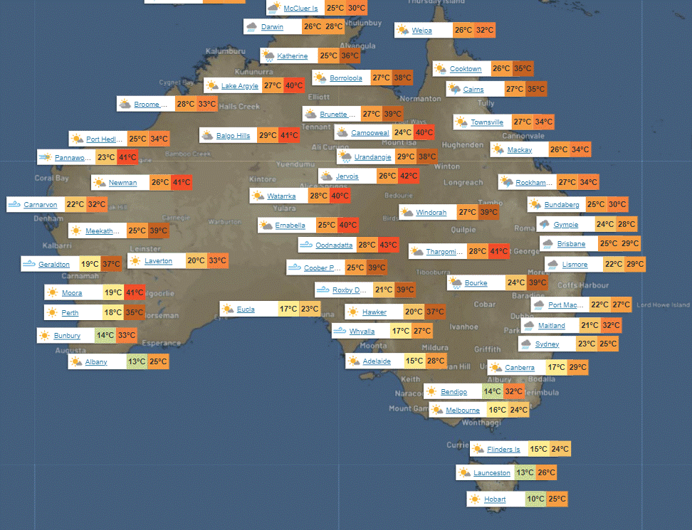
North Tropical Coast and Tablelands:
Max temperature: 35, Min temperature: 20, Wind speed: 25 km/h, Wind direction: west to northwesterly, Rainfall: showers likely in afternoon and evening, Other: chance of thunderstorm and light winds.
Herbert and Lower Burdekin:
Partly cloudy with very high chance of showers, possible severe thunderstorm in the south, light winds, overnight temps in low to high 20s and daytime temps in low to mid 30s. Max temp, min temp, wind speed, wind direction, rainfall.
Central Coast and Whitsundays:
The weather will be partly cloudy with very high chance of showers, most likely in the afternoon and evening, with a chance of a severe thunderstorm. Light winds. Max temperature in the low to mid 30s and overnight temperatures falling to the mid 20s.
Peninsula:
Maximum temperature: low to mid 30s, Minimum temperature: mid 20s, Wind speed: light becoming 20-30km/h in the morning and light in the evening, Wind direction: northwesterly, Rainfall: high chance of showers, most likely late morning and afternoon with a chance of a thunderstorm, Sky: partly cloudy.
Gulf Country:
Max temperature: 33 to 38, Min temperature: mid to high 20s, Wind speed: northerly 15 to 20 km/h becoming light before dawn then becoming north to northwesterly 15 to 25 km/h in the morning, Wind direction: north to northwesterly, Rainfall: Very high chance of showers in the southeast, high chance elsewhere, Thunderstorm: Possibly severe, Heavy falls possible, Other: Partly cloudy.
Northern Goldfields and Upper Flinders:
Max temperature: low to mid 30s; Min temperature: low to mid 20s; Wind speed: north to northwesterly 15 to 20 km/h; Wind direction: west to northwesterly in the early afternoon then becoming light in the evening; Rainfall: Partly cloudy with high chance of showers, most likely in the afternoon and evening; Other: chance of a severe thunderstorm in the south.
Capricornia:
Max temperature: low 30s, Min temperature: low to mid 20s, Wind speed: light winds becoming southeasterly 15 to 25 km/h in the morning, Wind direction: southeasterly, Rainfall: very high chance of showers, most likely in the morning and afternoon, Other: cloudy, chance of a severe thunderstorm.
Central Highlands and Coalfields:
Max temperature: low to mid 30s, Min temperature: low to mid 20s, Wind speed: light, Wind direction: southeasterly, Rainfall: high chance of showers, Thunderstorm possible.
Central West:
Max temperature: mid to high 30s, Min temperature: low to mid 20s, Wind speed: light winds becoming southeast to southwesterly 20 to 30 km/h in the morning then tending east to southeasterly 15 to 25 km/h in the evening, Wind direction: variable, Rainfall: medium chance of showers most likely from late morning, Other: partly cloudy, chance of a thunderstorm, possibly severe.
North West:
Max temperature: 40; Min temperature: 23; Wind speed: 25-35 km/h; Wind direction: SE to SW; Rainfall: High chance; Other: Partly cloudy, chance of severe thunderstorm, heavy falls possible.
Channel Country:
Maximum temperature: 38 to 44, minimum temperature: mid to high 20s, wind speed: 25 to 40 km/h south to southeasterly, wind direction: south to southeasterly, chance of rainfall: slight in the northeast, chance of thunderstorm: morning and afternoon, chance of raised dust: northwest. Mostly sunny.
Maranoa and Warrego:
The weather will have a max temperature of 31 to 39 degrees, min temperature in the low to mid 20s, wind speed of 15 to 20 km/h becoming 20 to 30 km/h, wind direction easterly to southeasterly, and a medium chance of showers with a slight chance elsewhere and a possibility of severe thunderstorms in the north, along with partly cloudy conditions.
Darling Downs and Granite Belt:
Max temperature: low to mid 30s, Min temperature: 19-22, Wind speed: easterly 15-20 km/h becoming light then east-southeasterly 15-25 km/h, Rainfall: slight chance of a shower, Partly cloudy with chance of thunderstorm in the north.
Wide Bay and Burnett:
Max temperature of 30, min temperature in the low to mid 20s, wind speed southeast 20-30 km/h, cloudy, very high chance of rain near the coast, medium chance elsewhere, chance of severe thunderstorm, heavy falls possible.
Southeast Coast:
Max temperature: 30°C, Min temperature: low 20s, Wind speed: 25-35 km/h southeasterly, Rainfall: Partly cloudy, Medium chance of showers, Slight chance elsewhere, Chance of thunderstorm in the north, winds overnight.
WEATHER WARNINGS
Strong Wind Warning for South East and South West coasts.
Strong Wind Warning for Sunshine Coast Waters and Fraser Island Coast.
Major Flood Warning for the Bremer River, with moderate flood warnings for Warrill Creek, Lockyer Creek, and flood warning for Laidley Creek.
Severe Storm Warning (Rain and Winds) for Northern Goldfields and Upper Flinders, Herbert and Herbert/Lower Burdekin, Central Coast and Whitsundays, Central Highlands and Coalfields.
Severe Thunderstorm Warning (Heavy Rainfall) for parts of North West Slopes and Plains.
Fire Weather Warning for Brockman and Blackwood.
Strong Wind Warning for Geraldton Coast.
Severe Weather Warning (Heavy Rainfall) for parts of Wide Bay and Burnett and Southeast Coast.
Severe Weather Warning (Heavy Rainfall) for parts of North West.
Major Flood Warning for the Condamine River and moderate flood warning for the Myall Creek.
Gale Warning for South Eastern and Southern Areas, and Western and Southern Areas.
Final Flood Warning for the Logan and Albert Rivers.
Strong Wind Warning for Spencer Gulf, Gulf St Vincent, and Adelaide Metropolitan Waters.
Moderate Flood Warning for the Moonie River, minor flood warning for the Thomson and Barcoo Rivers and Cooper Creek.
Flood Watch for parts of Central Queensland and coastal catchments between Gladstone and Caboolture.
Flood Watch for the Georgina River and Eyre Creek and parts of Gulf of Carpentaria.
Moderate Flood Warning for the Daly River, minor flood warning for the Fitzroy River.
Initial minor flood warning for the Burrum and Cherwell Rivers and flood warning for the Isis, Gregory, and Elliott Rivers.
Flood Warning for the Diamantina River, minor flood warning for the Flinders and Cloncurry Rivers.
Flood Watch for parts of Carpentaria Coast and Eastern Inland Northern Territory.
Final Flood Watch for Northern Rivers, Northern Tablelands, and Northwest Slopes and Plains.
Final Flood Warning for the Victoria River.
Minor Flood Warning for the Bulloo River.
Final Flood Warning for the Herbert River.
Minor Flood Warning for the Paroo River in Queensland and New South Wales.
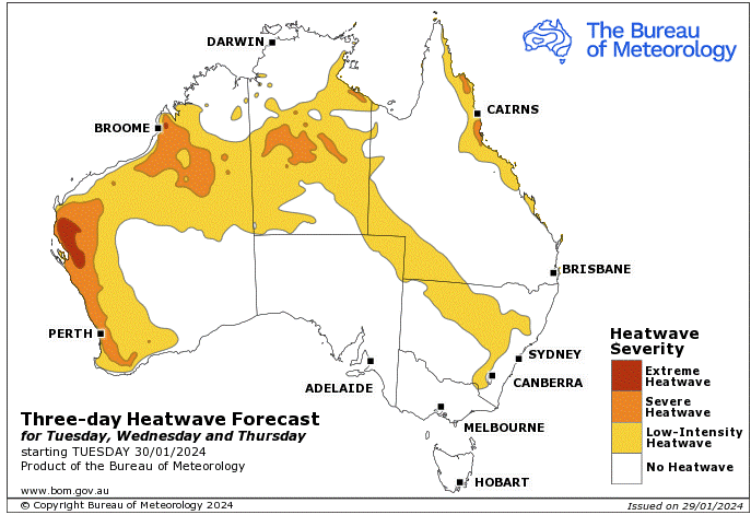
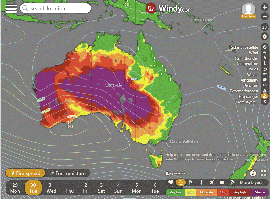
Storms - Heatwave - Fire danger
Click here to support to Wally's Weather
National maps by Weatherzone (weatherzone.com.au)
State maps by Windy (Windy.com)
Weather forecast supplemented by Bureau of Meteorology (bom.gov.au)
Rainfall daily totals (https://meteologix.com/ )
AccuWeather (https://www.accuweather.com/)
Nine Weather (https://www.9news.com.au/weather)
Wally's Weather provides professionally researched data and information. Andrew aka 'Wally' has over 20 years of experience in meteorology research and data analysis. In 2023 finished top 4 for the AMOS national weather forecasting competition. The content here is provided as educational information aimed at providing the community and businesses with the tools required to determine local-based forecasts. IMPORTANT: The forecasts and information posted should never be used on their own to make business decisions as local influences.


First thing I do in the morning is make a coffee, open your email and then walk the dog. Thank you for the forecasts and the education.