Morning Weather - July 21
- Jul 21, 2023
- 3 min read
This weather update is brought to you by Pandanus Park Golf Centre

Pandanus Park Golf Centre is located at 2 Tompkins Road, Shaw (opposite the RSPCA) and is Townsville’s only day and night driving range.
The concept behind Pandanus Park was to provide a facility to cater for all capabilities of golfers, including first-time golfers. The attractive watercourse and natural bushland setting provide a relaxing background. Entry from the car park crosses a bridge over a small creek lined with striking natural vegetation including some very picturesque stands of pandanus and melaleucas.
Intended to be much more than a golf practice centre, Pandanus Park Golf Centre offers a tranquil place to relax and enjoy all that the sport of golf has to offer.
Wally's Weather provides professionally researched data and information. Andrew aka 'Wally' has over 20 years of experience in meteorology research and data analysis. The content here is provided as educational information aimed at providing the community and businesses with the tools required to determine local-based forecasts. IMPORTANT: The forecasts and information posted should never be used on their own to make business decisions as local influences.
Click here to support to Wally's Weather
National
High over Coral Sea extends weak ridge east. Weak trough moves across southern Queensland, new high near Western Australia extends ridge over state. High moves east, strengthens ridge, and pushes cooler air northward. Upper trough may move over southeastern Queensland on Sunday, developing surface trough or low on east coast. Coastal trough may move north, weaken. High reaches Tasman Sea by Wednesday, extends firm ridge over state.


State
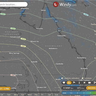
Isolated showers on east coast (north), slight chance afternoon shower south. Mostly sunny southwest, partly cloudy elsewhere. Light to moderate winds on east coast (north), moderate winds in afternoon across most interior. Winds in southeastern Queensland light to moderate, change to southwesterly in evening. Morning frost inland southeast. Temperatures near or above average. Minimums slightly below average in southeast, well above average in west.


4-day
Saturday: Mostly sunny in the west, south, and southeast. Partly cloudy elsewhere. Morning frost inland in the south. Temperatures near or above average in the north and central. Near or below average elsewhere.
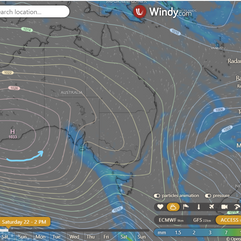
Sunday: Cloud increasing in the south. Isolated to scattered showers in the south interior and east (south of Rockhampton). Mostly sunny in the northwest. Partly cloudy elsewhere. Morning frost inland in the south and central. Max temperatures near or below average, well below in the west. Min temperatures below average in the southeast, near average elsewhere.
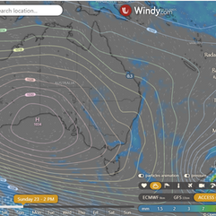
Monday: Isolated to scattered showers in the south and east (south of Mackay), widespread at times south of Hervey Bay. Chance of thunderstorms near the SE coast. Uncertainty in eastern districts (south of Rockhampton). Mostly sunny in the west. Partly cloudy elsewhere. Interior frost possible in the south and central. Cooler morning on northeast tropical coast. Moderate to fresh southerly winds with gusts, elevated Fire Dangers in some east and north areas. Temperatures below average, well below in the northwest, north, and central.
Tuesday until Thursday: Isolated to scattered showers in the east (south of the Whitsundays) on Tuesday. Possible thunderstorms on K'gari Tuesday. Showers extending to the east coast (south of Cooktown) from Wednesday, tending widespread about the Cassowary Coast from Thursday. Uncertainty about east coast rainfall on Tuesday. Mostly sunny in the west and southern interior. Partly cloudy elsewhere. Strong southeasterly winds south of Townsville on Tuesday and Wednesday. Elevated Fire Dangers possible in the north and North West with gusty winds. Temperatures near or below average, near or above in the south and central from Wednesday. Min temps well below average in the Far North on Tuesday, chance of patchy morning frosts about the Atherton Tablelands.


Townsville
Max 27, partly cloudy. Chance of rain: 5%. Light winds.
Herbert and Lower Burdekin
Max 27, partly cloudy. No rain expected. Herbert and Lower Burdekin area: Partly cloudy, light winds. Daytime max temperatures in the mid to high 20s.
North Tropical Coast and Tablelands
Max 27, partly cloudy. Chance of rain: 5%. North Tropical Coast and Tablelands area: Partly cloudy. Slight chance of a coastal shower in late morning and afternoon. Near zero chance of rain elsewhere. Winds east to southeasterly 15 to 25 km/h. Daytime max temperatures 23 to 28.
Cairns
Max 28, partly cloudy. Chance of rain: 10%. Partly cloudy, light winds becoming southeasterly 15 to 25 km/h in the middle of the day, then becoming light in the evening.
Mackay
Max 24, partly cloudy. No rain expected. Partly cloudy, light winds becoming southeasterly 15 to 20 km/h in the middle of the day, then becoming light in the early afternoon.
Mt Isa
Max 28, partly cloudy. No rain expected. Partly cloudy, light winds becoming southeasterly 15 to 20 km/h in the morning, then tending southerly in the early afternoon.
National maps by Weatherzone (weatherzone.com.au)
State maps by Windy (Windy.com)
Weather forecast supplemented by Bureau of Meteorology (bom.gov.au)
Rainfall daily totals (https://meteologix.com/ )