
To get your daily forecast delivered free goto http://wallysweather.com.au/blog

An added thanks to the sponsorship from NQ Licensed Events and the Country Festival on March 30 & 31 at the Dittman Bullpit

Website: https://www.countryfest.com.au/
Facebook: https://www.facebook.com/contryfestqld
Instagram: https://www.instagram.com/countryfestqld/
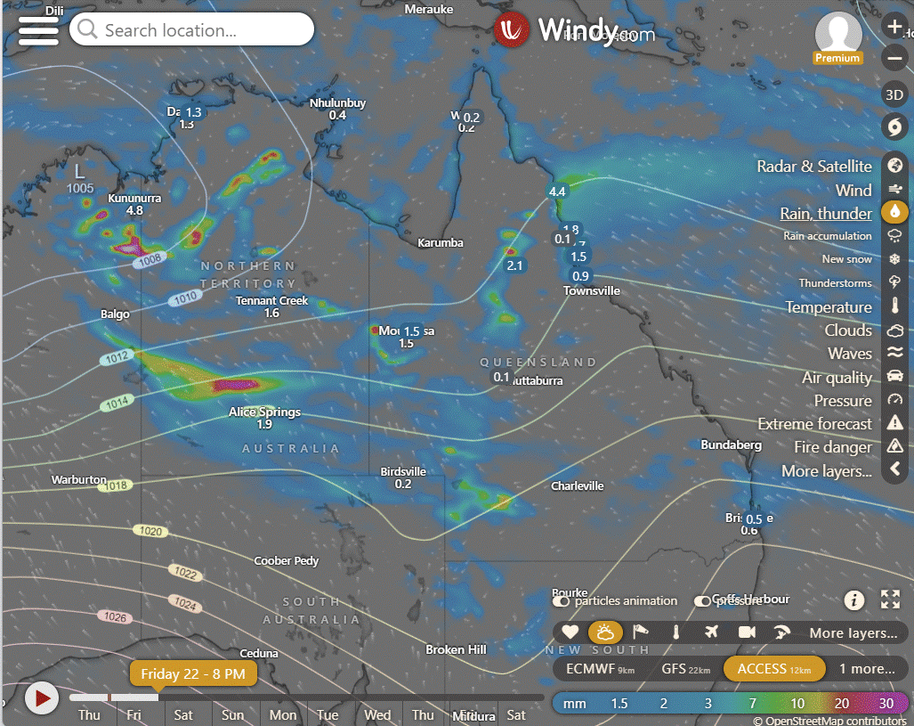
The weather for the Country Fest is looking mainly fine for the 2 days, 5mm rainfall forecast at the moment. I will keep you updated.
Monsoon Update
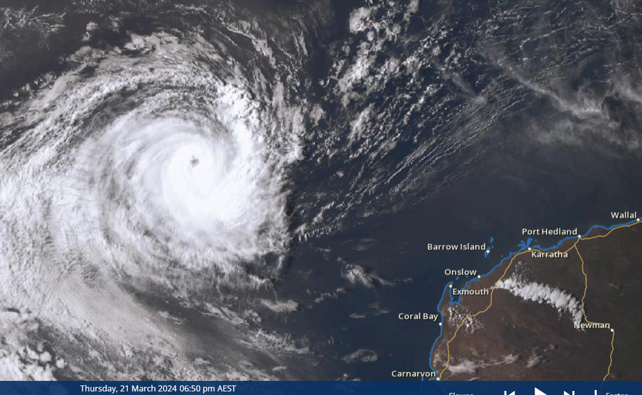
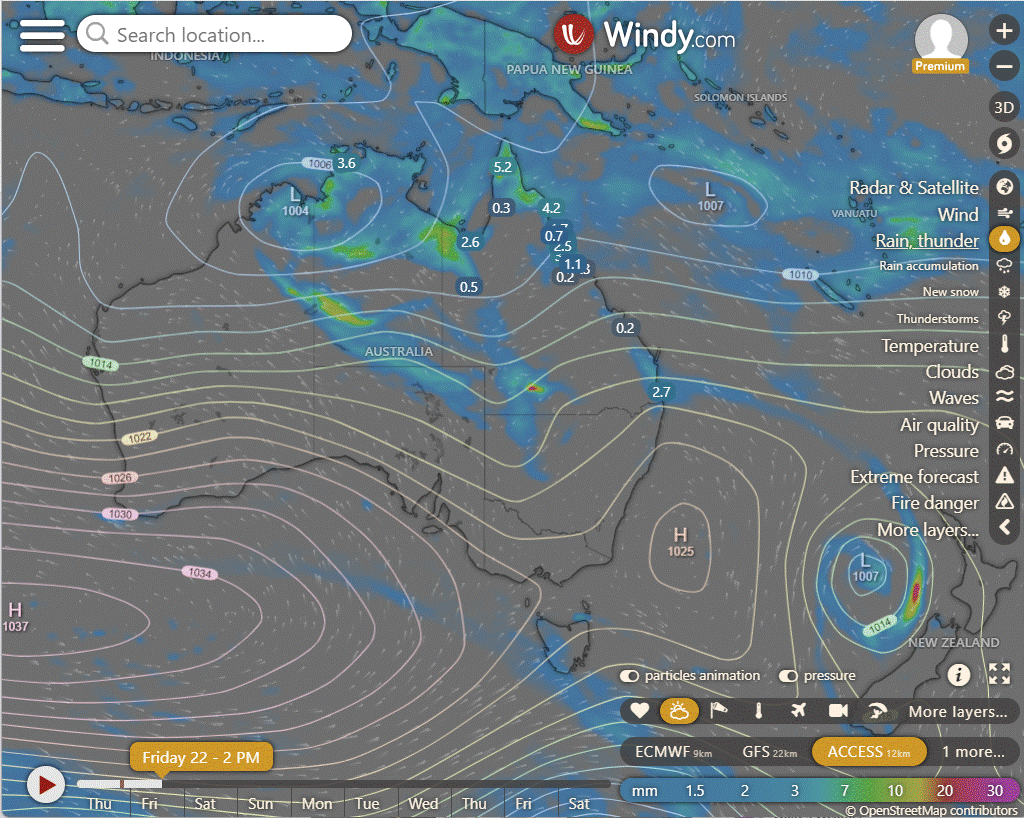
TC Neville is currently located approximately 1,010 kilometers west-northwest of Learmonth, Australia, with sustained winds recorded at 157 kilometers per hour. Over the past 6 hours, it has been moving steadily westward at a speed of 18.5 kilometers per hour, accompanied by significant wave heights reaching 8.2 meters. Satellite imagery indicates persistent deep convection around the storm's center, along with a distinct eye feature and convective banding. Favorable environmental conditions, including moderate radial outflow aloft, low vertical wind shear, and warm sea surface temperatures, support the storm's intensity. However, the exact intensity assessment remains moderately confident based on various intensity estimates.
The Pink concert should be ok with only scattered showers about Friday and Saturday night. Showers heavier to the North.
Easter could be a little soggy early with 5 to 10mm plus a few heavier systems along the FNQ coastline, but then trade winds should be the only showers for the second half, about 1 to 5mm.


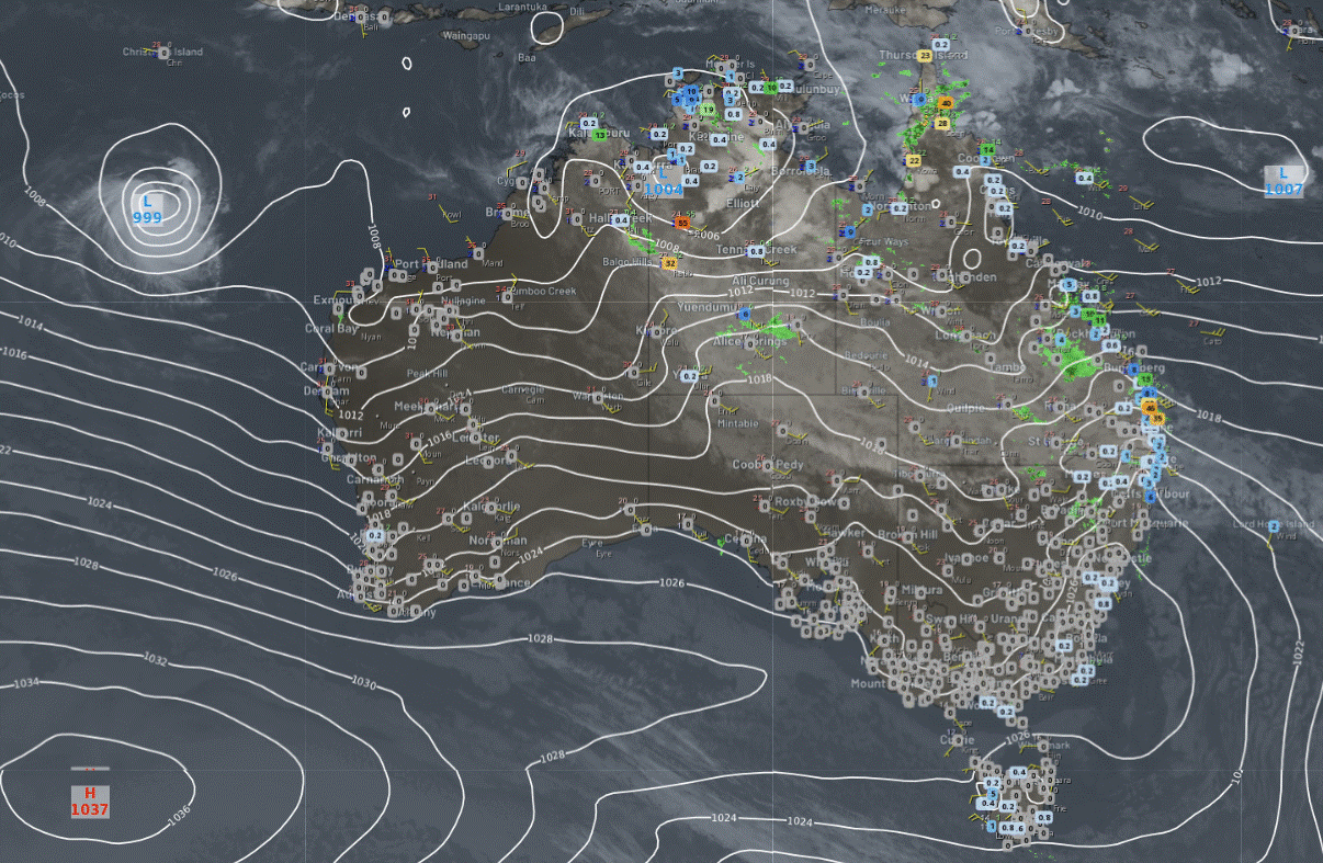
National
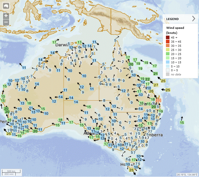
Expect humid and stable winds to produce rain and storms in the northern tropics and the interior of the Northern Territory. Patchy rain and storms will be scattered across western Queensland and northwestern New South Wales. On the east coast, showers are anticipated due to humid and unstable easterly winds. Meanwhile, a front will sweep through the southern regions, ushering in cool, gusty winds and showers.
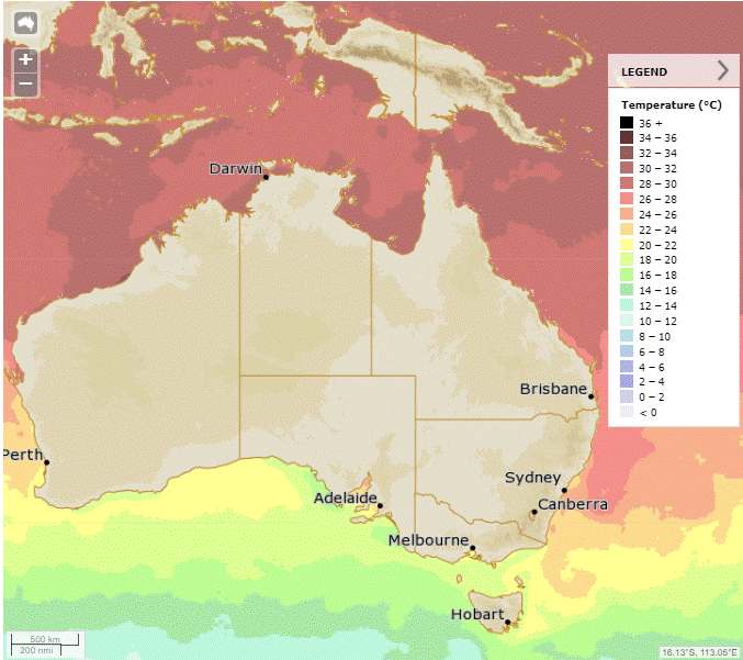
Synoptic | Temp/Rain | Wind | Sea Surface Temp
State
High pressure over east, windy with showers on east coast. Trough moving west with potential for rain. Another trough in Far North Queensland may move south with showers and storms.
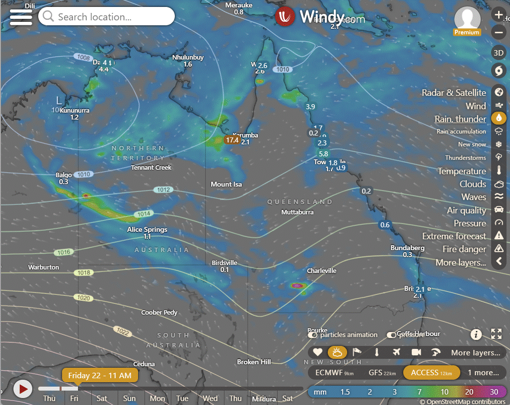
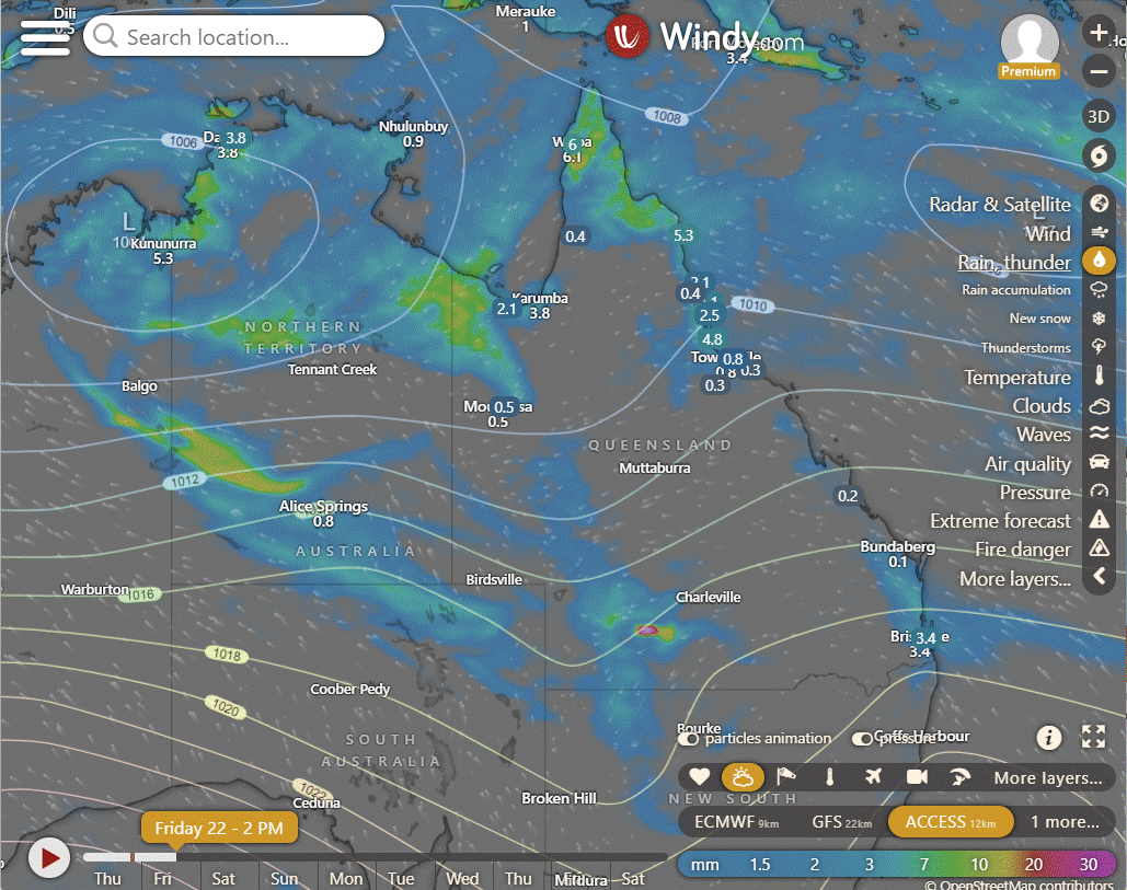
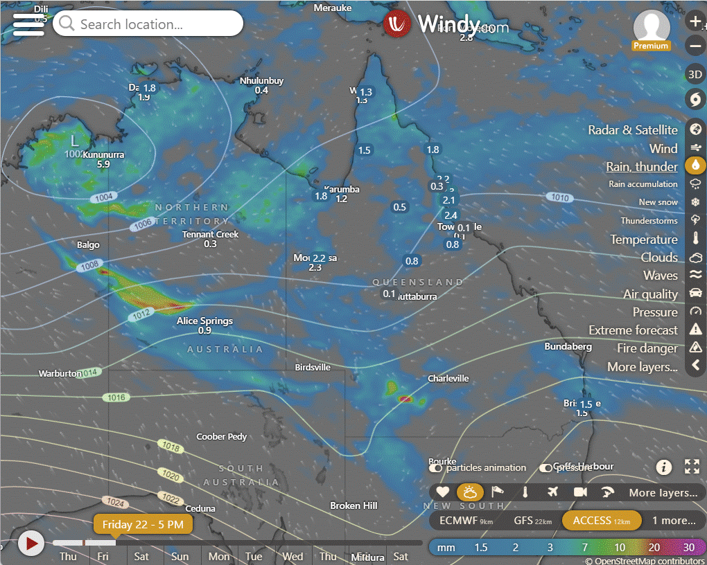
ACCESS (Values are rainfall over 3 hours)
4-day
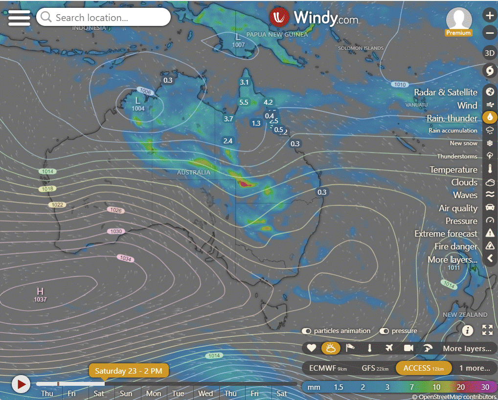
Friday: Partly cloudy in central/northern interior, isolated/scattered showers elsewhere, isolated thunderstorms in north, southern interior; showers at times in Central to Sunshine Coast, northern Peninsula. Winds variable. Partly cloudy in far southwest, central/northern interior.
Saturday: Spotty showers across most areas, possible thunderstorms in west. Showers likely in Cape York and east coast. Rain in west and southwest with lower temperatures. Possible severe thunderstorm in northwestern interior.
Sunday: Scattered showers, chance of thunderstorms in northern, central, and western Queensland. Risk of severe thunderstorms with heavy rainfall in central-west to northwestern interior. Showers becoming widespread, moderate rainfall possible in central-west to southern interior. Also showers in Cape York Peninsula and east coast north of Townsville with moderate rainfall. Maximum temperatures below average in west, south interior, southeast.
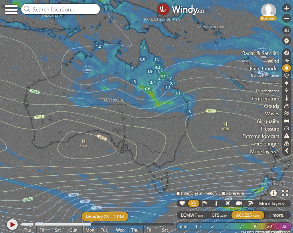
Monday: Scattered showers with possible thunderstorms in Queensland. Rain likely in central regions, with uncertainty in other areas. Cooler temperatures expected.

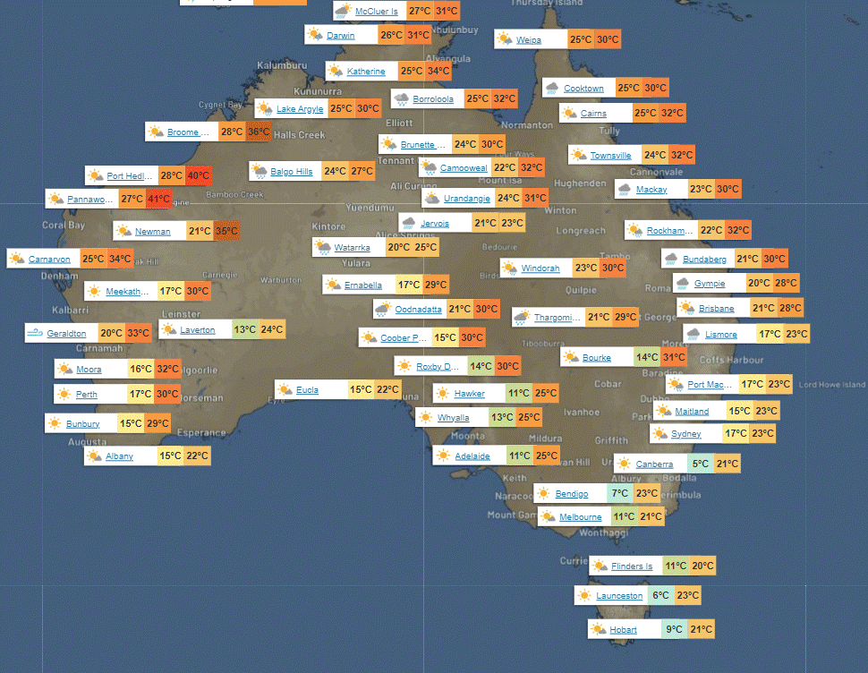
North Tropical Coast and Tablelands:
Max temperature: 31°C, Min temperature: 19°C, Wind speed: 15-25 km/h from east to southeasterly, Rainfall: Very high chance of showers near coast, medium chance elsewhere, Other: Partly cloudy with chance of thunderstorm.
Herbert and Lower Burdekin:
The weather forecast for today includes a maximum temperature of 33 degrees, a minimum temperature in the low to mid 20s, light winds becoming easterly at 15 to 25 km/h, a medium chance of showers mainly in the morning and afternoon, and partly cloudy skies.
Central Coast and Whitsundays:
Maximum temperature: 33°C, minimum temperature: 20°C, wind speed: 25-35 km/h east to southeasterly, rainfall: Medium chance of showers, most likely in the morning, sky conditions: Partly cloudy.
Peninsula:
The weather will be cloudy with a high chance of showers and a chance of thunderstorms, with light winds becoming easterly 15 to 20 km/h in the early afternoon then becoming light in the late afternoon, overnight temperatures falling to the low to mid 20s, and daytime temperatures reaching around 30, with no specific details about maximum temperature or minimum temperature, wind speed, wind direction, or rainfall provided.
Gulf Country:
The weather will be partly cloudy with a chance of showers, thunderstorms, light winds, and temperatures ranging from low 20s overnight to low 30s during the day.
Northern Goldfields and Upper Flinders:
Tomorrow will have a max temperature of 35°C, min temperature in the low to mid 20s, easterly winds at 15 to 35 km/h, with medium chance of showers in the east, slight chance elsewhere, and a slight chance of a thunderstorm in the north.
Capricornia:
The max temperature will be around 30 with overnight temperatures falling to 18-23, wind speeds of 20-30 km/h shifting from east to southeasterly and then becoming light, there is a slight chance of a shower with 'Partly cloudy' conditions and no mention of rainfall.
Central Highlands and Coalfields:
Max temperature: 33°C, Min temperature: 18°C, Wind: Easterly 25 to 35 km/h becoming light, Rainfall: Near zero chance, Other: Cloudy with slight chance of shower in southwest early morning.
Central West:
Max temperature: 30-35°C, Min temperature: low-mid 20s, Wind speed: easterly 25-40 km/h becoming light then 15-20 km/h, Wind direction: easterly, Rainfall: Partly cloudy, Medium chance of showers in southwest, slight chance elsewhere; Other: Chance of thunderstorm in southwest from late morning.
North West:
The weather will have a max temperature in the low to mid 30s, a min temperature in the low to mid 20s, southeasterly winds 15 to 20 km/h tending northeast to southeasterly 20 to 30 km/h, rainfall with medium chance of showers in the northwest and slight chance elsewhere, along with "Partly cloudy" conditions and a chance of thunderstorms west of Mt Isa in the late morning.
Channel Country:
Maximum temperature: 34°C, Minimum temperature: low to mid 20s, Wind speed: southeasterly 20 to 30 km/h, Wind direction: northeast to southeasterly, Rainfall: Medium chance of showers, Thunderstorm: possible in the east, Cloud cover: Cloudy.
Maranoa and Warrego:
Max temperature: 30°C, Min temperature: 18-23°C, Wind: Easterly 20-30 km/h becoming light, Rainfall: Showers likely in southwest, slight chance elsewhere, Thunderstorm: Chance in the west, possibly severe, Cloud cover: Cloudy.
Darling Downs and Granite Belt:
Max temperature: 31°C, Min temperature: 15°C, Wind speed: 20 to 30 km/h easterly becoming light, Wind direction: easterly, Rainfall: slight chance of a shower in the southwest, Other: Partly cloudy with overnight temperatures falling to between 15-19°C.
Wide Bay and Burnett:
Max temperature: 29°C, Min temperature: 16°C, Wind: Southeasterly 20 to 30 km/h becoming light in the evening, Rainfall: High chance of showers near the coast, medium chance elsewhere, Other: Cloudy. Overnight temperatures falling between 16-21°C.
Southeast Coast:
Max temperature: mid to high 20s, Min temperature: 16-20, Wind speed: southeasterly 20-30 km/h becoming light, Wind direction: southeasterly, Rainfall: showers along coastal fringe, slight chance elsewhere, Other: Cloudy with decreasing winds and temperatures overnight.
WEATHER WARNINGS
Severe thunderstorm warning issued for parts of Carpentaria, Barkly, and Gregory districts in the Northern Territory.
Strong wind warning in effect for Geraldton, Lancelin, Bunbury Geographe, and Leeuwin coasts in Western Australia.
Fire weather warning issued for Swan Inland North, Swan Inland South, Capes, and Brockman regions in Western Australia.
Severe weather warning for heavy rainfall declared for Tanami and parts of Simpson, Lasseter, and Barkly districts in the Northern Territory.
Major flood warning remains in place for the McArthur River in the Northern Territory.
Gale warning for the southern area issued in New South Wales and the Australian Capital Territory.
Strong wind warning for the Spencer Gulf, Upper West, and Lower West coasts in South Australia.
Strong wind warning for South East and South West coasts of Tasmania.
Flood watch initiated for the Sturt Creek District and East Kimberley Rivers in Western Australia.
Minor flood warning for the Fitzroy River in Western Australia.
Moderate flood warning for Eyre Creek and minor flood warning for the Georgina River in Queensland.
Flood watch issued for parts of the Cape York Peninsula, Gulf Country, and North Tropical Coast in Queensland.
Flood watch for inland parts of the Northern Territory and Carpentaria Coastal Rivers.
Flood warning for the inland rivers in South Australia.
Initial minor flood warning for the Nicholson River and flood warning for the Leichhardt River in Queensland.
Moderate flood warning for the Daly River in the Northern Territory.
Final flood warning for the Barron River in Queensland.
Minor flood warning for the Paroo River and the Warrego River in New South Wales and the Australian Capital Territory.


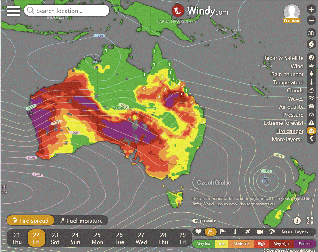
Storms - Heatwave - Fire danger
Click here to support to Wally's Weather
National maps by Weatherzone (weatherzone.com.au)
State maps by Windy (Windy.com)
Weather forecast supplemented by Bureau of Meteorology (bom.gov.au)
Rainfall daily totals (https://meteologix.com/ )
AccuWeather (https://www.accuweather.com/)
Nine Weather (https://www.9news.com.au/weather)
Wally's Weather provides professionally researched data and information. Andrew aka 'Wally' has over 20 years of experience in meteorology research and data analysis. In 2023 finished top 4 for the AMOS national weather forecasting competition. The content here is provided as educational information aimed at providing the community and businesses with the tools required to determine local-based forecasts. IMPORTANT: The forecasts and information posted should never be used on their own to make business decisions as local influences.