Morning Weather - March 23 - Wally's Weather Australia
- Mar 22, 2024
- 5 min read
To get your daily forecast delivered free goto http://wallysweather.com.au/blog

An added thanks to the sponsorship from NQ Licensed Events and the Country Festival on March 30 & 31 at the Dittman Bullpit

Website: https://www.countryfest.com.au/
Facebook: https://www.facebook.com/contryfestqld
Instagram: https://www.instagram.com/countryfestqld/
The weather for the Country Fest is looking mainly fine for the 2 days, 5mm rainfall forecast at the moment. I will keep you updated.
Easter looks like it might be wet under foot early but then the rain shifting North as the ridging along the coast moves into place and then clear later for Easter apart from the exposed coastline of the tropics. Good news also for the Country Fest.
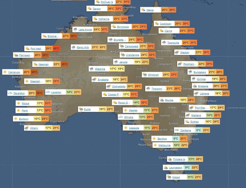
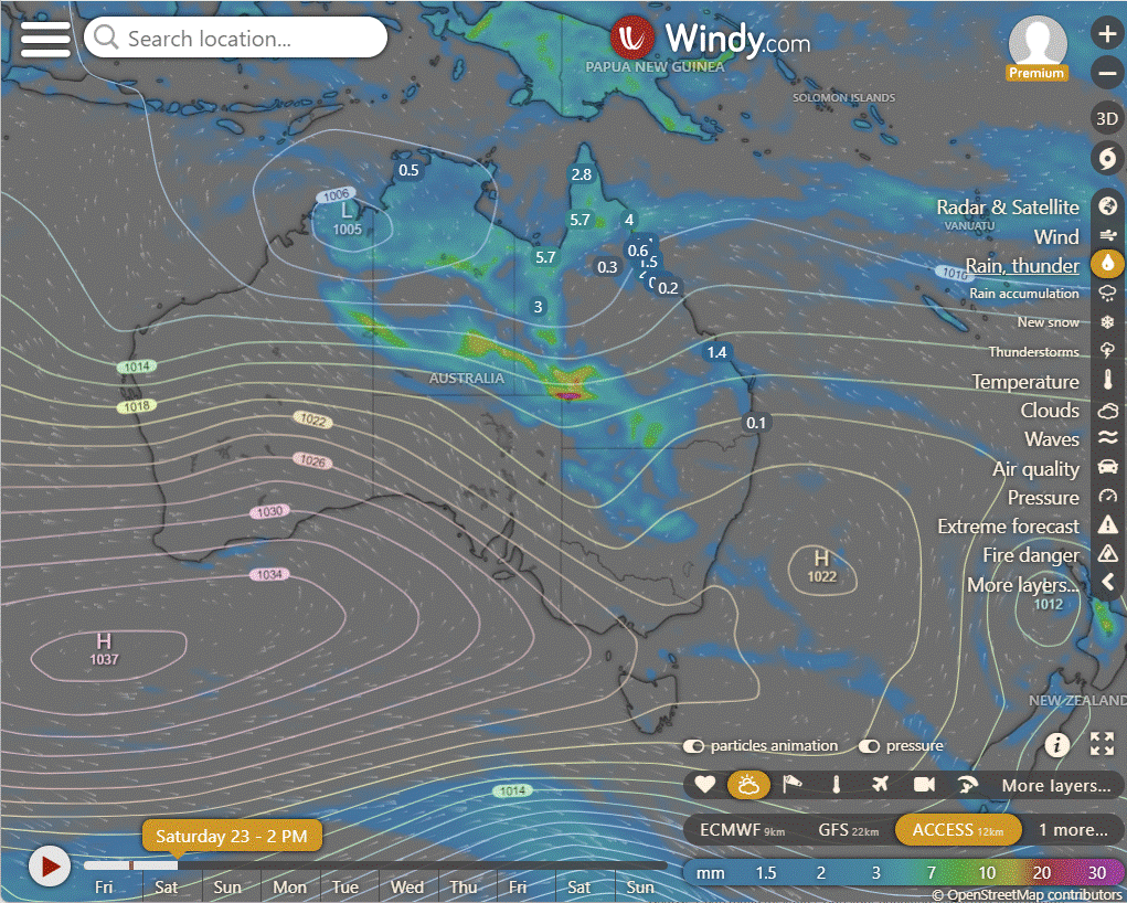
National
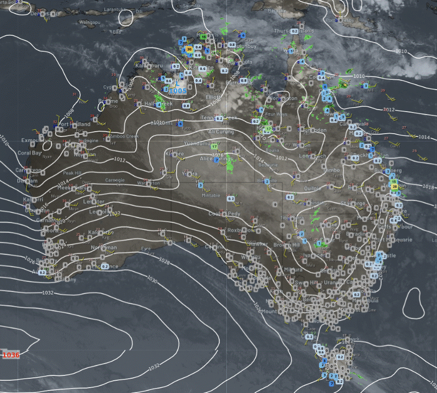
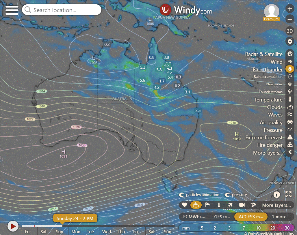
Tropical moisture will bring rain and occasional storms to large parts of the Northern Territory, as well as northern and western regions of Queensland, South Australia, and New South Wales. Eastern areas of Queensland and New South Wales, along with western Tasmania and southern Western Australia, will experience showers due to onshore winds.
The southern regions will have settled weather with cool mornings, thanks to high pressure systems.
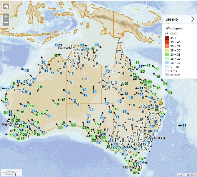
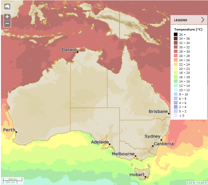
Synoptic | Temp/Rain | Wind | Sea Surface Temp
State
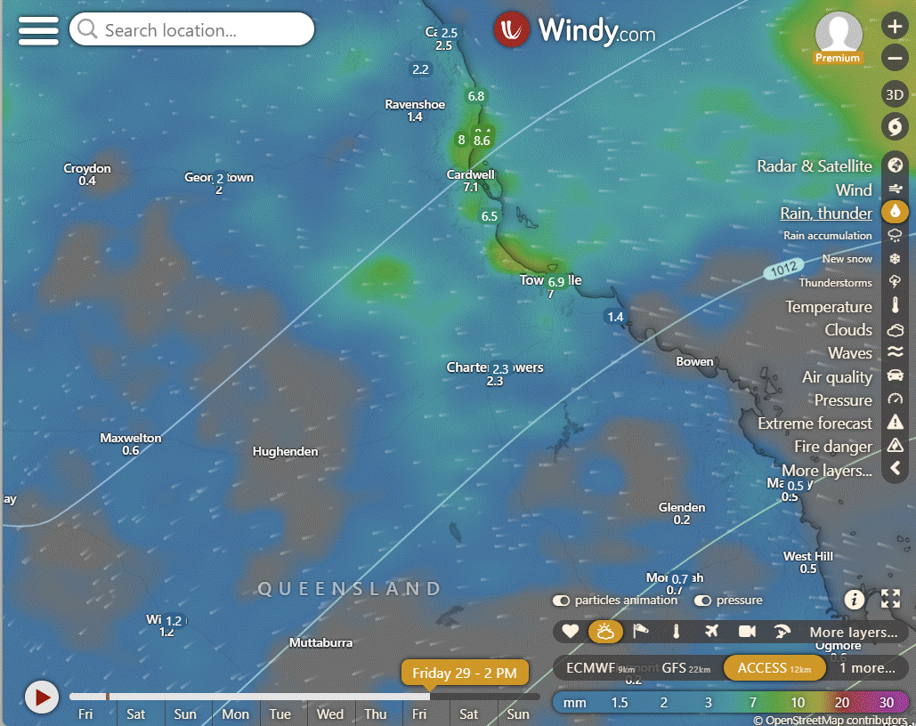
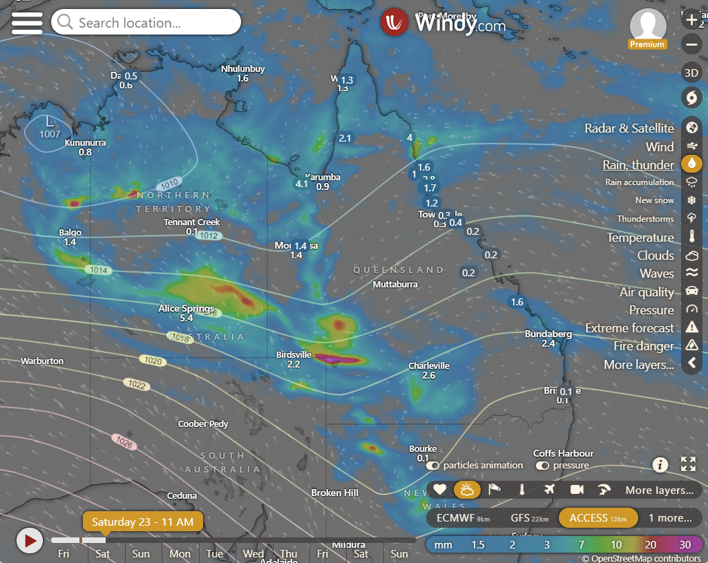
High pressure ridge over eastern districts with onshore winds and showers. Weak trough in western Queensland may deepen, draw tropical moisture southward, enhance rainfall, shift south over North Tropical Coast.
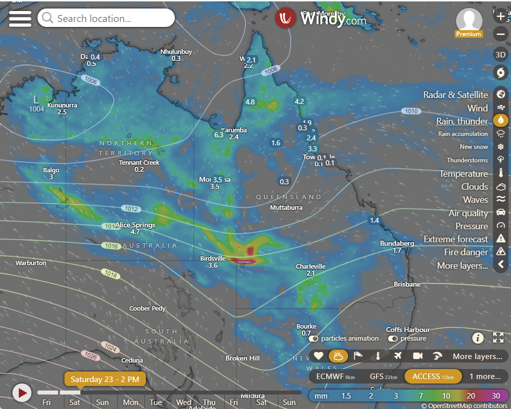
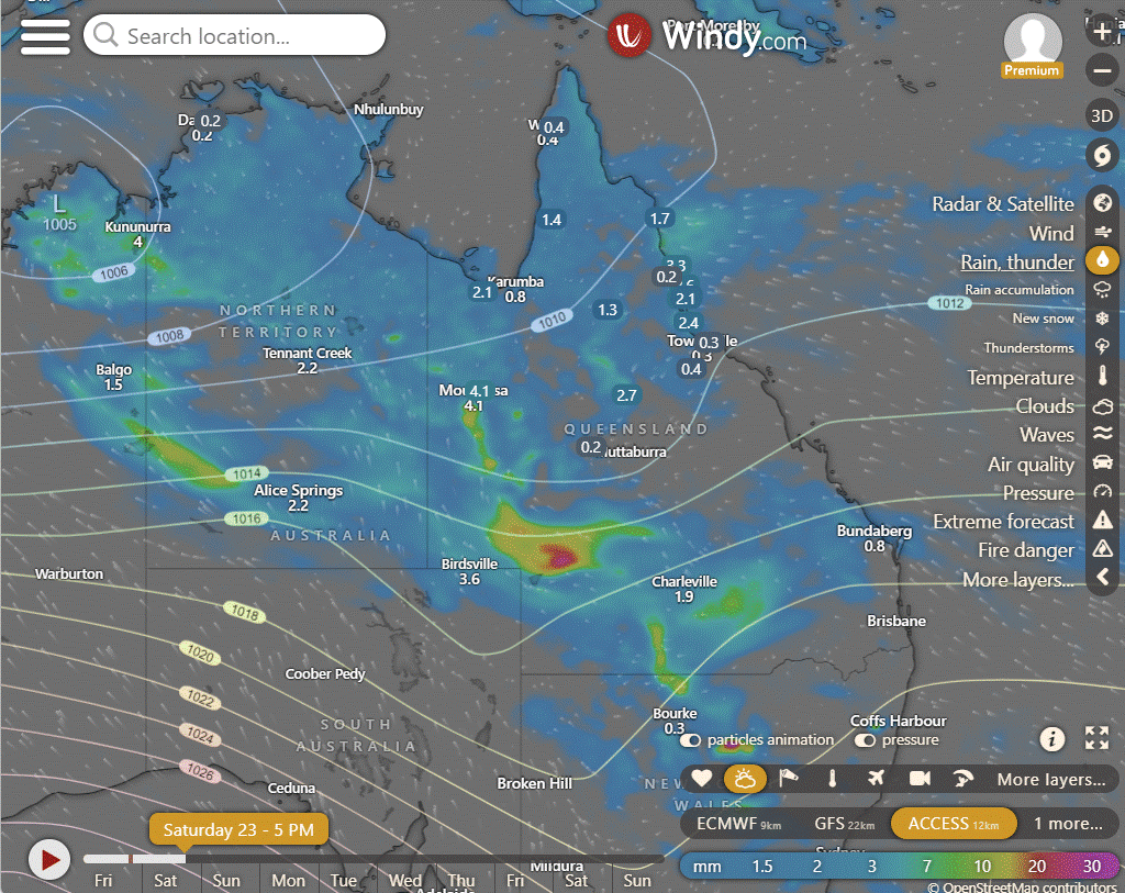
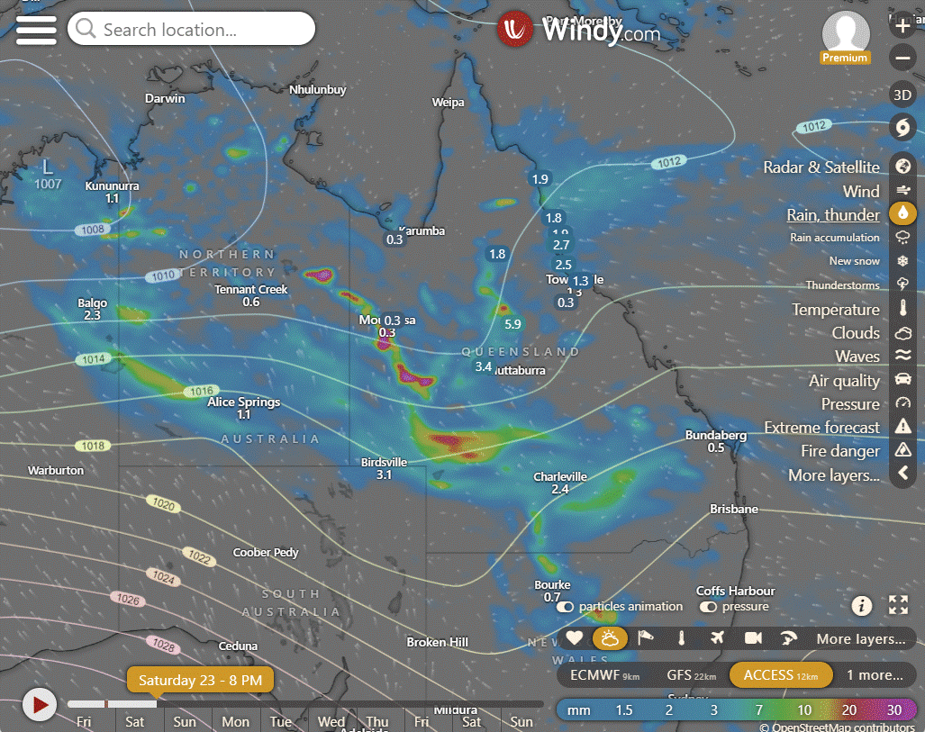
ACCESS (Values are rainfall over 3 hours)
4-day
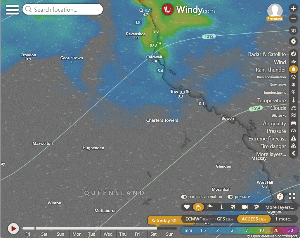
Saturday: Spotty showers likely across most areas, chance of thunderstorms in specific regions. Heavy rainfall possible in some areas. Winds vary in strength and direction.
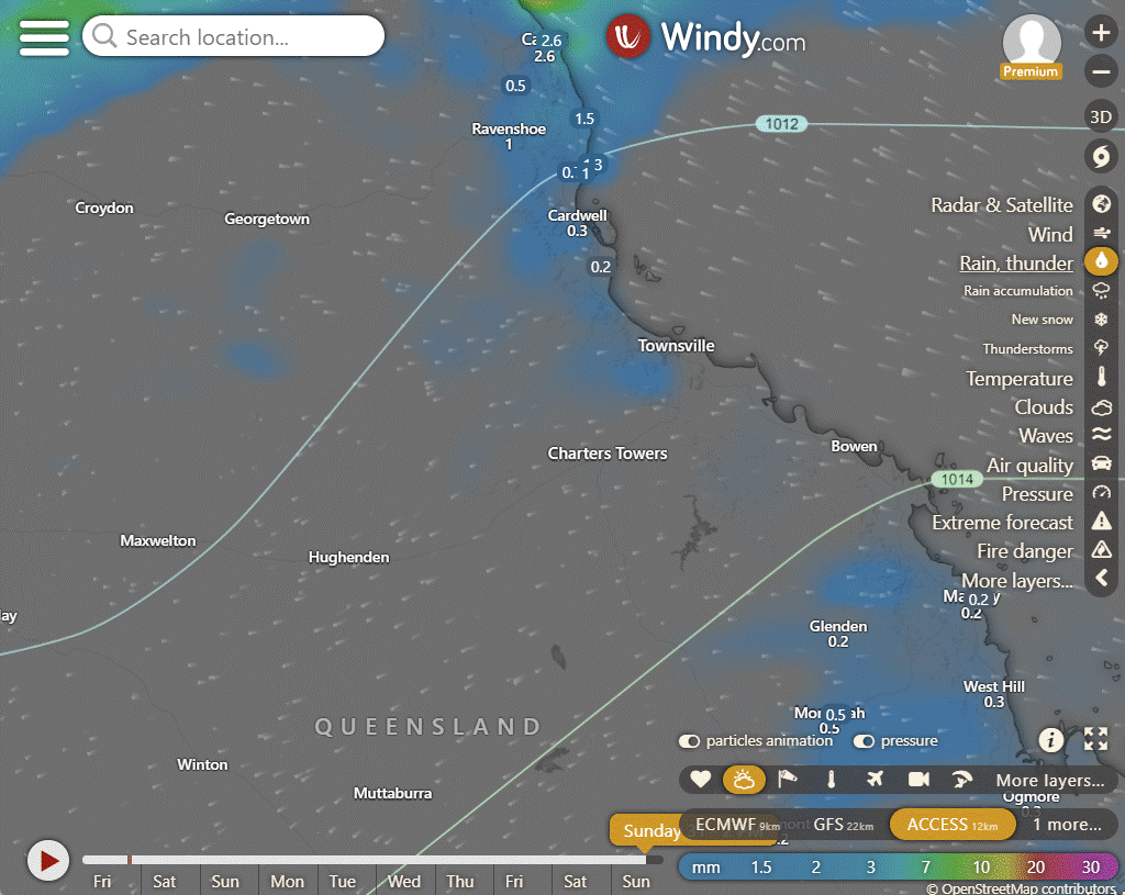
Sunday: Sunday: Scattered showers in most districts, chance of thunderstorms in northern, central, and western Queensland. Risk of severe thunderstorms with heavy rainfall in central west to northwestern interior. Showers widespread with moderate rainfall in central west to south interior. Max temperatures well below average in the west, central, and south interior, below average in southeast and east interior, near average elsewhere.
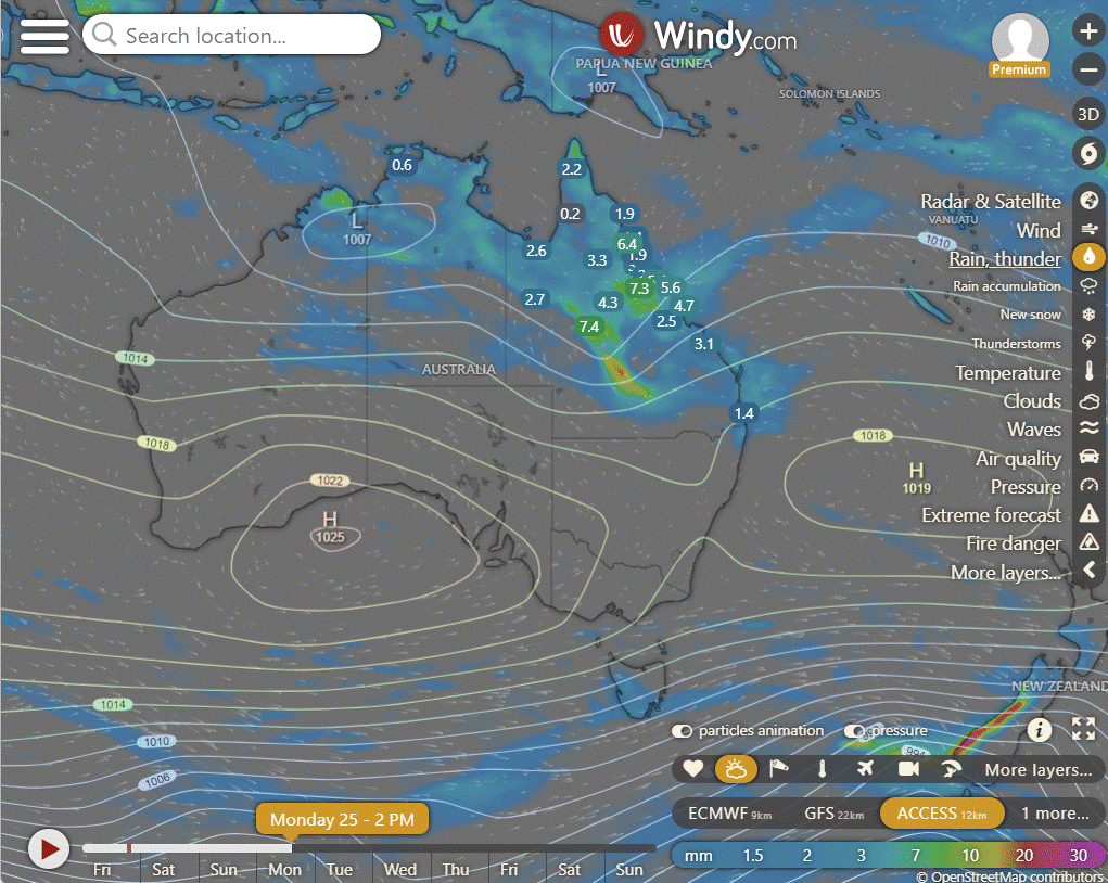
Monday: Scattered showers likely in most areas with possible thunderstorms in north Queensland. Showers may become widespread in central to southern regions with some moderate rain. Variability in rainfall amounts and locations. Lowest temperatures in western and southern areas, while elsewhere near normal.
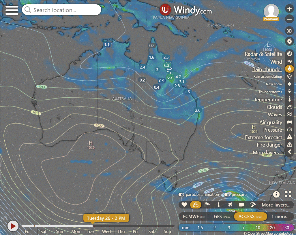
Tuesday: Scattered showers in most of Queensland, chance of thunderstorms in north and central regions. Rain likely in northern, central, and eastern areas, with varying intensity. Below-average temperatures across the state.
North Tropical Coast and Tablelands:
Max temperature: 30°C, Min temperature: 20°C, Wind speed: 15-25 km/h, Wind direction: Easterly, Rainfall: Showers with possible thunderstorms, Cloudy.
Herbert and Lower Burdekin:
Maximum temperature: 33°C, Minimum temperature: low to mid 20s, Wind speed: 15 to 25 km/h, Wind direction: East to northeasterly, Rainfall: High chance of showers in the north, medium chance elsewhere.
Central Coast and Whitsundays:
Maximum temperature: 33°C, Minimum temperature: 20°C, Wind speed: 20 to 30 km/h easterly, Wind direction: Easterly, Rainfall: Medium chance of showers, Weather: Partly cloudy
Peninsula:
The weather will be cloudy with a high chance of showers, most likely in the late morning and afternoon, with a chance of a thunderstorm. Light winds becoming easterly 15 to 20 km/h in the morning, then becoming light in the middle of the day. Overnight temperatures will fall to the low to mid 20s, with daytime temperatures reaching the low 30s.
Gulf Country:
High of low 30s, low in mid 20s, light winds, partly cloudy with showers likely in the afternoon and evening, chance of a severe thunderstorm in far southwest.
Northern Goldfields and Upper Flinders:
The weather will be partly cloudy with a medium chance of showers, most likely in the afternoon and evening, a chance of a thunderstorm, with temperatures ranging from a low in the low to mid 20s overnight to a high in the low to mid 30s during the day, and winds east to northeasterly at 20 to 30 km/h, becoming light in the evening.
Capricornia:
Max temperature around 30 with wind speed southeasterly 15 to 20 km/h turning easterly 15 to 25 km/h, medium chance of showers, most likely in late morning and afternoon, minimum temperature between 18 and 22, and partly cloudy.
Central Highlands and Coalfields:
Maximum temperature: 33°C, Minimum temperature: 18°C, Wind speed: Light becoming easterly 15-25 km/h then light, Wind direction: East, Rainfall: Medium chance of showers in the south, slight chance elsewhere, Other: Cloudy conditions.
Central West:
Maximum temperature: 34°C, Minimum temperature: 20°C, Wind: East to southeasterly 15-35 km/h, Rainfall: High chance of showers, Cloud Cover: Cloudy with possible thunderstorm.
North West:
Maximum temperature around 30, minimum temperature in the low to mid 20s, wind speeds 15 to 20 km/h from the northeast to southeast, high chance of showers mainly in the afternoon and evening, possible severe thunderstorm in the far west, cloudiness expected.
Channel Country:
Max temperature: 28°C, Min temperature: 19°C, Wind speed: 15-25 km/h, Wind direction: South to southeasterly, Rainfall: Very high chance with heavy falls possible, Other: Cloudy with chance of thunderstorm.
Maranoa and Warrego:
Max temperature 23-28°C, min temperature 18-21°C, wind speed 15-25 km/h, wind direction east to southeasterly, rainfall possibility of heavy falls in the southwest, other Cloudy with very high chance of showers from late morning.
Darling Downs and Granite Belt:
Highs in the mid to high 20s, lows between 14-19, easterly winds 15-25 km/h becoming light later, cloudy with showers likely.
Wide Bay and Burnett:
Max temperature: mid to high 20s, Min temperature: 15-21, Wind: Southeasterly 15-20 km/h shifting to easterly 15-25 km/h then light, Rainfall: Showers likely, Other: Cloudy with falling overnight temperatures.
Southeast Coast:
Partly cloudy with medium chance of showers, light winds becoming easterly/southeasterly 15-20 km/h, overnight temperatures 15-19°C, daytime temperatures mid to high 20s.
WEATHER WARNINGS
Western Australia (WA):
Strong winds are expected along the Gascoyne, Geraldton, Lancelin, Perth, Bunbury Geographe, and Leeuwin coasts.
A fire weather warning is issued for Swan Inland North, Swan Inland South, Capes, and Brockman regions.
A tropical cyclone technical bulletin is issued.
Minor flood warning is in place for the Fitzroy River.
Flood watch is issued for the Sturt Creek District and East Kimberley Rivers.
Final flood warnings are issued for the Salt Lakes District Rivers and the Eucla District.
Northern Territory (NT):
Severe weather warning for heavy rainfall is issued for parts of Simpson, Lasseter, and Tanami districts.
Moderate flood warning is in effect for the Mcarthur River.
Flood watch is issued for central and southern parts of NT.
Moderate flood warning is issued for the Daly River.
New South Wales/ACT (NSW/ACT):
Gale warning is issued for western, southern, and southeastern areas.
Final flood warning is issued for the Paroo River.
Final flood warning is issued for the Warrego River.
Queensland (QLD):
Flood watch is issued for South West Queensland and parts of Cape York Peninsula and Gulf Country.
Minor flood warning is issued for the Nicholson River and flood warning for the Leichhardt River.
Final flood warning is issued for the Russell River.
Moderate flood warning is in effect for Eyre Creek and minor flood warning for the Georgina River.
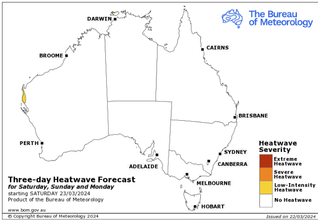
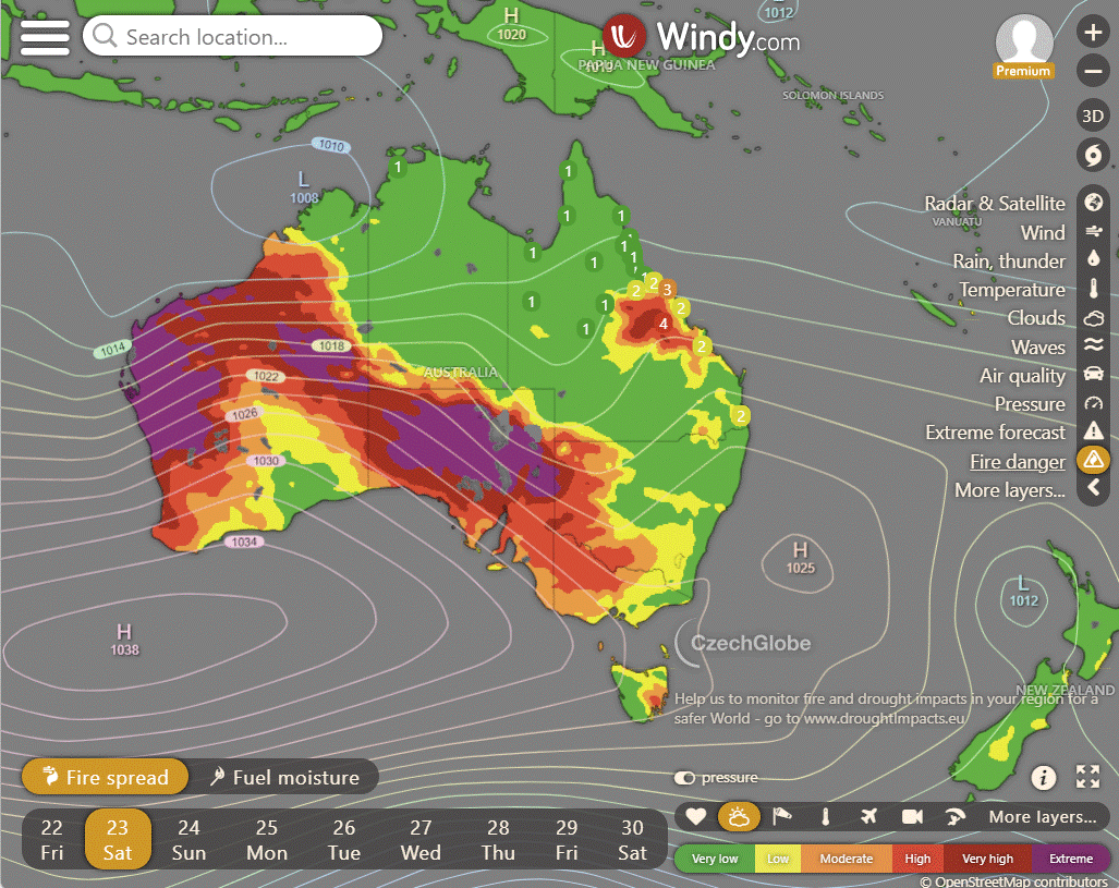
Storms - Heatwave - Fire danger
Click here to support to Wally's Weather
National maps by Weatherzone (weatherzone.com.au)
State maps by Windy (Windy.com)
Weather forecast supplemented by Bureau of Meteorology (bom.gov.au)
Rainfall daily totals (https://meteologix.com/ )
AccuWeather (https://www.accuweather.com/)
Nine Weather (https://www.9news.com.au/weather)
Wally's Weather provides professionally researched data and information. Andrew aka 'Wally' has over 20 years of experience in meteorology research and data analysis. In 2023 finished top 4 for the AMOS national weather forecasting competition. The content here is provided as educational information aimed at providing the community and businesses with the tools required to determine local-based forecasts. IMPORTANT: The forecasts and information posted should never be used on their own to make business decisions as local influences.


Comments