Morning Weather - March 25 - Wally's Weather Australia
- Mar 24, 2024
- 5 min read
To get your daily forecast delivered free goto http://wallysweather.com.au/blog

An added thanks to the sponsorship from NQ Licensed Events and the Country Festival on March 30 & 31 at the Dittman Bullpit

Website: https://www.countryfest.com.au/
Facebook: https://www.facebook.com/contryfestqld
Instagram: https://www.instagram.com/countryfestqld/
The weather for the Country Fest is looking mainly fine for the 2 days, 5mm rainfall forecast at the moment. I will keep you updated.
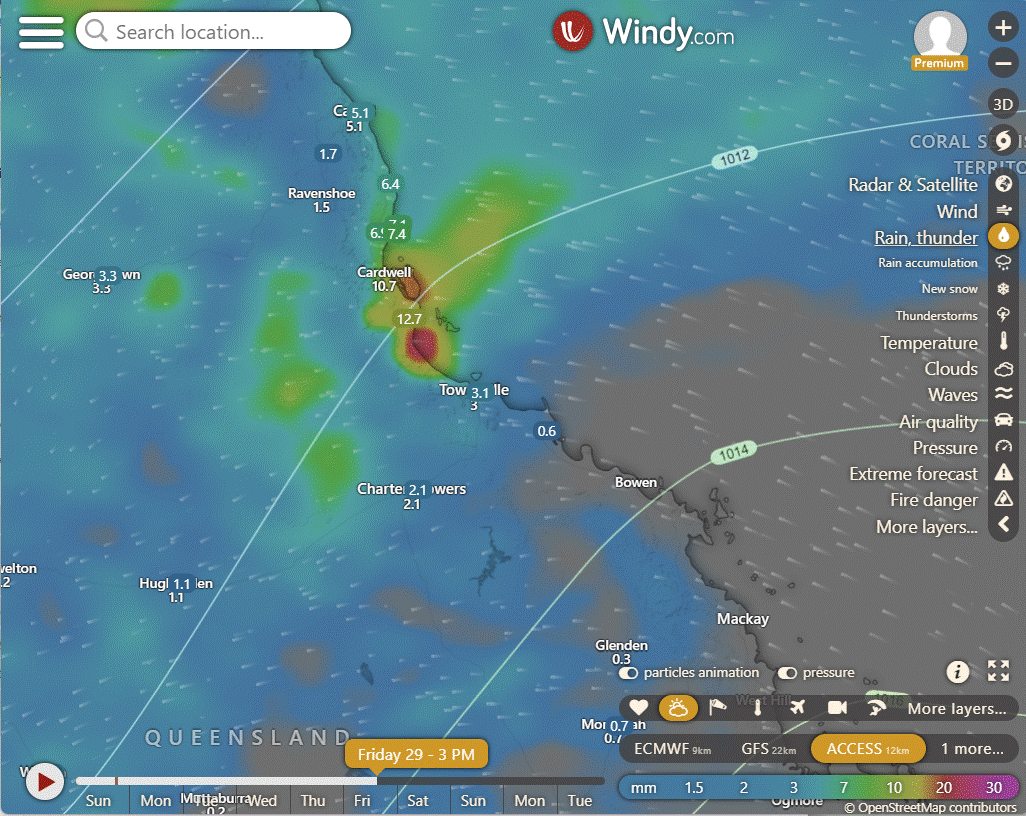
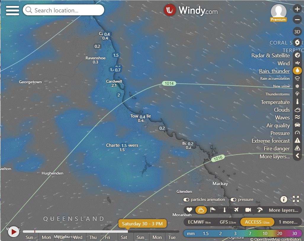
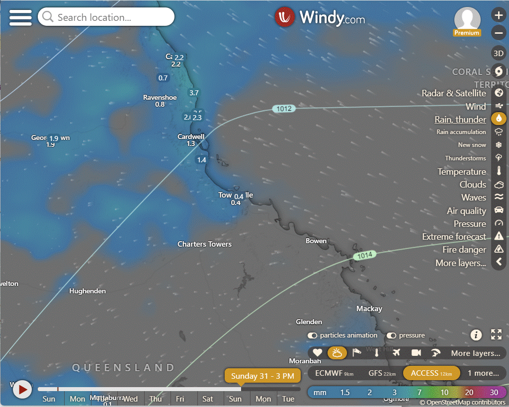
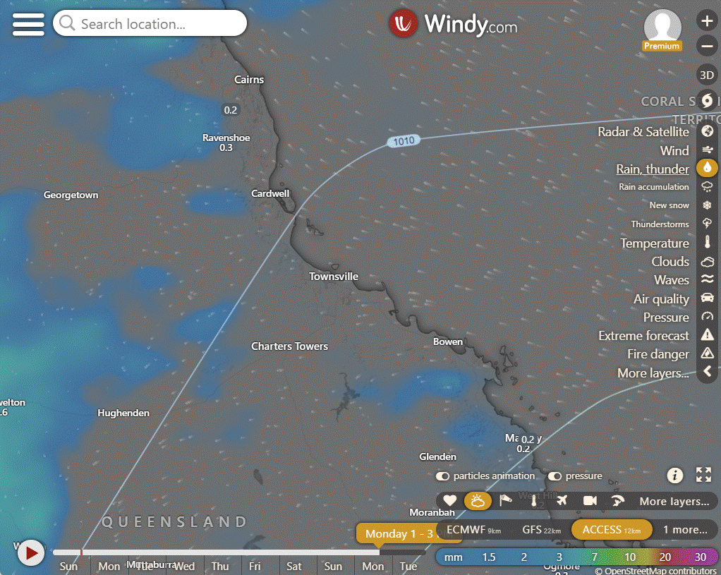
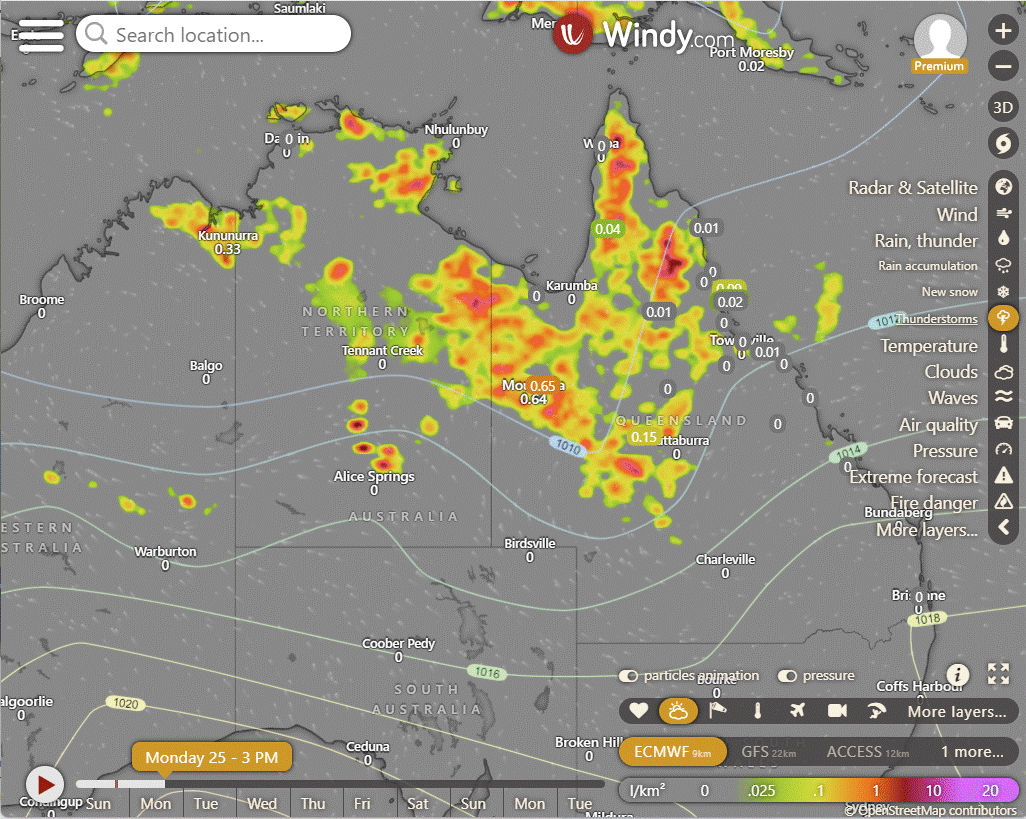
Easter heavier showers on Friday, mainly North of Townsville, then easing back Saturday, more easing on Sunday with very few isolated showers around the North on Monday.
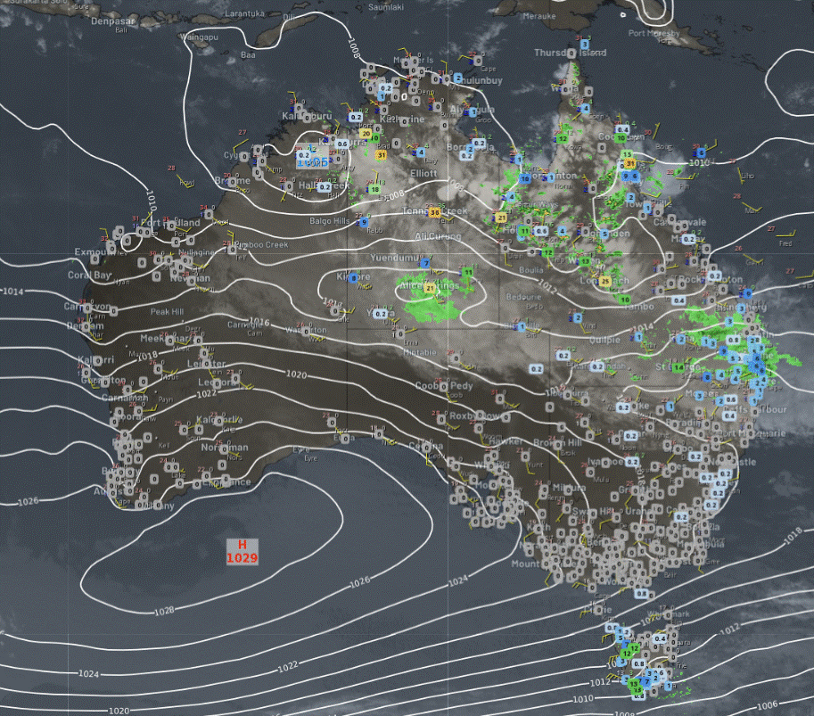
National
In WA's northeast, the NT, northern SA's far north, northern NSW, and QLD, there's rain, showers, and storms. TAS experiences gusty winds and showers as a cold front moves through. Meanwhile, the south, including SA, VIC, and southern NSW, remains mostly dry and settled, with a cool morning.
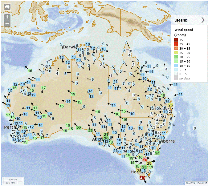
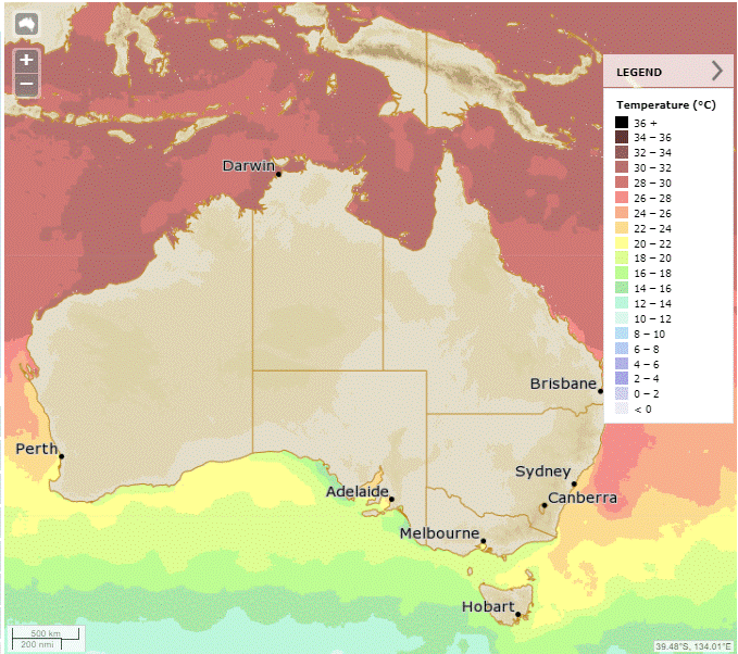
Synoptic | Temp/Rain | Wind | Sea Surface Temp
State
A weakening ridge on the east coast will strengthen later. A slow-moving trough in western Queensland brings rain and cooler temperatures. Another trough will move over North Tropical Coast.
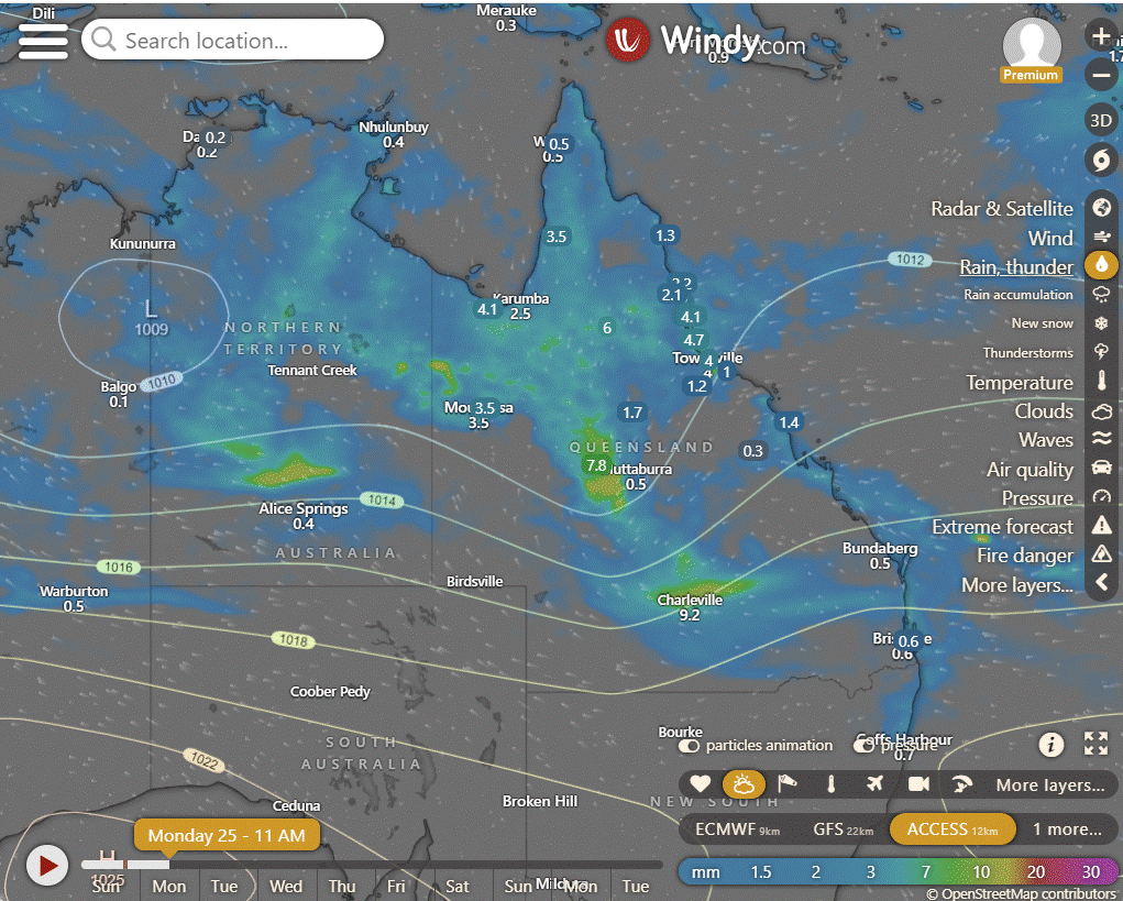
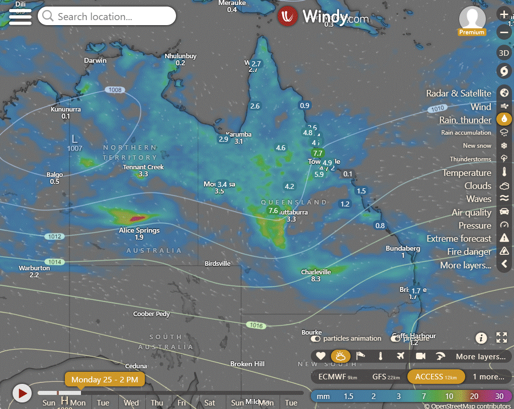
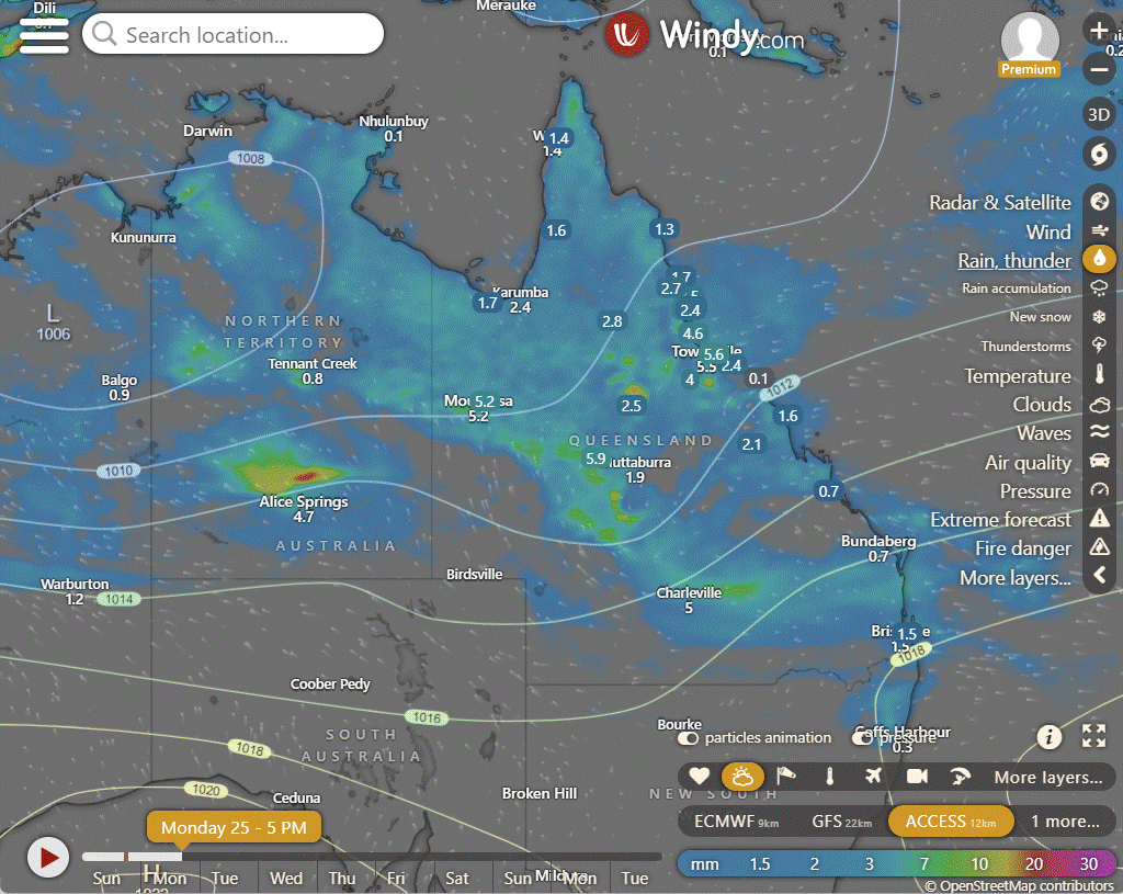
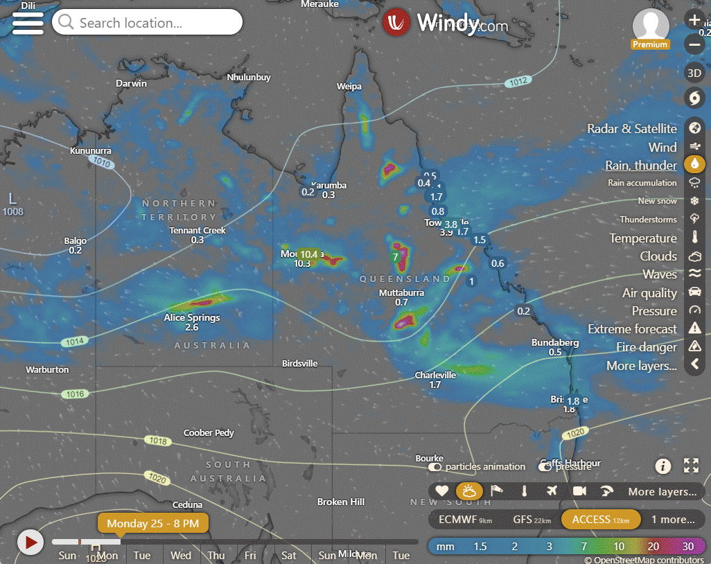
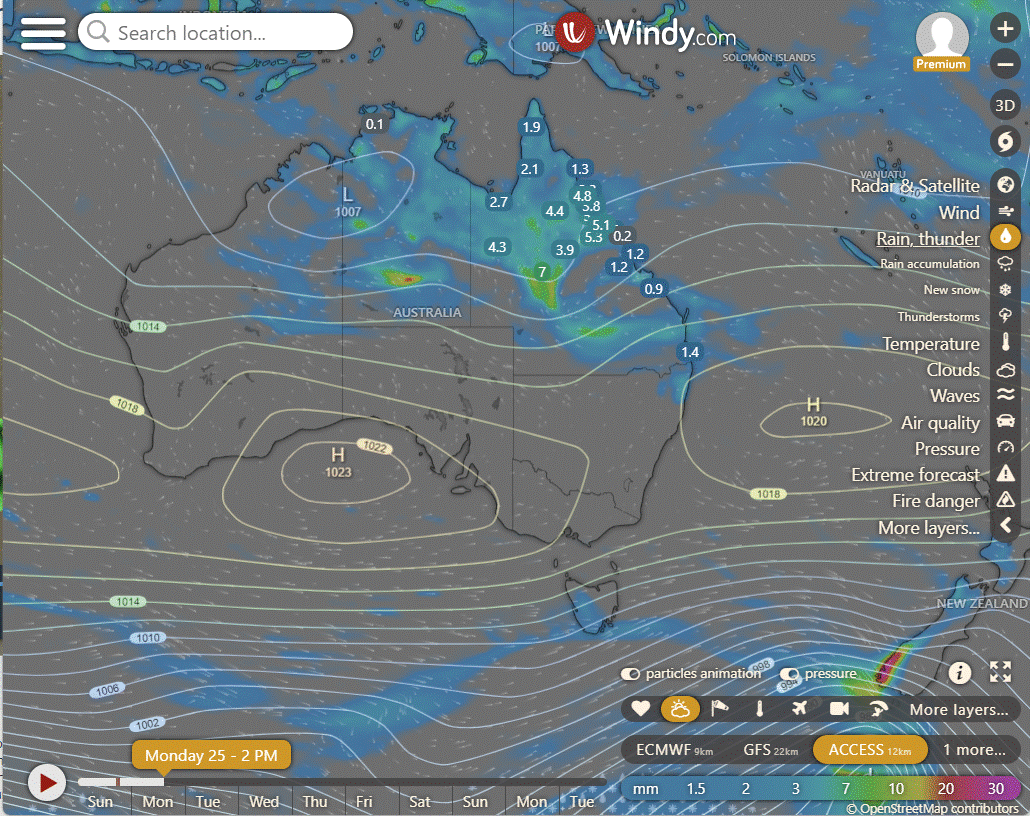
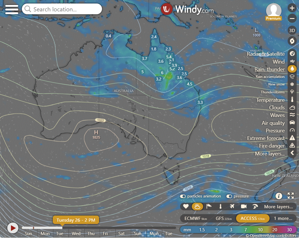
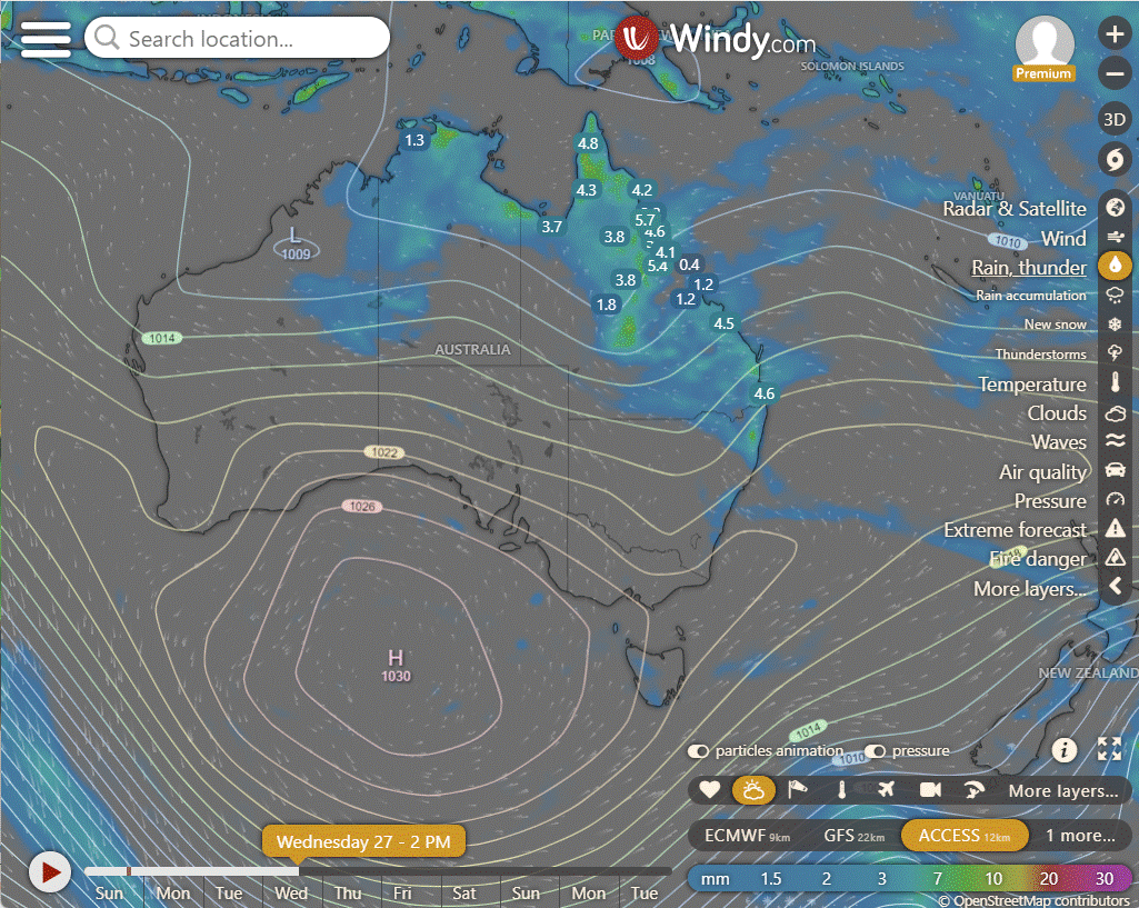
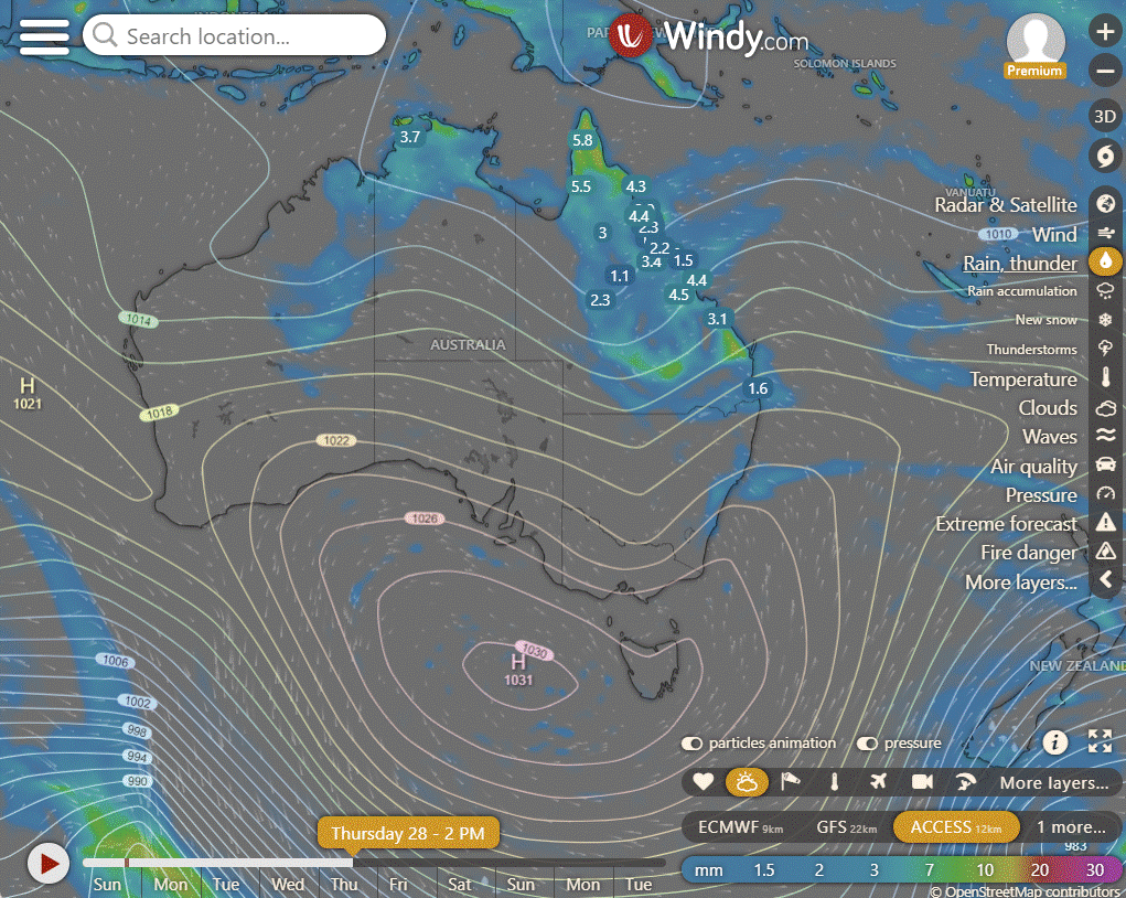
ACCESS (Values are rainfall over 3 hours)
4-day forecast
The 4 day forecast brought to you by our local businesses, you could have this spot with your details, support local, take out a Bold Shout! $250 for a year, you get this and the website every day!


Gecko Interiors, Learning Lair, Slip 'n' Stitch, The Urban Plantarium.
Monday: Scattered showers with thunderstorms, heavy rainfall risk, moderate rain in south, light winds.
Tuesday: Scattered showers and thunderstorms mainly in northern and central Queensland, with moderate rainfall along the east coast. Severe thunderstorm risk in central and southern interior. Cooler temperatures in the interior, west, and south.
Wednesday: Mostly scattered showers statewide, chance of thunderstorms in northern and central Queensland. Widespread showers with rain in east Queensland, uncertain rainfall amounts. Risk of severe thunderstorms in central and southern interior. Isolated showers in far southwest. Below-average temperatures in interior, west, and south, near average elsewhere.
Thursday: Thursday: Scattered showers with chance of thunderstorms in parts of Queensland. Possible widespread showers with uncertain rainfall amounts. Risk of severe thunderstorm in central and northern areas. Isolated showers in the southwest. Fresh southeasterly winds on the east coast. Below-average temperatures across most regions.
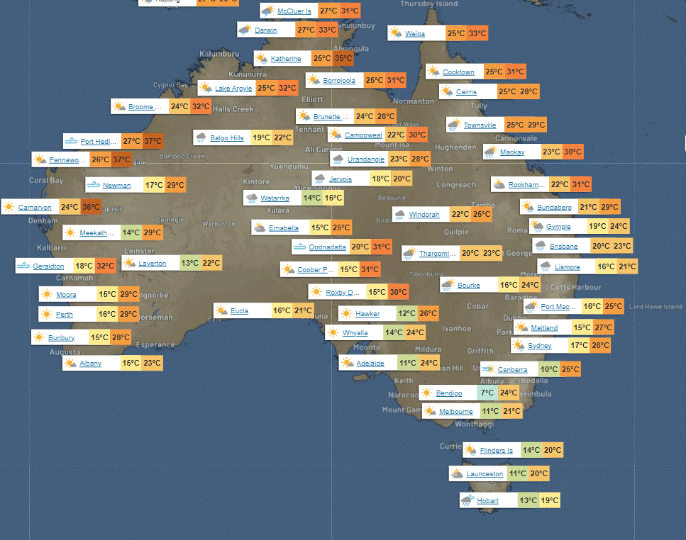
North Tropical Coast and Tablelands:
Max temperature: 31°C, Min temperature: 20°C, Wind speed: Light, Wind direction: Variable, Rainfall: Showers likely, Cloud cover: Cloudy.
Herbert and Lower Burdekin:
Max temperature: 32°C, Min temperature: 20°C, Wind speed: Light, Wind direction: Not specified, Rainfall: High chance of showers, Other: Cloudy with a chance of thunderstorm.
Central Coast and Whitsundays:
Max temperature: 33 degrees, Min temperature: low 20s, Wind speed: light, Wind direction: east to northeasterly, Rainfall: showers likely, Weather: Partly cloudy with chance of thunderstorms.
Peninsula:
Max temperature reaching the low to mid 30s, with overnight temperatures falling to the low to mid 20s, light winds, high chance of showers in the late morning, chance of a thunderstorm, partly cloudy.
Gulf Country:
Max temperature: 30°C, Min temperature: mid 20s, Wind speed: Light, Wind direction: Variable, Rainfall: Showers likely, Other: Cloudy with chance of thunderstorm.
Northern Goldfields and Upper Flinders:
Max temperature: Around 30°C, Min temperature: Low to mid 20s, Wind speed: Light winds becoming north to northeasterly 15 to 20 km/h, Wind direction: North to northeasterly, Rainfall: Very high chance of rain, Cloudy with a chance of severe thunderstorms.
Capricornia:
Max temperature: Mid to high 20s, Min temperature: Between 17 and 23, Wind speed: Light, Wind direction: Easterly, Rainfall: High chance of showers, Other: Cloudy with light winds fluctuating throughout the day and evening.
Central Highlands and Coalfields:
Max temperature: 30°C, Min temperature: 17°C, Wind speed: 15 to 20 km/h, Wind direction: East to northeasterly, Rainfall: High chance, Cloudy with chance of thunderstorm.
Central West:
The weather forecast includes a max temperature of 30°C, min temperature in the low 20s, wind speeds increasing from light to 15-25 km/h, northeasterly wind direction, very high chance of rain, potential for severe thunderstorms with heavy falls, and cloudy conditions overall.
North West:
Partly cloudy with showers likely in the afternoon, chance of thunderstorms, light winds, with maximum temperature around 30°C and minimum temperature in the low to mid 20s.
Channel Country:
Max temperature: 29°C, Min temperature: 20°C, Wind speed: 20 to 30 km/h, Wind direction: Southeasterly, Rainfall: Heavy falls possible, Other: Cloudy with medium chance of showers and slight chance of thunderstorm.
Maranoa and Warrego:
Max temperature: 26°C, Min temperature: 16°C, Wind speed: easterly 15 to 25 km/h becoming light, Wind direction: east, Rainfall: Very high chance in the north, medium chance elsewhere with heavy falls possible, Cloudy with a chance of thunderstorm and overnight temperatures falling to 16-19°C.
Darling Downs and Granite Belt:
Max temperature: 26, Min temperature: 16, Wind speed: 15 to 20 km/h, Wind direction: easterly, Rainfall: High chance of showers in the north, medium chance elsewhere, Cloud cover: Cloudy.
Wide Bay and Burnett:
Max temperature: 26°C, Min temperature: 16°C, Wind speed: 15-20 km/h, Wind direction: east to southeasterly, Rainfall: high chance of showers, Cloudy with light winds, becoming easterly in the morning and light in the late afternoon.
Southeast Coast:
The weather will be cloudy with light winds, temperatures ranging from 16 to 20 degrees, and a medium to high chance of showers, with increasing likelihood in the north.
WEATHER WARNINGS
Ocean Wind Warning in place for Tropical Cyclone in WA.
Gale Warning for Southern Area in NSW/ACT.
Gale Warnings issued for Western, Southeastern, and Southern Areas in NSW/ACT.
Final Gale Warning for Southeastern and Southern Areas in NSW/ACT.
Hazardous Surf Warning for Tuesday along various coasts in NSW/ACT.
Strong Wind Warning for Central, Central Gippsland, and East Gippsland coasts in VIC.
Moderate Flood Warning for the Victoria River in NT.
Severe Weather Warning for Damaging Winds in TAS.
Gale Warning for Southeast and Southwest coasts in TAS.
Strong Wind Warning for various areas in TAS.
Final Flood Warning for the Daintree and Mossman Rivers in QLD.
Flood Watch issued for the Sturt Creek District and East Kimberley Rivers in WA.
Flood Watch in place for South West Queensland and parts of Cape York Peninsula and Gulf Country in QLD.
Flood Watch issued for Central and Southern Parts of the Northern Territory.
Minor Flood Warning for the Barcoo River in QLD.
Minor and Moderate Flood Warnings for the Mcarthur and Daly Rivers in NT.
Final Flood Warning for the Tully and Murray Rivers in QLD.
Final Flood Warning for the Fitzroy River in WA.
Minor Flood Warning for the Nicholson River and Flood Warning for the Leichhardt River in QLD.
Moderate Flood Warning for Eyre Creek and Minor Flood Warning for the Georgina River in QLD.
Final Flood Warning for the Paroo River in NSW/ACT.
Final Flood Warnings for the Salt Lakes District and Eucla District Rivers in WA.
Final Flood Warning for the Warrego River in NSW/ACT.
Flood Warning for the Inland Rivers in SA.
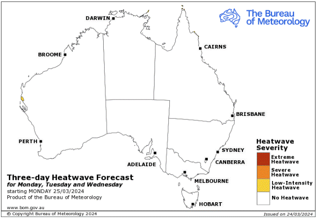
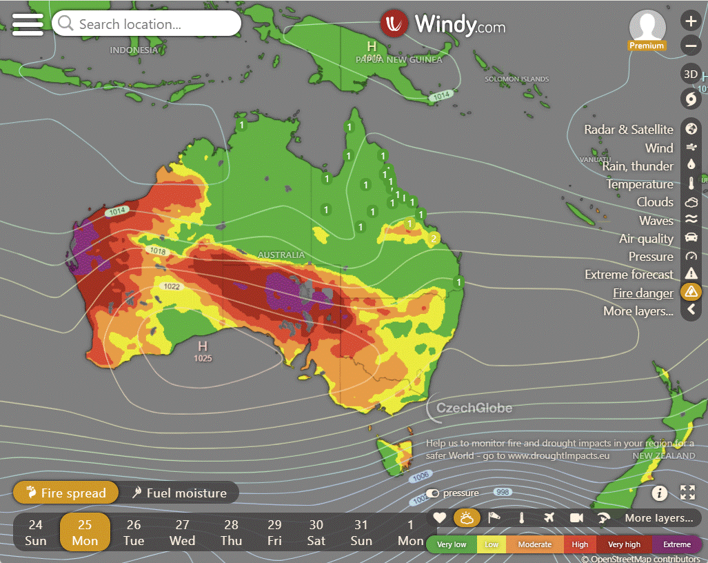
Storms - Heatwave - Fire danger
Click here to support to Wally's Weather
National maps by Weatherzone (weatherzone.com.au)
State maps by Windy (Windy.com)
Weather forecast supplemented by Bureau of Meteorology (bom.gov.au)
Rainfall daily totals (https://meteologix.com/ )
AccuWeather (https://www.accuweather.com/)
Nine Weather (https://www.9news.com.au/weather)
Wally's Weather provides professionally researched data and information. Andrew aka 'Wally' has over 20 years of experience in meteorology research and data analysis. In 2023 finished top 4 for the AMOS national weather forecasting competition. The content here is provided as educational information aimed at providing the community and businesses with the tools required to determine local-based forecasts. IMPORTANT: The forecasts and information posted should never be used on their own to make business decisions as local influences.


Comments