

Morning Weather - March 26 - Wally's Weather Australia
- Mar 25, 2024
- 6 min read
To get your daily forecast delivered free goto http://wallysweather.com.au/blog

An added thanks to the sponsorship from NQ Licensed Events and the Country Festival on March 30 & 31 at the Dittman Bullpit

Website: https://www.countryfest.com.au/
Facebook: https://www.facebook.com/contryfestqld
Instagram: https://www.instagram.com/countryfestqld/
Forecast for 30th and 31st for the Country Fest is mainly fine with a small chance of a shower.
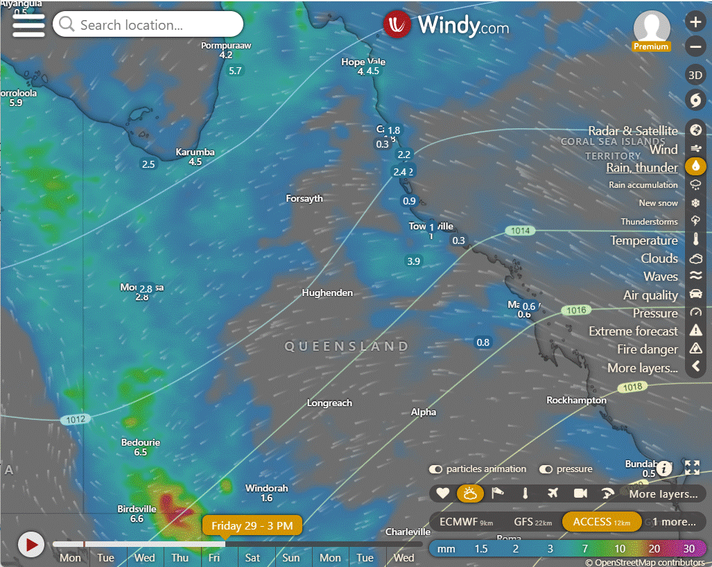
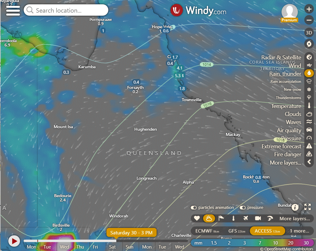
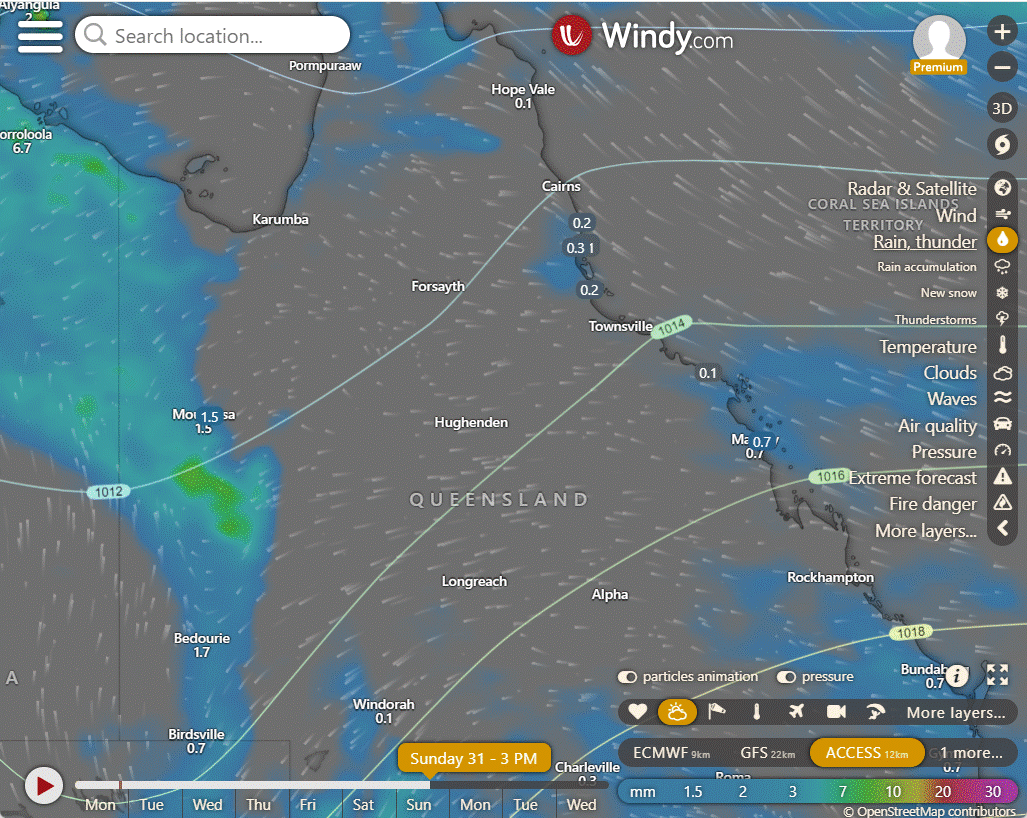
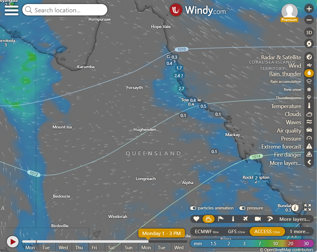
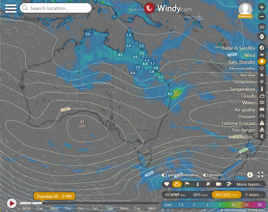
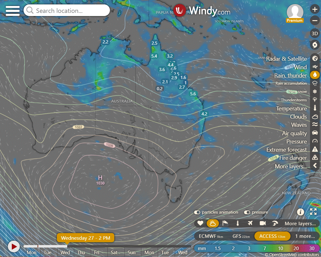
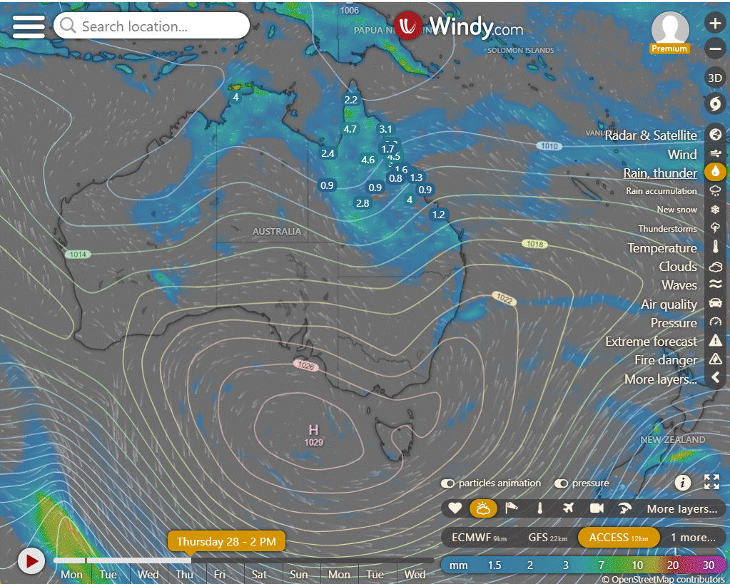
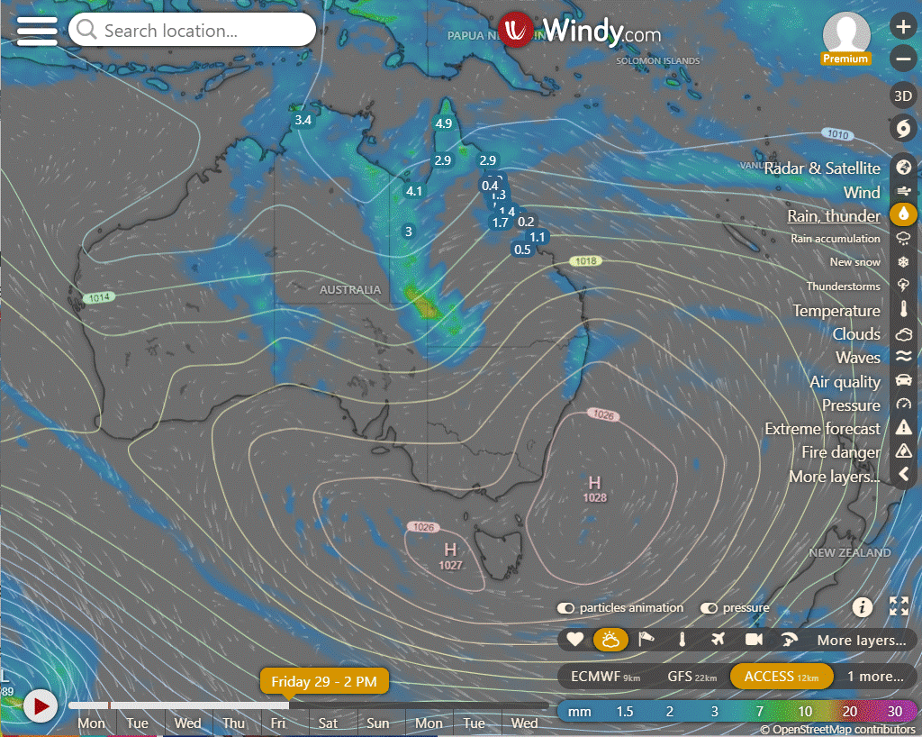
Easter As the trough over central QLD moves West the rain moves with it, however there is still some ridging from the High in the Tasman that may push showers onto the coast in the afternoons as the winds change from SE to Easterlies. Saturday looking clear for South of Ingham, Sunday mainly clear apart from the exposed coastline of the FNQ and Whitsundays, and Monday returning showers as the NE winds kick in.
The following shows showers lasting longer through Easter, however I find that forecasts of between 4 to 8 days out contain a lot of movement and variation. So while Friday and Saturday might be close to accurate, Sunday and Monday might be indicative only.
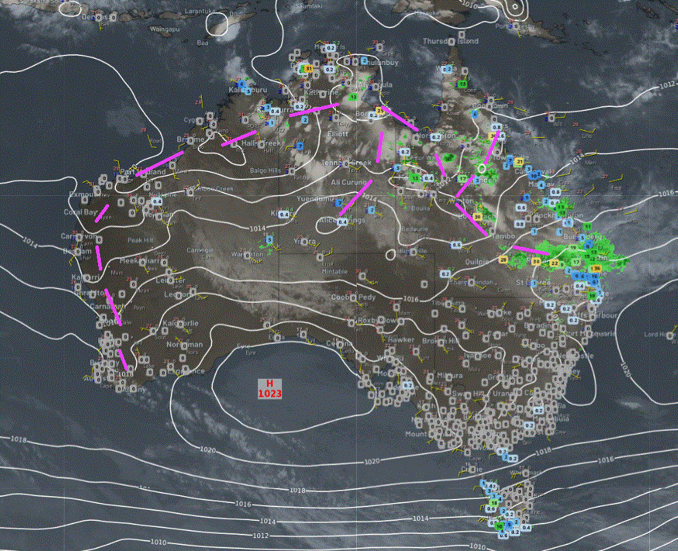
National
In northern Western Australia, the Northern Territory, Queensland, and the far northeastern part of New South Wales, expect rain, showers, and storms. Meanwhile, Tasmania, far eastern Victoria, and southeast New South Wales will experience showers accompanied by cool winds. For the most part, the rest of southern Australia will remain settled and dry, thanks to high-pressure systems.
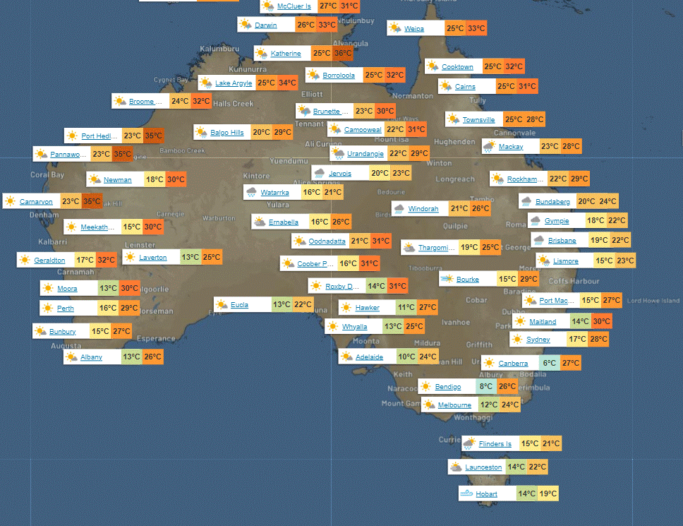
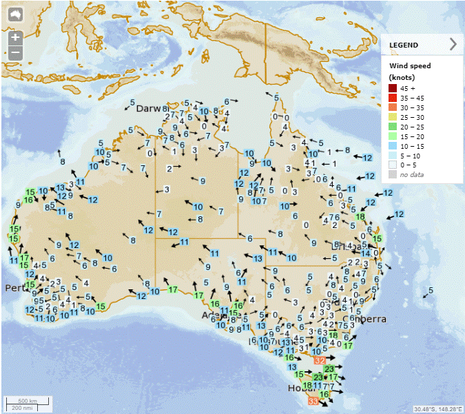
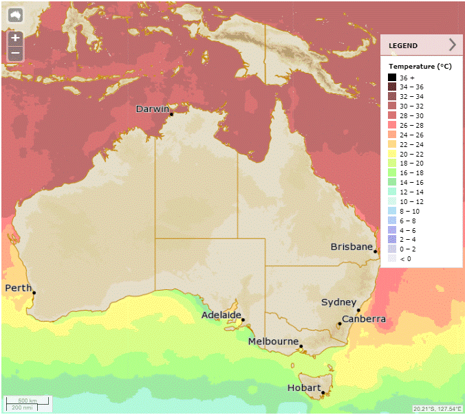
Synoptic | Temp/Rain | Wind | Sea Surface Temp
State
A trough near Ingham will linger before moving northward due to a strengthening ridge, while another trough in Queensland will bring rain and cooler temperatures before shifting west later.
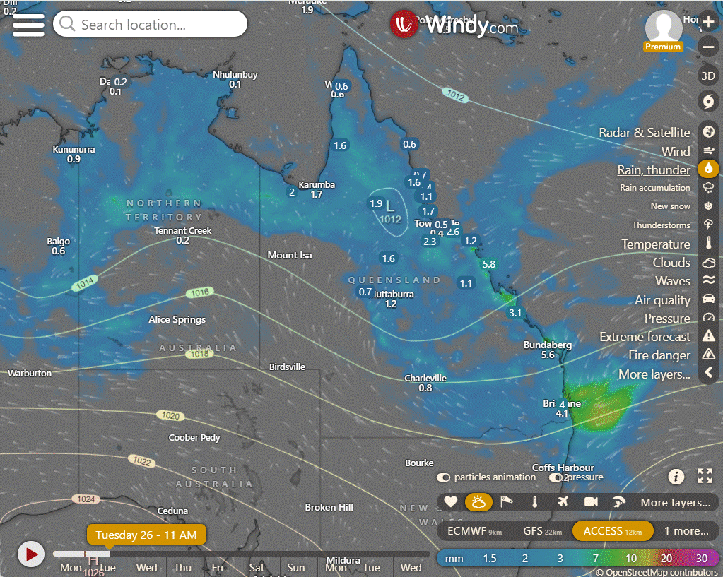
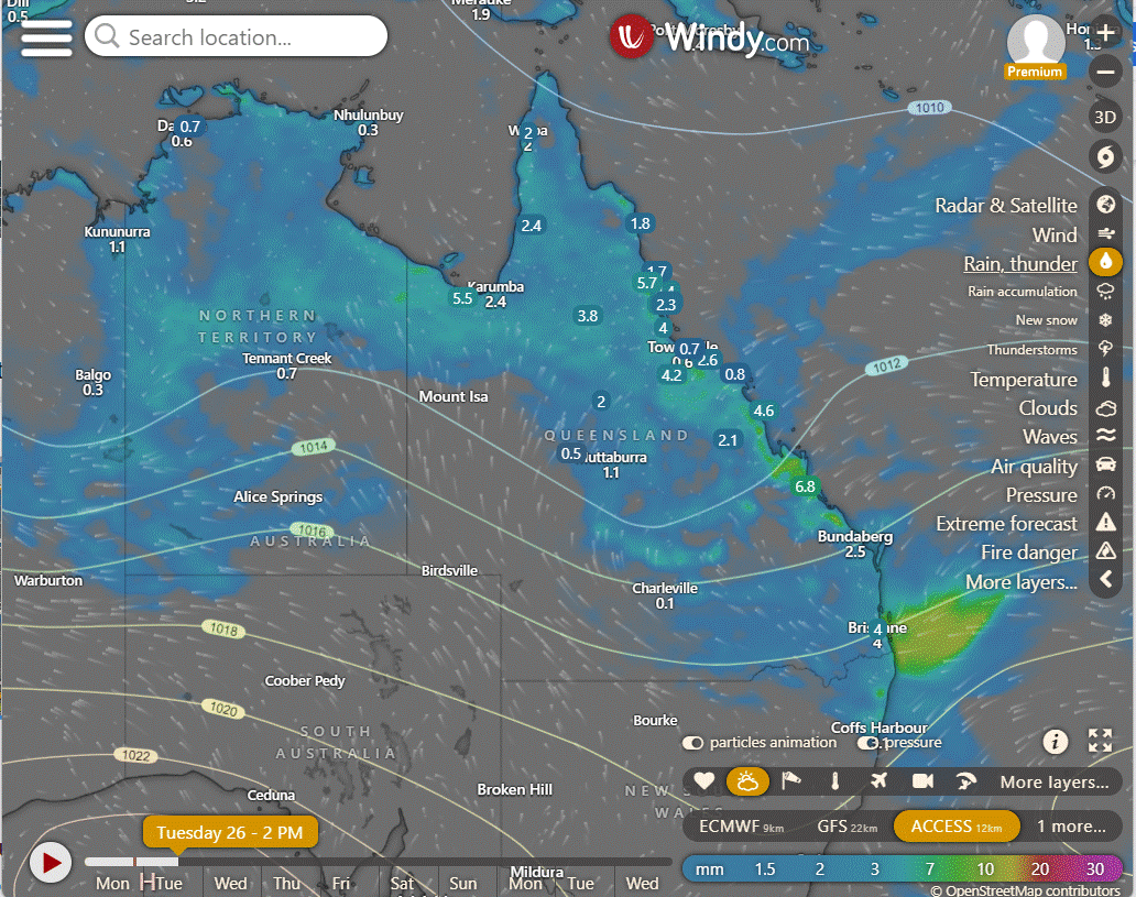
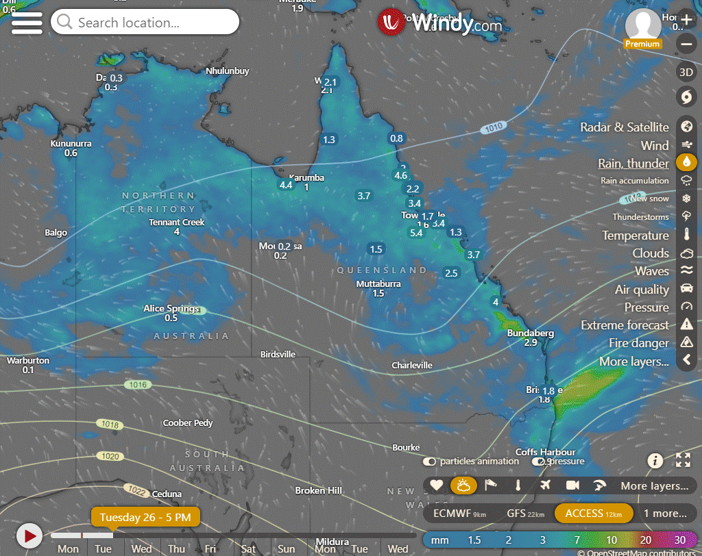
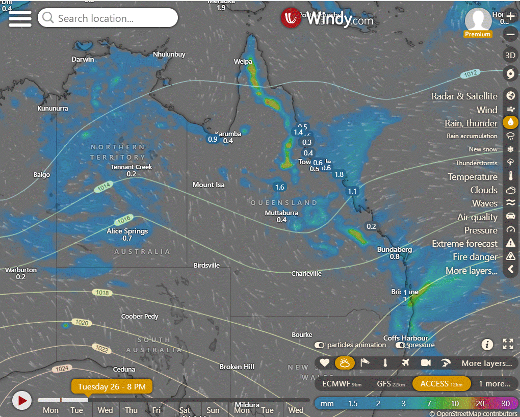
ACCESS (Values are rainfall over 3 hours)
4-day forecast
The 4 day forecast brought to you by our local businesses, you could have this spot with your details, support local, take out a Bold Shout! $250 for a year, you get this and the website every day!


Tuesday: Scattered showers state-wide, chance of storms in western, central, and northern Queensland. Rain in southern and southeast areas, showers in northern regions and tropical east coast. Possible heavy rainfall with thunderstorms in central, northern interior, and east coast. Winds northeast to southeasterly, becoming south to southeasterly in far southwest. Light winds in Cape York Peninsula and Torres Strait.
Wednesday: Scattered showers across most of the state, with the chance of thunderstorms in northern and central Queensland. Rain likely in the tropical east coast and South East Queensland. Risk of severe thunderstorms in interior areas. Temperature variation across regions.
Thursday: Scattered showers statewide, chance of storms in northern, western, central Queensland. Showers spreading with areas of rain in north, east; locally heavy falls possible. Severe thunderstorm risk in parts of North West, central, southwest Queensland. Fresh southeasterly winds on east coast. Max temperatures below average in interior, west, south; near/ slightly below average elsewhere.
Friday: Scattered showers and thunderstorms likely in parts of Queensland, with coastal areas at risk of moderate to heavy rainfall. Severe thunderstorms possible in the southwest. Winds strong on the east coast. Below-average temperatures expected.
North Tropical Coast and Tablelands:
Cloudy with showers likely in the afternoon and evening, chance of a thunderstorm, light winds, with maximum temperature around 30, overnight temperatures in the low to mid 20s, and possible rainfall.
Herbert and Lower Burdekin:
Maximum temperature around 30°C, minimum temperature in the low to mid 20s, light winds with a very high chance of showers and thunderstorms, and overnight temperatures dropping to the low to mid 20s under cloudy skies.
Central Coast and Whitsundays:
The weather will be hot with maximum temperature around 30 degrees, light winds, very high chance of rain with a chance of severe thunderstorms and overnight temperatures falling to the low 20s.
Peninsula:
Maximum temperature: Low to mid 30s, Minimum temperature: Low to mid 20s, Wind speed: Light winds, Wind direction: Not specified, Rainfall: High chance of showers with possible thunderstorms, Other: Partly cloudy with overnight temperatures falling to the low to mid 20s.
Gulf Country:
Max temperature: low 30s, Min temperature: mid 20s, Wind speed: Light, Wind direction: Other, Rainfall: High chance of showers, Other: Partly cloudy. High chance of showers. The chance of a thunderstorm. Light winds. Overnight temperatures falling to the mid 20s with daytime temperatures reaching the low 30s.
Northern Goldfields and Upper Flinders:
Max temperature: 30°C, Min temperature: 20°C, Wind speed: Light winds becoming 15 to 20 km/h, Wind direction: South to southwesterly, Rainfall: High chance of showers, possibly severe thunderstorm, Other: Cloudy with overnight temperatures in the low to mid 20s.
Capricornia:
Max temperature: 30°C, Min temperature: 19-23°C, Wind speed: Light winds, Wind direction: Unknown, Rainfall: High chance of showers, Cloud cover: Cloudy.
Central Highlands and Coalfields:
Maximum temperature: 31°C, Minimum temperature: 18°C, Wind speed: Light, Wind direction: Variable, Rainfall: High chance, Other: Cloudy with chance of thunderstorms.
Central West:
The maximum temperature will reach around 30 degrees with overnight temperatures falling to the low 20s, light winds becoming south to southwesterly, high chance of showers most likely in the late morning, with a chance of severe thunderstorms, and cloudy conditions expected.
North West:
Maximum temperature in the low 30s, minimum temperature in the low to mid 20s, winds light becoming southerly 15 to 25 km/h, partly cloudy with medium chance of showers north of Mt Isa, slight chance elsewhere, chance of a thunderstorm.
Channel Country:
Max temperature: 31°C, Min temperature: 20°C, Wind speed: 20-30 km/h, Wind direction: southeasterly, Rainfall: slight, Conditions: Partly cloudy with chance of showers and thunderstorms.
Maranoa and Warrego:
Max temperature: 28°C, Min temperature: 18°C, Wind: Light becoming E to SE 15-25km/h, Rainfall: High chance in the north, medium chance elsewhere, Other: Cloudy with possible thunderstorm in the north.
Darling Downs and Granite Belt:
Maximum temperature in the low to mid 20s, minimum temperature around 17, light winds becoming east to southeasterly 15 to 20 km/h, high chance of rain mainly in the morning and afternoon, and cloudy with overnight temperatures dropping.
Wide Bay and Burnett:
Max temperature in the low to mid 20s, min temperature between 17 and 21, light winds, very high chance of rain, cloudy.
Southeast Coast:
Maximum temperatures in the low to mid 20s, minimum temperatures falling to between 17 and 20, light winds, very high chance of rain with cloudy conditions.
WEATHER WARNINGS
Severe thunderstorm warning canceled for Gregory, Barkly, and Tanami districts in the Northern Territory.
Hazardous surf warning issued for Tuesday along Byron, Coffs, Macquarie, Hunter, Sydney, Illawarra, Batemans, and Eden coasts in New South Wales.
Gale warnings issued for the Southern and Western areas of New South Wales.
Strong wind warning issued for Central, Central Gippsland, and East Gippsland coasts in Victoria.
Strong wind warning issued for Banks Strait, Franklin Sound, East of Flinders Island, Far North West, Central North, Lower East, South East, and South West coasts in Tasmania.
Flood watch issued for South West Queensland, the Sturt Creek District, and East Kimberley Rivers in Western Australia.
Flood watch issued for the Cape York Peninsula and parts of the Gulf Country in Queensland.
Flood watch issued for central and southwest parts of the Northern Territory.
Moderate flood warning issued for Eyre Creek in Queensland.
Flood warning issued for inland rivers in South Australia.
Minor flood warning issued for the Barcoo River in Queensland.
Minor flood warning issued for the Daly River in the Northern Territory.
Final flood warning issued for the McArthur River in the Northern Territory.
Final gale warning issued for the southeastern area in New South Wales.
Moderate flood warning issued for the Nicholson River and flood warning for the Leichhardt River in Queensland.
Initial minor flood warning issued for the Bohle River in Queensland.
Minor flood warning issued for the Cloncurry and Upper Flinders Rivers in Queensland.
Final flood warning issued for the Victoria River in the Northern Territory.
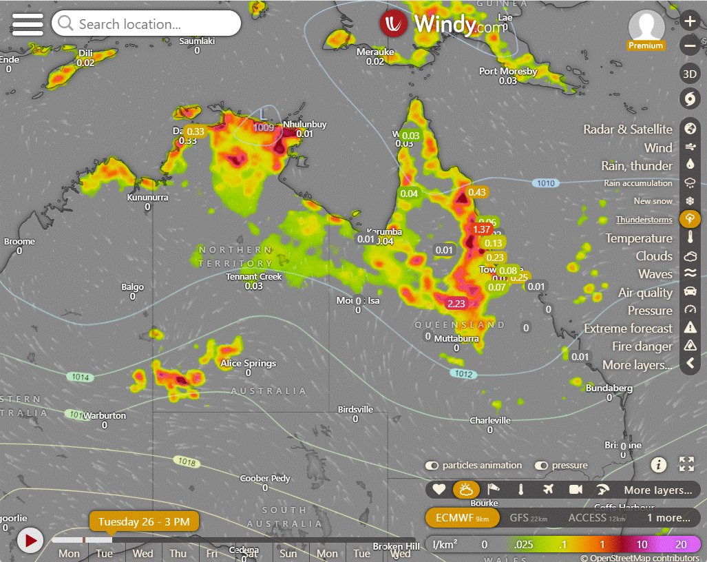
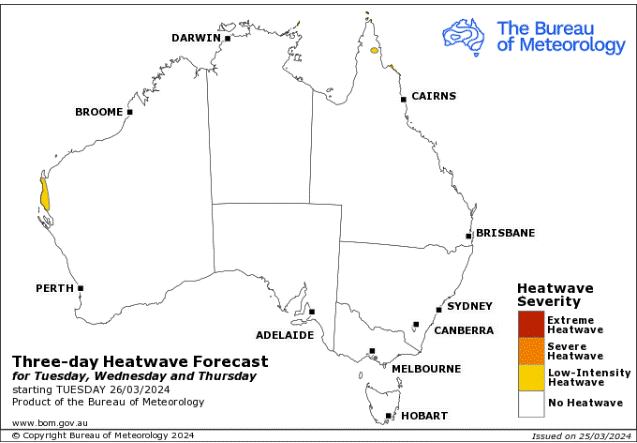
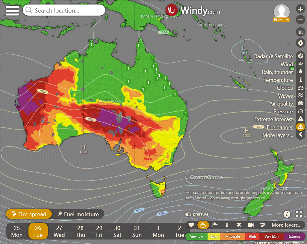
Storms - Heatwave - Fire danger
Click here to support to Wally's Weather
National maps by Weatherzone (weatherzone.com.au)
State maps by Windy (Windy.com)
Weather forecast supplemented by Bureau of Meteorology (bom.gov.au)
Rainfall daily totals (https://meteologix.com/ )
AccuWeather (https://www.accuweather.com/)
Nine Weather (https://www.9news.com.au/weather)
Wally's Weather provides professionally researched data and information. Andrew aka 'Wally' has over 20 years of experience in meteorology research and data analysis. In 2023 finished top 4 for the AMOS national weather forecasting competition. The content here is provided as educational information aimed at providing the community and businesses with the tools required to determine local-based forecasts. IMPORTANT: The forecasts and information posted should never be used on their own to make business decisions as local influences.


Comments