Morning Weather - March 3 - Wally's Weather Australia
- Mar 2, 2024
- 5 min read
To get your daily forecast delivered free goto http://wallysweather.com.au/blog
Thank you to our supporter Learning Lair


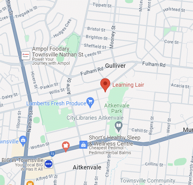
We are a small locally owned business with a love of learning and fun. The learning Lair also stock the Dam Filler educational game designed and built by Wally's Weather.
Phone: 07 4755 1544
Facebook: https://www.facebook.com/profile.php?id=100057298906383
Email: llair@bigpond.net.au
Welcome March
National
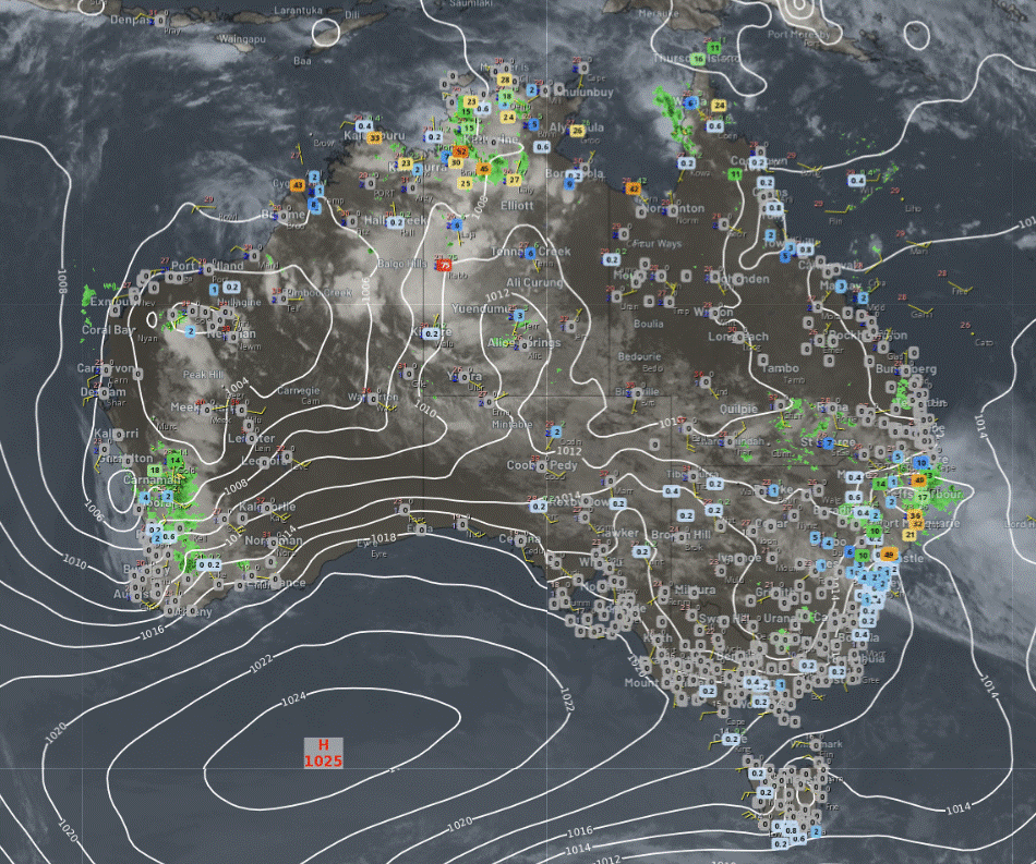
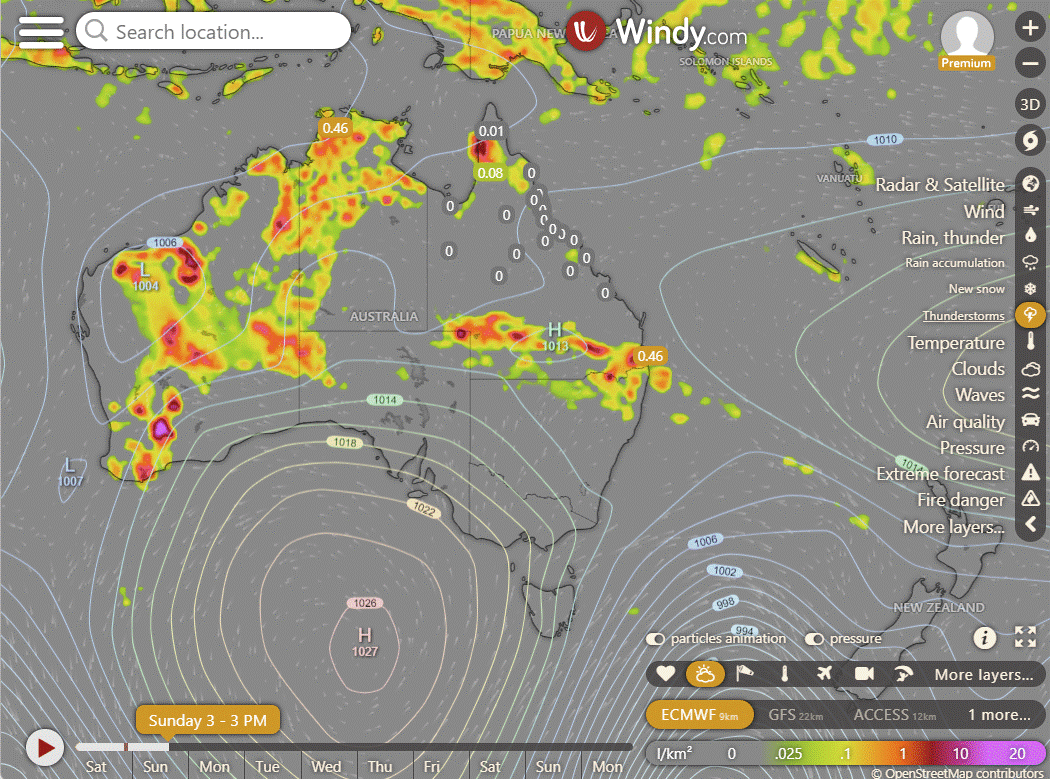
Showers & storms expected to scatter across much of WA, the NT, and far north QLD in humid and unstable air. Intensification of showers & storms anticipated in northeast NSW and parts of SA's north. A few showers expected in western Tas with brisk winds associated with a front. Vic expected to experience settled conditions due to high pressure.

Synoptic | Temp/Rain | Wind | Sea Surface Temp
State
A high near New Zealand is bringing stable weather to the east, while a trough in the far southwest is causing unsettled conditions. A southeasterly wind surge is currently increasing rainfall on the east Peninsula coast, expected to persist in Far North Queensland despite weakening on Sunday. The trough in southwestern Queensland will move eastward, accompanied by a weak upper trough, enhancing showers and thunderstorms in southern and central Queensland from Sunday onwards.
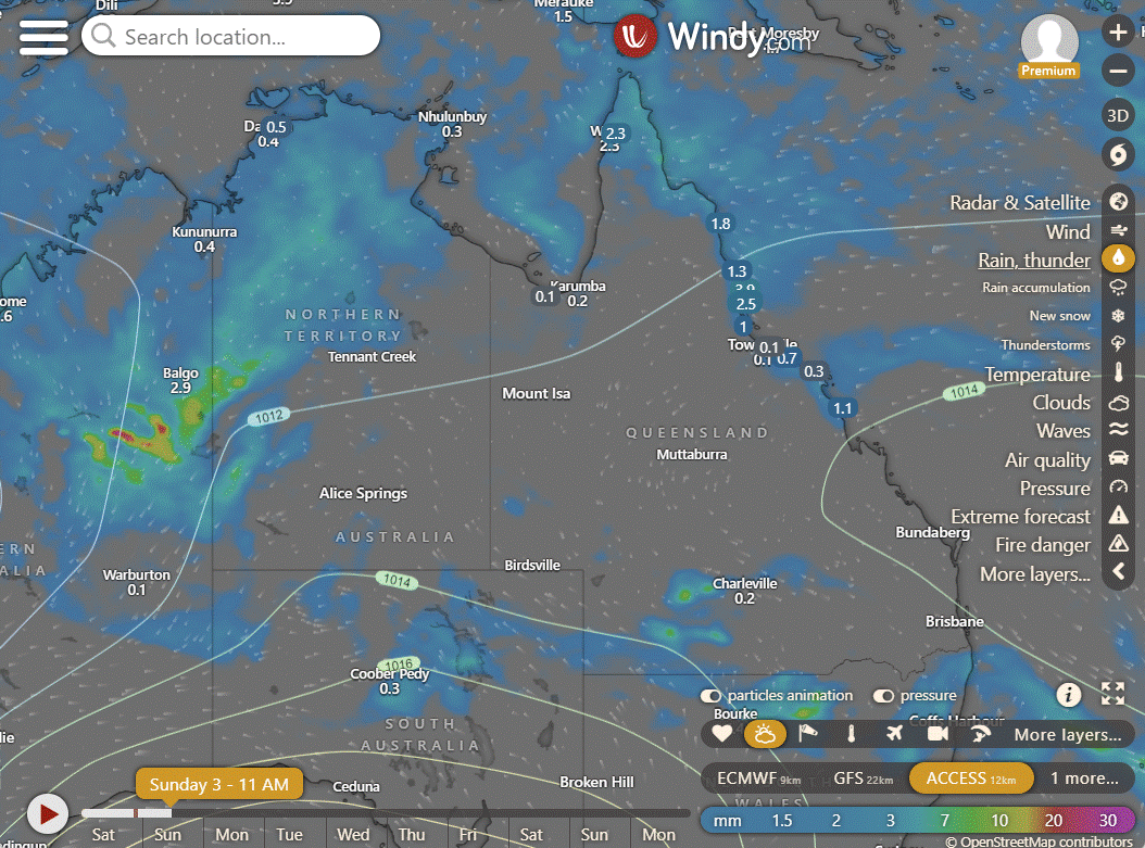
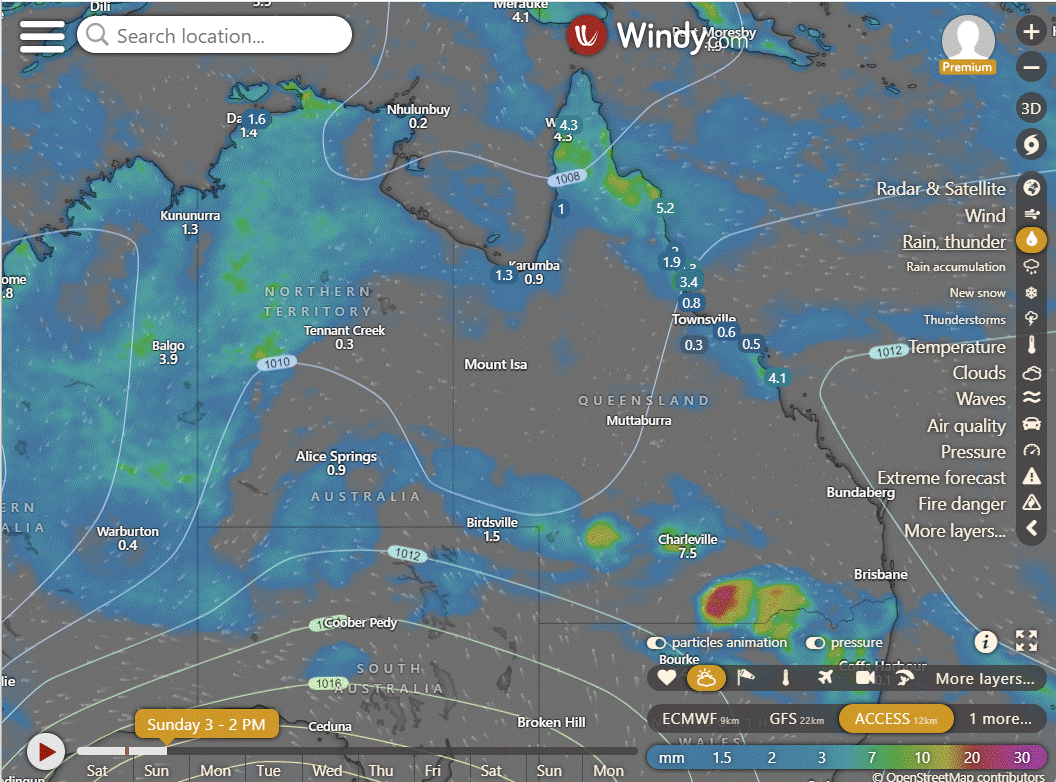
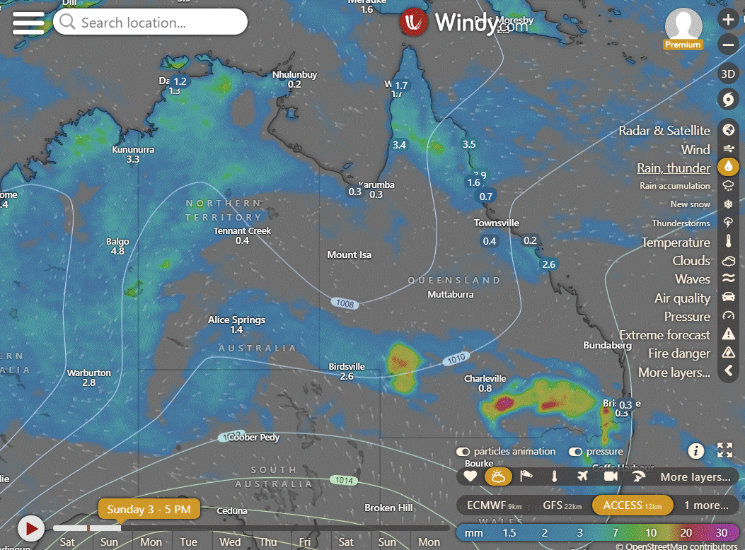
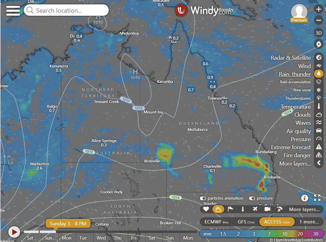
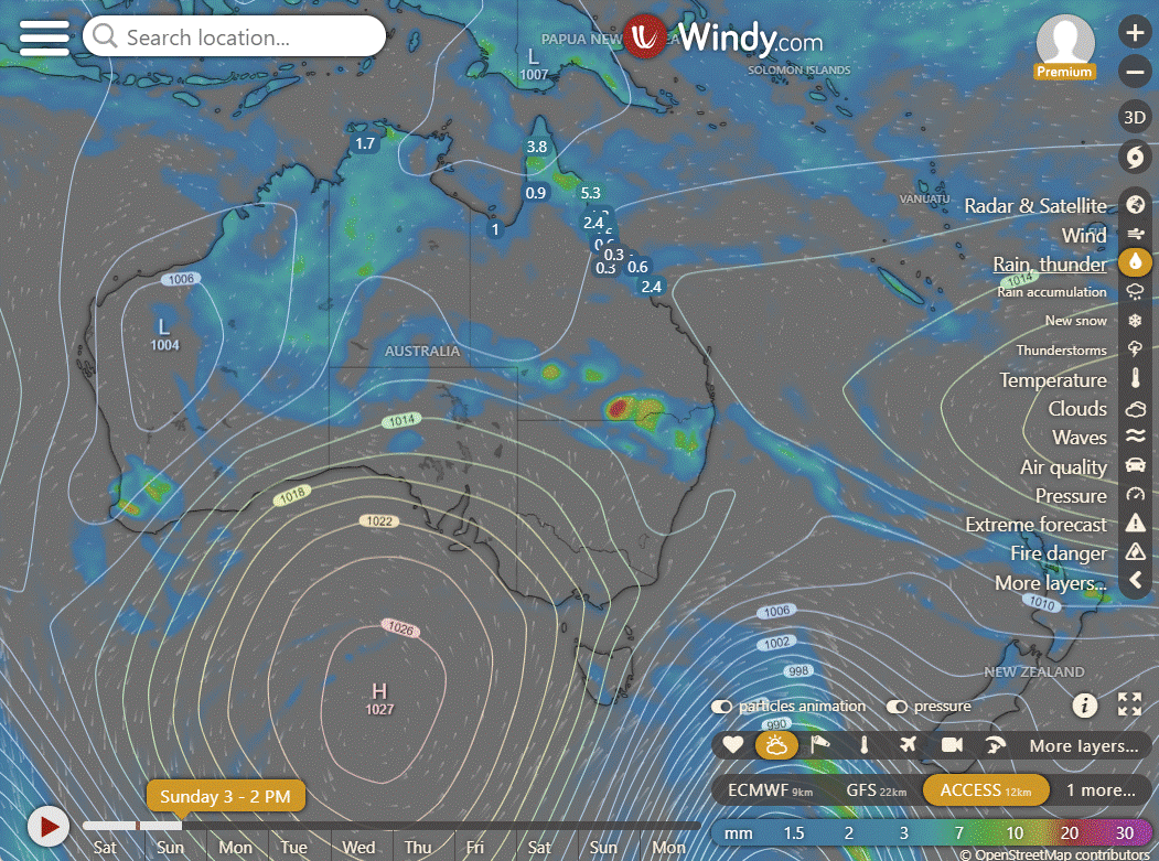
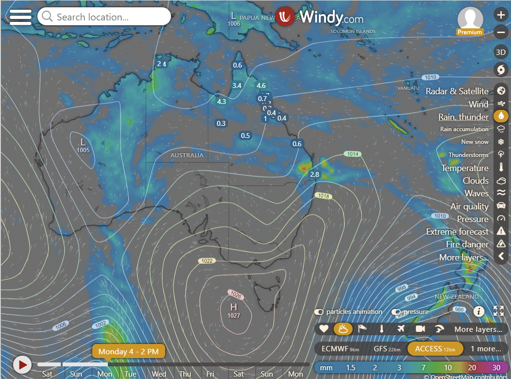
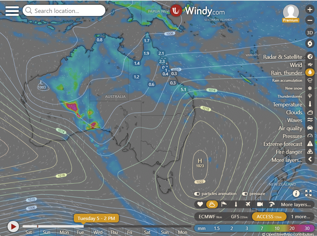
ACCESS (Values are rainfall over 3 hours)
4-day
Sunday: Spotty rain and storms in parts of northern and northwestern Queensland. Some showers in southern Queensland. Most areas sunny. Light to moderate winds.
Monday: Mainly sunny in southwest, showers and isolated thunderstorms elsewhere, with higher temperatures in southwest and Capricornia coast.
Tuesday: Sunny in the far south, showers and storms elsewhere, becoming widespread in the far north. Above-average temperatures in the southwest, near average elsewhere.
Wednesday: Sunny in the south and southwest, showers elsewhere, warmer in the southwest.

North Tropical Coast and Tablelands:
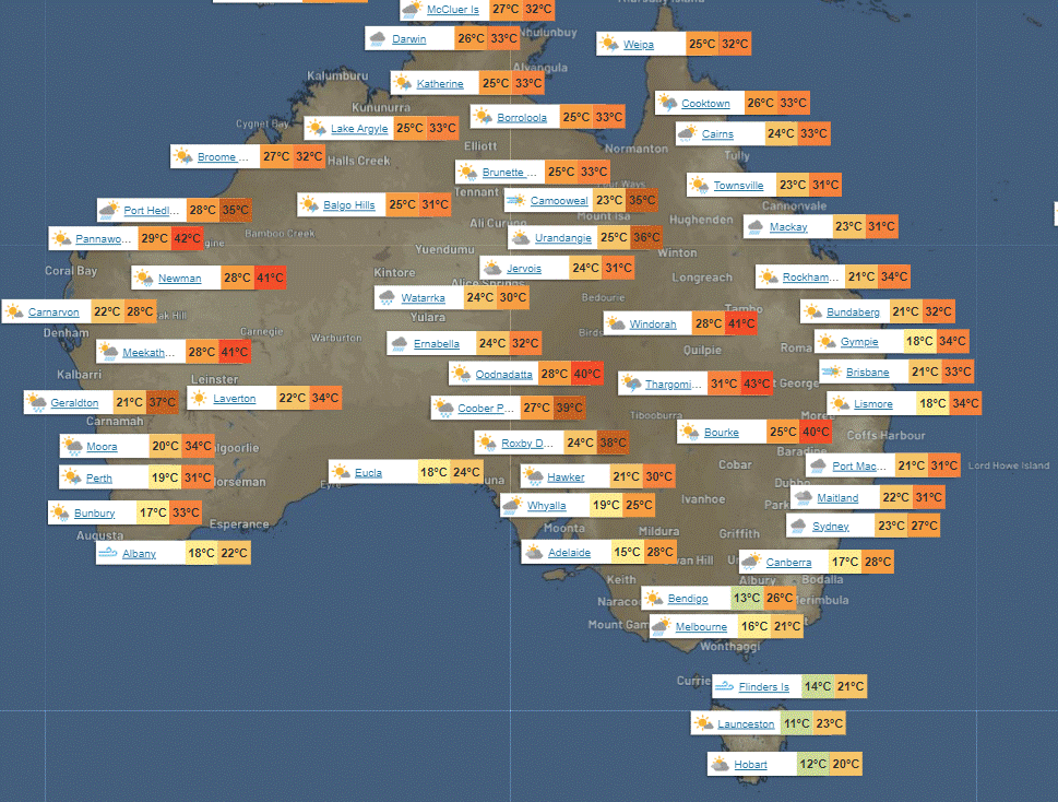
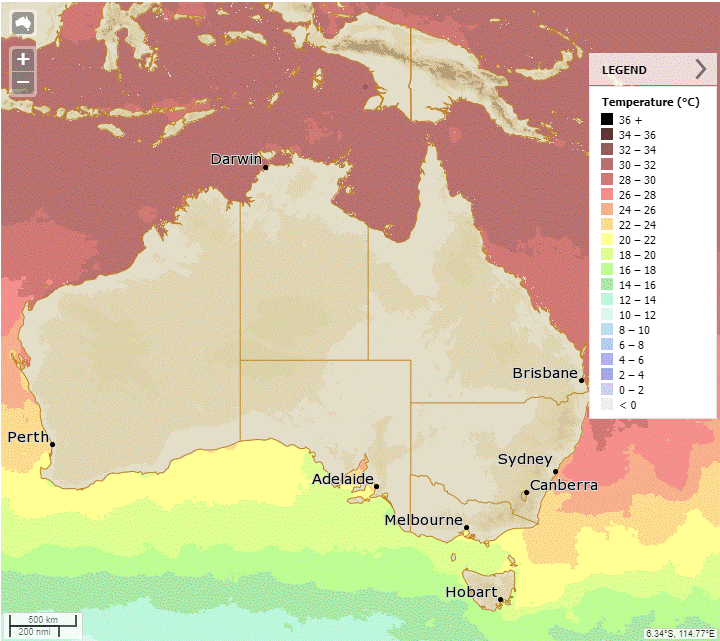
The weather forecast includes a max temperature of 33°C, a min temperature of 20°C, wind speeds varying from light to 25 km/h, rain showers likely with a chance of thunderstorms under partly cloudy skies.
Herbert and Lower Burdekin:
The forecast for today is a maximum temperature in the low to mid 30s, a minimum temperature in the low to mid 20s, with light winds becoming east to northeasterly 15 to 20 km/h, a medium chance of showers mostly in the late morning and afternoon, and partly cloudy conditions.
Central Coast and Whitsundays:
The forecast includes temperatures ranging from low to mid 30s, light winds becoming northeasterly, and a medium chance of showers mainly in the late morning and afternoon.
Peninsula:
Max temperature: low to mid 30s; Min temperature: low to mid 20s; Wind: Light and easterly 15 to 20 km/h; Rainfall: High chance of showers, likely in late morning/afternoon with a chance of thunderstorm; Other: Partly cloudy with overnight temperatures falling to low to mid 20s.
Gulf Country:
Max temperature: Mid to high 30s, Min temperature: Mid 20s, Wind speed: Light, Wind direction: N/A, Rainfall: High chance of showers near east coast, medium chance elsewhere, Other: Partly cloudy, Chance of a thunderstorm overnight.
Northern Goldfields and Upper Flinders:
Max temperature: low to high 30s, Min temperature: low 20s, Wind speed: light breezes becoming 15 to 20 km/h, Wind direction: east to northeasterly, Rainfall: medium chance of showers in north, slight chance elsewhere, Other: mostly sunny becoming cloudy with a chance of thunderstorm in the north.
Capricornia:
Max temperature: low to mid 30s, Min temperature: 19 to 23, Wind speed: light becoming north to northeasterly 15 to 20 km/h, Wind direction: north to northeasterly, Rainfall: slight chance of a shower, Overall: Mostly sunny with a chance of thunderstorm in the southwest in the evening.
Central Highlands and Coalfields:
Mostly sunny with medium chance of showers in Carnarvon Ranges, slight chance elsewhere; chance of thunderstorm in south with light winds, max temp in high 30s, min temp in 19-23, medium chance of showers, and light winds.
Central West:
Max temperature around 40 degrees, mostly sunny with medium chance of showers in southeast and near zero elsewhere, chance of thunderstorm south of Longreach, light winds becoming 15-25 km/h northeast to southeasterly, overnight lows in low to mid 20s.
North West:
Max temperature: mid to high 30s, Min temperature: low to mid 20s, Wind speed: light becoming easterly 15 to 20 km/h, Wind direction: easterly, Rainfall: none.
Channel Country:
Max temperature: 41°C, min temperature: mid 20s, wind speed: 20-30 km/h, wind direction: East to southeasterly, rainfall: showers likely, other: partly cloudy with chance of thunderstorm.
Maranoa and Warrego:
The weather will be partly cloudy with high chance of showers and thunderstorm, light winds becoming southeast to southwesterly 15 to 25 km/h, dropping to low to mid 20s at night and reaching low to mid 30s during the day.
Darling Downs and Granite Belt:
Max temperature: low to mid 30s, min temperature: low to mid 20s, wind speed: light winds becoming northwest to southwesterly 15 to 20 km/h, wind direction: becoming light in the evening, rainfall: high chance of showers most likely in the afternoon and evening, other: partly cloudy with a chance of thunderstorm.
Wide Bay and Burnett:
The weather forecast includes maximum temperatures in low to mid 30s, minimum temperatures around 20, light winds becoming west to northwesterly at 15 to 20 km/h, medium chance of showers in the south and slight chance elsewhere, a chance of a thunderstorm inland in the afternoon and evening, and partly cloudy conditions.
Southeast Coast:
The weather will be partly cloudy with high chance of showers and thunderstorms in the late afternoon and evening, light winds, maximum of around 30°C, minimum in low 20s, and no rainfall.
WEATHER WARNINGS
Gale Warning for South East & South West coasts. Strong Wind Warning for Central North & Central West coasts. Lower East Coast warning cancelled.
Severe Thunderstorm Warning (Damaging Winds & Heavy Rain) for Gascoyne, Central West, Lower West, Great Southern & Central Wheat Belt districts.
Strong Wind Warning for Pilbara Coast West, Perth Local Waters & Perth, Leeuwin, Albany & Esperance coasts. Lancelin Coast warning cancelled.
Hazardous Surf Warning for Monday for Byron, Coffs, Macquarie, Hunter, Sydney, Illawarra, Batemans, and Eden coasts.
Sheep Graziers Warning for South East.
Storm Force Wind Warning For Western, Southeastern And Southern Areas.
Severe Weather Warning (Damaging, Locally Destructive Winds) for U Derwent, SE, C Plateau, Midlands & Western, NE, E Coast, NW Coast & CN.
Gale Warning for Sunday for Central Gippsland and East Gippsland coasts. Strong Wind Warning for Sunday for Port Phillip & Central Coast.
Gale Warning For Western And Southern Areas.
Strong Wind Warning Sunday for Spencer Gulf, Gulf St Vincent & Far West, Upper West & Lower West coasts. Sunday Investigator Strait warning cancelled.
Fire Weather Warning for East Coast.
Initial Flood Watch For The Salt Lake District And Nullarbor District Rivers.
Flood Watch For The Central Inland.
Minor Flood Warning For The Paroo River (Nsw).
Minor Flood Warning For The Flinders River.
Moderate Flood Warning For Eyre Creek And Minor Flood Warning For The Georgina River.
Moderate Flood Warning For The Diamantina River.
Final Flood Warning For The Nicholson River.
Final Flood Warning For The Paroo River (Qld).
Flood Warning For The Inland Rivers Sa.
Final Flood Warning For The Warrego River (Nsw).
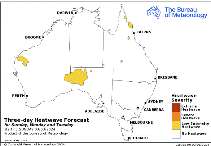
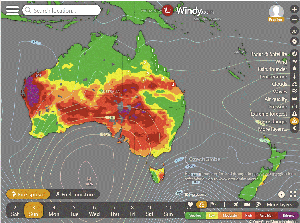
Storms - Heatwave - Fire danger
Click here to support to Wally's Weather
National maps by Weatherzone (weatherzone.com.au)
State maps by Windy (Windy.com)
Weather forecast supplemented by Bureau of Meteorology (bom.gov.au)
Rainfall daily totals (https://meteologix.com/ )
AccuWeather (https://www.accuweather.com/)
Nine Weather (https://www.9news.com.au/weather)
Wally's Weather provides professionally researched data and information. Andrew aka 'Wally' has over 20 years of experience in meteorology research and data analysis. In 2023 finished top 4 for the AMOS national weather forecasting competition. The content here is provided as educational information aimed at providing the community and businesses with the tools required to determine local-based forecasts. IMPORTANT: The forecasts and information posted should never be used on their own to make business decisions as local influences.


Comments