Morning Weather - March 6 - Wally's Weather Australia
- Mar 5, 2024
- 5 min read
To get your daily forecast delivered free goto http://wallysweather.com.au/blog
Thank you to our supporter Learning Lair


We are a small locally owned business with a love of learning and fun. The learning Lair also stock the Dam Filler educational game designed and built by Wally's Weather.
Phone: 07 4755 1544
Facebook: https://www.facebook.com/profile.php?id=100057298906383
Email: llair@bigpond.net.au
Welcome March
National
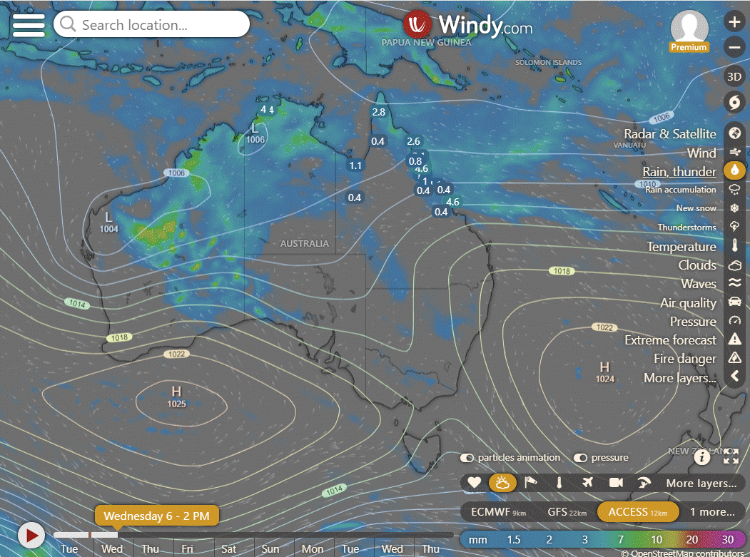
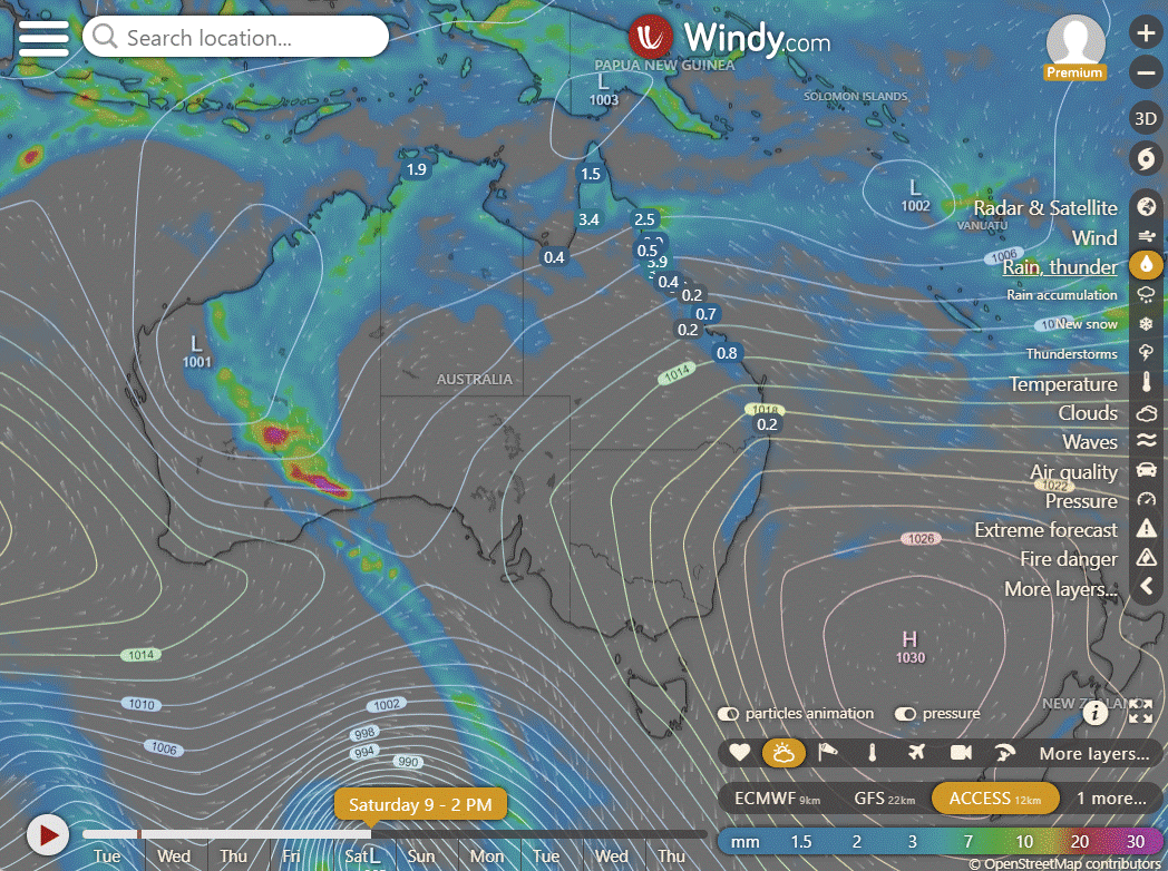
Showers and storms expected to scatter across broad areas of WA's east, the tropics, and SA's west, driven by moist and unstable winds. Heaviest showers and storms anticipated in the western deserts. Showers expected in eastern QLD and NSW due to moist winds.
A cool southerly change is forecasted to move along the NSW coast.
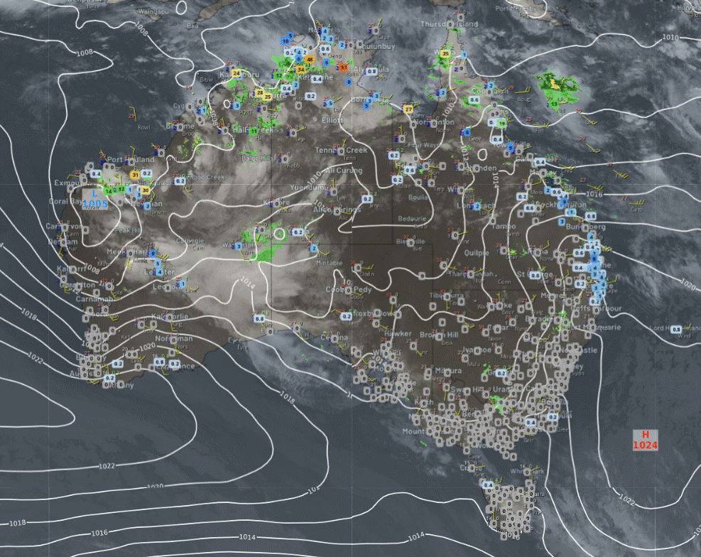
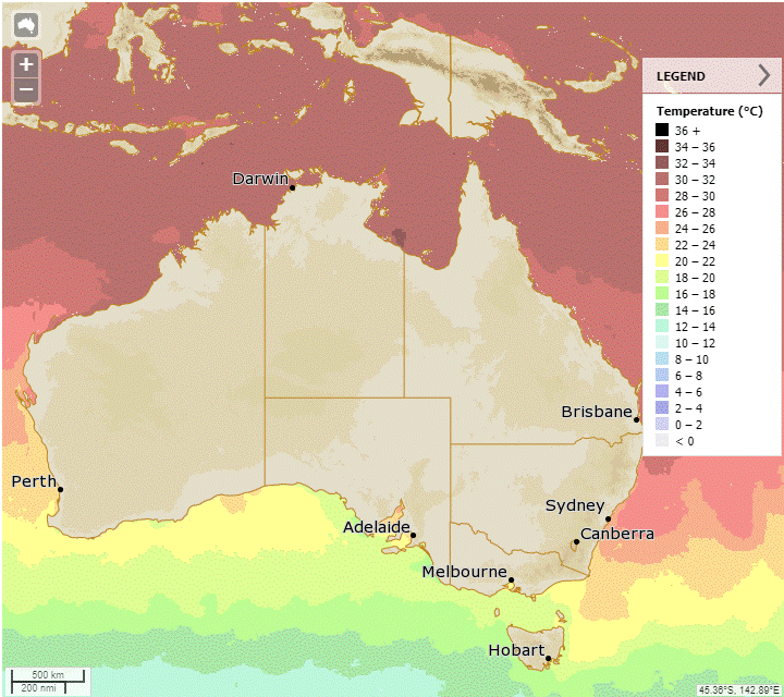
Synoptic | Temp/Rain | Wind | Sea Surface Temp
State
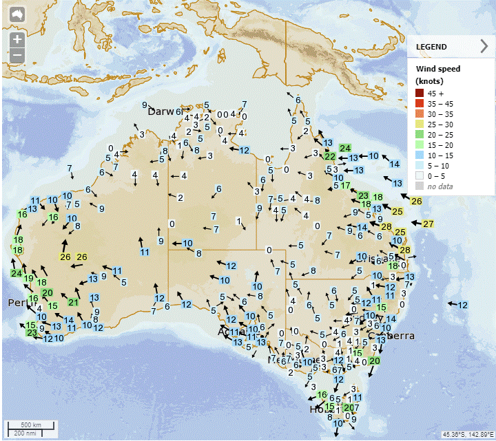
A high over the Tasman Sea will bring strong winds to the state's east coast in the coming days, with another high moving in on Friday to maintain windy conditions.
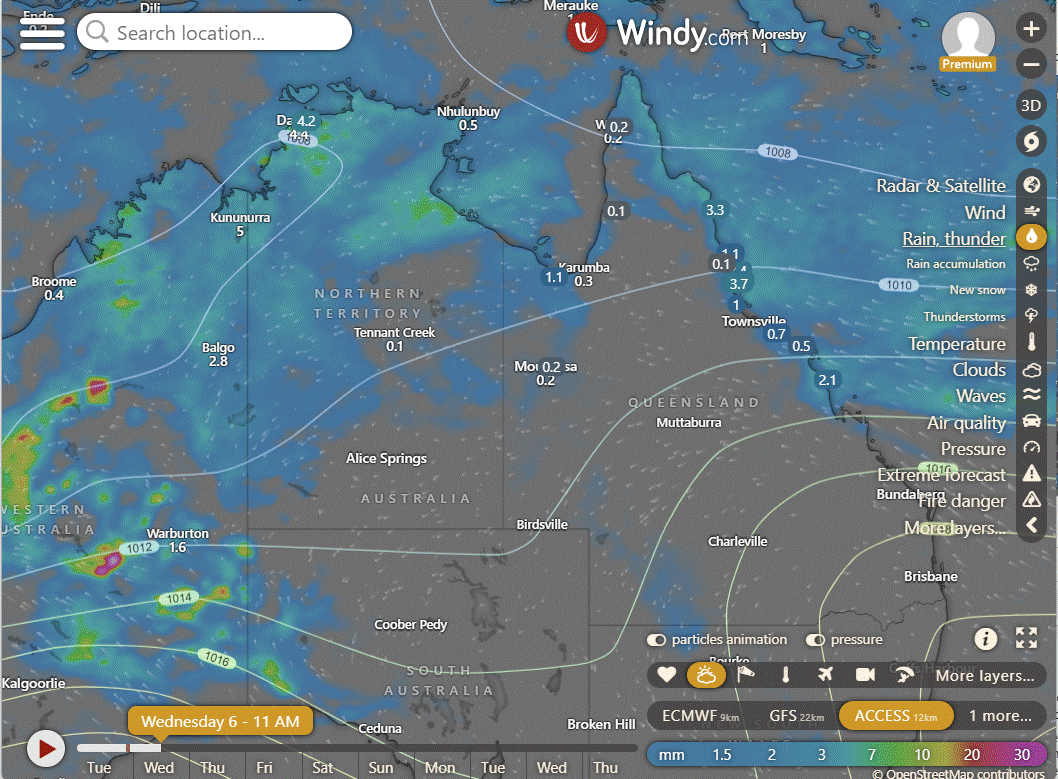
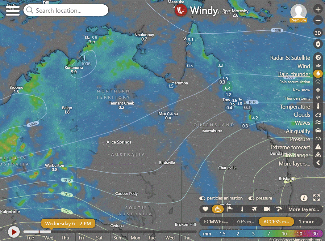
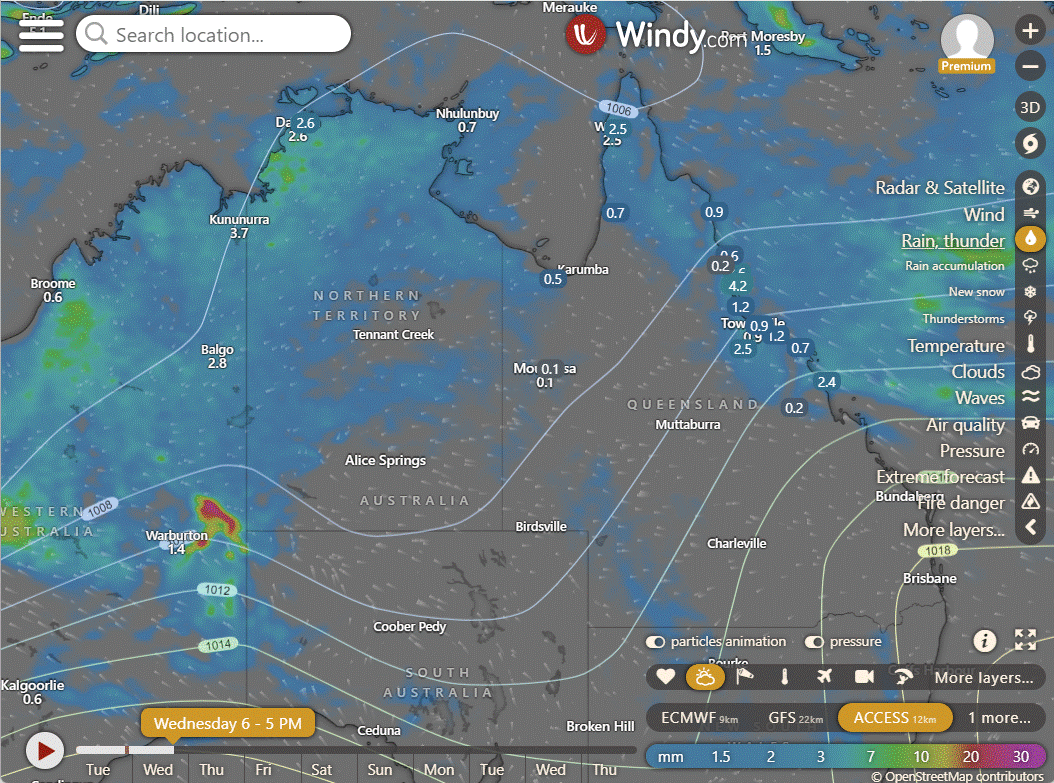
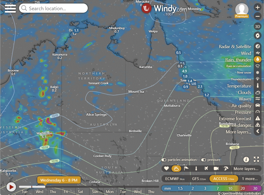
ACCESS (Values are rainfall over 3 hours)
4-day
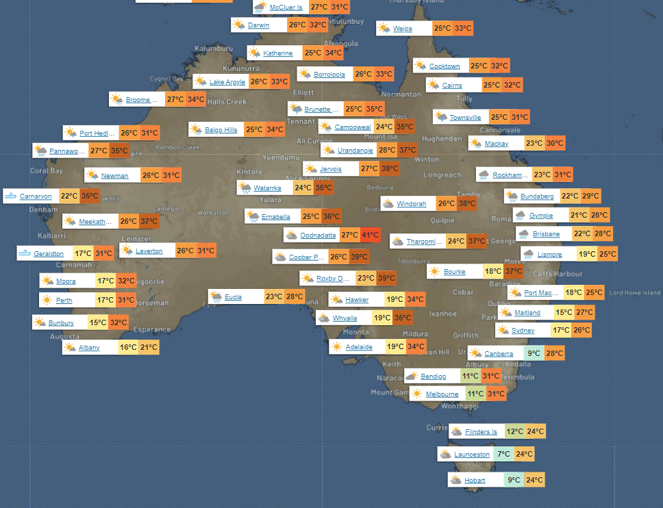
Wednesday: Clear in far southwest, scattered showers elsewhere, mainly showers in southeast. Light to moderate winds from northeast to southeast, occasionally fresh on east coast.
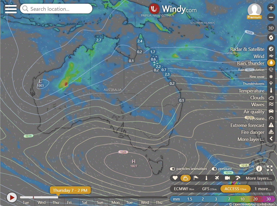
Thursday: Weather outlook: Sporadic showers and thunderstorms in the north, scattered showers in the east and widespread showers along the North Tropical Coast. Mostly sunny elsewhere with above-average temperatures in the southwest and near average elsewhere.
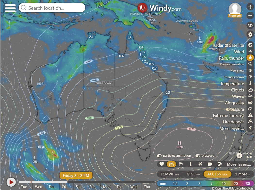
Friday: Spotty showers and thunderstorms in some areas north of Georgetown, with isolated showers in eastern districts south of Ingham. Chance of a thunderstorm between Townsville and Charters Towers. Showers mainly along the North Tropical Coast. Mostly sunny elsewhere. Above-average maximum temperatures in far southwest, near average elsewhere.
Saturday: Showers and storms in north of Winton, eastern districts south of Charters Towers. Widespread showers in North Tropical Coast. Mostly sunny elsewhere. Above average temperatures in far southwest, near average elsewhere.
North Tropical Coast and Tablelands:
Max temperature: 32°C, Min temperature: 20°C, Wind speed: 15-25 km/h, Wind direction: East to southeasterly, Rainfall: High chance of showers with thunderstorm expected, Sky condition: Partly cloudy.
Herbert and Lower Burdekin:
Tomorrow's weather: Max temperature around 30°C, min temperature in low to mid 20s, light winds becoming 15-25 km/h from east to southeasterly, partly cloudy with medium chance of showers and thunderstorm.
Central Coast and Whitsundays:
Max temperature: 32°C, Min temperature: 20°C, Wind speed: 20 to 30 km/h, Wind direction: southeasterly, Rainfall: High chance of showers with chance of thunderstorm, Other: Partly cloudy, showers likely in late morning and afternoon, overnight temperatures in low 20s.
Peninsula:
Max temperature: low to mid 30s, Min temperature: mid 20s, Wind: 15-20 km/h east to southeasterly, Rainfall: High chance of showers, Wind direction: east to southeasterly, Conditions: Partly cloudy with a chance of thunderstorm.
Gulf Country:
Max temperature in the mid 30s, min temperature in the mid 20s, light winds becoming east to southeasterly, rainfall with high chance of showers in the north and medium chance elsewhere, partly cloudy with a chance of thunderstorm.
Northern Goldfields and Upper Flinders:
The weather will be mostly sunny with a high chance of showers in the east and a slight chance elsewhere, with the possibility of a thunderstorm in the late morning; easterly winds of 15-20 km/h increasing to 20-30 km/h in the early morning, overnight temperatures in the low to mid 20s, and daytime temperatures in the low to mid 30s.
Capricornia:
Max temperature: 30°C, Min temperature: 18°C, Wind speed: 25-35 km/h, Wind direction: East to southeasterly, Rainfall: Near zero chance, Forecast: Partly cloudy with showers in the north mostly in the morning and afternoon, chance of thunderstorm.
Central Highlands and Coalfields:
Max temperature: low 30s; Min temperature: 18-22; Wind speed: 20-30 km/h easterly; Wind direction: east; Rainfall: Slight chance in north; Other: Partly cloudy, chance of thunderstorm in north.
Central West:
Mostly sunny with easterly winds reaching 25 to 35 km/h, overnight temperatures dropping to 20 to 25, daytime temperatures in the low to high 30s, and minimal rainfall expected.
North West:
Maximum temperature: mid to high 30s, Minimum temperature: mid 20s, Wind speed: 20 to 30 km/h, Wind direction: Easterly, Rainfall: Near zero chance, Other: Mostly sunny with a chance of showers and thunderstorms in the northwest.
Channel Country:
Max temperature around 40, min temperature in the mid to high 20s, northeasterly winds 20-30 km/h turning easterly 15-25 km/h, chance of a thunderstorm near Northern Territory border, sunny morning.
Maranoa and Warrego:
The weather forecast includes a maximum temperature of 37°C, minimum temperature of 19°C, northeasterly winds at 15-25 km/h turning easterly, and sunny conditions with no rainfall expected.
Darling Downs and Granite Belt:
The weather forecast includes a maximum temperature of 34, minimum temperature of 16, wind speed of 15 to 25 km/h, wind direction east to northeasterly, rainfall, and Sunny conditions with temperatures dropping to 16-19 overnight.
Wide Bay and Burnett:
Max temperature: 30°C, Min temperature: 17-21°C, Wind speed: 20-30 km/h easing, Wind direction: East to southeasterly, Rainfall: Slight chance of showers coastal, Other: Partly cloudy, Overnight temp: 17-21°C.
Southeast Coast:
The weather forecast indicates a maximum temperature of around 30°C, with overnight temperatures dropping to between 17-21°C, light winds becoming east to southeasterly at 15-20 km/h in the morning and then becoming light in the evening, along with partly cloudy skies and no significant rainfall expected.
WEATHER WARNINGS
Strong Wind Warning for Wednesday for Lower East, South East, and South West coasts.
Strong Wind Warning for Wednesday for Batemans Coast.
Hazardous Surf Warning for Byron, Coffs, Macquarie, Hunter, Sydney, Illawarra, Batemans, and Eden coasts.
Severe Thunderstorm Warning (Heavy Rainfall and Damaging Winds) for parts of Gascoyne, Goldfields, and South Interior districts.
Strong Wind Warning for Wednesday for Spencer Gulf.
Strong Wind Warning for Gascoyne, Geraldton, Lancelin, Perth, Bunbury Geographe, and Leeuwin coasts, with cancellation for Perth Local Waters.
Fire Weather Warning for Capes.
Strong Wind Warning for Capricornia and K'gari coasts.
Flood Watch For The Salt Lake District And Nullarbor District Rivers And Sandy Desert.
Minor Flood Warning For The Tully And Murray Rivers.
Flood Watch For The Victoria River Below Kalkarindji.
Moderate Flood Warning For The Paroo River (Qld).
Initial Minor Flood Warning For The Warrego River (Nsw).
Fire Weather Warning for Brockman.
Moderate Flood Warning For The Diamantina River.
Moderate Flood Warning For The Flinders Rivers.
Flood Warning For The Inland Rivers Sa.
Minor Flood Warning For The Paroo River (Nsw).
Moderate Flood Warning For Eyre Creek And Minor Flood Warning For The Georgina River.
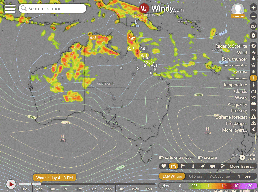
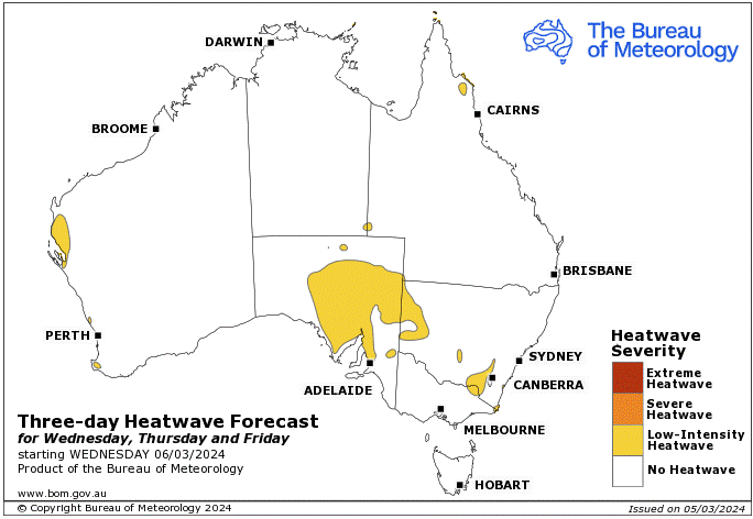
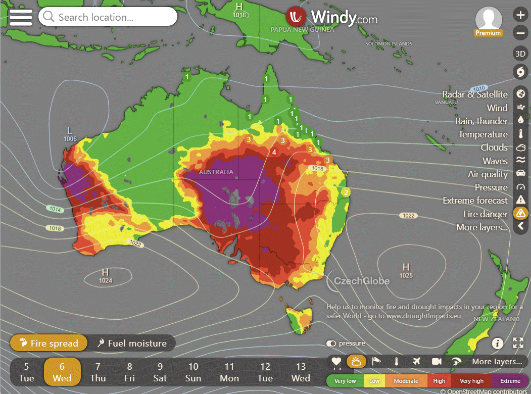
Storms - Heatwave - Fire danger
Click here to support to Wally's Weather
National maps by Weatherzone (weatherzone.com.au)
State maps by Windy (Windy.com)
Weather forecast supplemented by Bureau of Meteorology (bom.gov.au)
Rainfall daily totals (https://meteologix.com/ )
AccuWeather (https://www.accuweather.com/)
Nine Weather (https://www.9news.com.au/weather)
Wally's Weather provides professionally researched data and information. Andrew aka 'Wally' has over 20 years of experience in meteorology research and data analysis. In 2023 finished top 4 for the AMOS national weather forecasting competition. The content here is provided as educational information aimed at providing the community and businesses with the tools required to determine local-based forecasts. IMPORTANT: The forecasts and information posted should never be used on their own to make business decisions as local influences.


Comments