Morning Weather - March 7 - Wally's Weather Australia
- Mar 6, 2024
- 4 min read
To get your daily forecast delivered free goto http://wallysweather.com.au/blog

An added thanks to the sponsorship from NQ Licensed Events and the Country Festival on March 30 & 31 at the Dittman Bullpit

Website: https://www.countryfest.com.au/
Facebook: https://www.facebook.com/contryfestqld
Instagram: https://www.instagram.com/countryfestqld/
Welcome March
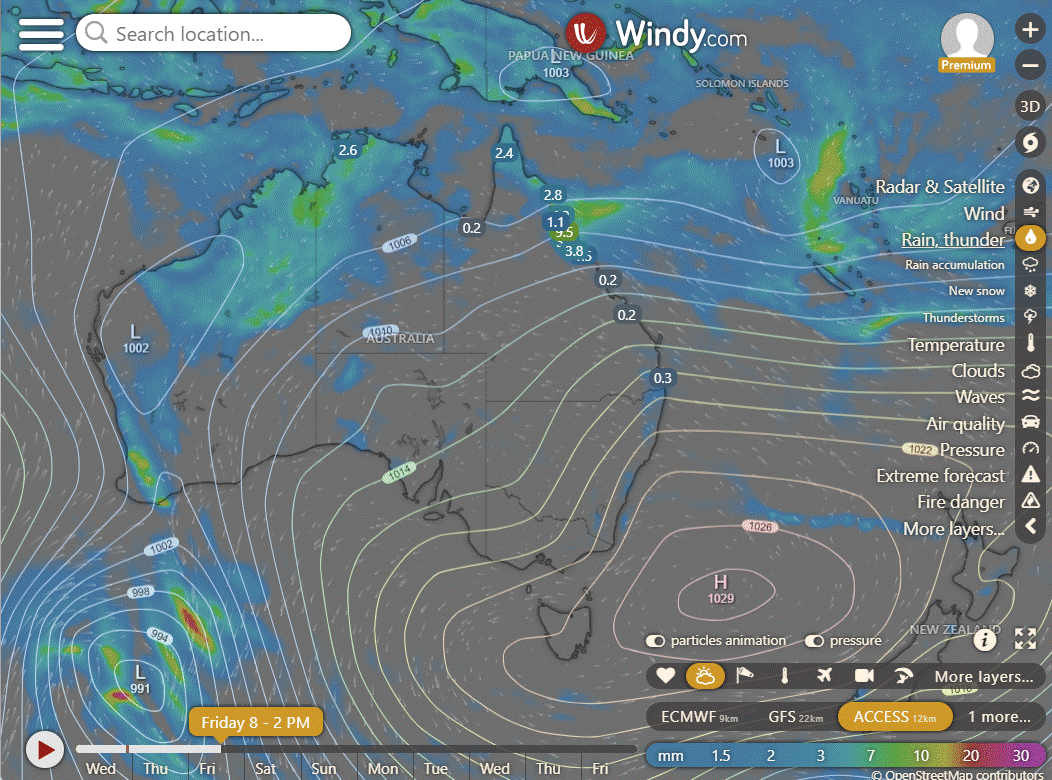
National
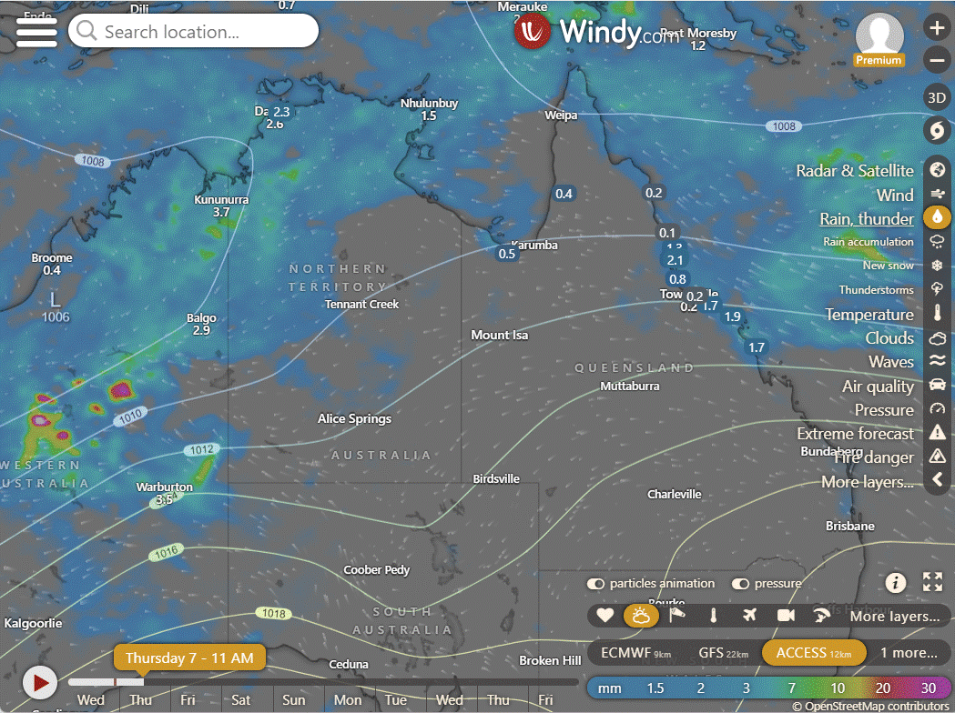
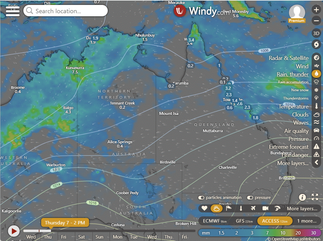
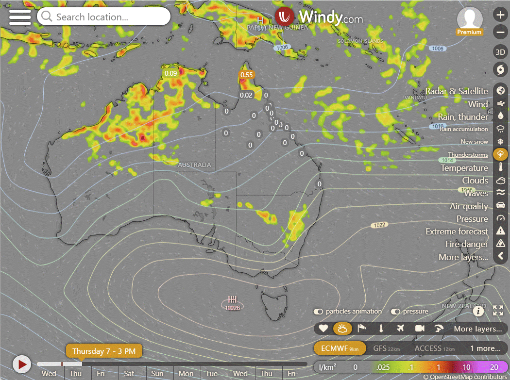
Showers and storms expected to scatter across the northern tropics and the western and central deserts due to moist and unstable winds. Isolated showers and storms likely in the east of QLD with moist onshore winds. Isolated showers forecasted over western TAS and southern VIC following a cold front.
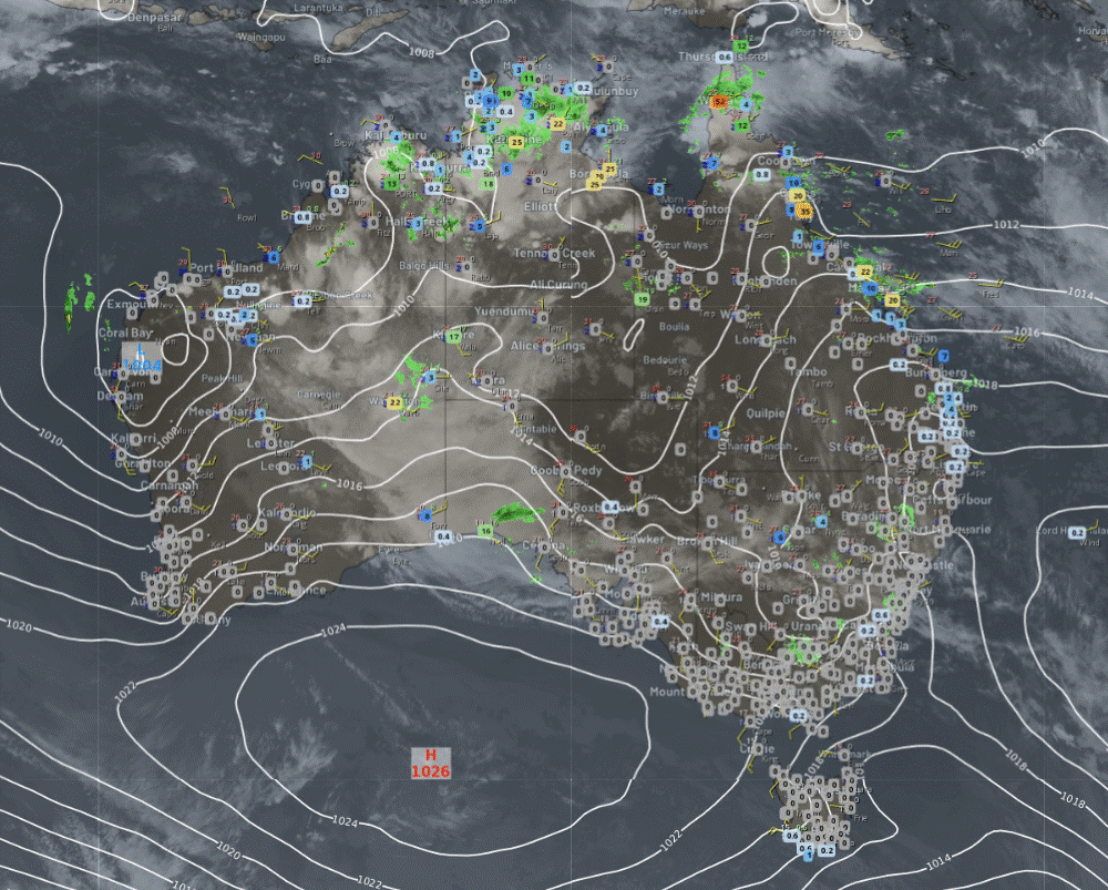


Synoptic | Temp/Rain | Wind | Sea Surface Temp
State
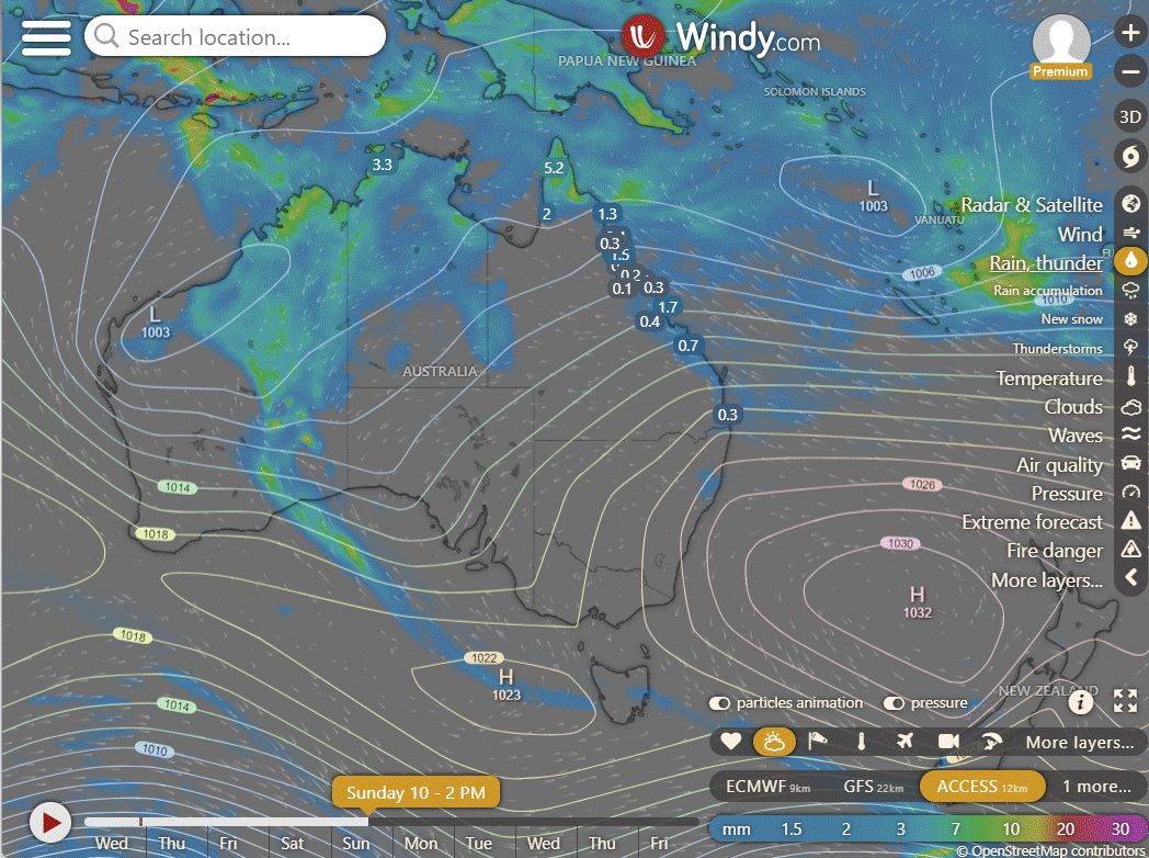
High in Tasman Sea extends ridge over state; southeasterly wind moving north along east coast reaching North Tropical Coast Thursday. New high in Tasman Sea on Friday strengthens ridge over state, increasing east coast winds. High persists, weakens from Tuesday. Trough deepens over Coral Sea and Arafura Sea from Sunday, may develop into monsoon trough from Monday.
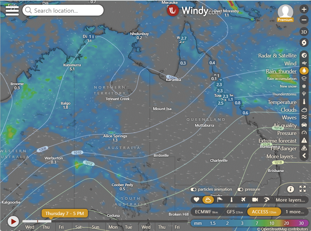
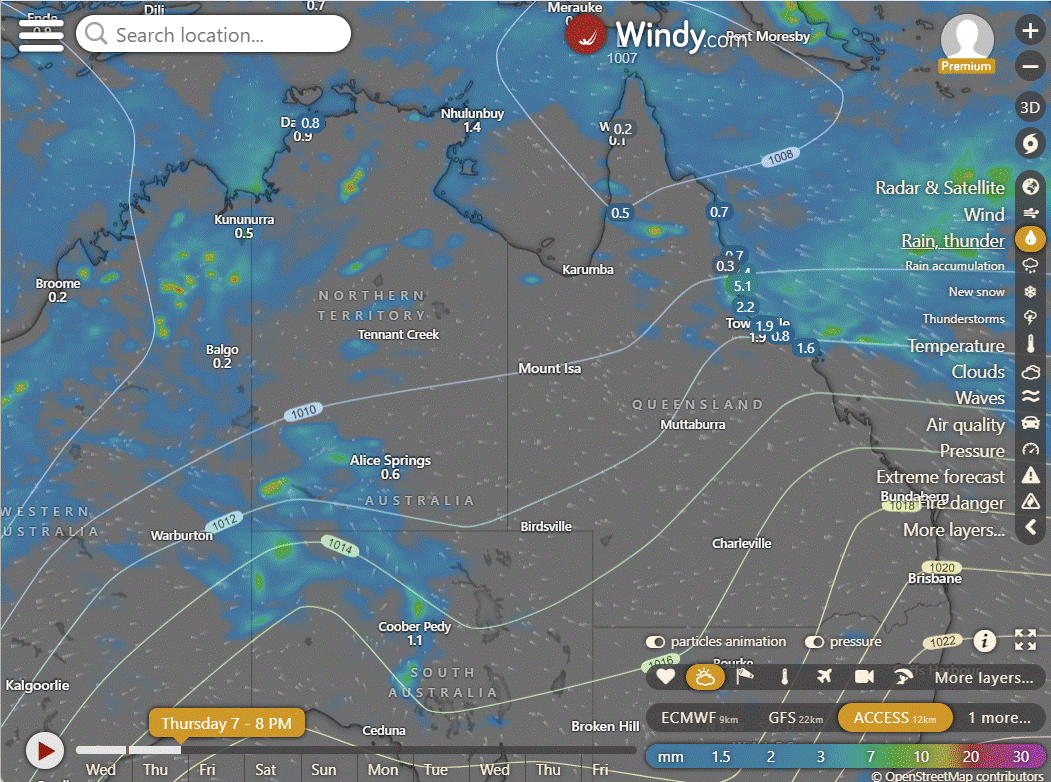
ACCESS (Values are rainfall over 3 hours)
4-day
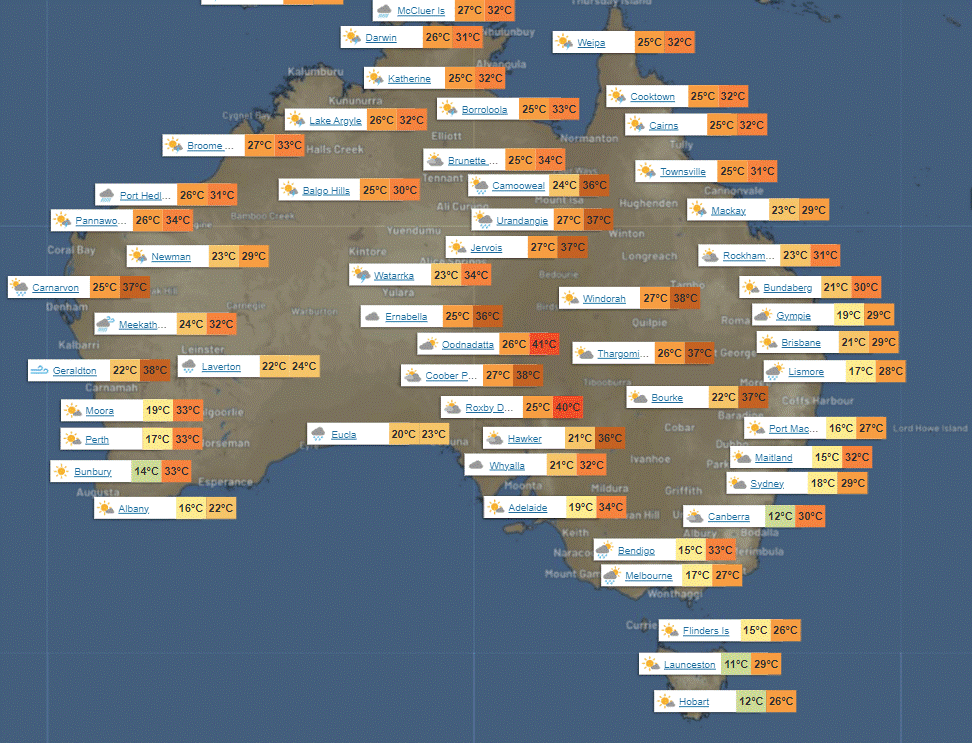
Thursday: Some showers and storms in the north, widespread rain from Cooktown to St Lawrence. Patchy showers in the far southwest and Sunshine Coast. Clear skies elsewhere with light to moderate winds from the northeast to southeast, sometimes fresh on the east coast north of Sunshine Coast.
Friday: North of Mackay: Isolated showers and thunderstorms. South of Mackay: Scattered showers. North Tropical Coast: Showers becoming widespread. Elsewhere: Mostly sunny, with temperatures varying.
Saturday: Spotty showers and storms in the north, showers in the east and North Tropical Coast. Mostly sunny elsewhere. Warmer temperatures in the far southwest, typical elsewhere.
Sunday: Sunday: Showers in some areas, sunny in others. Temps vary across regions.


North Tropical Coast and Tablelands:
Max temperature: 32°C, Min temperature: 20°C, Wind speed: 20-30 km/h, Wind direction: East to southeasterly, Rainfall: High chance of showers, Other: Partly cloudy with a chance of thunderstorms.
Herbert and Lower Burdekin:
The weather forecast for today includes maximum temperature around 30°C, minimum temperature in the low to mid 20s, with easterly to southeasterly winds at 20-30 km/h, high chance of showers most likely from late morning, and partly cloudy conditions.
Central Coast and Whitsundays:
The weather is expected to have a maximum temperature around 30°C, minimum in the low 20s, with southeasterly winds at 25 to 35 km/h, a medium chance of showers in the late morning and afternoon, and will be partly cloudy.
Peninsula:
Highs in the low to mid 30s, lows in the low to mid 20s, light winds becoming easterly 15-25 km/h, a chance of showers and thunderstorms with partly cloudy skies.
Gulf Country:
Max temperature: mid 30s, Min temperature: mid 20s, Wind speed: Light becoming east to southeasterly 15-20 km/h, Wind direction: East to southeasterly, Rainfall: Slight chance showers, Other: Partly cloudy, chance of thunderstorm.
Northern Goldfields and Upper Flinders:
The maximum temperature will reach 31 to 36 degrees with easterly winds at 25 to 35 km/h, partly cloudy with a medium chance of showers in the east and a chance of thunderstorms in the north in the afternoon and evening, and overnight temperatures dropping to the low to mid 20s.
Capricornia:
The weather will be partly cloudy with a slight chance of showers near the coast, winds east to southeasterly at 25-35 km/h, and temperatures falling to between 17-22°C overnight and reaching the low 30s during the day.
Central Highlands and Coalfields:
Low to mid 30s, 16-21, 20-30 km/h easterly to southeasterly, Slight chance of showers in northwest, mostly sunny,
Central West:
Maximum temperature in the mid to high 30s, minimum temperature between 19 and 24, easterly winds at 25 to 35 km/h, sunny weather with overnight temperatures falling.
North West:
Max temperature: mid to high 30s, Min temperature: mid 20s, Wind speed: 25 to 35 km/h easterly, Wind direction: easterly, Rainfall: None, Weather: Mostly sunny.
Channel Country:
High of 30s°C, low of 20s°C, Wind: 20-30 km/h E-NE, Mostly sunny with overnight temp mid-high 20s.
Maranoa and Warrego:
Max temperature: 38°C, Min temperature: 17°C, Wind speed: 15 to 35 km/h, Wind direction: Northeasterly to easterly, Rainfall: None, Weather: Mostly sunny.
Darling Downs and Granite Belt:
Tomorrow will be mostly sunny with light winds becoming easterly 15 to 25 km/h in the middle of the day, with minimum temperature between 15 and 20 and maximum temperature between 30 and 36, with no rainfall expected.
Wide Bay and Burnett:
Max temperature: 30°C, Min temperature: 16-21°C, Wind speed: 25-35 km/h, Wind direction: East to southeasterly, Rainfall: Medium chance of showers, Other: Partly cloudy.
Southeast Coast:
Partly cloudy with max temp around 30, min temp between 16-21, light winds becoming southeasterly 15-25 km/h, medium chance of showers in north, slight chance elsewhere, and overnight temperatures falling to 16-21.
WEATHER WARNINGS
Severe Thunderstorm Warning (Heavy Rainfall) for parts of Arnhem, Carpentaria, and Daly districts.
Strong Wind Warning for Spencer Gulf, Upper West, and Lower West coasts.
Strong Wind Warning for Leeuwin Coast.
Strong Wind Warning for Townsville, Mackay, and Capricornia coasts.
Strong Wind Warning for Lower East, South East, and South West coasts.
Flood Watch For The Salt Lake District, Nullarbor District Rivers, Sandy Desert, and Parts Of The Pilbara Coast Rivers.
Moderate Flood Warning For The Paroo River (Qld).
Minor Flood Warning For The Tully And Murray Rivers.
Final Flood Watch For The Victoria River Below Kalkarindji.
Minor Flood Warning For The Paroo River (Nsw).
Moderate Flood Warning For The Diamantina River.
Moderate Flood Warning For The Flinders Rivers.
Minor Flood Warning For The Warrego River (Nsw).
Moderate Flood Warning For Eyre Creek And Minor Flood Warning For The Georgina River.
Fire Weather Warning for Capes.
Flood Warning For The Inland Rivers Sa.
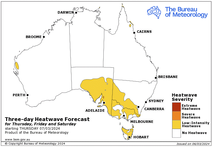

Storms - Heatwave - Fire danger
Click here to support to Wally's Weather
National maps by Weatherzone (weatherzone.com.au)
State maps by Windy (Windy.com)
Weather forecast supplemented by Bureau of Meteorology (bom.gov.au)
Rainfall daily totals (https://meteologix.com/ )
AccuWeather (https://www.accuweather.com/)
Nine Weather (https://www.9news.com.au/weather)
Wally's Weather provides professionally researched data and information. Andrew aka 'Wally' has over 20 years of experience in meteorology research and data analysis. In 2023 finished top 4 for the AMOS national weather forecasting competition. The content here is provided as educational information aimed at providing the community and businesses with the tools required to determine local-based forecasts. IMPORTANT: The forecasts and information posted should never be used on their own to make business decisions as local influences.


Comments