Morning Weather - November 15 - Wally's Weather Australia
- Nov 15, 2023
- 3 min read
This weather update is brought to you by Genesis Electrical NQ

Genesis Electrical NQ
We can Solve all of your Electrical, Air Conditioning and Solar needs!
Green Energy Initiative
Phone: 1300 443 637
Email: info@genesislec.com
Prize money for the best guess on each cyclone in 2023/24. Select the cyclone name, start date, end date, category and region it starts. Fill out the form here, you need to be a member http://wallysweather.com.au/cyclone-season
Sign up as a member free to enter
The rules are set out on the page.
Storms special report
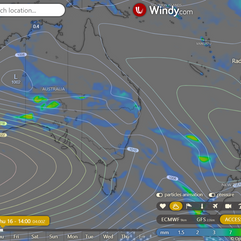
Troughs will cause showers and storms in WA, SA, QLD's south and west, and the NT.
Troughs will maintain heat over the interior and bring heat into the east.
Cool winds with a nearby front will result in showers over southeast SA, southern VIC, and TAS.
WEATHER WARNINGS
Gale Warning For Southern Area
Strong Wind Warning for Wednesday for Sunshine Coast Waters
Strong Wind Warning for Wednesday for Far West and Upper West coasts
Strong Wind Warning for Wednesday for Byron Coast
Strong Wind Warning Wednesday Banks Strait & Franklin Sound, East of Flinders Island & Central North, South East & South West coasts
Strong Wind Warning for Wednesday for Central Gippsland and East Gippsland coasts
Strong Wind Warning for Bunbury Geographe and Leeuwin coasts. Cancellation for Eucla Coast
Hazardous Surf Warning for Wednesday for Macquarie, Hunter, Sydney, Illawarra, Batemans, and Eden coasts
Tropical cyclone Mal special report
Model forecasts show a narrow agreement in the track, ranging from 65 to 110 nautical miles from 24 to 72 hours. Both the GEFS and EPS probabilistic guidance align well, ensuring high confidence in the JTWC forecast track. Regarding intensity, there is moderate confidence for the next 24 hours, with some mesoscale guidance indicating varied trends, including a flat trend, steady weakening, and slight intensification to 70 knots by 12 hours in different models. After 12 hours, intensity guidance converges, supporting a steady weakening trend.
ECWMF Thunderstorms | Accumulated Rainfall 5 days | Fiji Radar of Cyclone Mal
National
Weak ridge over east and north QLD, with inland trough causing warm, unsettled weather in the south. Trough moves east/north, off southern coast late Thu/Fri. High moves to Great Australian Bight Thu, bring cooler winds on Fri. Ridge extends along east coast, pushing trough west. Onshore winds increase moisture, widespread showers/storms next week.
State
Weak ridge over east and north Queensland, trough in interior promotes warmth in south. Trough moving east/north across state, going offshore south coast by late Thu/Fri. High moving into Great Australian Bight, bringing cooler wind change on Fri. Ridge extending further east through weekend, pushing trough back west. Onshore winds increasing moisture, causing showers and storms in interior next week.
4-day
Wednesay: Isolated thunderstorms, little rainfall in southern and southeast inland Queensland. Mostly clear elsewhere. Light to
Thursday: Isolated showers and thunderstorms in parts of Queensland, risk of severe thunderstorms inland in southeast. Mostly sunny elsewhere. Above average temperatures, severe heatwave conditions developing in central and northern interior.
Friday: Scattered showers and thunderstorms in the west, with some risk of severe storms in central and southeast QLD. Mostly sunny in other areas. Temperatures returning to average in the south, but remaining above average in the interior, with severe heatwave conditions in the north.
Saturday: Expect scattered showers and thunderstorms in the northern, central, and southern inland areas. The Far North will be mostly sunny, while other areas will have some clouds. Interior temperatures will be higher than usual, but eastern districts
Townsville
Min 20°C, Max 31°C, ☀️. Rain chance: 0%. Light winds, becoming NE 15-20 km/h in the morning, then turning N midday.
Herbert and Lower Burdekin
Min 17°C, Max 31°C, ☀️. Rain chance: 0%. Winds becoming NE 15-25 km/h in the morning, then light in the evening.
North Tropical Coast and Tablelands
Min 15°C, Max 33°C, ☀️. Rain chance: 0%. Winds E to SE 15-20 km/h, becoming light in the late evening.
Cairns
Min 19°C, Max 32°C, 🌤️. Rain chance: 0%. Mostly sunny. Light winds.
Mackay
Min 17°C, Max 30°C, ☀️. Rain chance: 0%. Sunny. Light winds becoming northeasterly 15 to 25 km/h in the middle of the day, then tending northerly in the late afternoon.
Northern Goldfields
Min 17°C, Max 38°C, ☀️. Rain chance: 0%. Winds east to northeasterly 15 to 25 km/h, tending north to northeasterly 15 to 20 km/h in the late evening.
Mt Isa
Min 21°C, Max 40°C, ☀️. Rain chance: 0%. Mostly sunny. Light winds.
Click here to support to Wally's Weather
National maps by Weatherzone (weatherzone.com.au)
State maps by Windy (Windy.com)
Weather forecast supplemented by Bureau of Meteorology (bom.gov.au)
Rainfall daily totals (https://meteologix.com/ )
AccuWeather (https://www.accuweather.com/)
Wally's Weather provides professionally researched data and information. Andrew aka 'Wally' has over 20 years of experience in meteorology research and data analysis. In 2023 finished top 4 for the AMOS national weather forecasting competition. The content here is provided as educational information aimed at providing the community and businesses with the tools required to determine local-based forecasts. IMPORTANT: The forecasts and information posted should never be used on their own to make business decisions as local influences.


Comments