Morning Weather - November 9 - Wally's Weather Australia
- Nov 9, 2023
- 4 min read
This weather update is brought to you by Genesis Electrical NQ

Genesis Electrical NQ
We can Solve all of your Electrical, Air Conditioning and Solar needs!
Phone: 1300 443 637
Email: info@genesislec.com
Wanting to know how the rain works, specially in the NQ?
Have a look at Dam Filler the board game that educates without having to learn before playing.
Storms and tropical low special report
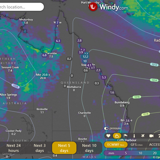
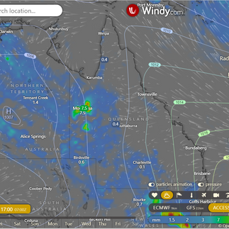
Storms mainly throughout the NT and NW WA along the trough. A slow moving High over the Tasman is still pushing NE winds via a ridge along the QLD coast, so some residual showers for the NQ coast.
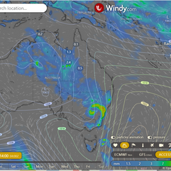
The new low East of the Solomon Islands and North of Vanuatu is now strengthening, this is expected to deepen as a tropical low over the next week as it drifts South, possibly SE then SW. The High over the Tasman will dictate that, depending on how slow it moves away from the Tasman to the East.
National
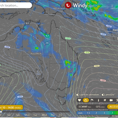
A slow-moving weather system will move to the western part of the state, bringing showers and thunderstorms. Meanwhile, a high-pressure system over the Tasman Sea will continue to affect the eastern coast, and there might be a new weather system in far southwest Queensland by the weekend, which could affect the southern and southeastern inland areas early next week.
State
Expect isolated showers in the eastern region, south of Cooktown, with the potential for scattered showers and thunderstorms in western and interior Queensland, while other areas will be partly cloudy with light to moderate winds from the southeast to the northeast.
4-day
Thursday: Expect isolated showers in the eastern region from Cooktown to Mackay, with scattered showers and thunderstorms in western, central, southern Queensland, the Gulf Country southwest of Kowanyama to Goondiwindi, and the Granite Belt, as well as some scattered showers in the North West, while the rest of the areas will be partly cloudy with various wind conditions and temperatures.
Friday: Expect isolated showers along the east coast from Cooktown to Townsville and in the Granite Belt, along with isolated showers and thunderstorms in various regions, while the rest of the areas will be mostly sunny, with temperatures above average in the southwest and below average minimums in the east, and high fire dangers in the southwest, central, and southern interior.
Saturday: Expect isolated showers in the southeast inland, the Granite Belt, and near the east coast from Mackay to Cooktown, along with isolated showers and thunderstorms in the far west and the Gulf Country, tending to be scattered in the North West district west of Mount Isa, while the rest of the areas will be partly cloudy, with above-average temperatures in the southwest and southern interior, and near or below average temperatures elsewhere, resulting in high fire dangers in the interior.
Sunday: Isolated showers and thunderstorms in far northwestern Queensland and the far southwest and southern interior. Isolated showers near the east coast, mainly between Townsville and Cooktown. Isolated showers with the chance of a thunderstorm about the Granite Belt. Mostly sunny elsewhere. Above to well above average temperatures in the southwest and southern inland Queensland. Minimum temperatures near or below average in eastern and northern Queensland. High fire dangers about the interior.
Townsville
Min 22°C, Max 30°C, Mostly sunny with a 20% chance of rain. A slight chance of a morning shower, followed by a mostly sunny day. Light winds, becoming E to NE 15-25 km/h in the morning, and light in the evening.
Herbert and Lower Burdekin
Min 20°C, Max 30°C, Partly cloudy with a 10% chance of rain. Expect partly cloudy skies with a slight chance of a morning coastal shower and near-zero chance of rain elsewhere, accompanied by winds from E to NE 15-20 km/h, becoming light before dawn and E to NE 15-25 km/h in the morning.
North Tropical Coast and Tablelands
Min 19°C, Max 31°C, Partly cloudy with a 10% chance of rain. Anticipate partly cloudy conditions with a slight chance of a morning coastal shower and near-zero chance of rain elsewhere, accompanied by easterly winds at 20-30 km/h.
Cairns
Min 22°C, Max 31°C, Partly cloudy with a 30% chance of up to 1 mm of rain. Expect partly cloudy conditions with a slight chance of a shower and light winds, becoming E to SE at 20-25 km/h in the morning and then becoming light in the evening.
Mackay
Min 19°C, Max 28°C, Partly cloudy with a 10% chance of rain. Anticipate partly cloudy conditions with easterly winds at 15-20 km/h, becoming light before dawn and then shifting to E at 15-25 km/h in the morning.
Northern Goldfields
Min 22°C, Max 36°C, Partly cloudy with a 10% chance of rain. it will be mostly sunny with a slight chance of a southwest shower from late morning and near-zero rain elsewhere, accompanied by the potential for a thunderstorm in the west from late morning. Winds will be east to northeasterly at 20-30 km/h, shifting to east to southeasterly at 15-20 km/h in the early afternoon and then east to northeasterly in the evening.
Mt Isa
Min 22°C, Max 36°C, Expect showers with possible storms and 0-10 mm of rain, an 80% chance of rain. Partly cloudy with high chances of afternoon and evening showers, a potential thunderstorm from late morning, and winds starting as northerly at 15-20 km/h, shifting to northeasterly in the early afternoon, and becoming light in the evening.
Click here to support to Wally's Weather
National maps by Weatherzone (weatherzone.com.au)
State maps by Windy (Windy.com)
Weather forecast supplemented by Bureau of Meteorology (bom.gov.au)
Rainfall daily totals (https://meteologix.com/ )
Wally's Weather provides professionally researched data and information. Andrew aka 'Wally' has over 20 years of experience in meteorology research and data analysis. In 2023 finished top 4 for the AMOS national weather forecasting competition. The content here is provided as educational information aimed at providing the community and businesses with the tools required to determine local-based forecasts. IMPORTANT: The forecasts and information posted should never be used on their own to make business decisions as local influences.


Comments