Morning Weather - October 20 - Wally's Weather Australia
- Oct 19, 2023
- 3 min read
This weather update is brought to you by Gecko Interior

Welcome to Gecko Interiors, a fun and colourful gift and homewares store based in tropical North Queensland, Australia. . Whether you're a local shopping from home, or dropped into my store while on a recent holiday to Townsville (with no room left to take everything back in your suitcase! ), let us take care of delivering to you.
Tropical Low
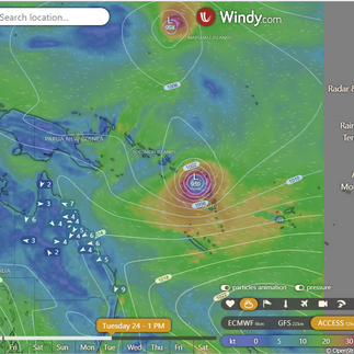
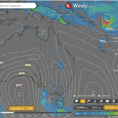
The tropical low NE of the Solomon Islands is deepening to 1005hPa tomorrow and will deepen further to 1001hPa by Saturday as it drifts slowly SSW towards Vanuatu. By Sunday it will continue towards Vanuatu a little faster and deepen to around 986hPa. At this point it will be well fed from the warm humid air to the NE and mix with the cooler drier air from the South creating severe storms. The Satellite is now showing great form and some partial circulation. The cloud covers a very large area. Tuesday is where the tropical low will reach it's peak, and as it reaches more dry air and cooler waters it will start to degrade a little. A low South of Victoria is blocking a High that might have guided the low differently.
National
High pressure extends across eastern Queensland, promoting settled conditions, with a moving trough in western Queensland.
State
A Tasman Sea high extends high pressure across eastern Queensland, promoting settled conditions. A trough over western Queensland will move eastward across the interior this weekend.
4-day
Friday: Partly cloudy with scattered showers and thunderstorms in central and southern interior. Isolated showers and thunderstorms in western Gulf Country. Smoke haze in central and northern Queensland. Mostly clear elsewhere. Light to moderate winds, fresh at times along North Queensland coast.
Saturday: Saturday: Mostly sunny with isolated afternoon showers and thunderstorms in the western Gulf Country. Above average temperatures, especially in the southern interior.
Sunday: Sunday: Afternoon showers and thunderstorms in the western Gulf Country. Mostly sunny and warm elsewhere. Above average maximum temperatures, especially in central and southern Queensland. High fire danger in the interior.
Monday: Sunny with above-average temperatures, especially in central and southern Queensland. High fire danger in the interior.
Townsville
Min 19 Max 30 Mostly sunny. Chance of any rain: 0%. Light winds becoming E-NE 15-25 km/h in the morning, then light in the evening.
Herbert and Lower Burdekin
Min 17 Max 30 Mostly sunny. Chance of any rain: 0%. Light winds becoming E-NE 20-30 km/h in the morning.
North Tropical Coast and Tablelands
Min 16 Max 31 Mostly sunny. Chance of any rain: 0%. Winds E-SE 20-30 km/h.
Cairns
Min 20 Max 31 Mostly sunny. Chance of any rain: 0%. Light winds becoming E-SE 15-25 km/h in the morning, then becoming light in the evening.
Mackay
Min 17 Max 28 Mostly sunny. Chance of any rain: 0%. Light winds becoming SE 15-20 km/h in the morning, then becoming E 15-25 km/h in the middle of the day.
Northern Goldfields
Min 20 Max 37 Mostly sunny. Chance of any rain: 0%. Winds E to NE 15-25 km/h, shifting to E to SE 15-20 km/h in the middle of the day, then to E to NE in the late evening.
Mt Isa
Min 20 Max 39 Sunny. Chance of any rain: 0%. Light winds.
Click here to support to Wally's Weather
National maps by Weatherzone (weatherzone.com.au)
State maps by Windy (Windy.com)
Weather forecast supplemented by Bureau of Meteorology (bom.gov.au)
Rainfall daily totals (https://meteologix.com/ )
Wally's Weather provides professionally researched data and information. Andrew aka 'Wally' has over 20 years of experience in meteorology research and data analysis. In 2023 finished top 4 for the AMOS national weather forecasting competition. The content here is provided as educational information aimed at providing the community and businesses with the tools required to determine local-based forecasts. IMPORTANT: The forecasts and information posted should never be used on their own to make business decisions as local influences.


Comments