Morning Weather - October 6 - Wally's Weather Australia
- Oct 5, 2023
- 3 min read
This weather update is brought to you by Gecko Interior

Welcome to Gecko Interiors, a fun and colourful gift and homewares store based in tropical North Queensland, Australia. . Whether you're a local shopping from home, or dropped into my store while on a recent holiday to Townsville (with no room left to take everything back in your suitcase! ), let us take care of delivering to you.
Rain event special
More unsettled conditions ahead with isolated showers and trade wind showers along the NQ coast. Then more unsettled conditions to the West over the weekend.


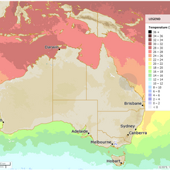
National
Trough moves eastward, clears southern coast today, then Capricornia and Central Coast Friday. High extends ridge across state, another trough later this weekend aids shower activity. High moves into Tasman Sea, maintains ridge next week.


State
Eastern Queensland's trough will move eastward and clear off the southern coast today, followed by the Capricornia and Central Coast on Friday. A high over the Great Australian Bight will create a ridge across most of the state after the trough passes. A second trough may deepen over the interior during the upcoming weekend and early next week, resulting in increased shower and thunderstorm activity nearby. The high will then move into the Tasman Sea on Sunday and maintain a firm ridge over the eastern part of the state throughout next week.


4-day
Friday: Scattered showers, chance of thunder near the coast. Isolated showers elsewhere. Mostly clear elsewhere. Light to moderate winds in central and Far North Queensland. Moderate winds elsewhere.
Saturday: Scattered showers on the east coast, central inland, and northeastern interior. More showers from Cooktown to Mackay and the exposed southeast coast. Mostly sunny elsewhere. Fresh southeasterly winds on the southeast and central coast. Near or below average temperatures. High fire risk in central west and northwest.
Sunday: Scattered showers likely near east coast and North Tropical Coast, with widespread showers expected at times in the Wet Tropics. Isolated showers and possible thunderstorms possible west of Hughenden to Charleville. Partly cloudy elsewhere. Fresh southeasterly winds along east coast. Near or below average temperatures. High fire danger in central and northwest interior.
Monday: Expect scattered showers on the east coast and north tropical coast, with isolated showers in South East Queensland. Showers may become more widespread at times on the Cassowary Coast. In the west, isolated showers and possible thunderstorms can be expected, becoming scattered in the far southwest. Southeasterly winds will be fresh along the tropical east coast. It will be partly cloudy elsewhere with temperatures near or below average, except for above-average minimum temperatures in the far southwest.


Townsville
Min 21 Max 31 Mostly sunny. Possible rainfall: 0-1 mm. Chance of any rain: 30%. Mostly sunny day. Slight chance of a shower at night. Light winds becoming N to NE 15 to 20 km/h in the middle of the day then becoming light in the evening.
Herbert and Lower Burdekin
Min 19 Max 31 Mostly sunny. Chance of any rain: 20%. Slight chance of a coastal shower, near zero chance elsewhere. Light winds becoming E to NE 15 to 20 km/h in the middle of the day.
North Tropical Coast and Tablelands
Min 17 Max 32 Mostly sunny. Chance of any rain: 5%. Slight coastal shower chance, near zero elsewhere. Winds E 20 to 30 km/h.
Cairns
Min 21 Max 31 Mostly sunny. Chance of any rain: 20%. Light winds becoming SE 15 to 25 km/h in the morning, then light in the evening.
Mackay
Min 19 Max 28 Possible shower. Possible rainfall: 0-1 mm. Chance of any rain: 40%. Partly cloudy. Medium chance of AM and PM showers. Light winds becoming SE 15 to 25 km/h in the midday, then light in the late evening.
Northern Goldfields
Min 15 Max 36 Sunny. Chance of any rain: 0%. Winds S to SE 15 to 20 km/h, becoming SE to SW 20 to 30 km/h in the morning.
Mt Isa
Min 13 Max 32 Sunny. Chance of any rain: 0%. Light winds becoming SE 25 to 35 km/h in the morning, then becoming light in the evening.
Click here to support to Wally's Weather
National maps by Weatherzone (weatherzone.com.au)
State maps by Windy (Windy.com)
Weather forecast supplemented by Bureau of Meteorology (bom.gov.au)
Rainfall daily totals (https://meteologix.com/ )
Wally's Weather provides professionally researched data and information. Andrew aka 'Wally' has over 20 years of experience in meteorology research and data analysis. The content here is provided as educational information aimed at providing the community and businesses with the tools required to determine local-based forecasts. IMPORTANT: The forecasts and information posted should never be used on their own to make business decisions as local influences.


Comments