Morning Weather - September 11 - Wally's Weather Australia
- Sep 11, 2023
- 2 min read
This weather update is brought to you by Your Business

Your product promoted here with email marketing and links to your Facebook or Store.
National
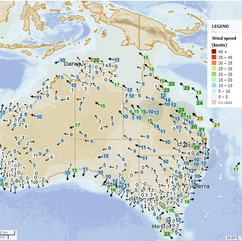
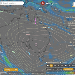
A slow-moving high extends ridge over southeastern Australia. It will reach Tasman Sea, linger, and maintain the ridge. An upper trough may enhance coastal showers on Tuesday/Wednesday.
State
A slow-moving high over southeastern Australia will bring a ridge to the state. It will reach the Tasman Sea and continue for several days. There might be enhanced showers near the east coast due to an upper trough crossing the state.
4-day
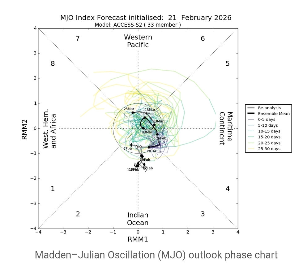
First of all check out the activity near the Solomon Islands, an area to watch during the up-coming wet season.
Tuesday: Some showers on the North Tropical Coast, rest of east coast has isolated showers. Mostly sunny everywhere else. Temperatures near average in southwest, below average elsewhere. Minimum temperatures near average in northwest, below average elsewhere.
Wednesday: Showers in North Tropical Coast. Isolated showers in east coast and Torres Strait. Partly cloudy in Cape York Peninsula, mostly sunny elsewhere. Temps near average south of Longreach, below average elsewhere. Minimum temps near average in northwest, below average elsewhere.
Thursday: Isolated showers in the North Tropical Coast, mostly sunny elsewhere. Above average maximum temperatures in the southwest and southern interior, near average elsewhere. Below average minimum temperatures, except in the southwest.
Friday: On Sunday, there will be some showers on the east coast above Ingham. There will also be isolated showers in the rest of the east coast above Mackay and in the Torres Strait. The weather will be partly cloudy over Cape York Peninsula and in eastern districts starting from Saturday, but mostly sunny in other areas. Maximum temperatures will be above average in areas south of Longreach, significantly above average in the southwest and southern interior, and around average in other places. Minimum temperatures will be above average in the southwest, close to average in the southeast, and below average in other areas.
Townsville
Max 28°C, Mostly sunny. Rain: 5%. Mostly sunny. Light winds, E-SE 25-35 km/h AM, becoming light late eve.
Herbert and Lower Burdekin
Max 27°C, Mostly sunny. Rain: 5%. Winds E-SE 15-20 km/h, becoming light AM, then E 20-30 km/h AM.
North Tropical Coast and Tablelands
Max 26°C, Partly cloudy. Rain: 5%. Med. coastal showers, easing PM. Winds E-SE 25-35 km/h.
Cairns
Max 28°C, Partly cloudy. Rain: 20%. Partly cloudy. Slight shower chance. SE winds 15-25 km/h, increasing to 25-40 km/h AM.
Mackay
Max 25°C, Mostly sunny. Rain: 20%. Mostly sunny. Slight evening shower chance. SE winds 25-35 km/h.
Northern Goldfields
Max 30°C, Sunny. Rain: 0%. Winds E-SE 20-30 km/h.
Mt Isa
Max 31°C, Sunny. Rain: 0%. Sunny. SE winds 20-30 km/h.
Click here to support to Wally's Weather
National maps by Weatherzone (weatherzone.com.au)
State maps by Windy (Windy.com)
Weather forecast supplemented by Bureau of Meteorology (bom.gov.au)
Rainfall daily totals (https://meteologix.com/ )
Wally's Weather provides professionally researched data and information. Andrew aka 'Wally' has over 20 years of experience in meteorology research and data analysis. The content here is provided as educational information aimed at providing the community and businesses with the tools required to determine local-based forecasts. IMPORTANT: The forecasts and information posted should never be used on their own to make business decisions as local influences.


Comments