Morning Weather - February 16 - Wally's Weather Australia
- Feb 15, 2024
- 7 min read
This weather update is brought to you by Genesis Electrical NQ

Genesis Electrical NQ
We can Solve all of your Electrical, Air Conditioning and Solar needs!
Phone: 1300 443 637
Email: info@genesislec.com
Monsoon Update
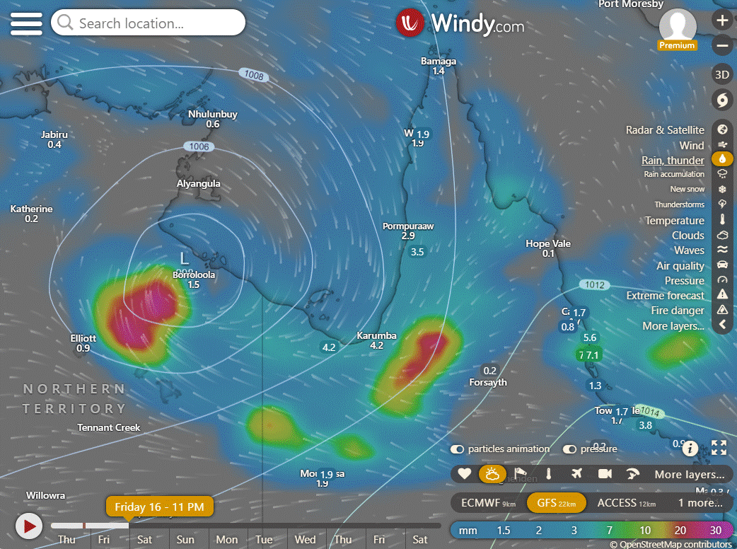
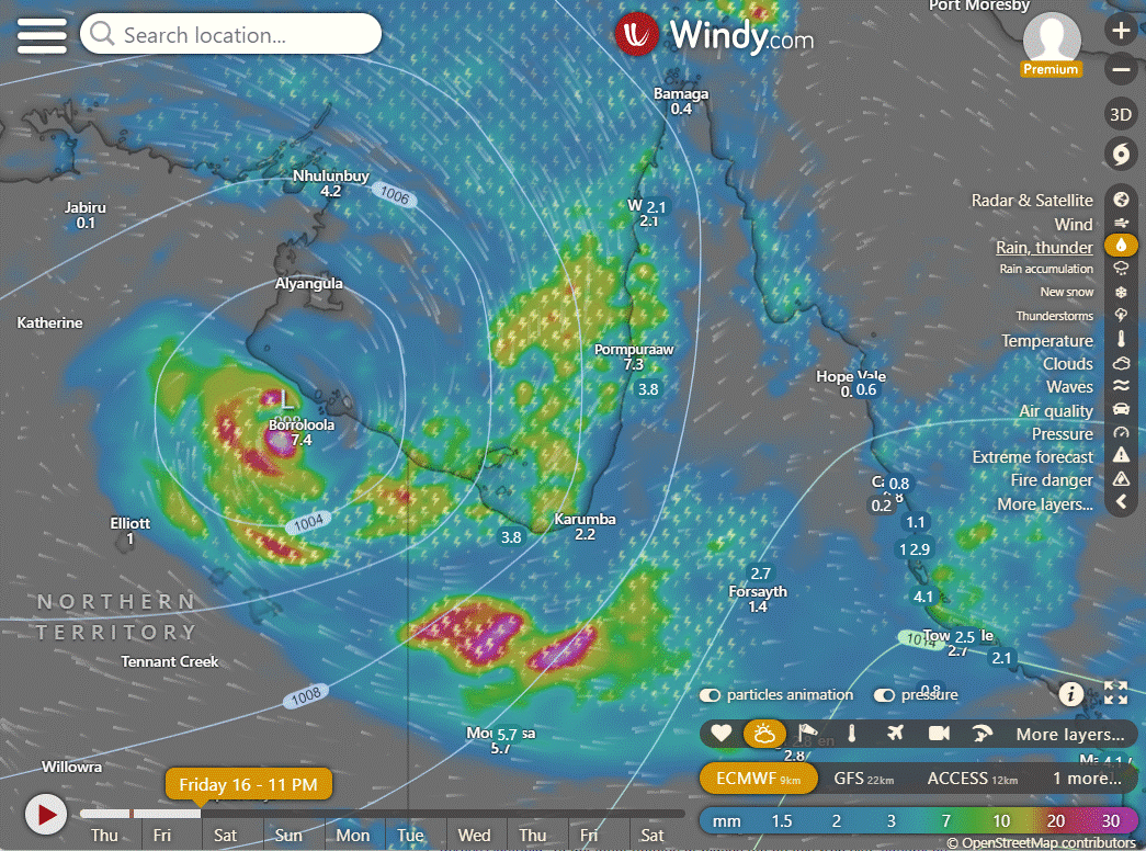
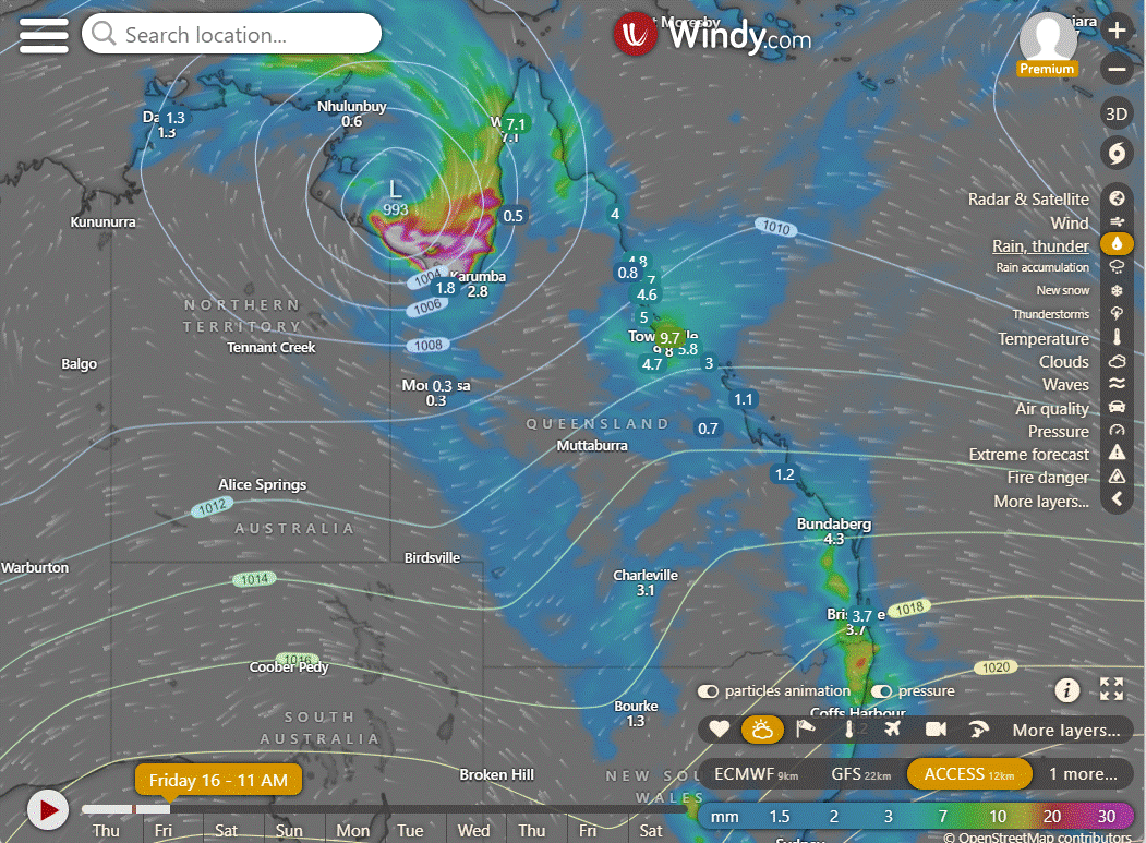
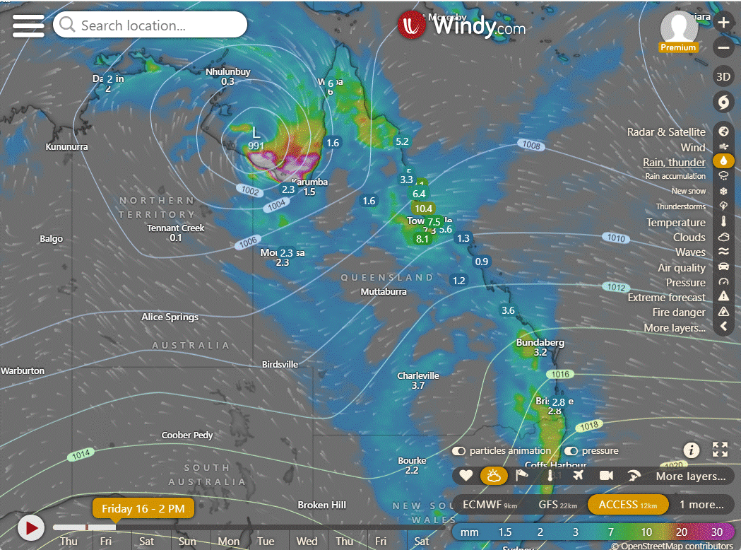
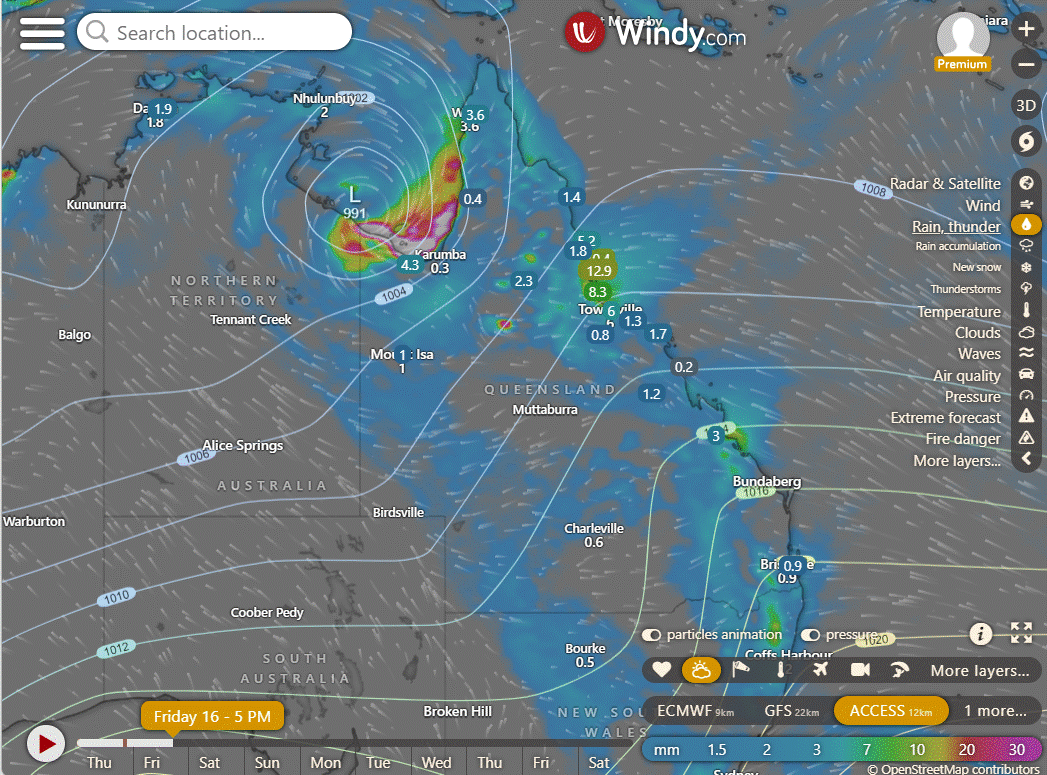
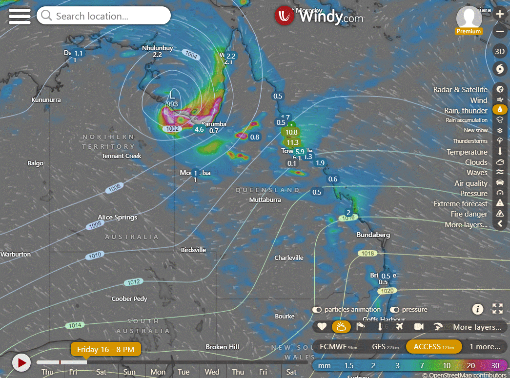
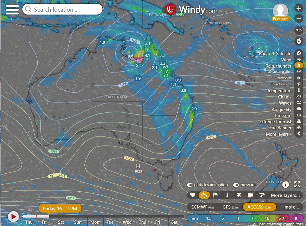
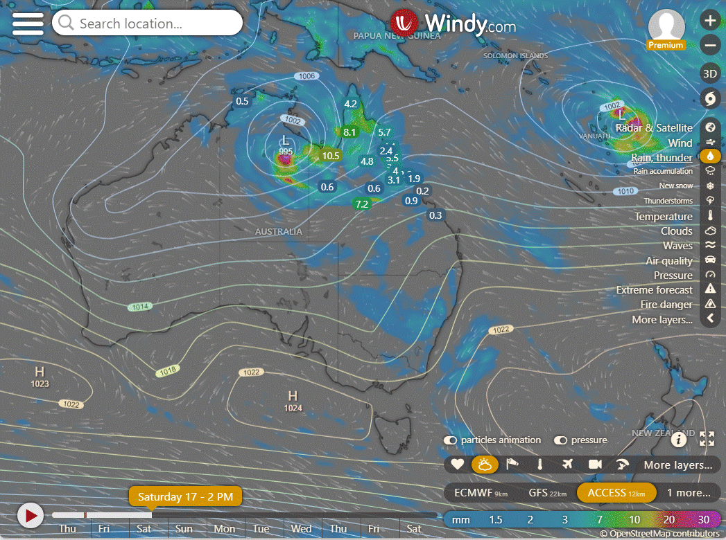
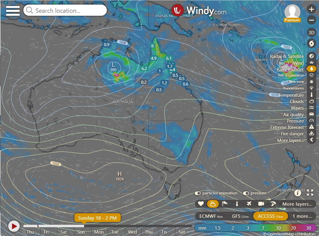
With 07U/93S has moved further into the Gulf and has produced some good rain around the Gulf region but not large numbers yet. The tropical low is a little further West than it was forecast to be and thus the rain dropped in mainly over water. Tonight the main rainfall area will be around Borroloola to the Robinson River and to a lesser extent Croydon to Gregory. The low will then shift SW over the next 24 hours and then more WSW over the subsequent 24 hours.
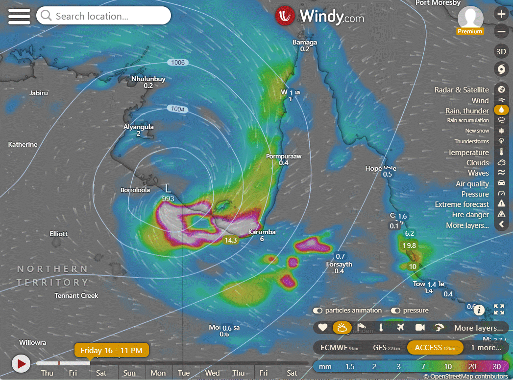
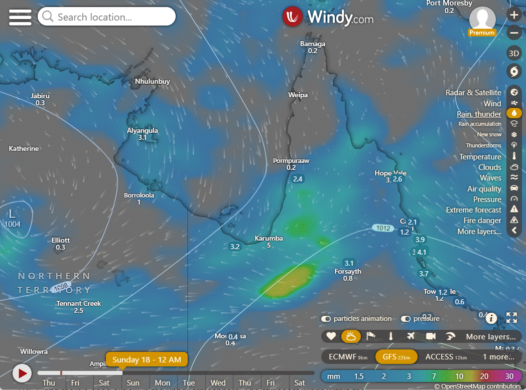
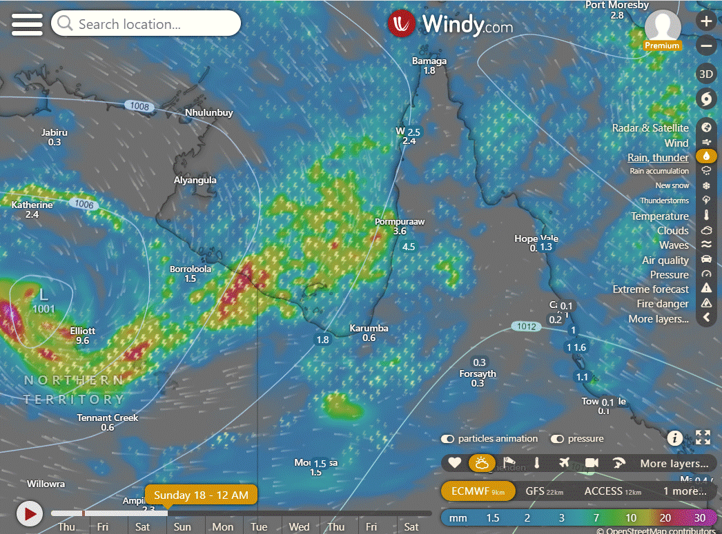
The system is approximately 193 kilometers northwest of Mornington Island. Conditions are favorable for further development, with warm sea surface temperatures (28°C), good upper-level outflow, and low vertical wind shear (5-10 knots). Global models predict the system to move southeastward in the next 24-36 hours. Maximum sustained winds are around 25 to 30 knots, and the minimum sea level pressure is estimated at about 1000 hPa. There is a medium chance of the system evolving into a significant tropical cyclone within the next 24 hours.
National
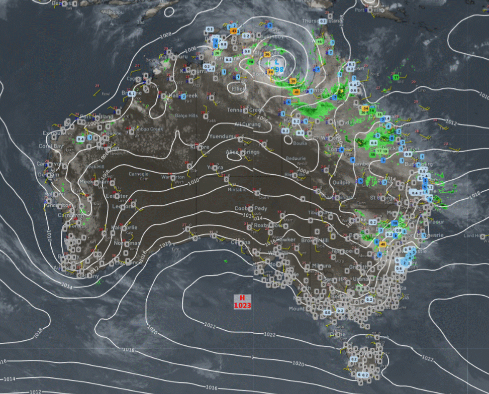
A monsoon low is causing heavy rain, storms, and strong winds around the Gulf of Carpentaria. Showers and storms are ongoing in Queensland, scattered across New South Wales and eastern Victoria due to moist and unstable winds. Isolated showers and storms are expected in the northern part of Western Australia. High-pressure systems will keep the rest of the areas dry.
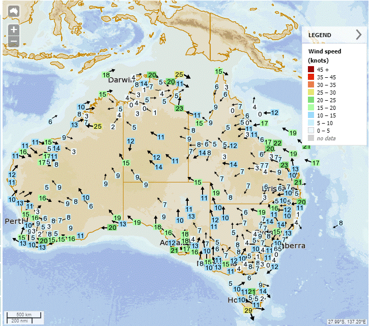
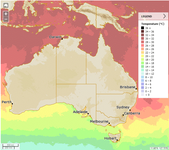
Synoptic | Temp/Rain | Wind | Sea Surface Temp
State
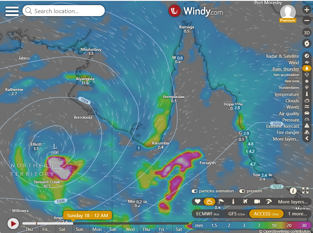
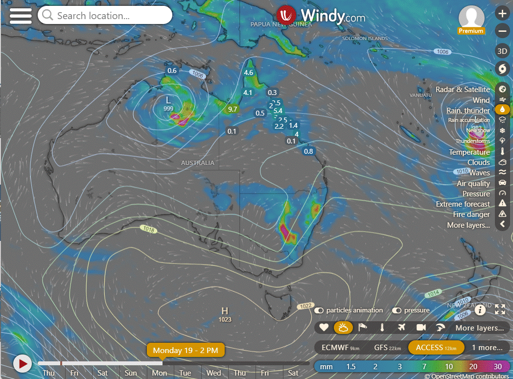
Monsoon trough developing in Gulf of Carpentaria, tropical low may become cyclone. Low to move over Northern Territory, then weaken. Unsettled conditions in east, trough moves west Friday. High pressure strengthens over Queensland, rainfall on east coast. Upper trough brings rain but moves offshore, settling conditions return.
ACCESS (Values are rainfall over 3 hours)
4-day
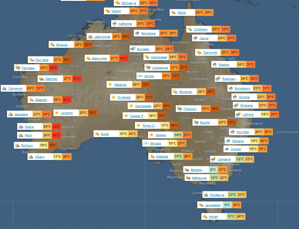
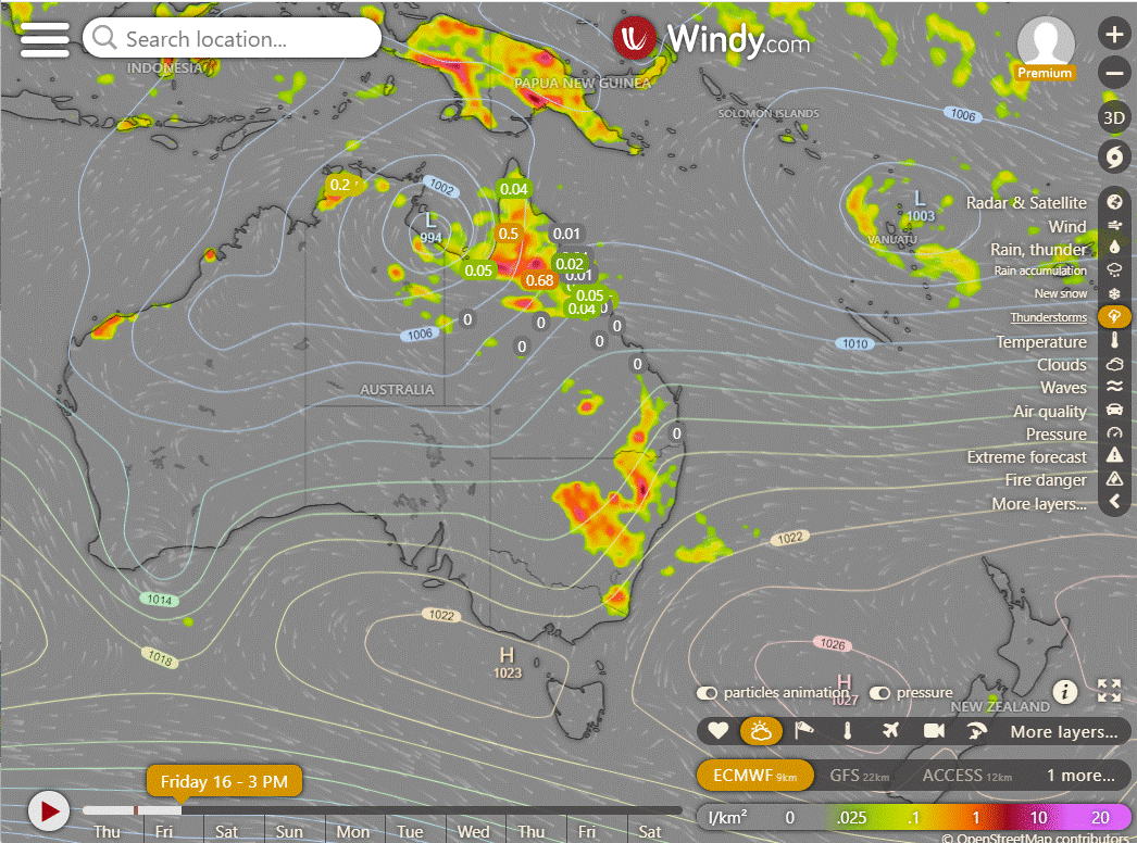
Friday: Rain showers and thunderstorms scattered across the state, mainly isolated in the Channel Country and southeastern interior. Showers becoming more widespread and possibly turning into rain at times along the Peninsula and Gulf Country coast. There is a chance of heavy rainfall, especially near the south Gulf Coast, depending on the movement and development of a tropical low and monsoon trough. Damaging wind gusts are possible along the south Gulf coast. Winds will be light to moderate, mostly coming from the northeast to southeast, except for stronger winds along the Gulf Country and west Peninsula coasts. Winds will shift to northwesterly on the northern Peninsula and Torres Strait.
Saturday: Possible isolated thunderstorms and widespread showers, with heavy rain in certain areas, especially the south Gulf coast and North West. Chance of heavy rainfall near the northeast coast between Innisfail and Townsville in the morning, depending on tropical low movement. Isolated showers in the southern and central interior and remaining eastern districts, scattered showers in the Central Coast, Herbert, and Lower Burdekin. Possible damaging wind gusts in the North West and Gulf Country. Maximum temperatures below average in the northwest, closer to average elsewhere.
Sunday: Sunday's weather forecast includes isolated thunderstorms, scattered showers, and heavy rainfall in certain areas like the Peninsula, Gulf Country, and North Tropical Coast. There may also be isolated showers in other eastern districts, with a chance of a thunderstorm near the New South Wales border. The central and southern interior will be partly cloudy, and maximum temperatures will be below average in the northwest and near average elsewhere.
Monday: Monday: Scattered showers, some turning into rain, and isolated thunderstorms in Gulf Country, North West, Peninsula, and North Tropical Coast. Scattered showers in the remaining eastern districts. Isolated showers and possible thunderstorms in the southern inland. Max temperatures below average in the northwest, above average in the south.
North Tropical Coast and Tablelands:
Maximum temperature: 31, Minimum temperature: low to mid 20s, Wind speed: easterly 15-25km/h, Wind direction: easterly, Rainfall: high chance of showers, Clouds: cloudy, Thunderstorm possible.
Herbert and Lower Burdekin:
Max temp: 30, Min temp: low to mid 20s, Wind: light to easterly 15-20 km/h, Rain: Cloudy with high chance of showers, possibly severe thunderstorm in the north.
Central Coast and Whitsundays:
Max temperature: 30, Min temperature: low to mid 20s, Wind speed: 15 to 25 km/h easterly to southeasterly, Rainfall: Cloudy with high chance of showers, Thunderstorm possible in the south.
Peninsula:
Max temperature: low 30s, Min temperature: mid 20s, Wind speed: 15 to 25 km/h, Wind direction: north to northeasterly, Rainfall: Very high chance of showers, Other: Cloudy with a chance of a severe thunderstorm.
Gulf Country:
Max temperature: 31, Min temperature: low to mid 20s, Wind speed: 25 to 35km/h, Wind direction: east to northeasterly, Rainfall: Very high chance of rain, other: Cloudy with chance of a thunderstorm and heavy falls possible, Damaging winds possible near NT border.
Northern Goldfields and Upper Flinders:
Max temperature: 32, Min temperature: low to mid 20s, Wind speed: 20-30 km/h, Wind direction: easterly, Rainfall: high chance of showers, Thunderstorm possible, Other: Cloudy, temperatures reaching 27-32 during the day, overnight temperatures falling to low to mid 20s.
Capricornia:
Max temperature: mid to high 20s, Min temperature: low to mid 20s, Wind speed: east to southeasterly 15 to 20 km/h, Wind direction: east to southeasterly, Rainfall: high chance of showers, Thunderstorm possible.
Central Highlands and Coalfields:
Max temperature: high 20s; Min temperature: low 20s; Wind speed: light winds becoming easterly 15 to 25 km/h in the morning then becoming light in the evening; Wind direction: easterly; Rainfall: high chance of showers, most likely from late morning; Other: cloudy, chance of thunderstorm, overnight temperatures falling to low 20s, daytime temperatures reaching high 20s.
Central West:
Max temperature: 33, Min temperature: low 20s, Wind speed: 20-30 km/h, Wind direction: east to northeasterly, Rainfall: high chance of showers, Thunderstorm chance: yes, Condition: Partly cloudy.
North West:
Max temperature: 35, Min temperature: low to mid 20s, Wind speed: 20-30 km/h east, Wind direction: easterly, Rainfall: medium chance, Thunderstorms: possible, Cloud cover: Partly cloudy
Channel Country:
Max temperature of 33 to 39, min temperature in the low to high 20s, wind speed of 15 to 25 km/h in the morning increasing to 20 to 30 km/h, chance of showers and a thunderstorm, wind direction east to southeasterly in the morning, turning east to northeasterly.
Maranoa and Warrego:
Max temperature: 29 to 34. Min temperature: low 20s. Wind speed: light, becoming east to northeasterly 15 to 20 km/h. Wind direction: undefined. Rainfall: medium chance of showers, most likely in the morning and afternoon. Other: Partly cloudy with a chance of severe thunderstorm.
Darling Downs and Granite Belt:
Max temperature: 33, Min temperature: 19, Wind speed: 15-25 km/h, Wind direction: east to northeasterly, Rainfall: high chance of showers, Thunderstorm possible, Partly cloudy.
Wide Bay and Burnett:
Max temperature: mid to high 20s; Min temperature: low 20s; Wind speed: light becoming easterly 15 to 20 km/h in the morning then light in the evening; Wind direction: easterly; Rainfall: high chance of showers, most likely in the morning and afternoon, chance of thunderstorm; Other: Cloudy. Overnight temperatures falling to low 20s.
Southeast Coast:
Max temperature: mid to high 20s, Min temperature: low 20s, Wind speed: light, Wind direction: easterly, Rainfall: very high chance of showers, Thunderstorm possible, Cloudy.
WEATHER WARNINGS
Strong Wind Warning for Esperance Coast.
Severe Weather Warning (Heavy, Locally Intense Rainfall And Damaging Winds) for parts of Gulf Country.
Fire Weather Warning for Roe, Lakes, and Fitzgerald Inland.
Severe Weather Warning (Heavy, Locally Intense Rainfall And Damaging Winds) for parts of Carpentaria and Barkly districts.
Severe Thunderstorm Warning (Heavy Rainfall & Damaging Winds) for North West Slopes & Plains, Central West Slopes & Plains & Upper Western.
Tropical Cyclone Forecast Track Map.
Tropical Cyclone Warning for Port Roper (NT) to Burketown (Qld), including Mornington Island and Borroloola, excluding Ngukurr.
Gale Warning for Roper Groote Coast. Strong Wind Warning for Arafura and Gove Peninsula coasts.
Gale Warning for North East Gulf of Carpentaria. Strong Wind Warning for South East Gulf of Carpentaria.
Strong Wind Warning for Spencer Gulf.
Strong Wind Warning for South East and South West coasts.
Major Flood Warning For The Nicholson River.
Final Gale Warning For Southeastern And Southern Areas.
Minor Flood Warning For The Balonne River And Balonne River Minor.
Moderate Flood Warning For The Barcoo River And Cooper Creek.
Flood Watch For Parts Of Carpentaria Coastal And Central Inland Rivers.
Moderate Flood Warning For The Diamantina River.
Minor Flood Warning For The Paroo River (Qld).
Initial Minor Flood Warning For The Daly River.
Flood Watch For Gulf Of Carpentaria Catchments.
Moderate Flood Warning For The Waterhouse River.
Minor Flood Warning For The Katherine River.
Minor Flood Warning For The Moonie River.
Minor Flood Warning For The Bulloo River.
Fire Weather Warning for Midwest Inland, Lesueur, Yarra Yarra, Swan Coastal North, Swan Inland North, Blackwood, Mortlock & Stirling North.
Major Flood Warning For The Flinders River.
Minor Flood Warning For The Lower Warrego River (Qld).
Major Flood Warning For Eyre Creek And Minor Flood Warning For The Georgina River.
Flood Warning For The Inland Rivers Sa.
Minor Flood Warning For The Paroo River (Nsw).
Minor Flood Warning For The Dawson River.
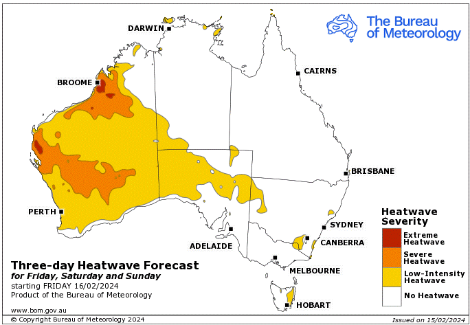
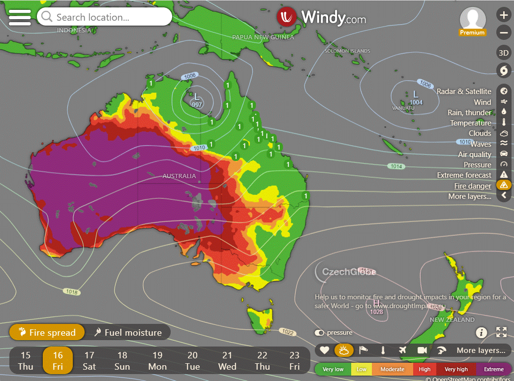
Storms - Heatwave - Fire danger
Click here to support to Wally's Weather
National maps by Weatherzone (weatherzone.com.au)
State maps by Windy (Windy.com)
Weather forecast supplemented by Bureau of Meteorology (bom.gov.au)
Rainfall daily totals (https://meteologix.com/ )
AccuWeather (https://www.accuweather.com/)
Nine Weather (https://www.9news.com.au/weather)
Wally's Weather provides professionally researched data and information. Andrew aka 'Wally' has over 20 years of experience in meteorology research and data analysis. In 2023 finished top 4 for the AMOS national weather forecasting competition. The content here is provided as educational information aimed at providing the community and businesses with the tools required to determine local-based forecasts. IMPORTANT: The forecasts and information posted should never be used on their own to make business decisions as local influences.


Comments