Morning Weather - July 26 - Wally's Weather Australia
- Jul 26, 2023
- 3 min read
This weather update is brought to you by Wally's Weather Gift Shop
Thank you for your appreciation and continued presence in this community. Wally's Weather is about informing and educating the community about weather events, how to prepare, and deal with them mentally and educating with experience and facts. To fund this process the gift shop has been set up for people to purchase a range of Wally's Weather gifts. The proceeds go back into running and improving this community.
Purchase Wally's game Dam Filler, a T-Shirt, or any other amazing gifts available from the gift shop today!
Rain event special

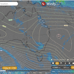
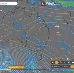
The converging winds around the end of the trough continue to move North, as the trough didn't push over the coast rain was light in Townsville, the rain tends to burn off mid-morning so it won't be as heavy as it might have it been overnight for the FNQ coastline. It should ease later tonight for the FNQ. If you think Monday was Winter, you may want to look ahead a little to Tuesday or Wednesday next week, specially at night.
Rain 11am | Rain 2pm | Rain 5pm and Wind 9pm
North Queensland
Townsville Max 26. Showers 80%. Partly cloudy. High chance of showers, decreasing late morning. Winds east to southeasterly 25-40 km/h, easing to 15-20 km/h in the evening, then becoming light.
Herbert and Lower Burdekin Max 25. Morning shower or two. Windy. Chance of rain 50%. Very high chance of showers in the north, medium chance elsewhere. Winds SE 20-30 km/h, becoming E 25-40 km/h in the morning, then E-SE 15-25 km/h in the evening.
North Tropical Coast and Tablelands Max 23. Showers likely (90% chance). Cloudy. High chance of showers. Winds E-SE 25-35 km/h.
Cairns Max 25. Showers likely (100% chance). Cloudy. Very high chance of showers. Winds SE 25-40 km/h decreasing to 20-25 km/h in late evening.
Mackay Max 24. Shower or two possible (60% chance). Partly cloudy. Medium chance of showers. Winds SE 30-45 km/h.
Northern Goldfields Max 25. Windy. Cloudy (0% chance of rain). Partly cloudy. Medium chance of showers in east, slight chance elsewhere. Winds E-SE 25-35 km/h, becoming E 30-45 km/h in the morning, then decreasing to 15-25 km/h in the evening.
Mt Isa Max 27. Mostly sunny (10% chance of rain). Winds E 25-35 km/h, decreasing to 15-20 km/h in the evening, then becoming light late evening.
National
High expands over southeastern Australia, creating ridge in Queensland while coastal trough moves north. Upper trough in northern Queensland moves offshore, weakening coastal trough. High shifts eastward towards Tasman Sea. Weak trough and new ridge forecasted for southern Queensland.
State
Showers, moderate in North Tropical Coast. Partly cloudy, isolated showers on east coast. Mostly sunny elsewhere. Morning frost inland in south QLD. Moderate to fresh southeasterly winds, strong and gusty along east coast. Min temps near average in far north, above average elsewhere. Max temps near average in east and north, above average elsewhere.
4-day
Thursday: Isolated showers north, scattered in Central & North Tropical Coast. Mostly sunny southwest, partly cloudy elsewhere. Patchy fog inland southeast, frost at Granite Belt. Moderate to fresh northeasterly winds in west, gusty southeasterly winds along east coast. Min temps above average, max temps near average in east & north, above average elsewhere.
Friday: Partly cloudy east & north, isolated showers on east coast north of Bundaberg, scattered in North Tropical Coast. Mostly sunny elsewhere. Patchy fog inland southeast, frost at Granite Belt. Min temps below average inland southeast, above average elsewhere. Max temps near average along tropical east coast, above average elsewhere.
Saturday: Partly cloudy east & north, isolated showers on east coast north of Rockhampton. Mostly sunny elsewhere. Patchy fog inland eastern districts, frost at Granite Belt. Min temps near average in southeast, above average elsewhere. Max temps near average along tropical east coast, above average elsewhere.
Sunday until Tuesday: Partly cloudy, isolated showers on exposed east coast. Partly cloudy in southern Queensland, mostly sunny elsewhere. Morning frost at Granite Belt. Min temps near/below average in southeast, otherwise above average across the state.
Click here to support to Wally's Weather
National maps by Weatherzone (weatherzone.com.au)
State maps by Windy (Windy.com)
Weather forecast supplemented by Bureau of Meteorology (bom.gov.au)
Rainfall daily totals (https://meteologix.com/ )
Wally's Weather provides professionally researched data and information. Andrew aka 'Wally' has over 20 years of experience in meteorology research and data analysis. The content here is provided as educational information aimed at providing the community and businesses with the tools required to determine local-based forecasts. IMPORTANT: The forecasts and information posted should never be used on their own to make business decisions as local influences.


Comments