Morning Weather - July 5
- Jul 5, 2023
- 3 min read
This weather update is brought to you by Pandanus Park Golf Centre

Pandanus Park Golf Centre is located at 2 Tompkins Road, Shaw (opposite the RSPCA) and is Townsville’s only day and night driving range.
The concept behind Pandanus Park was to provide a facility to cater for all capabilities of golfers, including first-time golfers. The attractive watercourse and natural bushland setting provide a relaxing background. Entry from the car park crosses a bridge over a small creek lined with striking natural vegetation including some very picturesque stands of pandanus and melaleucas.

Intended to be much more than a golf practice centre, Pandanus Park Golf Centre offers a tranquil place to relax and enjoy all that the sport of golf has to offer.
Wally's Weather provides professionally researched data and information. Andrew aka 'Wally' has over 20 years of experience in meteorology research and data analysis. The content here is provided as educational information aimed at providing the community and businesses with the tools required to determine local-based forecasts. IMPORTANT: The forecasts and information posted should never be used on their own to make business decisions as local influences.
Click here to support to Wally's Weather
National
A weather system called a "high" over the Tasman Sea is working together with a trough in inland Queensland to bring a moist wind from the northeast along the central and southern coast of Queensland. The trough will move towards the east across central and southeast Queensland in the next few days, and by Wednesday afternoon, it will no longer affect the southern coast of Queensland. After the trough moves away, a strong ridge of high pressure and drier air will spread across Queensland. A check on the July pinned post shows that we had the coldest day for the week on the 3rd, the rain and trade winds combined to agree with this. Also, the heaviest rainfall for the week was on the 3rd and the rain event maxed for Mt Isa on the 2nd but coastal regions on the 3rd.


State
Morning fog in the interior and parts of central/southeast Queensland, with scattered showers in the east clearing the far southeast, isolated showers in Far North Queensland, mostly sunny in the northwest, partly cloudy elsewhere, and temperatures above average in the east but below average in the west, accompanied by light to moderate winds from various directions.


4-day
Thursday: Morning fog in central/southern/southeast Queensland, isolated showers along the east coast, mostly sunny in the northwest, below average temperatures in the west and above average in the east.
Friday: Isolated showers in the Wet Tropics, scattered in Torres Strait, mostly sunny elsewhere, developing westerly winds in the southeast, below average temperatures in the northwest and above average in the east.
Saturday: Morning frost in central/southern/southeast inland areas, isolated showers in the Wet Tropics/Torres Strait, mostly sunny elsewhere, above average temperatures in the Peninsula and below average elsewhere.
Sunday-Tuesday: Morning frost in central/southern/southeast inland areas, isolated showers in the Wet Tropics/Torres Strait, mostly sunny elsewhere, below average temperatures.


Townsville
The forecast for the remainder of Wednesday indicates partly cloudy skies with a maximum temperature of 28 degrees. There is a slight chance of a shower, although the likelihood decreases as the morning progresses. The overall chance of rain is around 30 percent. Light winds are expected to accompany these weather conditions.
National maps by Weatherzone (weatherzone.com.au)
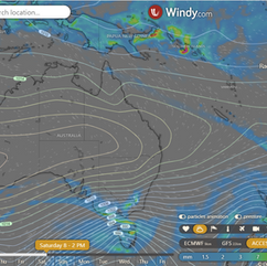
State maps by Windy (Windy.com)
Weather forecast supplemented by Bureau of Meteorology (bom.gov.au)
Rainfall daily totals (https://meteologix.com/ )


Comments