Morning Weather - March 28 - Wally's Weather Australia
- Mar 27, 2024
- 6 min read
Updated: Mar 28, 2024
To get your daily forecast delivered free goto http://wallysweather.com.au/blog

An added thanks to the sponsorship from NQ Licensed Events and the Country Festival on March 30 & 31 at the Dittman Bullpit

Website: https://www.countryfest.com.au/
Facebook: https://www.facebook.com/contryfestqld
Instagram: https://www.instagram.com/countryfestqld/
Forecast for 30th and 31st for the Country Fest continues to show as mainly fine with only scattered showers.
Welcome another Bold Shout supporter, TyrePlus Townsville, Sturt St. TyrePlus will also be the major sponsor for April of the Daily Forecast.
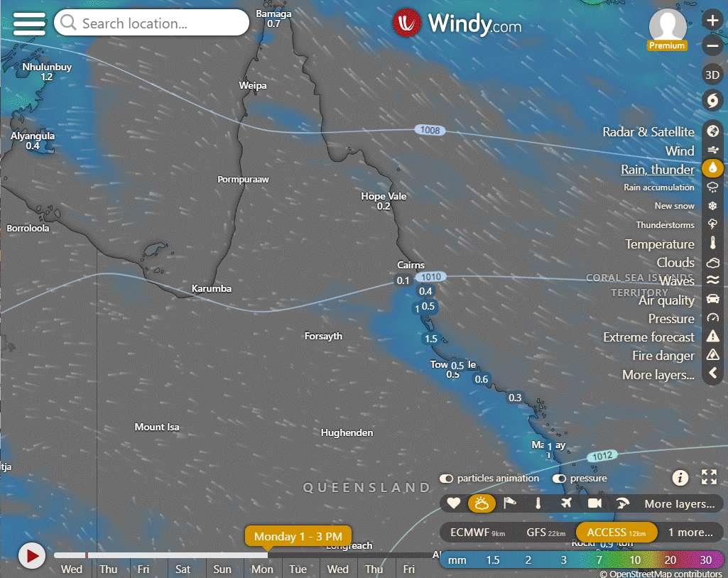
Easter and Good Friday is when the rain should begin the ease back as the trough shifts into the NT. Rain for the NW and Peninsula as well as the FNQ coast North of Cardwell but there should be showers around the Burdekin and some of the Northern Goldfields.
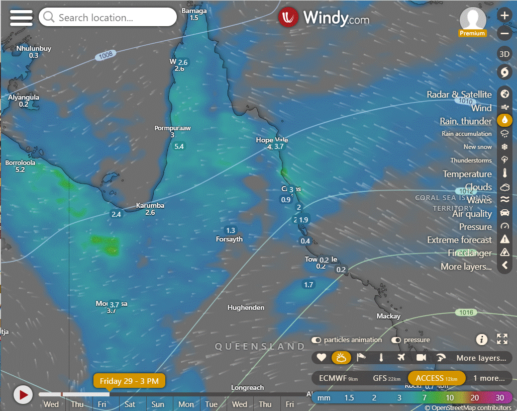
Saturday the trough out to the NE in the Coral Sea will hang for a bit and keep rain North of and including Cooktown and for the rest of the Peninsula.
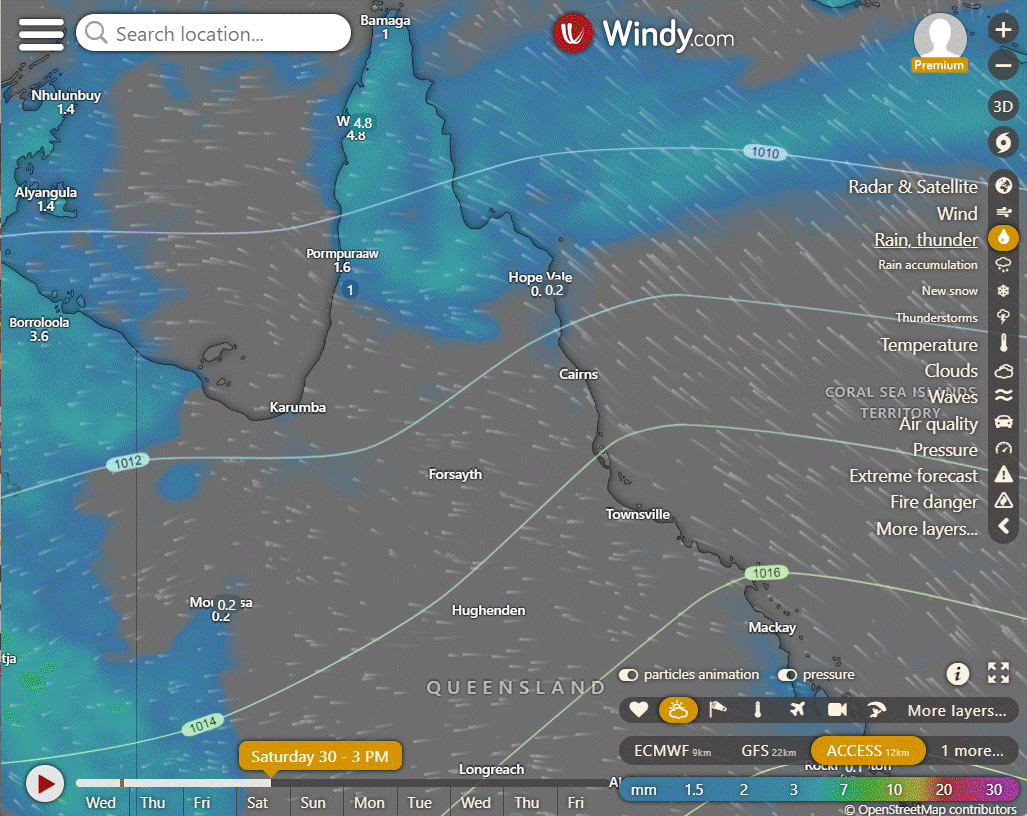
Sunday and Monday are easing right back with just trade winds and some High pressure ridging along the NQ coastline.

National
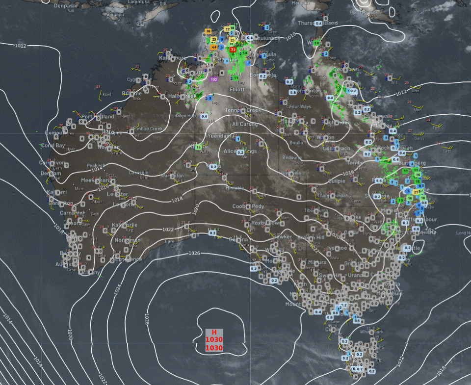
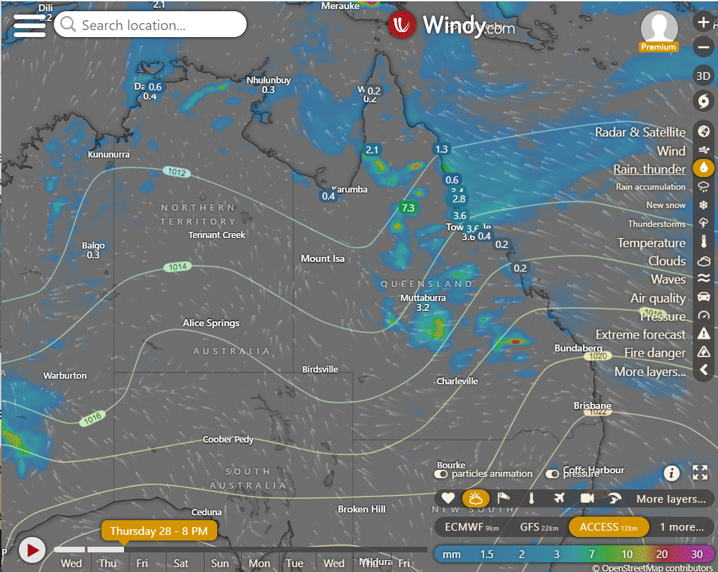
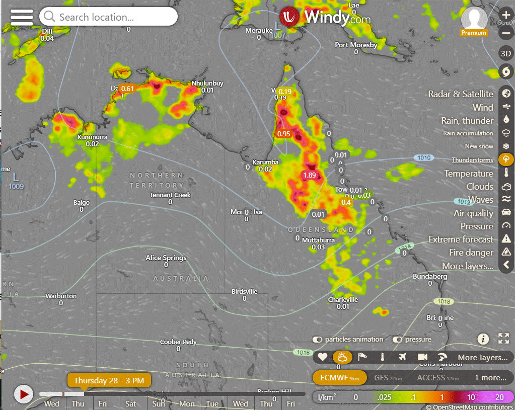
Eastern parts of Western Australia, the Northern Territory, and Queensland are experiencing showers and storms due to moist and unstable winds. Showers are present in eastern Queensland, eastern New South Wales, and eastern Victoria due to onshore flow. Southern Australia remains mostly settled and dry elsewhere due to the influence of high pressure systems.

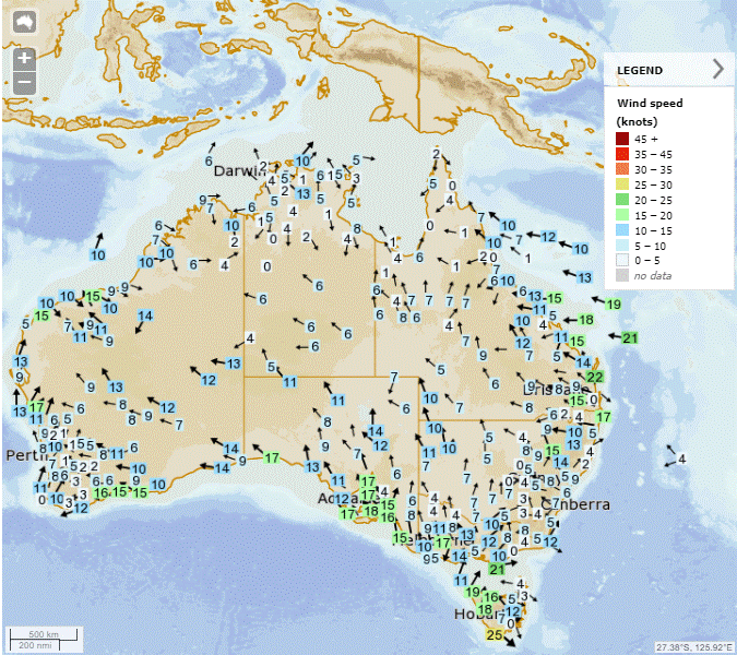

Synoptic | Temp/Rain | Wind | Sea Surface Temp
State
A trough in Queensland brings rain and clouds in the north, while cool temperatures persist in the southeast. Weak troughs in the southeast and north will weaken as a high pressure ridge develops along the east coast. The inland trough will move westward across the state and remain in the southwest over the weekend.
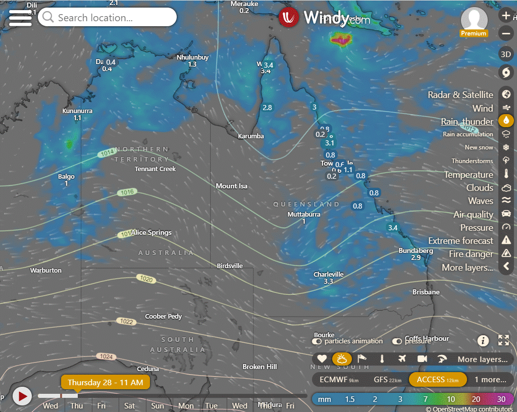
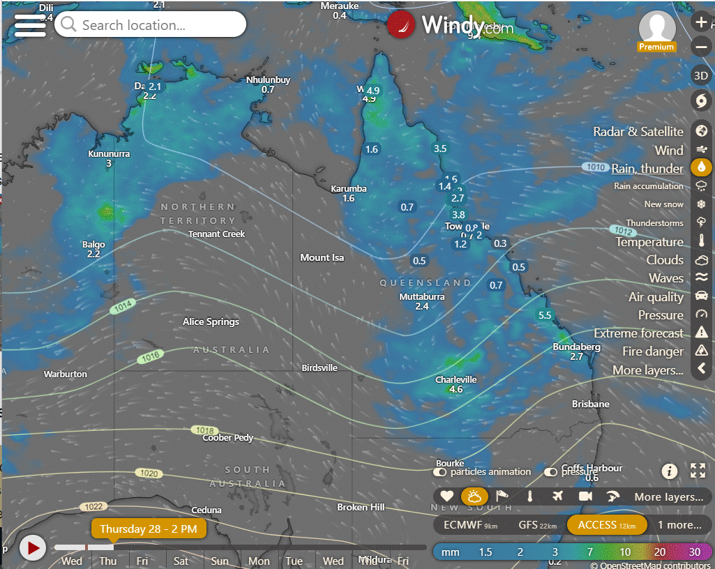
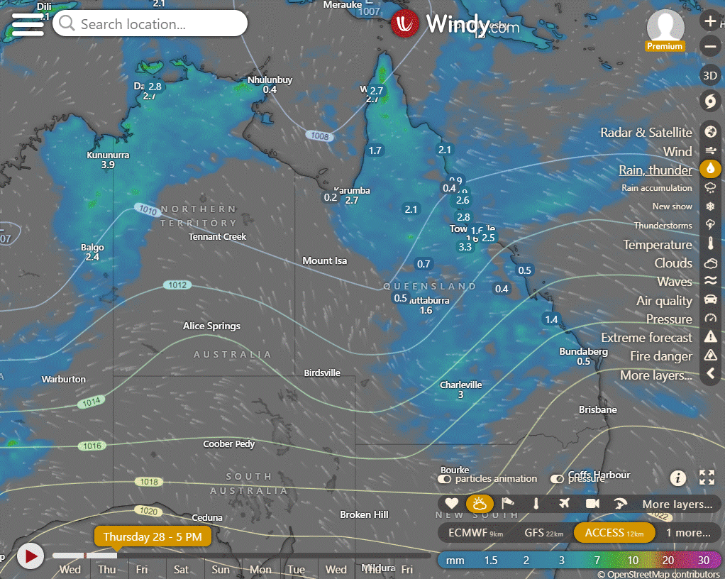
ACCESS (Values are rainfall over 3 hours)
4-day forecast
The 4 day forecast brought to you by our local businesses, you could have this spot with your details, support local, take out a Bold Shout! $250 for a year, you get this and the website every day! |


Thursday: Scattered showers likely across parts of Queensland with possible thunderstorms. Rain expected in South East Queensland and chance of heavy falls in some areas. Wind mostly from northeast to southeasterly, increasing in southwest.
Friday: Most of state: Isolated to scattered showers, chance of thunderstorms in western, northern, and central Queensland. Widespread showers possible in North Tropical Coast with moderate to heavy falls. Severe thunderstorms with heavy rainfall possible southwest of Mount Isa to Thargomindah. Fresh southeasterly winds on east coast, strong at times south of Bowen. Maximum temperatures below average except parts of east coast.
Saturday: Scattered showers, thunderstorms likely across Queensland west, northern. Heavier rain, possible severe storms in Channel Country. Isolated showers south of Port Douglas, coastal areas. Widespread showers in Wet Tropics, partly cloudy in central, southern interior. Fresh southeasterly winds on east coast. Temps below average, close to average on tropical coasts.
Sunday: Scattered showers and possible thunderstorms in the west. Isolated showers in the east. Partly cloudy with cool temperatures.


North Tropical Coast and Tablelands:
The weather will have a high of 31°C, a low of low to mid 20s, light winds easterly 15 to 20 km/h becoming light, with a chance of showers, thunderstorms, and cloudy conditions.
Herbert and Lower Burdekin:
Maximum temperature: Around 30 degrees; Minimum temperature: Low to mid 20s; Wind speed: Light winds becoming easterly 15 to 20 km/h; Wind direction: Easterly becoming light; Rainfall: High chance of showers, most likely in the late morning and afternoon with a chance of a thunderstorm; Other: Cloudy.
Central Coast and Whitsundays:
The weather forecast includes a maximum temperature around 30°C, with light winds becoming easterly at 15 to 25 km/h, and a high chance of showers, most likely in the morning and afternoon, along with the possibility of a thunderstorm, with overnight temperatures in the low to mid 20s and partly cloudy conditions.
Peninsula:
Partly cloudy with showers likely in the afternoon, possible thunderstorm, light winds, low to mid 20s overnight, low to mid 30s daytime.
Gulf Country:
Highs in the low to mid 30s, lows in the mid 20s, light winds, partly cloudy with high chance of showers in the east, slight chance elsewhere, chance of a severe thunderstorm.
Northern Goldfields and Upper Flinders:
Partly cloudy with high chance of showers, thunderstorm, light winds becoming easterly 15-20 km/h, max temperature in the low to mid 30s, min temperature in the low to mid 20s, rainfall expected, and overnight temperatures falling to the low to mid 20s.
Capricornia:
Today will be mostly cloudy with a high chance of showers and a possible severe thunderstorm, light winds becoming easterly 15 to 25 km/h, with temperatures ranging from the low 20s overnight to around 30 during the day.
Central Highlands and Coalfields:
Max temperature: 32°C, Min temperature: 19°C, Wind speed: Light becoming easterly 15-20 km/h, Wind direction: East, Rainfall: High chance of showers with a chance of a severe thunderstorm, Other: Cloudy with light winds.
Central West:
Max temperature: 34°C, Min temperature: low 20s, Wind speed: southeasterly 15 to 20 km/h becoming easterly 15 to 20 km/h, Wind direction: change from southeasterly to easterly, Rainfall: high chance of showers with a chance of thunderstorm, Other: Partly cloudy with temperatures reaching 29 to 34°C.
North West:
Max temperature: low to mid 30s; Min temperature: low 20s; Wind speed: south to southeasterly 15 to 20 km/h; Wind direction: southeasterly; Rainfall: slight chance in the northeast; Other: Partly cloudy with a slight chance of a shower in the northeast, near zero chance elsewhere, and a chance of a thunderstorm east of Mt Isa.
Channel Country:
Highs in the low to mid 30s, lows in the low 20s, southeasterly winds of 20 to 30 km/h, with a medium chance of showers and thunderstorms in the northeast but near-zero chance of rain elsewhere, partly cloudy.
Maranoa and Warrego:
Max temperature: 31°C, Min temperature: 20°C, Wind speed: easterly 15 to 25 km/h, Wind direction: easterly, Rainfall: High chance of showers in the north, medium chance elsewhere, Other: Partly cloudy with chance of thunderstorm in the north.
Darling Downs and Granite Belt:
Maximum temperature: 30°C, Minimum temperature: 18°C, Wind speed: Easterly 15 to 25 km/h becoming light in the evening, Wind direction: Easterly, Rainfall: Near zero chance of rain, Other: Partly cloudy with a medium chance of showers in the north, most likely in the morning and afternoon, and a chance of a thunderstorm in the north in the morning and afternoon.
Wide Bay and Burnett:
Mostly cloudy with a medium chance of showers in the morning and afternoon, possibility of a thunderstorm inland, light winds becoming easterly to southeasterly 15-25 km/h changing to light in the evening, overnight temperatures dropping to 18-21°C with daytime highs in the mid to high 20s, with no forecasted rainfall.
Southeast Coast:
The weather forecast includes temperatures in the mid to high 20s, light winds becoming east to southeasterly, medium chance of showers in the north in the morning, and near zero chance of rain elsewhere.
WEATHER WARNINGS
Parts of Central Highlands and Capricornia in Queensland are under a severe thunderstorm warning due to heavy rainfall.
Severe thunderstorm warnings for Arnhem, Gregory, and Tanami districts in the Northern Territory have been canceled.
Esperance Coast in Western Australia is under a strong wind warning.
Lower East and South East coasts in Tasmania are also under a strong wind warning.
Southern areas of New South Wales and Queensland are under gale warnings.
The Upper Flinders River in Queensland has a moderate flood warning.
The Mary River in Queensland has an initial minor flood warning.
The flood warning for the Barron River in Queensland has been finalized.
South West Queensland is under a flood watch.
Eyre Creek in Queensland has a moderate flood warning.
The Herbert River in Queensland has a minor flood warning.
The Cape York Peninsula in Queensland is under a flood watch.
The Paroo River in New South Wales has a minor flood warning.
Inland rivers in South Australia are under a flood warning.
The flood watch for the Tanami and Western Deserts in Western Australia has ended.
Byron and Coffs coasts in New South Wales have had their surf warning canceled.
Central and South West parts of the Northern Territory are under a flood watch.
The Nicholson River and Leichhardt River in Queensland have moderate flood warnings.
The Barcoo River in Queensland has a minor flood warning.
The Diamantina River in Queensland is under a flood warning.
The flood warning for the Mulgrave River in Queensland has ended.
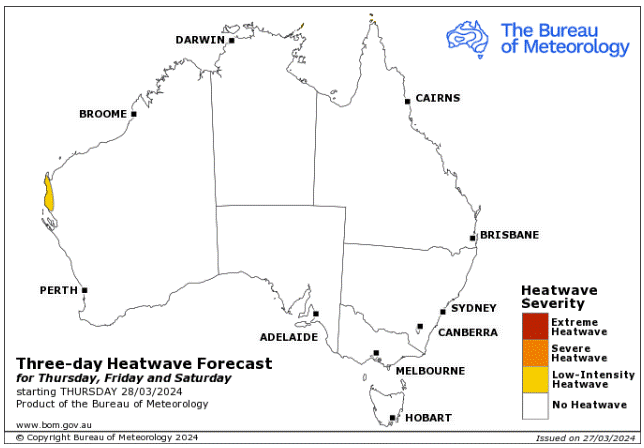

Storms - Heatwave - Fire danger
Click here to support to Wally's Weather
National maps by Weatherzone (weatherzone.com.au)
State maps by Windy (Windy.com)
Weather forecast supplemented by Bureau of Meteorology (bom.gov.au)
Rainfall daily totals (https://meteologix.com/ )
AccuWeather (https://www.accuweather.com/)
Nine Weather (https://www.9news.com.au/weather)
Wally's Weather provides professionally researched data and information. Andrew aka 'Wally' has over 20 years of experience in meteorology research and data analysis. In 2023 finished top 4 for the AMOS national weather forecasting competition. The content here is provided as educational information aimed at providing the community and businesses with the tools required to determine local-based forecasts. IMPORTANT: The forecasts and information posted should never be used on their own to make business decisions as local influences.


Comments