Tropical Low 12U - Willis Island Perspective
- Jan 8
- 1 min read
Willis Island update (late morning AEST): why it’s windy even though it’s not “in the centre”
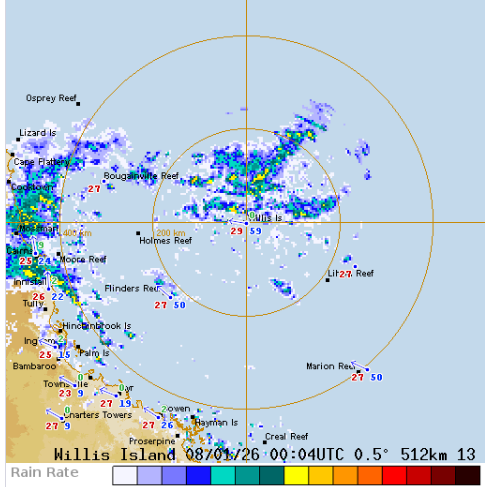
Willis Island is sitting close to the tropical low, but not right in the middle of it — and that’s often where the stronger winds show up.
🔹 Current obs (around 10:30am AEST):
Easterly winds ~60 km/h with gusts ~70–80 km/h
Pressure around 1005 hPa
Rain coming and going in bursts (radar shows bands wrapping around the island)
🌪️ Why stronger winds away from the centre?The very centre of a broad tropical low can be messy and sometimes relatively calmer, while the tightest pressure gradient + squally rain bands sit offset from the middle — that’s where Willis is right now, so the wind gets “squeezed up” and gustier.
⛈️ Next few hours:Expect pulses of showers/storms rotating through. When a heavier band moves over, winds can spike quickly, then ease again between bands.


Comments